Curdridge, Southampton
- Land size
- 1.78 acres
- Bedrooms
- 5
- Bathrooms
- 5
Key Features
- 16th century timber framed former farmhouse set in 1.78 acres of landscaped gardens overlooking open countryside
- Heated outdoor 12m x 6m swimming pool, tennis court and croquet lawn providing activities for all the family
- Impressive Inglenook fireplaces with wood burning stoves create a cosy setting in the snug and sitting room
- Sympathetically extended and modernised in the 1970s, retaining many of the original features, with floors lowered to give generous ceiling heights rarely found in a house of this age
- Only the second time on the market in some forty years, a rare chance to own a piece of Hampshire history
- 3838 sq ft comprising 5 bedrooms, 5 bathrooms, 3 ensuite, 4 reception rooms and double garage
Description
Titlarks Farm, named after a small songbird also known as a Meadow Pipit, is believed to date back to the c16th, with a sympathetic 1970s extension that has given this home its generous proportions without losing its unique character. An attractive timber framed brick-built home beneath a clay tiled roof, it offers 3,838 sq ft of well-proportioned, bright accommodation over two floors, with areas of exposed brick and beams that add warmth without dominating the spaces. Unusually for a house of this age, ceiling heights are generous throughout — the floors were lowered during the 1970s refurbishment programme, giving the interior a real sense of scale rarely found in a home of this period.
A welcoming entrance hall, laid with flagstones, sets the tone from the moment you step foot inside. The elegant drawing room to the rear of the house is a particular highlight — dual aspect, filled with light, and opening via French doors onto the terrace, with views over the garden and countryside beyond. A cosy snug with an impressive Inglenook fireplace and wood burning stove leads through into the well proportioned formal dining room, which again opens onto the terrace and pool area — ideal for entertaining on a grand scale. Here there are fine examples of exposed herring bone brick work set within the exposed timber frame.
The kitchen/breakfast room has been thoughtfully upgraded in recent years into an excellent "cook's kitchen," featuring a central island, bespoke cabinetry, high-end integrated appliances, and a dual control electric Aga, with space for a breakfast table. A useful utility room and a conveniently placed shower room — perfect for access from the pool — complete the practical side of the ground floor, alongside a further sitting room with its own Inglenook fireplace and wood burner with shelving to the chimney recesses, and a study with built-in cupboards and bookcases overlooking the front garden.
A wonderful open landing adds to the sense of space upstairs and showcases the original "Queen Strut" timber construction which has been preserved and exposed as one of the many features. The principal bedroom sits to the rear of the house, enjoying the same glorious views across the gardens and countryside, along with an en suite shower room and a walk-in wardrobe. Two further bedrooms each have their own en suite bathrooms, while two additional bedrooms share a family bathroom — most with the benefit of built-in storage.
A sweeping gravel driveway via a 5 bar gate at the entrance from Vicarage Lane, and surrounded by lawns and mature trees on either side, leads to the front of the house, with ample parking and turning area and access to the double garage. To the rear, a paved, west-facing terrace is perfect for outdoor dining, entertaining and watching the sun set overlooking a generous 12m x 6m (1m deep rising gradually to 2.5m) swimming pool and the countryside beyond. A well-maintained and enclosed tennis court, added in 2015, provides further scope for entertainment combined with exercise while the mature gardens — mainly laid to lawn with carefully planted shrub and herbaceous borders — also include an enclosed kitchen garden and fruit trees. There is also a productive greenhouse to the rear of the garage.
Titlarks Farm is set on the outskirts of Curdridge, situated close to the picturesque village of Botley, once home to 18th century radical journalist William Cobbett, author of Rural Rides and founder of what is now known as Hansard, the parliamentary record of debates. The small market towns of Bishop's Waltham, and Wickham are just a short drive away as is the thriving commercial port and cruise terminal in the city of Southampton and the historic cathedral city of Winchester. Nearby Botley station offers regular rail links to Winchester in 20 minutes and London Waterloo, while the property's location also provides easy access to the M27, M3 and A34 road networks. Curdridge itself offers a network of footpaths and bridleways through beautiful surrounding countryside and for boaters there are a choice of marinas in Hamble and Swanwick.
Location:
Bishops Waltham - 3.8 miles
Winchester - 14.3 miles
Hamble Marinas - 7.1 miles
Southampton Airport Parkway - 7.8 miles
Southampton Airport - 7.68miles
M27 J11 - 2.9 miles
Prep Schools:
Pilgrims Winchester
Twyford School
Prince's Mead, Winchester
Public Schools:
Winchester College
King Edward VI Southampton
St Swithuns Winchester
Sixth Form Colleges
Peter Symonds Winchester
Barton Peveril Eastleigh
Nursery
Hop Scotch Curdridge
Primary School:
Botley
Curdridge
Secondary School:
Wildern School Hedge End
Swanmore College Swanmore
Map Location
Property details
- Tenure
- Freehold
- Council Tax Band
- Ask Agent
- Date Posted
- 2026-09-30
Market Value Analysis
Compared with 1,735 Homes with Land listings in South East England (1+ acres).
Energy Performance Certificate
Energy Efficiency Rating
Based on UK Energy Performance Certificate standards (EU Directive 2002/91/EC)
Running costs are one side. Planning activity, flood history and ground risks for this location are in the full report.
Utilities & Restrictions
Utilities
- Electricity
- Mains
- Water
- Mains
- Heating
- Gas Heating
- Broadband
- Ask Agent
- Sewerage
- Mains
Rights & Restrictions
- Public Rights of Way
- Ask Agent
- Private Rights of Way
- Ask Agent
- Listed Property
- Ask Agent
- Restrictions
- Ask Agent
Listed status, conservation areas and planning constraints for this location are in the full report.
Property Features
- Accessibility
- Ask Agent
- Parking
- Garage
- Garden
- Ask Agent
Beyond the particulars: planning activity, flood history, heritage and ground risks, checked for this exact spot.
Connectivity
Broadband
Fastest speed available at this postcode
1 Gbps
Superfast · available to 44% of premises
Suitable for
- 4K streaming on every screen
- Full-time home working
- Online gaming & big downloads
Mobile signal
Predicted 4G and 5G signal; indoor signal depends on building materials.
Ofcom Connected Nations postcode-level predictions. Speeds and signal are modelled, not measured, and vary between addresses and providers.
Signal is the easy part. Planning activity, flood history and protected designations here are in the full report.
Nearest Schools
Primary
- Curdridge Primary School524 metresNo Ofsted rating
- Ages
- 4 to 11
- Pupils
- 110
- Type
- Community school
- Botley Church of England Controlled Primary School0.7 milesOfsted: Good
- Ages
- 4 to 11
- Pupils
- 357
- Type
- Voluntary controlled school
- Faith
- Church of England
- Boorley Park1 mileOfsted: Good
- Ages
- 4 to 11
- Pupils
- 380
- Type
- Free schools
- Berrywood Primary School1.7 milesOfsted report card · Nov 2025
- Ages
- 4 to 11
- Pupils
- 631
- Type
- Community school
- Freegrounds Junior School1.8 milesNo Ofsted rating
- Ages
- 7 to 11
- Pupils
- 301
- Type
- Community school
Secondary
- Deer Park School1.3 milesOfsted: Good
- Ages
- 11 to 16
- Pupils
- 910
- Type
- Free schools
- Wildern School2 milesOfsted: Good
- Ages
- 11 to 16
- Pupils
- 1,674
- Type
- Academy converter
- Swanmore College3.3 milesNo Ofsted rating
- Ages
- 11 to 16
- Pupils
- 1,338
- Type
- Community school
- Wyvern College3.4 milesNo Ofsted rating
- Ages
- 11 to 16
- Pupils
- 1,313
- Type
- Academy converter
- Woodlands Community College3.6 milesOfsted: Good
- Ages
- 11 to 16
- Pupils
- 907
- Type
- Foundation school
Distances are straight-line from the advertised location. Source: the national school registers (DfE, Welsh Government, Scottish Government) and Ofsted.
Schools are just the start: sold prices nearby, planning activity and any flood history are in the full report.
Amenities
Supermarket
GP surgery
Pharmacy
Hospital
Green space
Straight-line distances from the advertised location. Sources: NHS records, Geolytix supermarket locations, OS Open Greenspace and the national trails registers.
The area stacks up? Now check the location itself: planning nearby, protected designations and past flooding.
Getting Around
Nearest station
Nearest bus stop
Typical drive times
Straight-line distances from the advertised location; drive times are typical free-flow times over OpenStreetMap road data, so allow more at peak. Public transport locations from DfT NaPTAN.
Easy to reach matters. So do planning activity, flood history and ground risks: all in the full report.
Flood Risk
Environment Agency open data, checked around the advertised map pin for the listed acreage. Long-term risk counts flood defences; the planning map's flood zones do not. The map pin for this listing marks the postcode area rather than the exact location, so these readings describe the surrounding area. Provided by LandSale, not the listing agent, and not part of the agent's particulars. Risk varies across a holding, so verify before committing.
Rivers and the sea
Planning map: Flood Zone 1.
Surface water
These bandings are the summary. Where this location sits on the flood maps, plus planning activity, heritage and ground risks, is in the full report.
Important notice: Information, maps and tags on this page are drawn from the advertising agent's marketing materials or generated automatically. LandSale has not verified them. Relying on these details is at your own risk, always carry out independent checks before committing to a purchase.
LandSale full disclaimer
Marketing information only - not formal particulars. The details on this website are provided for general guidance and do not constitute an offer or contract. Neither LandSale nor the advertising estate/land agent accepts responsibility for any inaccuracy.
1. Source of information
- Listing content: Core description, asking price, tenure, measurements, photographs and planning history originate from the marketing materials of the advertising estate or land agent. LandSale does not author this content and cannot guarantee its accuracy.
- Automated tags & categorisation: Property type, land-use class, acreage bands and similar labels may be applied by machine-learning models. They are intended as a helpful guide only and may not reflect the property's legal status or permitted use.
- Third-party & enriched data layers: Maps, boundary outlines, planning designations, soil reports, broadband coverage and other environmental or location-based insights are licensed from external suppliers. Such data are supplied “as is", may be incomplete or out of date and are subject to change without notice.
2. Verification required
Prospective purchasers must verify critical matters, including but not limited to planning permission, title boundaries, public rights of way, environmental constraints, acreage, services, access and VAT status, through their own inspections, specialist surveys, legal advisers and the selling agent before relying on the information or entering into any contract.
3. No warranty or liability
LandSale gives no warranty, express or implied, as to the accuracy, completeness or fitness for any particular purpose of the information displayed. LandSale shall not be liable for any loss, damage, cost or expense arising directly or indirectly from any use of or reliance on such information, save where liability may not be excluded by law.
4. Updates & feedback
If you believe any detail on this listing is inaccurate, please let us know. We will investigate and, where appropriate, update the listing or notify the agent.
© LandSale | Version 1.3 - August 2026

Listing agent
By Design, covering Nationwide
12 Old Bond Street, Mayfair, London, W1S 4PW
Contact By Design, covering Nationwide
12 Old Bond Street, Mayfair, London, W1S 4PW
View agent profileSimilar properties for sale
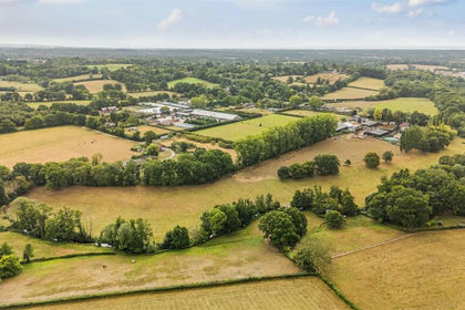
- Price
- Guide Price£2,000,000
- Size
- 12.28 acres
Long Acres Farm, Wangfield Lane, Curdridge, Southampton, Curdridge, Hampshire SO32 England
Added on 01/07/2026Farm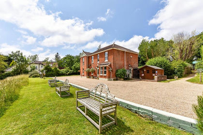
- Price
- Guide Price£1,500,000
- Size
- 8.43 acres
Added on 29/01/2026Equestrian property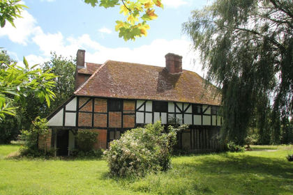
- Price
- Guide Price£1,375,000
- Size
- 1.85 acres
Sandy Lane, Waltham Chase, Shedfield, Hampshire SO32 England
Added on 13/10/2026House with Land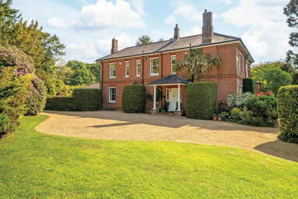
- Price
- Guide Price£1,750,000
- Size
- 2 acres
Greenwood Lane, Durley, SO32, Durley, Hampshire SO32 England
Added on 29/09/2026Country Home
- Price
- £1,595,000
- Size
- 2.8 acres
Botley Road, Bishops Waltham, Southampton, SO32, Bishops Waltham, Hampshire SO32 England
Added on 29/01/2026House with Land
- Price
- Guide Price£1,500,000
- Size
- 2.36 acres
Added on 17/06/2026House with Land
- Price
- Guide Price£1,850,000
- Size
- 13.08 acres
Added on 17/06/2026Farm
- Price
- Offers in Excess of£2,000,000
- Size
- 3.5 acres
Salterns Lane, Hampshire, SO31, Bursledon, Hampshire SO31 England
Added on 16/10/2026House with Land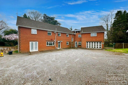
- Price
- Guide Price£1,500,000
Redcote Close, Southampton, SO18, Southampton Itchen, Southampton SO18 England
Added on 16/07/2026Development Land
- Price
- Offers Over£1,850,000
- Size
- 1 acres
Grange Road, Southampton, SO31, Hound, Hampshire SO31 England
Added on 13/06/2026House with Land