Sparty Lea, Hexham, NE47
- Land size
- 10.5 acres
- Bedrooms
- 3
- Bathrooms
- 1
Key Features
- Set within an Area of Outstanding Natural Beauty
- Recently renovated with substantial investment
- Grade II listed cottage with planning permission
- 10 ½ acres of pastureland with river access
- Traditional farm outbuildings with versatile use
- New stable conversion and upgraded infrastructure
Description
Accommodation in Brief
Sitting Room | Dining Room | Dining Room | Kitchen | Pantry/Store
Three Bedrooms | Shower Room
Grade Listed Cottage With Planning Permission
Additional Stone-Built Outbuilding
The Property
Set within the wide, unspoiled landscapes of West Allen Valley, Sparty Lea Farmhouse is a characterful country home that remains true to its traditional charm while incorporating considered modern updates. The property includes a thoughtfully renovated main farmhouse, two historic farm outbuildings including a characterful Grade II listed cottage and approximately 10 ½ acres of expansive pastureland extending to the scenic River East Allen, complete with fishing rights. As a smallholding, the estate also benefits from a reduced stamp duty classification, offering an additional advantage to prospective buyers.
The main farmhouse has been thoughtfully updated to maintain its rustic allure while incorporating modern amenities. A newly created dining room sits adjacent to the kitchen, providing a dedicated space for gatherings and featuring french doors to the exterior. The kitchen itself features an electric oven, induction hobs, and handcrafted cabinetry. The sitting room remains a focal point, centered around a log burner set in an original inglenook fireplace, while an additional adjacent dining room is anchored by another impressive inglenook fireplace with a wood-burning stove. The first floor continues the theme of understated charm with neutral lavender tones, featuring well-proportioned bedrooms offering serene views of the surrounding countryside and a modern bathroom equipped with a newly installed shower.
Development potential abounds with this Grade II listed stone building, now a substantial and carefully prepared shell with planning permission granted for conversion into a two-bedroom dwelling. Significant structural works have already been undertaken, including the installation of a new first floor following a full structural survey, with twelve new structural beams introduced while the original oak beams have been retained for decorative effect, preserving the building’s historic character. New windows complete with lintels have also been installed, while water and electricity are now connected to the cottage, with the electrical installation signed off under Building Regulations.
The ground floor has been finished using traditional lime construction and fully conforms to current Building Regulations, incorporating furnaced glass cube insulation beneath the lime floor to provide modern performance while respecting the integrity of the original structure. The building also retains its striking inglenook fireplace and exposed beams, offering a dramatic sense of scale and atmosphere and lending itself equally well to future residential use or creative space.
Externally, the property has benefited from extensive recent improvements, including a fully repointed exterior, a water treatment plant and upgraded drainage serving the cottage, dairy and a potential shepherd’s hut site. All windows, doors and structural beams have been approved by Building Control. The building is now ready for internal fit-out and customisation, allowing an incoming owner to complete the interior entirely to their own specification.
Externally
Additional structures include a robust stone-built barn or dairy, which echoes the property’s agricultural heritage and could be utilised as a workshop. A recently completed stable conversion adds further versatility, while a newly created parking area provides space for a horsebox and approximately six vehicles.
The property also benefits from its own water borehole, providing an independent private water supply, together with a recently installed generator designed to provide back-up power during occasional outages. A water treatment plant provides a further practical addition to the infrastructure serving the property.
The substantial landholding extends to approximately 10½ acres of pastureland, reaching the River East Allen and including fishing rights.
Local Information
Sparty Lea is a hamlet in the East Allen Valley, within the Pennines Area of Outstanding Natural Beauty. The beautiful surrounding area is ideal for the outdoor enthusiast with walking, cycling and nature on the doorstep including many rare birds such as the black grouse and curlew. The C2C cycle route and the Pennine Way are also both nearby. Just up the road, Sinderhope has a community centre while nearby Allendale offers everyday amenities with small supermarket, art gallery, craft shops, café, local public houses with restaurants and leisure facilities. Hexham is also within easy reach and offers further local services including a number of larger supermarkets, a selection of shops and a regular farmer's market, professional services, a leisure/sports centre, an independent cinema, busy theatre and hospital. Newcastle city centre provides comprehensive cultural, educational, recreational and shopping facilities.
For schooling there is a primary school in Allendale while senior schooling is offered at Haydon Bridge Community High School and Sports College (HBCHS) and Queen Elizabeth High School in Hexham. In addition, Mowden Hall Preparatory School, just outside Corbridge, provides private education from nursery up to 13 years and there are several private day schools in Newcastle with transport available from Hexham.
For the commuter the A69 is a short drive away and provides easy access to Newcastle International Airport and City Centre, Carlisle and onward access to the A1 and M6. The rail station at Hexham provides regular cross country services to both Newcastle and Carlisle, which in turn link to main line services to major UK cities north and south.
Approximate Mileages
Allendale 5.0 miles | Haydon Bridge 12.6 miles | Hexham 15.5 miles | Haltwhistle 21.4 miles | Corbridge 21.7 miles | Newcastle International Airport 39.2 miles | Newcastle City Centre 39.7 miles
Services
Mains electricity. Private water supply. Oil-fired central heating. Drainage upgraded with new water treatment plant and compliant septic system.
Wayleaves, Easements & Rights of Way
The property is being sold subject to all existing wayleaves, easements and rights of way, whether or not specified within the sales particulars.
Agents Note to Purchasers
We strive to ensure all property details are accurate, however, they are not to be relied upon as statements of representation or fact and do not constitute or form part of an offer or any contract. All measurements and floor plans have been prepared as a guide only. All services, systems and appliances listed in the details have not been tested by us and no guarantee is given to their operating ability or efficiency. Please be advised that some information may be awaiting vendor approval.
Submitting an Offer
Please note that all offers will require financial verification including mortgage agreement in principle, proof of deposit funds, proof of available cash and full chain details including selling agents and solicitors down the chain. To comply with Money Laundering Regulations, we require proof of identification from all buyers before acceptance letters are sent and solicitors can be instructed.
Disclaimer
The information displayed about this property comprises a property advertisement. Finest Properties strives to ensure all details are accurate; however, they do not constitute property particulars and should not be relied upon as statements of fact or representation. All information is provided and maintained by Finest Properties.
EPC Rating: C
Map Location
Property details
- Tenure
- Freehold
- Council Tax Band
- D
- Date Posted
- 2026-09-28
Market Value Analysis
Compared with 22 Farms & Smallholdings listings in North East England (10+ acres).
Energy Performance Certificate
Energy Efficiency Rating
Based on UK Energy Performance Certificate standards (EU Directive 2002/91/EC)
Running costs are one side. Planning activity, flood history and ground risks for this location are in the full report.
Utilities & Restrictions
Utilities
- Electricity
- Ask Agent
- Water
- Ask Agent
- Heating
- Ask Agent
- Broadband
- Ask Agent
- Sewerage
- Ask Agent
Rights & Restrictions
- Public Rights of Way
- Ask Agent
- Private Rights of Way
- Ask Agent
- Listed Property
- Ask Agent
- Restrictions
- Ask Agent
Listed status, conservation areas and planning constraints for this location are in the full report.
Property Features
- Accessibility
- Ask Agent
- Parking
- Parking Available
- Garden
- Ask Agent
Beyond the particulars: planning activity, flood history, heritage and ground risks, checked for this exact spot.
Connectivity
Broadband
Fastest speed available at this postcode
80 Mbps
Superfast · available to 88% of premises
Suitable for
- HD streaming
- Video calls
- Web & social
Mobile signal
Predicted 4G and 5G signal; indoor signal depends on building materials.
Ofcom Connected Nations postcode-level predictions. Speeds and signal are modelled, not measured, and vary between addresses and providers.
Signal is the easy part. Planning activity, flood history and protected designations here are in the full report.
Nearest Schools
Primary
- Allendale Primary School4.3 milesNo Ofsted rating
- Ages
- 2 to 11
- Pupils
- 126
- Type
- Community school
- Nenthead Primary School5.5 milesOfsted: Good
- Ages
- 4 to 11
- Pupils
- 17
- Type
- Community school
- Wearhead Primary School5.9 milesNo Ofsted rating
- Ages
- 2 to 11
- Pupils
- 11
- Type
- Community school
- St John's Chapel Primary School7.1 milesNo Ofsted rating
- Ages
- 2 to 11
- Pupils
- 24
- Type
- Community school
- Whitley Chapel Church of England First School7.3 milesOfsted: Good *
- Ages
- 3 to 9
- Pupils
- 28
- Type
- Voluntary aided school
- Faith
- Church of England
Secondary
- Samuel King's School8.4 milesNo Ofsted rating
- Ages
- 11 to 16
- Pupils
- 113
- Type
- Foundation school
- Haydon Bridge High School9.7 milesOfsted report card · Jan 2026
- Ages
- 11 to 18
- Pupils
- 392
- Type
- Foundation school
- St Joseph's Catholic Middle School, Hexham10 milesNo Ofsted rating
- Ages
- 9 to 13
- Pupils
- 168
- Type
- Academy converter
- Faith
- Roman Catholic
- Queen Elizabeth High School10 milesOfsted: Good
- Ages
- 13 to 18
- Pupils
- 1,299
- Type
- Academy converter
- Hexham Middle School11 milesNo Ofsted rating
- Ages
- 9 to 13
- Pupils
- 619
- Type
- Academy converter
* Latest graded judgement covers quality of education only; no overall grade was issued under the 2024-25 inspection framework.
Distances are straight-line from the advertised location. Source: the national school registers (DfE, Welsh Government, Scottish Government) and Ofsted.
Schools are just the start: sold prices nearby, planning activity and any flood history are in the full report.
Amenities
Supermarket
GP surgery
Pharmacy
Hospital
Straight-line distances from the advertised location. Sources: NHS records, Geolytix supermarket locations, OS Open Greenspace and the national trails registers.
The area stacks up? Now check the location itself: planning nearby, protected designations and past flooding.
Getting Around
Nearest station
Nearest bus stop
Typical drive times
Straight-line distances from the advertised location; drive times are typical free-flow times over OpenStreetMap road data, so allow more at peak. Public transport locations from DfT NaPTAN.
Easy to reach matters. So do planning activity, flood history and ground risks: all in the full report.
Flood Risk
Environment Agency open data, checked around the advertised map pin for the listed acreage. Long-term risk counts flood defences; the planning map's flood zones do not. Provided by LandSale, not the listing agent, and not part of the agent's particulars. Risk varies across a holding, so verify before committing.
Rivers and the sea
Planning map: Flood Zone 1.
Surface water
These bandings are the summary. Where this location sits on the flood maps, plus planning activity, heritage and ground risks, is in the full report.
Important notice: Information, maps and tags on this page are drawn from the advertising agent's marketing materials or generated automatically. LandSale has not verified them. Relying on these details is at your own risk, always carry out independent checks before committing to a purchase.
LandSale full disclaimer
Marketing information only - not formal particulars. The details on this website are provided for general guidance and do not constitute an offer or contract. Neither LandSale nor the advertising estate/land agent accepts responsibility for any inaccuracy.
1. Source of information
- Listing content: Core description, asking price, tenure, measurements, photographs and planning history originate from the marketing materials of the advertising estate or land agent. LandSale does not author this content and cannot guarantee its accuracy.
- Automated tags & categorisation: Property type, land-use class, acreage bands and similar labels may be applied by machine-learning models. They are intended as a helpful guide only and may not reflect the property's legal status or permitted use.
- Third-party & enriched data layers: Maps, boundary outlines, planning designations, soil reports, broadband coverage and other environmental or location-based insights are licensed from external suppliers. Such data are supplied “as is", may be incomplete or out of date and are subject to change without notice.
2. Verification required
Prospective purchasers must verify critical matters, including but not limited to planning permission, title boundaries, public rights of way, environmental constraints, acreage, services, access and VAT status, through their own inspections, specialist surveys, legal advisers and the selling agent before relying on the information or entering into any contract.
3. No warranty or liability
LandSale gives no warranty, express or implied, as to the accuracy, completeness or fitness for any particular purpose of the information displayed. LandSale shall not be liable for any loss, damage, cost or expense arising directly or indirectly from any use of or reliance on such information, save where liability may not be excluded by law.
4. Updates & feedback
If you believe any detail on this listing is inaccurate, please let us know. We will investigate and, where appropriate, update the listing or notify the agent.
© LandSale | Version 1.3 - August 2026
Listing agent
Ellisons, Edinburgh
Suite 2, Ground Floor, Orchard Brae House, 30 Queensferry Road, Edinburgh, EH4 2HS
Contact Ellisons, Edinburgh
Suite 2, Ground Floor, Orchard Brae House, 30 Queensferry Road, Edinburgh, EH4 2HS
View agent profileSimilar properties for sale
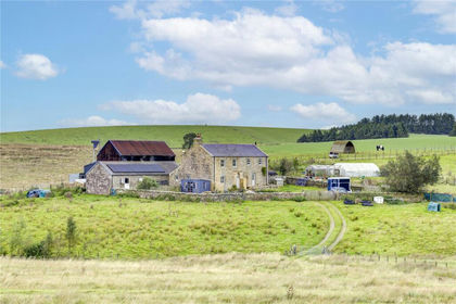
- Price
- £625,000
- Size
- 26.07 acres
High Tipalt Farm, Greenhead, Brampton, Northumberland, CA8, Greenhead, Northumberland CA8 England
Added on 22/09/2026Smallholding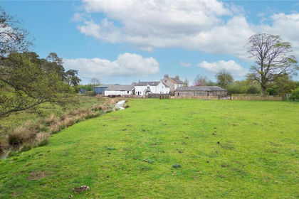
- Price
- £800,000
- Size
- 6.64 acres
Soulby, Kirkby Stephen, Cumbria, CA17, Soulby, Westmorland and Furness CA17 England
Added on 29/01/2026Farm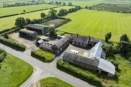
- Price
- Offers in Excess of£825,000
- Size
- 7.05 acres
Long Park Farm, Long Park, Carlisle, Cumbria, CA6, Scaleby, Cumberland CA6 England
Added on 08/08/2026Small Farm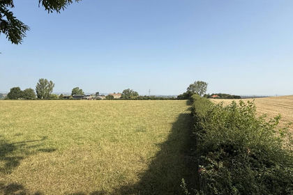
- Price
- Offers in Region of£895,000
- Size
- 27.89 acres
Caldwell, Richmond, North Yorkshire, DL11, Barforth, County Durham DL11 England
Added on 29/01/2026Smallholding
- Price
- £795,000
- Size
- 43.45 acres
Lot 1 Hopes House, Penton, Carlisle, CA6, Solport, Cumberland CA6 England
Added on 07/07/2026Smallholding
- Price
- £795,000
- Size
- 7.5 acres
Added on 07/07/2026Smallholding
- Price
- £600,000
- Size
- 18.28 acres
Hurst, Richmond, North Yorkshire, DL11, Marrick, North Yorkshire DL11 England
Added on 01/05/2026Farmland