Cherry Tree Farm, Monksdale Lane, Tideswell
- Land size
- 4.02 acres
- Bedrooms
- 2
- Bathrooms
- 1
Key Features
- A delightful smallholding in a highly sought after rural location
- The property offers a stone-built two bedroom farmhouse
- Adjoining stone barn benefitting from planning permission for a two-bedroom unrestricted dwelling,
- Further range of outbuildings and stables
- Surrounded by 4.02 acres (1.63 ha) of grassland
- On the edge of Tideswell village within the Peak District National Park
- The Farmhouse is subject to a S106 local need occupancy clause
- For Sale by Private Treaty
Description
Cherry Tree Farm presents a unique opportunity to acquire a delightful smallholding in a highly sought after rural location on the edge of Wheston village. The property offers a stone-built two bedroom farmhouse, an adjoining stone barn benefitting from planning permission for conversion into a two-bedroom unrestricted dwelling, a further range of outbuildings and stables, surrounded by 4.02 acres (1.63 ha) of grassland, offered as a whole or in two lots. The property is subject to a S106 local need occupancy clause.
Location: - Cherry Tree Farm boasts a picturesque, rural position set back from the roadside, on the edge of the popular village of Tideswell where a basic range of amenities can be found including a primary school, public houses, a pharmacy, and a church. Whilst offering rural outlooks, the property remains nearby to further towns and villages offers a wider range of amenities including; Buxton to the west (6.4 miles), Chapel-en-le-frith (7.4 miles), and Bakewell to the southeast (8.6 miles). The city of Sheffield locates just 20 miles to the northeast whilst Manchester sits just 30 miles to the northwest. Being situated within the heart of the Peak District National Park, the surrounding area is renowned for its scenic walks, cycle routes, and local beauty spots.
Description: - Cherry Tree Farm presents a rare opportunity to acquire a pleasant smallholding on the edge of Tideswell village benefitting from a private rural position within the Peak District National Park. The property briefly comprises a two bedroom farmhouse subject to a S106 local need occupancy clause, an adjoining stone barn with planning consent for an unrestricted two-bedroom dwelling, various other workshops/general purposes stores and stables, and surrounding grassland paddocks all extending to approximately 4.02 acres (1.63 hectares). The property will suit those with smallholder, equestrian and/or hobby farming interests, as well as those seeking business potential.
The property is offered in two lots, or as a whole;
Lot 1: Farmhouse and driveway
Lot 2: Buildings, planning permission for an unrestricted dwelling, and surrounding paddocks extending to 3.79 acres.
Directions: - From Buxton town centre, head northwest out of town on the A6 Fairfield Road. At the top of the hill turn right onto Waterswallows Road. Continue straight on that road for approximately 5 miles. At a crossroads turn left onto Monksdale Lane, the property can be found on your left hand side indicated by our ‘For Sale’ board.
What3Words: //tilt.treatment.harmless
Lot A - Farmhouse - Cherry Tree Farmhouse presents a stone-built dwelling with accommodation across two floors, finished to a high standard offering great family living spaces, and benefiting from views across the rural surroundings.
Through the front entrance, the ground floor offers a spacious dining kitchen with fitted units to three walls. The Lounge offers a pleasant family living space with a feature stone-surround fireplace hosting a log burner, and stairs up to the first floor with useful under stairs storage. The first floor offers two double bedrooms and a family bathroom with a modern fitted suite including a shower, bath, w/c, and basin.
The property offers an attractive driveway from the roadside leading down into a spacious yard area providing parking for multiple vehicles. Lawned areas offer pleasant garden spaces, each with far reaching rural views.
Occupancy Condition - Lot A is subject a S106 local need occupancy clause. Please contact the Bakewell office for further details.
Lot B - Outbuildings - The property benefits from a range of useful outbuildings, each flexible in their uses with the ability to be adapted and tailored to a purchasers needs. The buildings offer great spaces for those with equestrian and/or hobby farming interests or those seeking workshop spaces. The property previously benefited from granted planning permission for the erection of an additional agricultural or implement shed. (NP/DDD/0408/0318 )
Briefly, the buildings comprise of;
Two-storey stone built barn adjoining the farmhouse to one end. The barn benefits from planning consent for conversion into accommodation for an unrestricted dwelling. (Full Planning Permission for Proposed conversion of barn to dwelling. Ref; NP/DDD/0326/0336. Granted May 2026). Further details can be found online or via request.
Two storey, block built barn adjoining the farmhouse to one end, housing two stables, a general storage space for fodder, a tack room with w/c, and an outside kitchen with fitted units. A Lean-To adjoins to one end.
Block built detached building currently utilised as a workshop and internally divided.
The buildings have been well-maintained and potentially offer home business opportunities, subject to the necessary consent, situated within a very useful yard area.
The adjoining barn with planning permission is also likely to suit those wishing to accommodate multi-generational families, or create income from residential letting.
Lot B - Land - The grassland at the property is all down to permanent pasture, in very good heart, and divided into multiple parcels surrounding the buildings in a desirable ring fence. The grassland is all suitable for mowing and grazing of livestock and horses, bounded by dry stone walling, and laying flat. With an acreage of 3.79 ac, the land will appeal to those with smallholder/hobby farming interests and/or equestrians.
Services: - The property benefits from mains water, and electricity, with private drainage via a septic tank. The house benefits from LPG gas fired central heating.
Fixtures And Fittings: - Only those fixtures and fittings referred to in the sale particulars are included in the purchase price. Bagshaws have not tested any equipment, fixtures, fittings or services and no guarantee is given that they are in good working order.
Tenure And Possession: - The property is sold freehold, with vacant possession granted upon completion.
Sporting, Mineral And Timber Rights: - It is understood that the sporting, mineral and timber rights are included in the sale as far as they exist.
Rights Of Way, Wayleaves And Easements: - The property is sold subject to and with the benefit of all rights of way, wayleaves and easements whether or not they are described in these particulars. Lot B benefits from a right of way along the driveway for access.
Council Tax Band: - C
Epc Rating: - D
Vendor's Solicitors: - TBC
Local Authority: - Derbyshire Dales District Council, Town Hall, Bank Rd, Matlock, Derbyshire DE4 3NN
Local Planning Authority: - Peak District National Park Authority, Aldern House, Baslow Road, Bakewell, Derbyshire DE45 1AE
Broadband Connectivity: - It is understood that the property benefits from a satisfactory broadband service; however, due to the property's location, connection speeds may fluctuate. We recommend that prospective purchasers consult to obtain an estimated broadband speed for the area.
Mobile Network Coverage: - The property is well-situated for mobile signal coverage and is expected to be served by a broad range of providers. Prospective purchasers are encouraged to consult the Ofcom website ( to obtain an estimate of the signal strength for this specific location.
Method Of Sale: - The property will be offered for sale by private treaty.
Viewing: - Strictly by appointment only through the selling agents Bagshaws at the Bakewell Office on .
Agents Notes - Bagshaws LLP have made every reasonable effort to ensure these details offer an accurate and fair description of the property. The particulars are produced in good faith, for guidance only and do not constitute or form an offer or part of the contract for sale. Bagshaws LLP and their employees are not authorised to give any warranties or representations in relation to the sale and give notice that all plans, measurements, distances, areas and any other details referred to are approximate and based on information available at the time of printing.
Map Location
Property details
- Tenure
- Freehold
- Council Tax Band
- C
- Date Posted
- 2026-09-18
Market Value Analysis
Compared with 49 Farms & Smallholdings listings in East Midlands (1+ acres).
Energy Performance Certificate
Energy Efficiency Rating
Based on UK Energy Performance Certificate standards (EU Directive 2002/91/EC)
Running costs are one side. Planning activity, flood history and ground risks for this location are in the full report.
Utilities & Restrictions
Utilities
- Electricity
- Mains
- Water
- Mains
- Heating
- Gas Heating
- Broadband
- Ask Agent
- Sewerage
- Septic Tank / Private
Rights & Restrictions
- Public Rights of Way
- Ask Agent
- Private Rights of Way
- Ask Agent
- Listed Property
- Ask Agent
- Restrictions
- Ask Agent
Listed status, conservation areas and planning constraints for this location are in the full report.
Property Features
- Accessibility
- Ask Agent
- Parking
- Off-Street Parking
- Garden
- Garden
Beyond the particulars: planning activity, flood history, heritage and ground risks, checked for this exact spot.
Connectivity
Broadband
Fastest speed available at this postcode
29 Mbps
Standard (10-30 Mbps)
Suitable for
- Web & social
- Music streaming
- Standard video calls
Mobile signal
Outdoor predictions; indoor signal depends on building materials.
Ofcom Connected Nations postcode-level predictions. Speeds and signal are modelled, not measured, and vary between addresses and providers.
Signal is the easy part. Planning activity, flood history and protected designations here are in the full report.
Nearest Schools
Primary
- Bishop Pursglove CofE (A) Primary School1.1 milesNo Ofsted rating
- Ages
- 4 to 11
- Pupils
- 75
- Type
- Academy converter
- Faith
- Church of England
- Litton CofE Primary School1.7 milesOfsted: Good *
- Ages
- 3 to 11
- Pupils
- 42
- Type
- Voluntary aided school
- Faith
- Church of England
- Taddington and Priestcliffe School2.7 milesOfsted: Good
- Ages
- 4 to 11
- Pupils
- 64
- Type
- Voluntary aided school
- Faith
- Church of England
- Peak Forest Church of England Voluntary Controlled Primary School2.7 milesNo Ofsted rating
- Ages
- 4 to 11
- Pupils
- 42
- Type
- Voluntary controlled school
- Faith
- Church of England
- Peak Dale Primary School3.1 milesOfsted: Good *
- Ages
- 4 to 11
- Pupils
- 77
- Type
- Community school
Secondary
- St Thomas More Catholic Voluntary Academy4.9 milesOfsted: Good *
- Ages
- 11 to 16
- Pupils
- 407
- Type
- Academy converter
- Faith
- Roman Catholic
- Hope Valley College5.3 milesOfsted: Good
- Ages
- 11 to 18
- Pupils
- 518
- Type
- Academy sponsor led
- Buxton Community School5.4 milesNo Ofsted rating
- Ages
- 11 to 18
- Pupils
- 954
- Type
- Academy converter
- Chapel-en-le-Frith High School5.9 milesOfsted: Good *
- Ages
- 11 to 16
- Pupils
- 941
- Type
- Community school
- Lady Manners School6.8 milesOfsted: Good
- Ages
- 11 to 18
- Pupils
- 1,405
- Type
- Foundation school
* Latest graded judgement covers quality of education only; no overall grade was issued under the 2024-25 inspection framework.
Distances are straight-line from the advertised location. Source: the national school registers (DfE, Welsh Government, Scottish Government) and Ofsted.
Schools are just the start: sold prices nearby, planning activity and any flood history are in the full report.
Amenities
Supermarket
GP surgery
Pharmacy
Hospital
Walking trail
Straight-line distances from the advertised location. Sources: NHS records, Geolytix supermarket locations, OS Open Greenspace and the national trails registers.
The area stacks up? Now check the location itself: planning nearby, protected designations and past flooding.
Getting Around
Nearest station
Nearest bus stop
Typical drive times
Straight-line distances from the advertised location; drive times are typical free-flow times over OpenStreetMap road data, so allow more at peak. Public transport locations from DfT NaPTAN.
Easy to reach matters. So do planning activity, flood history and ground risks: all in the full report.
Flood Risk
From Environment Agency flood map open data, checked around the advertised map pin and allowing for the listed acreage where known. This summary comes from LandSale, the advertising platform, not from the listing agent, and is not part of the agent's particulars. Risk can vary across a single holding, so verify anything critical through your own searches before committing.
Rivers and the sea
Surface water
These bandings are the summary. Where this location sits on the flood maps, plus planning activity, heritage and ground risks, is in the full report.
Important notice: Information, maps and tags on this page are drawn from the advertising agent's marketing materials or generated automatically. LandSale has not verified them. Relying on these details is at your own risk, always carry out independent checks before committing to a purchase.
LandSale full disclaimer
Marketing information only - not formal particulars. The details on this website are provided for general guidance and do not constitute an offer or contract. Neither LandSale nor the advertising estate/land agent accepts responsibility for any inaccuracy.
1. Source of information
- Listing content: Core description, asking price, tenure, measurements, photographs and planning history originate from the marketing materials of the advertising estate or land agent. LandSale does not author this content and cannot guarantee its accuracy.
- Automated tags & categorisation: Property type, land-use class, acreage bands and similar labels may be applied by machine-learning models. They are intended as a helpful guide only and may not reflect the property's legal status or permitted use.
- Third-party & enriched data layers: Maps, boundary outlines, planning designations, soil reports, broadband coverage and other environmental or location-based insights are licensed from external suppliers. Such data are supplied “as is", may be incomplete or out of date and are subject to change without notice.
2. Verification required
Prospective purchasers must verify critical matters, including but not limited to planning permission, title boundaries, public rights of way, environmental constraints, acreage, services, access and VAT status, through their own inspections, specialist surveys, legal advisers and the selling agent before relying on the information or entering into any contract.
3. No warranty or liability
LandSale gives no warranty, express or implied, as to the accuracy, completeness or fitness for any particular purpose of the information displayed. LandSale shall not be liable for any loss, damage, cost or expense arising directly or indirectly from any use of or reliance on such information, save where liability may not be excluded by law.
4. Updates & feedback
If you believe any detail on this listing is inaccurate, please let us know. We will investigate and, where appropriate, update the listing or notify the agent.
© LandSale | Version 1.3 - August 2026
Listing agent
Bagshaws, Bakewell
The Agricultural Business Centre, Agricultural Way, Bakewell, DE45 1AH
Contact Bagshaws, Bakewell
The Agricultural Business Centre, Agricultural Way, Bakewell, DE45 1AH
View agent profileSimilar properties for sale
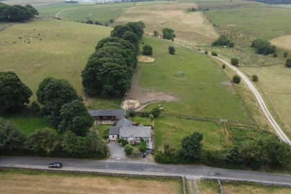
- Price
- £800,000
- Size
- 4 acres
The Ditch, Chelmorton, Buxton, Chelmorton, Derbyshire SK17 England
Added on 24/07/2026House with Land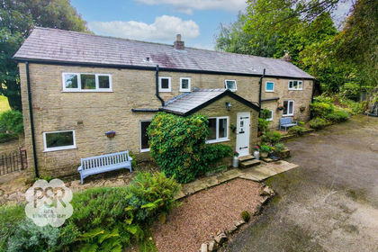
- Price
- Guide Price£850,000
- Size
- 3 acres
Redmoor Lane, New Mills, SK22, Disley, Cheshire East SK12 England
Added on 11/09/2026House with Land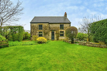
- Price
- £720,000
- Size
- 2.7 acres
Alstonefield, Ashbourne, Alstonefield, Staffordshire DE6 England
Added on 01/07/2026House with Land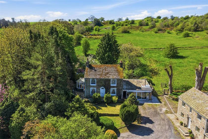
- Price
- Offers in Excess of£775,000
- Size
- 7.61 acres
Added on 11/05/2026Farmhouse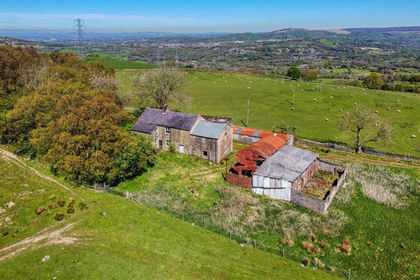
- Price
- Offers in Excess of£950,000
- Size
- 84.82 acres
Higher Chisworth, Chisworth, Glossop, Chisworth, Derbyshire SK13 England
Added on 08/07/2026Farm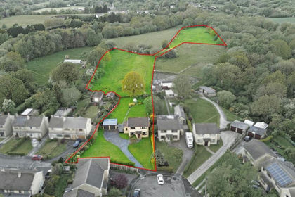
- Price
- Offers in Region of£650,000
- Size
- 3.63 acres
26 Springmeadow, Charlesworth, Glossop, Charlesworth, Derbyshire SK13 England
Added on 22/05/2026House with Land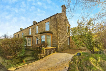
- Price
- Offers in Region of£850,000
- Size
- 2.01 acres
Mottram Moor, Mottram, Hyde, Stalybridge and Hyde, Tameside SK14 England
Added on 02/07/2026Equestrian property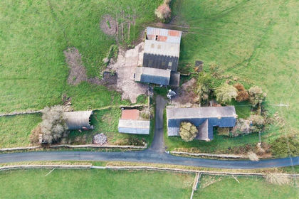
- Price
- Offers in Region of£745,000
- Size
- 22.24 acres
Bridge Flatts Farm, Winkhill, Leek, Waterhouses, Staffordshire ST13 England
Added on 21/02/2026Farmhouse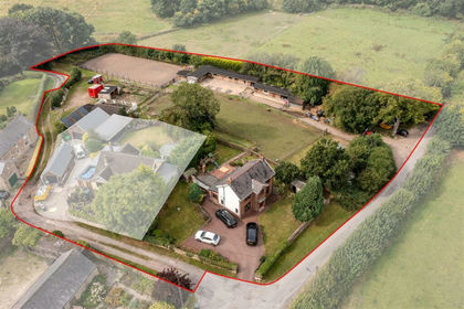
- Price
- £750,000
- Size
- 6.57 acres
Northmoor House, Martins Lane, Old Tupton, Wingerworth, Derbyshire S42 England
Added on 16/08/2026House with Land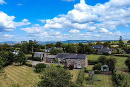
- Price
- £799,950
- Size
- 3.03 acres
Newtown, Biddulph Park, Staffordshire, Rushton, Staffordshire ST8 England
Added on 08/08/2026Smallholding