Maidstone Road, Hempstead
- Land size
- 9.6 acres
Key Features
- 88 Dwellings
- Resolution to grant full planning permission
- Close to the Hempstead Valley shopping centre
- Easy access onto M2 at Junction 4
Description
QUALITY RESIDENTIAL DEVELOPMENT SITE IN PRIME HEMPSTEAD LOCATION CLOSE TO JUNCTION 4 OF THE M2
Summary - Located in Hempstead with easy access onto the M2 at Junction 4 this site has a resolution to grant planning permission for 88 dwellings of which 25% are affordable. The developer who was proceeding with the application has decided to withdraw their interest but has agreed to leave the application ‘live’ and we are now seeking a developer to take the planning forward with a plot substitution on a subject to planning basis. The access into the site is owned by a third party and terms have been agreed to provide the necessary access. The site is offered for sale with offers invited.
Location - The site is well situated on the southern boundary of the Medway towns conurbation with very good access to the M2 at Junction 4 which is only 1/4 mile to the southeast. Rainham mainline station is less than 3 miles to the northeast with high speed services to St Pancras in 51 minutes. The Medway Towns enjoy a wide range of retail, educational, cultural and leisure facilities all within close proximity of the site and the Hempstead Valley Shopping Centre is only 1/2 mile to the northwest.
Description & Site Area - The site is bound by a block of woodland to the north and by the A278 to the east. Beyond this are existing residential areas on the periphery of Hempstead. The south-western edge is bound by further woodland and the south-eastern edge by Maidstone Road which connects the site to the A278 and the M2 motorway.
The site extends to approximately 9.6 acres (3.9 hectares).
Land To Be Sold And Access - The Plan shows the area of land being offered for sale outlined in red. The blue hatched area is required for access and terms have been agreed for this land to be acquired - further details on request.
Tenure And Vat - The freehold interest in the land is offered for sale. VAT will not be chargeable on the sale price.
Planning - A resolution to grant Full Planning Permission was granted by Medway Council on 23rd October 2024 for the ’Construction of 88 dwellings (including 25% affordable) together with associated parking, access, open space, landscaping and SuDS.’ The Planning Committee Report sets out details of the proposed planning conditions and section 106 contributions—this is available in the dataroom.
Services - Purchasers are advised to make their own enquiries with the relevant statutory authorities to ensure availability and sufficient capacity at the site in order to service any proposed development.
Development Proposal - Access into the site will be from Maidstone Road and the proposed layout comprises a mix of 1 and 2 bed apartments, 2, 3, 4 and 5 bed houses. The scheme is surrounded by woodland both within and outside the site’s boundary. The public right of way will be diverted to follow a green corridor. A row of terraced units and apartments are located along the south eastern boundary to screen the remainder of the development and mitigate against noise from the A278.
Additional Information - The following information, inter alia, is available from RPC Land & New Homes' Website
• Planning Information
• Plans
• Design & Access Statement
• Air Quality Report
• Arboricultural Assessment
• Ecology Report
• Flood Risk Assessment
• Landscape & Visual Appraisal
• Transport Assessment
• Proposed site layout plan
• Utility Report
Method Of Sale - Offers are invited for the freehold interest (subject to planning only). Bids must be emailed to RPC Land & New Homes
In submitting a proposal please provide details as below:
1. Purchase Price.
2. Details of any abnormal costs allowed for.
3. Details of due diligence required prior to exchange of contracts.
4. Timescale for exchange and completion.
5. Confirmation of funds.
6. Board approval process.
The vendor reserves the right not to accept the highest nor any bid made for the site.
A successful bidder will be required to provide the usual information to satisfy the AML requirements when Heads of Terms are agreed.
Misrepresentation Clause - RPC Land & New Homes for themselves and for the vendors of this property for whom they act, give notice that:
These particulars are prepared only for the guidance of prospective purchasers. They are intended to give a fair overall description of the property but do not constitute the whole or any part of an offer or contract. RPC Land & New Homes undertake to comply with the terms of the Property Misdescriptions Act 1991 but prospective purchasers must satisfy themselves as to the accuracy of the contents of these particulars, and RPC Land & New Homes will not be liable in negligence for any loss arising from the use of these particulars.
Any information contained herein (whether in the text, plans or photographs) is given in good faith but RPC Land & New Homes cannot guarantee the accuracy of any description, dimensions, references to condition, necessary permissions for use and occupation or any other details contained therein, nor should any information contained herein be relied upon as a statement or representation of fact. Prospective purchasers or tenants must satisfy themselves as to the accuracy of all information contained in these particulars. Prices and rents quoted in these particulars may be subject to VAT in addition.
Nothing in these particulars shall be deemed to be a statement that the property is in good condition or otherwise, and reference to any plant, machinery, equipment, services, fixtures or fittings at the property shall not constitute a representation as to its state or condition or that it is capable of fulfilling its intended function. Prospective purchasers should satisfy themselves as to the fitness of such items for their requirements.
The photographs appearing in this brochure show only certain parts and aspects of the property. Certain aspects of the property may have changed since the photographs were taken and it should not be assumed that the property remains precisely as displayed in the photographs. It should not be assumed that everything shown in the photographs is included in the sale of the property. Furthermore no assumptions should be made in respect of parts of the property which are not shown in the photographs. Any reference in these particulars to the fact that alterations have been carried out or that a particular use is made of any part of the property is not intended to be a statement that any necessary planning, building regulations or other consents have been obtained and these matters must be verified by any intending purchaser. No employee of RPC Land & New Homes has any authority to make or give any representation or warranty whatsoever in relation to the property.
Map Location
Property details
- Tenure
- Ask Agent
- Council Tax Band
- Ask Agent
- Date Posted
- 2026-09-16
Market Value Analysis
Compared with 35 Development Land listings in South East England (5+ acres).
Utilities & Restrictions
Utilities
- Electricity
- Ask Agent
- Water
- Ask Agent
- Heating
- Ask Agent
- Broadband
- Ask Agent
- Sewerage
- Ask Agent
Rights & Restrictions
- Public Rights of Way
- Ask Agent
- Private Rights of Way
- Ask Agent
- Listed Property
- Ask Agent
- Restrictions
- Ask Agent
Listed status, conservation areas and planning constraints for this location are in the full report.
Property Features
- Accessibility
- Ask Agent
- Parking
- Parking Available
- Garden
- Ask Agent
Beyond the particulars: planning activity, flood history, heritage and ground risks, checked for this exact spot.
Connectivity
Broadband
Fastest speed available at this postcode
5.5 Gbps
Gigabit full fibre
Suitable for
- 4K streaming on every screen
- Full-time home working
- Online gaming & big downloads
Mobile signal
Outdoor predictions; indoor signal depends on building materials.
Ofcom Connected Nations postcode-level predictions. Speeds and signal are modelled, not measured, and vary between addresses and providers.
Signal is the easy part. Planning activity, flood history and protected designations here are in the full report.
Nearest Schools
Primary
- Bredhurst Church of England Voluntary Controlled Primary School916 metresOfsted: Good
- Ages
- 4 to 11
- Pupils
- 140
- Type
- Voluntary controlled school
- Faith
- Church of England
- Hempstead Junior School958 metresNo Ofsted rating
- Ages
- 7 to 11
- Pupils
- 371
- Type
- Community school
- Deanwood Primary School997 metresNo Ofsted rating
- Ages
- 2 to 11
- Pupils
- 238
- Type
- Academy converter
- Hempstead Infant School0.7 milesNo Ofsted rating
- Ages
- 4 to 7
- Pupils
- 251
- Type
- Community school
- Fairview Community Primary School0.7 milesNo Ofsted rating
- Ages
- 3 to 11
- Pupils
- 670
- Type
- Community school
Secondary
- Rainham School for Girls1.7 milesOfsted report card · May 2026
- Ages
- 11 to 18
- Pupils
- 1,622
- Type
- Academy converter
- Gender
- Girls
- The Howard School1.8 milesOfsted report card · Feb 2026
- Ages
- 11 to 18
- Pupils
- 1,471
- Type
- Academy converter
- Gender
- Boys
- Rainham Mark Grammar School2.3 milesOfsted: Good
- Ages
- 11 to 18
- Pupils
- 1,568
- Type
- Academy converter
- Greenacre School2.4 milesOfsted: Inadequate
- Ages
- 11 to 18
- Pupils
- 747
- Type
- Academy converter
- Gender
- Boys
- Walderslade School2.5 milesOfsted: Inadequate
- Ages
- 11 to 18
- Pupils
- 697
- Type
- Academy converter
- Gender
- Girls
Distances are straight-line from the advertised location. Source: the national school registers (DfE, Welsh Government, Scottish Government) and Ofsted.
Schools are just the start: sold prices nearby, planning activity and any flood history are in the full report.
Amenities
Supermarket
GP surgery
Pharmacy
Hospital
Green space
Straight-line distances from the advertised location. Sources: NHS records, Geolytix supermarket locations, OS Open Greenspace and the national trails registers.
The area stacks up? Now check the location itself: planning nearby, protected designations and past flooding.
Getting Around
Nearest station
Nearest bus stop
Typical drive times
Straight-line distances from the advertised location; drive times are typical free-flow times over OpenStreetMap road data, so allow more at peak. Public transport locations from DfT NaPTAN.
Easy to reach matters. So do planning activity, flood history and ground risks: all in the full report.
Flood Risk
From Environment Agency flood map open data, checked around the advertised map pin and allowing for the listed acreage where known. This summary comes from LandSale, the advertising platform, not from the listing agent, and is not part of the agent's particulars. Risk can vary across a single holding, so verify anything critical through your own searches before committing.
Rivers and the sea
Surface water
These bandings are the summary. Where this location sits on the flood maps, plus planning activity, heritage and ground risks, is in the full report.
Important notice: Information, maps and tags on this page are drawn from the advertising agent's marketing materials or generated automatically. LandSale has not verified them. Relying on these details is at your own risk, always carry out independent checks before committing to a purchase.
LandSale full disclaimer
Marketing information only - not formal particulars. The details on this website are provided for general guidance and do not constitute an offer or contract. Neither LandSale nor the advertising estate/land agent accepts responsibility for any inaccuracy.
1. Source of information
- Listing content: Core description, asking price, tenure, measurements, photographs and planning history originate from the marketing materials of the advertising estate or land agent. LandSale does not author this content and cannot guarantee its accuracy.
- Automated tags & categorisation: Property type, land-use class, acreage bands and similar labels may be applied by machine-learning models. They are intended as a helpful guide only and may not reflect the property's legal status or permitted use.
- Third-party & enriched data layers: Maps, boundary outlines, planning designations, soil reports, broadband coverage and other environmental or location-based insights are licensed from external suppliers. Such data are supplied “as is", may be incomplete or out of date and are subject to change without notice.
2. Verification required
Prospective purchasers must verify critical matters, including but not limited to planning permission, title boundaries, public rights of way, environmental constraints, acreage, services, access and VAT status, through their own inspections, specialist surveys, legal advisers and the selling agent before relying on the information or entering into any contract.
3. No warranty or liability
LandSale gives no warranty, express or implied, as to the accuracy, completeness or fitness for any particular purpose of the information displayed. LandSale shall not be liable for any loss, damage, cost or expense arising directly or indirectly from any use of or reliance on such information, save where liability may not be excluded by law.
4. Updates & feedback
If you believe any detail on this listing is inaccurate, please let us know. We will investigate and, where appropriate, update the listing or notify the agent.
© LandSale | Version 1.3 - August 2026
Listing agent
RPC Land and New Homes, Kent
158 High Street Tonbridge TN9 1BB
Similar properties for sale
- Price
- Guide Price£5,750,000
- Size
- 9.28 acres
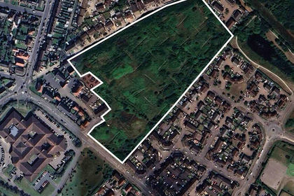
Land at Plover Road, Minster on Sea, Kent, ME12, Minster-on-Sea, Kent ME12 England
Added on 17/07/2026Development Land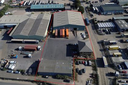
- Price
- Guide Price£3,750,000
Beacon Hill Industrial Estate, Purfleet, Thurrock, Thurrock RM19 England
Added on 15/09/2026Warehouse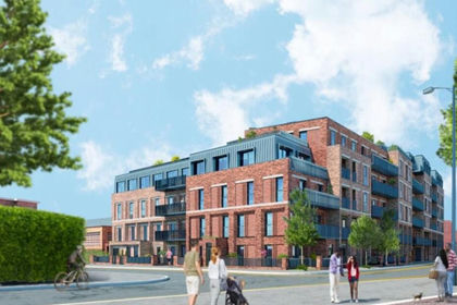
- Price
- Guide Price£5,250,000
- Size
- 1.02 acres
Former Car Park, London Road, Essex, RM7, Romford, Havering RM7 England
Added on 26/08/2026Development Land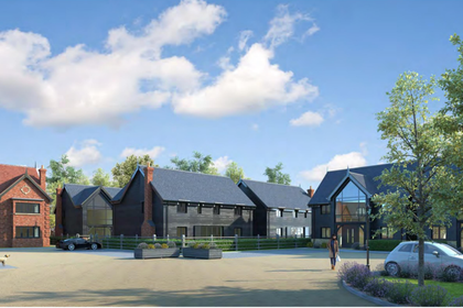
- Price
- Offers in Excess of£7,000,000
- Size
- 3.7 acres
Mylands Farm, Broxhill Road, Havering-atte-bower, Romford, Havering, Romford, Havering RM4 England
Added on 17/07/2026Development Land
- Price
- Guide Price£5,000,000
Added on 10/07/2026Development Land
- Price
- Offers Over£6,000,000
Added on 29/01/2026Pub
- Price
- Guide Price£4,500,000
- Size
- 0.85 acres
Added on 16/05/2026Warehouse
- Price
- £4,500,000
- Size
- 12.92 acres
Aerodrome Road, Hawkinge, Folkestone, Kent, CT18, Hawkinge, Kent CT18 England
Added on 29/01/2026Development Land
- Price
- £6,150,000
- Size
- 2.2 acres
Land On The South Side Of Grange Farm Lane, Chigwell, IG7, Chigwell, Essex IG7 England
Added on 17/07/2026Industrial Land
- Price
- Offers in Excess of£4,250,000
Church Hill, Walthamstow, London E17, Walthamstow, Waltham Forest E17 England
Added on 07/09/2026Development Land