Tysoe Road, Kineton, Warwickshire
- Land size
- 1.26 acres
- Bedrooms
- 2
- Bathrooms
- 1
Key Features
- Open plan kitchen/breakfast/sitting room
- Master bedroom
- Second Bedroom with loft study
- Bathroom
- Two garages and ample parking
- Delightful private gardens
- Adjacent paddock/amenity land
- In all about 1.26 acres
Description
A charming and characterful barn conversion set within a peaceful rural setting, with landscaped gardens and adjoining paddock extending to about 1.26 acres in all.
Living accommodation
• Light, flexible accommodation with underfloor heating throughout.
• Spacious open-plan kitchen, dining and living area with vaulted ceilings, oak Shaker-style cabinetry, granite worktops and integrated appliances.
• Bi-fold doors open onto the south-west facing garden and paddock, flooding the space with natural light.
• Cosy sitting area featuring a wood burner, exposed stonework and a unique floor-set wine cellar.
• Principal bedroom with vaulted ceiling, exposed beams, built-in storage and split stable doors to the garden.
• Stylish bathroom finished in travertine with a freestanding bath and separate shower.
• Versatile second bedroom, ideal as a guest room or home office.
• Mezzanine level accessed via a feature spiral staircase, providing additional study, guest or storage space.
• Practical vaulted hallway with generous utility and storage cupboards.
Gardens and grounds
• Ample private parking for several vehicles, finished with Cotswold stone chippings, together with a useful log and bin store and generator point.
• Detached double garage/stable with power, lighting and wide access doors, ideal for storage, hobbies or workshop space.
• Beautifully landscaped south-west facing gardens with lawn, mature planting and a variety of private seating areas enjoying the afternoon and evening sun.
• Well-stocked borders, fruit trees and Cotswold stone pathways create an attractive and productive garden setting.
• Backing onto over an acre of paddock and amenity land, fully fenced with a water supply and established wildlife corridors.
• Three mature oak trees, from which the property takes its name, enhance the sense of privacy and provide a haven for local wildlife.
• A delightful rural setting with far-reaching countryside views and a rich variety of birds and wildlife regularly seen throughout the year.
Situation
Three Oaks forms part of an exclusive courtyard-style development of converted barns, creating a small and welcoming rural community in a beautiful countryside setting.
Positioned between the highly regarded villages of Tysoe and Kineton, the property enjoys easy access to village amenities, well-regarded schools and excellent transport links, while being surrounded by rolling Warwickshire countryside beneath the historic Edge Hill ridge.
Set within the Vale of the Red Horse and close to the north-eastern edge of the Cotswolds, the area offers superb walking and riding routes, together with golf, racing, polo and theatres all within easy reach. Soho Farmhouse and Daylesford Organic are also nearby.
A rare opportunity to enjoy country living in an unspoilt setting, without feeling isolated, and with excellent amenities and connectivity close at hand.
Fixtures and fittings
All fixtures, fittings and furniture such as curtains, light fittings, garden ornaments and statuary are excluded from the sale. Some may be available by separate negotiation.
Services
Mains water and electricity, private LPG gas supply, and drainage via a shared treatment plant. None of the services or appliances, heating installations, plumbing or electrical systems have been tested by the selling agents.
If the private drainage system requires updating/replacement, it is assumed that prior to offers being made, associated costs have been considered and are the responsibility of the purchaser. Interested parties are advised to make their own investigations, no further information will be provided by the selling agents.
The estimated fastest download speed currently achievable for the property postcode area is around 3 Mbps (data taken from checker.ofcom.org.uk on 10/09/2026). Actual service availability at the property or speeds received may be different.
We understand that the property postcode area is likely to have current mobile coverage outdoors (data taken from checker.ofcom.org.uk on 10/09/2026). Please note that actual services available may be different depending on the particular circumstances, precise location and network outages.
Tenure
The property is to be sold freehold with vacant possession.
Method of sale
The property is offered for sale by Private Treaty method. However the vendor reserves the right to conclude the sale by an alternative method if required.
Local Authority
Stratford-on-Avon District Council
Council Tax Band C
Public rights of way, wayleaves and easements
The property is sold subject to all rights of way, wayleaves and easements whether or not they are defined in this brochure.
Planning
The selling agents will not provide advice/guidance on the planning history for the property/land. Interested parties are advised to make their own investigations. It is assumed that enquiries have been satisfied, prior to an offer being made.
Anti Money Laundering Regulations (AML)
In accordance with Anti Money Laundering Regulations (AML), we are required to request forms of identification and carry out due diligence on any parties connected to a successful offer. Should an offer be made on behalf of a business/company, AML due diligence will also be necessary. Proof/source of funding must be supplied, prior to offer acceptance.
Plans and boundaries
The plans within these particulars are based on Ordnance Survey data and provided for reference only. They are believed to be correct but accuracy is not guaranteed. The purchaser shall be deemed to have full knowledge of all boundaries and the extent of ownership. Neither the vendor nor the vendor’s agents will be responsible for defining the boundaries or the ownership thereof.
Viewings
Strictly by appointment through Fisher German LLP.
Directions
Postcode – CV35 0DY
what3words – ///vision.polar.fired
Map Location
Property details
- Tenure
- Freehold
- Council Tax Band
- C
- Date Posted
- 2026-09-14
Market Value Analysis
Compared with 1,047 Homes with Land listings in West Midlands (1+ acres).
Energy Performance Certificate
Energy Efficiency Rating
Based on UK Energy Performance Certificate standards (EU Directive 2002/91/EC)
Running costs are one side. Planning activity, flood history and ground risks for this location are in the full report.
Utilities & Restrictions
Utilities
- Electricity
- Ask Agent
- Water
- Ask Agent
- Heating
- Ask Agent
- Broadband
- Ask Agent
- Sewerage
- Ask Agent
Rights & Restrictions
- Public Rights of Way
- Ask Agent
- Private Rights of Way
- Ask Agent
- Listed Property
- Ask Agent
- Restrictions
- Ask Agent
Listed status, conservation areas and planning constraints for this location are in the full report.
Property Features
- Accessibility
- Ask Agent
- Parking
- Parking Available
- Garden
- Garden
Beyond the particulars: planning activity, flood history, heritage and ground risks, checked for this exact spot.
Connectivity
Broadband
Fastest speed available at this postcode
12 Mbps
Standard (10-30 Mbps)
Suitable for
- Web & social
- Music streaming
- Standard video calls
Fixed wireless access may also be an option here.
Mobile signal
Outdoor predictions; indoor signal depends on building materials.
Ofcom Connected Nations postcode-level predictions. Speeds and signal are modelled, not measured, and vary between addresses and providers.
Signal is the easy part. Planning activity, flood history and protected designations here are in the full report.
Nearest Schools
Primary
- Tysoe CofE Primary School1.9 milesOfsted: Good
- Ages
- 4 to 11
- Pupils
- 121
- Type
- Academy converter
- Faith
- Church of England
- Kineton Church of England Primary School2.4 milesNo Ofsted rating
- Ages
- 4 to 11
- Pupils
- 208
- Type
- Academy converter
- Faith
- Church of England
- Shenington Church of England Primary School3.3 milesOfsted: Good *
- Ages
- 4 to 11
- Pupils
- 84
- Type
- Voluntary aided school
- Faith
- Church of England
- Hornton Primary School3.5 milesOfsted: Good
- Ages
- 2 to 11
- Pupils
- 109
- Type
- Academy converter
- Temple Herdewyke Primary School3.8 milesNo Ofsted rating
- Ages
- 2 to 11
- Pupils
- 107
- Type
- Academy converter
Secondary
- Kineton High School2.2 milesNo Ofsted rating
- Ages
- 11 to 18
- Pupils
- 1,082
- Type
- Academy converter
- North Oxfordshire Academy6.7 milesNo Ofsted rating
- Ages
- 11 to 19
- Pupils
- 1,004
- Type
- Academy sponsor led
- Shipston High School7 milesOfsted: Good
- Ages
- 11 to 16
- Pupils
- 526
- Type
- Academy converter
- Futures Institute Banbury8.4 milesNo Ofsted rating
- Ages
- 14 to 18
- Pupils
- 116
- Type
- Studio schools
- Wykham Park8.4 milesNo Ofsted rating
- Ages
- 11 to 18
- Pupils
- 800
- Type
- Academy sponsor led
* Latest graded judgement covers quality of education only; no overall grade was issued under the 2024-25 inspection framework.
Distances are straight-line from the advertised location. Source: the national school registers (DfE, Welsh Government, Scottish Government) and Ofsted.
Schools are just the start: sold prices nearby, planning activity and any flood history are in the full report.
Amenities
Supermarket
GP surgery
Pharmacy
Hospital
Straight-line distances from the advertised location. Sources: NHS records, Geolytix supermarket locations, OS Open Greenspace and the national trails registers.
The area stacks up? Now check the location itself: planning nearby, protected designations and past flooding.
Getting Around
Nearest station
Nearest bus stop
Typical drive times
Straight-line distances from the advertised location; drive times are typical free-flow times over OpenStreetMap road data, so allow more at peak. Public transport locations from DfT NaPTAN.
Easy to reach matters. So do planning activity, flood history and ground risks: all in the full report.
Flood Risk
From Environment Agency flood map open data, checked around the advertised map pin and allowing for the listed acreage where known. This summary comes from LandSale, the advertising platform, not from the listing agent, and is not part of the agent's particulars. Risk can vary across a single holding, so verify anything critical through your own searches before committing.
Rivers and the sea
Surface water
These bandings are the summary. Where this location sits on the flood maps, plus planning activity, heritage and ground risks, is in the full report.
Important notice: Information, maps and tags on this page are drawn from the advertising agent's marketing materials or generated automatically. LandSale has not verified them. Relying on these details is at your own risk, always carry out independent checks before committing to a purchase.
LandSale full disclaimer
Marketing information only - not formal particulars. The details on this website are provided for general guidance and do not constitute an offer or contract. Neither LandSale nor the advertising estate/land agent accepts responsibility for any inaccuracy.
1. Source of information
- Listing content: Core description, asking price, tenure, measurements, photographs and planning history originate from the marketing materials of the advertising estate or land agent. LandSale does not author this content and cannot guarantee its accuracy.
- Automated tags & categorisation: Property type, land-use class, acreage bands and similar labels may be applied by machine-learning models. They are intended as a helpful guide only and may not reflect the property's legal status or permitted use.
- Third-party & enriched data layers: Maps, boundary outlines, planning designations, soil reports, broadband coverage and other environmental or location-based insights are licensed from external suppliers. Such data are supplied “as is", may be incomplete or out of date and are subject to change without notice.
2. Verification required
Prospective purchasers must verify critical matters, including but not limited to planning permission, title boundaries, public rights of way, environmental constraints, acreage, services, access and VAT status, through their own inspections, specialist surveys, legal advisers and the selling agent before relying on the information or entering into any contract.
3. No warranty or liability
LandSale gives no warranty, express or implied, as to the accuracy, completeness or fitness for any particular purpose of the information displayed. LandSale shall not be liable for any loss, damage, cost or expense arising directly or indirectly from any use of or reliance on such information, save where liability may not be excluded by law.
4. Updates & feedback
If you believe any detail on this listing is inaccurate, please let us know. We will investigate and, where appropriate, update the listing or notify the agent.
© LandSale | Version 1.3 - August 2026
Listing agent
Fisher German, Covering South East
Covering South East
Similar properties for sale
- Price
- Guide Price£420,000
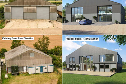
The Drying Barn, Idlicote Estate Barns, Idlicote, Warwickshire CV36 England
Added on 23/07/2026Development Land
- Price
- Guide Price£575,000
Middle Lane, Shotteswell, OX17, Shotteswell, Warwickshire OX17 England
Added on 25/08/2026Barn Conversion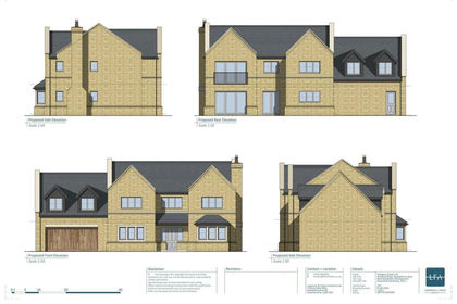
- Price
- Guide Price£409,100
Plot 1, Stratford Road, Newbold On Stour, Stratford-Upon-Avon, Tredington, Warwickshire CV37 England
Added on 29/01/2026Self Build Plot- Price
- Guide Price£441,000
Plot 2, Stratford Road, Newbold On Stour, Stratford-Upon-Avon, Tredington, Warwickshire CV37 England
Added on 29/01/2026Self Build Plot- Price
- Guide Price£387,100
Plot 3, Stratford Road, Newbold On Stour, Stratford-Upon-Avon, Tredington, Warwickshire CV37 England
Added on 29/01/2026Self Build Plot Added on 29/01/2026Barn Conversion
- Price
- £450,000
Added on 09/06/2026Barn Conversion
- Price
- Offers in Region of£495,000
- Size
- 0.3 acres
Bretch Hill, Banbury, Oxfordshire. OX16 0QW., Banbury, Oxfordshire OX16 England
Added on 16/07/2026Building Plot
- Price
- Guide Price£435,000
Added on 09/07/2026Barn Conversion
- Price
- Guide Price£550,000
- Size
- 11 acres
Windmill View | Welsh Road East Marston Doles, Priors Hardwick, Warwickshire CV47 England
Added on 04/06/2026House with Land