Sizewell, Suffolk Coast
- Bedrooms
- 3
- Bathrooms
- 2
Key Features
- Established coastal public house premises
- Prominent roadside position close to Sizewell Beach
- Bar, dining areas and commercial kitchen
- Three-bedroom first-floor living accommodation
- Approximately 2,570 sq. ft. (238.8 sq. m.) overall
- Customer parking and external trade areas
- Potential for continued hospitality or alternative uses, subject to planning
- Freehold with vacant possession on completion
Description
Location
The property occupies a prominent position on the southern side of Sizewell Gap, on the western approach to the coastal hamlet of Sizewell. Sizewell Beach and the Suffolk coast are within a short walk. The property is also close to the Sizewell energy complex and lies within the Suffolk Coast and Heaths National Landscape.
The town of Leiston is approximately two miles to the west and provides a range of shops, schools and other local facilities. Thorpeness and Aldeburgh are approximately five and six miles away respectively.
Description
The Vulcan Arms comprises an established detached public house arranged over ground and first floors. The principal building is of traditional brick construction, with a rendered front elevation, beneath pitched tiled roofs. There are a number of single-storey additions.
The ground floor is arranged around a fitted central bar servery and provides two principal public bar and dining areas, together with a commercial kitchen, cellar and storage areas, customer WC facilities and other ancillary accommodation. The public areas retain a traditional character, with exposed timbers and fireplaces.
The first floor provides living accommodation comprising a sitting room, fitted kitchen, three bedrooms and a bathroom with bath and separate shower.
Externally, the property benefits from a substantial gravel-surfaced customer parking area, together with external seating and trade garden areas. There is also a timber storage building and other ancillary structures.
The property offers an opportunity to continue its established public house and hospitality use or, subject to obtaining all necessary consents, explore other commercial or residential uses.
Accommodation
Accommodation
Ground-floor public house, kitchen, cellar and ancillary areas -150.0 sqm - 1,614 sq ft
First-floor living accommodation - 88.8 sqm - 956 sq ft
Total - 238.8 sqm - 2,570 sq ft
Sale Boundary
The sale comprises the public house and the land shown shaded pink on the indicative plan enclosed within these particulars.
The adjoining raised land to the east, historically used for caravan and camping purposes, is excluded from the sale and will be retained by the vendor. The precise sale boundary will be confirmed within the sale contract.
The plan is provided for identification purposes only and is not to scale.
Planning
We understand that the property has an established use as a public house with ancillary residential accommodation. The property may offer potential for alternative uses, subject to obtaining all necessary planning permissions and other consents. Interested parties should make their own enquiries of East Suffolk Council.
Services
We understand that mains water and electricity are connected. Heating is provided by an LPG-fired system, with an external LPG storage tank. Drainage is via a private septic tank system. The services and installations have not been tested by the agents. Interested parties should satisfy themselves as to their condition and suitability.
Business Rates
The property appears in the Rating List with a Rateable Value of £4,500 with effect from 1 April 2026. Small Business Rates Relief may be available, subject to the circumstances of the occupier. Interested parties should verify the rates payable with East Suffolk Council.
Council Tax
The first-floor living accommodation is understood to be assessed within Council Tax Band A.
EPC
The property has an Energy Performance Rating of C (71). The certificate is valid until 29 April 2036 and is available from the agents.
Fixtures and Fittings
The guide price is intended to include those trade fixtures, fittings and contents owned by the vendor and remaining at the property, save for any items expressly excluded.
Tenure
The property is to be sold freehold with vacant possession upon completion. The transaction will comprise a transfer of part, reflecting the sale boundary shown on the plan.
Terms
Offers are invited in the region of £285,000 for the freehold interest.
VAT
All figures are quoted exclusive of VAT, which will be charged where applicable.
Legal Costs
Each party will be responsible for their own legal costs incurred in connection with the transaction.
Anti-Money Laundering
The successful purchaser will be required to provide appropriate identification and proof of funds in accordance with current anti-money laundering regulations.
Viewing
Strictly by prior appointment with the sole agents.
Directions
Travelling east on the B1119, proceed towards Leiston. Take a right turn onto Park Hill, then immediately left onto the B1122 Main Street/High Street. After a short time take the left hand turn into Sizewell Road/King Georges Avenue. At the T-junction turn right heading East on Sizewell Gap. The Vulcan Arms will be found on the right hand side.
What3Words: ///legend.brotherly.chew
NOTES
1. Every care has been taken with the preparation of these particulars, but complete accuracy cannot be guaranteed. If there is any point, which is of particular importance to you, please obtain professional confirmation. Alternatively, we will be pleased to check the information for you. These Particulars do not constitute a contract or part of a contract. All measurements quoted are approximate. The Fixtures, Fittings & Appliances have not been tested and therefore no guarantee can be given that they are in working order. Photographs are reproduced for general information, and it cannot be inferred that any item shown is included. No guarantee can be given that any planning permission or listed building consent or building regulations have been applied for or approved. The agents have not been made aware of any covenants or restrictions that may impact the property, unless stated otherwise. Any site plans used in the particulars are indicative only and buyers should rely on the Land Registry/transfer plan.
2. The Money Laundering, Terrorist Financing and Transfer of Funds (Information on the Payer) Regulations 2017 require all Estate Agents to obtain sellers’ and buyers’ identity.
September 2026
Map Location
Property details
- Tenure
- Freehold
- Council Tax Band
- A
- Date Posted
- 2026-09-14
Utilities & Restrictions
Utilities
- Electricity
- Mains
- Water
- Mains
- Heating
- Ask Agent
- Broadband
- Ask Agent
- Sewerage
- Septic Tank / Private
Rights & Restrictions
- Public Rights of Way
- Ask Agent
- Private Rights of Way
- Ask Agent
- Listed Property
- Ask Agent
- Restrictions
- Ask Agent
Listed status, conservation areas and planning constraints for this location are in the full report.
Property Features
- Accessibility
- Ask Agent
- Parking
- Off-Street Parking
- Garden
- Private Garden
Beyond the particulars: planning activity, flood history, heritage and ground risks, checked for this exact spot.
Connectivity
Broadband
Fastest speed available at this postcode
2 Mbps
Under 10 Mbps here
Suitable for
- Basic browsing & email
Mobile signal
Outdoor predictions; indoor signal depends on building materials.
Ofcom Connected Nations postcode-level predictions. Speeds and signal are modelled, not measured, and vary between addresses and providers.
Signal is the easy part. Planning activity, flood history and protected designations here are in the full report.
Nearest Schools
Primary
- Leiston Primary School1.5 milesOfsted: Requires improvement *
- Ages
- 3 to 11
- Pupils
- 383
- Type
- Academy converter
- Coldfair Green Community Primary School2.7 milesOfsted: Good
- Ages
- 4 to 11
- Pupils
- 160
- Type
- Academy converter
- Aldeburgh Primary School4.1 milesOfsted: Good
- Ages
- 4 to 11
- Pupils
- 78
- Type
- Academy converter
- Middleton Community Primary School4.2 milesOfsted: Good
- Ages
- 4 to 11
- Pupils
- 16
- Type
- Academy converter
- Snape Primary School5.5 milesNo Ofsted rating
- Ages
- 2 to 11
- Pupils
- 103
- Type
- Academy converter
Secondary
- Alde Valley Academy1.5 milesOfsted: Requires improvement
- Ages
- 11 to 16
- Pupils
- 645
- Type
- Academy sponsor led
- Thomas Mills High School & Sixth Form12 milesOfsted: Good
- Ages
- 11 to 18
- Pupils
- 1,056
- Type
- Academy converter
- Farlingaye High School15 milesOfsted report card · May 2026
- Ages
- 11 to 18
- Pupils
- 1,861
- Type
- Academy converter
- Stradbroke High School16 milesNo Ofsted rating
- Ages
- 11 to 16
- Pupils
- 353
- Type
- Academy converter
- Beccles High School17 milesOfsted: Requires improvement
- Ages
- 11 to 16
- Pupils
- 182
- Type
- Free schools
* Latest graded judgement covers quality of education only; no overall grade was issued under the 2024-25 inspection framework.
Distances are straight-line from the advertised location. Source: the national school registers (DfE, Welsh Government, Scottish Government) and Ofsted.
Schools are just the start: sold prices nearby, planning activity and any flood history are in the full report.
Amenities
Supermarket
GP surgery
Pharmacy
Hospital
Straight-line distances from the advertised location. Sources: NHS records, Geolytix supermarket locations, OS Open Greenspace and the national trails registers.
The area stacks up? Now check the location itself: planning nearby, protected designations and past flooding.
Getting Around
Nearest station
Nearest bus stop
Typical drive times
Straight-line distances from the advertised location; drive times are typical free-flow times over OpenStreetMap road data, so allow more at peak. Public transport locations from DfT NaPTAN.
Easy to reach matters. So do planning activity, flood history and ground risks: all in the full report.
Flood Risk
From Environment Agency flood map open data, checked around the advertised map pin and allowing for the listed acreage where known. This summary comes from LandSale, the advertising platform, not from the listing agent, and is not part of the agent's particulars. Risk can vary across a single holding, so verify anything critical through your own searches before committing.
Rivers and the sea
Surface water
These bandings are the summary. Where this location sits on the flood maps, plus planning activity, heritage and ground risks, is in the full report.
Important notice: Information, maps and tags on this page are drawn from the advertising agent's marketing materials or generated automatically. LandSale has not verified them. Relying on these details is at your own risk, always carry out independent checks before committing to a purchase.
LandSale full disclaimer
Marketing information only - not formal particulars. The details on this website are provided for general guidance and do not constitute an offer or contract. Neither LandSale nor the advertising estate/land agent accepts responsibility for any inaccuracy.
1. Source of information
- Listing content: Core description, asking price, tenure, measurements, photographs and planning history originate from the marketing materials of the advertising estate or land agent. LandSale does not author this content and cannot guarantee its accuracy.
- Automated tags & categorisation: Property type, land-use class, acreage bands and similar labels may be applied by machine-learning models. They are intended as a helpful guide only and may not reflect the property's legal status or permitted use.
- Third-party & enriched data layers: Maps, boundary outlines, planning designations, soil reports, broadband coverage and other environmental or location-based insights are licensed from external suppliers. Such data are supplied “as is", may be incomplete or out of date and are subject to change without notice.
2. Verification required
Prospective purchasers must verify critical matters, including but not limited to planning permission, title boundaries, public rights of way, environmental constraints, acreage, services, access and VAT status, through their own inspections, specialist surveys, legal advisers and the selling agent before relying on the information or entering into any contract.
3. No warranty or liability
LandSale gives no warranty, express or implied, as to the accuracy, completeness or fitness for any particular purpose of the information displayed. LandSale shall not be liable for any loss, damage, cost or expense arising directly or indirectly from any use of or reliance on such information, save where liability may not be excluded by law.
4. Updates & feedback
If you believe any detail on this listing is inaccurate, please let us know. We will investigate and, where appropriate, update the listing or notify the agent.
© LandSale | Version 1.3 - August 2026
Listing agent
Clarke and Simpson Commercial, Framlingham
Clarke & Simpson Well Close Square, Framlingham, IP13 9DU
Contact Clarke and Simpson Commercial, Framlingham
Clarke & Simpson Well Close Square, Framlingham, IP13 9DU
View agent profileSimilar properties for sale
- Price
- Guide Price£285,000
- Size
- 0.05 acres
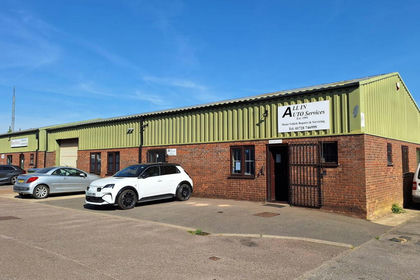
Riverside View, Wickham Market, Suffolk, Wickham Market, Suffolk IP13 England
Added on 08/09/2026Workshop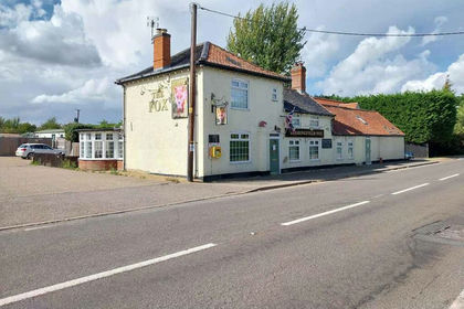
- Price
- £315,000
E-619881 - Shadingfield Fox, London Road, Beccles NR34, Willingham St. Mary, Suffolk NR34 England
Added on 20/03/2026Pub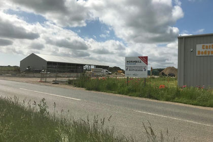
- Price
- Guide Price£300,000
Hornbill Business Park, Benacre Road, NR34, Ellough, Suffolk NR34 England
Added on 17/07/2026Development Land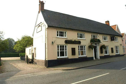
- Price
- £349,995
E-218248 - White Hart, Church Street, Stradbroke nr Eye IP21, Stradbroke, Suffolk IP21 England
Added on 29/01/2026Pub
- Price
- £250,000
- Size
- 0.05 acres
Rodent Services (east Anglia) Ltd, Cooke Road, Gisleham, Suffolk, Gisleham, Suffolk NR33 England
Added on 04/09/2026Industrial Land
- Price
- Guide Price£325,000
Redenhall Road, Harleston, Redenhall with Harleston, Norfolk IP20 England
Added on 03/07/2026Development Land
- Price
- £295,000
- Size
- 0.07 acres
Wollaston Road, Lowestoft, Suffolk, NR32, Lowestoft, Suffolk NR32 England
Added on 11/09/2026Warehouse Added on 29/01/2026Pub
- Price
- £300,000
- Size
- 4.74 acres
Added on 28/01/2026Development Land
- Price
- £225,000
- Size
- 0.14 acres
Bells Marsh Road, Gorleston, Great Yarmouth, Norfolk NR31 England
Added on 29/01/2026Industrial Land