Chilfrome Farm, Chilfrome, Dorchester
- Land size
- 364.5 acres
Key Features
- 364.50 acres (147.51 hectares)
- Two farm buildings, one with livestock handling area
- Seven points of access from the public highway
- Good connectivity with central track
- High conservation value areas
- Far reaching Dorset countryside views
- Sporting appeal in a rolling valley with hunt jumps
Description
An attractive and private, ring fenced parcel of land totalling 364.50 acres (147.51 hectares). Set in the heart of west Dorset with useful agricultural buildings and access from the highway.
Introduction - Chilfrome Farm offers prospective purchasers the opportunity to acquire a ring-fenced parcel of attractive and private agricultural land in this sought after part of Dorset. Well suited to a range of farming enterprises, the farm is predominantly pastureland but also includes areas of arable land and woodland.
The current owners have owned the farm since 2001, grazing livestock, producing arable crops as well as establishing two areas of woodland.
This excellent farm has considerable agricultural, conservation, environmental and amenity appeal with far reaching views, mature hedgerows, established fencing and is in no way obviously overlooked by other property.
Chilfrome Farm would make a useful addition to an existing agricultural enterprise but equally has the scale to be a standalone unit.
Situation - The farm is situated just less than a mile north-west of the village of Maiden Newton providing village shops, garage, doctor’s surgery, fuel station, public house and a primary school. The County Town of Dorchester, 7 miles to the south-east, provides an excellent range of retail, recreational and commercial facilities.
The A35 and A37 trunk roads and mainline stations at Dorchester provide good communication links.
The area is well served by independent and state schools including the Sherborne Schools, Leweston, Milton Abbey, Bryanston and Sunninghill Prep School.
Directions - From Dorchester, take the A37 towards Yeovil, turning left onto the A356 (Crewkerne Road) after about 4 miles. Drive through the village of Maiden Newton, heading uphill out of the village. The southernmost access to the farm will be found on the right-hand side opposite the junction to Toller Porcorum.
The farm can also be accessed from Higher Drove to the north and east.
The Land - The property extends to a total area of 354.50 acres (147.51 hectares), summarised below:
Pastureland - 334.64 Ac (135.43 Ha)
Arable Land - 18.76 Ac (7.59 Ha)
Woodland - 7.57 Ac (3.06 Ha)
Buildings & Tracks - 3.53 Ac (1.43 Ha)
TOTAL - 364.50 Ac (147.51 Ha)
The farmland is arranged in one ring-fenced block with soils being a mix of Blewbury and Batcombe types, being clayey over chalk in areas, with others being a deep loam to clay, all of which is generally free draining. A mix of grades 3, 4 and 5 in terms of agricultural classification.
The land is laid out in a valley configuration, with the top and bottom parts of the valley being the most productive and level. The valley sides provide shelter from the prevailing weather from the southwest and are of high conservation value, being recognised as Lowland Calcareous Grassland on Natural England’s Priority Habitat Inventory and as a Site of Nature Conservation Interest by Dorset Council.
All of the pastureland has been grazed by livestock and benefits from a good standard of stock fencing with drinking troughs distributed throughout.
The topography dictates that the lower part of the valley is incredibly private, not being overlooked by other properties and would lend itself to sporting opportunities.
Farm Buildings - Two farm buildings offer both a useful and adaptable provision of built space, suitable for livestock enterprises or agricultural storage, summarised below:
Building A - Livestock & handing Concrete frame, part concrete floor with central feed trough, footbath and external yard/handing area. Enclosed to 3 sides
(16.45m x 14.10m)
Buildings B - Agricultural Storage Concrete frame, earth floor, open to 3 sides
(18.03m x 17.90m)
Tenure And Possession - Freehold with vacant possession upon completion.
Sporting, Timber & Minerals - Sporting rights, timber rights and mineral rights are all included and run with the rest of the freehold.
Services - The farm benefits from a private water supply (borehole) on land in separate ownership.
Public Rights Of Way And Public Access - Footpaths (marked dashed blue on the plan) and bridleways (marked dashed brown) cross the property and 3 parcels are Open Access Land, as defined by the Countryside and Rights of Way Act 2000.
Rural Grant Schemes - The land is subject to a Higher Tier Countryside Stewardship Agreement started 1st January 2024, ending 31st December 2033 (with some options ending 31st December 2028), which includes retained land. It is estimated that the annual payments due from options on land at Chilfrome Farm are currently approximately £49,500 per annum. More details available from the agents on request.
None of the land is subject to a Sustainable Farming Incentive Agreement.
Any delinked payments due in relation to the Basic Payment Scheme will be retained by the vendors.
Designations - All of the property lies within the Dorset National Landscape (previously Area of Outstanding Natural Beauty) and within a Nitrate Vulnerable Zone within part of the Poole Harbour catchment. Part of the property is recognised on Natural England’s Priority Habitat Inventory and as a Sites of Nature Conservation Interest by Dorset Council.
Local Authority - Dorset Council, telephone number:
Viewings - All viewings are by appointment only with the vendors’ sole agents.
Important Notice - Symonds & Sampson and their clients give notice that:
1They have no authority to make or give any representations or warranties in relation to the property. These particulars do not form part of any offer or contract and must not be relied upon as statements or representations of fact.
2Any areas, measurements or distances are approximate. The text, photographs and plans are for guidance only and are not necessarily comprehensive. It should not be assumed that the property has all necessary planning, Building Regulations or other consents, and Symonds & Sampson have not tested any services, equipment or facilities. Purchasers must satisfy themselves by inspection or otherwise.
Map Location
Property details
- Tenure
- Freehold
- Council Tax Band
- Ask Agent
- Date Posted
- 2026-09-02
Market Value Analysis
Compared with 20 Farms & Smallholdings listings in South West England (100+ acres).
Utilities & Restrictions
Utilities
- Electricity
- Ask Agent
- Water
- Ask Agent
- Heating
- Ask Agent
- Broadband
- Ask Agent
- Sewerage
- Ask Agent
Rights & Restrictions
- Public Rights of Way
- Ask Agent
- Private Rights of Way
- Ask Agent
- Listed Property
- Ask Agent
- Restrictions
- Ask Agent
Listed status, conservation areas and planning constraints for this location are in the full report.
Property Features
- Accessibility
- Ask Agent
- Parking
- Parking Available
- Garden
- Garden
Beyond the particulars: planning activity, flood history, heritage and ground risks, checked for this exact spot.
Connectivity
Broadband
Fastest speed available at this postcode
11 Mbps
Standard (10-30 Mbps)
Suitable for
- Web & social
- Music streaming
- Standard video calls
Mobile signal
Predicted 4G and 5G signal; indoor signal depends on building materials.
Ofcom Connected Nations postcode-level predictions. Speeds and signal are modelled, not measured, and vary between addresses and providers.
Signal is the easy part. Planning activity, flood history and protected designations here are in the full report.
Nearest Schools
Primary
- Maiden Newton, Greenford Church of England Primary School1 mileOfsted: Good
- Ages
- 4 to 11
- Pupils
- 137
- Type
- Voluntary controlled school
- Faith
- Church of England
- Sticklands Church of England Voluntary Aided Primary School3.9 milesOfsted: Good *
- Ages
- 5 to 11
- Pupils
- 70
- Type
- Voluntary aided school
- Faith
- Church of England
- Powerstock Church of England Voluntary Aided Primary School4 milesOfsted: Requires improvement
- Ages
- 4 to 11
- Pupils
- 33
- Type
- Voluntary aided school
- Faith
- Church of England
- Thorner's Church of England School, Litton Cheney5.2 milesOfsted: Good *
- Ages
- 2 to 11
- Pupils
- 115
- Type
- Voluntary aided school
- Faith
- Church of England
- Winterbourne Valley Church of England Aided First School5.5 milesOfsted report card · Jan 2026
- Ages
- 3 to 9
- Pupils
- 60
- Type
- Voluntary aided school
- Faith
- Church of England
Secondary
- Beaminster School6.6 milesOfsted: Good
- Ages
- 11 to 18
- Pupils
- 673
- Type
- Voluntary controlled school
- Faith
- Christian
- The Sir John Colfox Academy6.9 milesNo Ofsted rating
- Ages
- 11 to 18
- Pupils
- 756
- Type
- Academy converter
- The Thomas Hardye School8.2 milesOfsted: Good *
- Ages
- 13 to 18
- Pupils
- 2,014
- Type
- Academy converter
- Dorchester Middle School8.4 milesOfsted report card · Jun 2026
- Ages
- 9 to 13
- Pupils
- 527
- Type
- Academy converter
- St Osmund's Church of England Middle School9.1 milesOfsted: Good
- Ages
- 9 to 13
- Pupils
- 714
- Type
- Academy converter
- Faith
- Church of England
* Latest graded judgement covers quality of education only; no overall grade was issued under the 2024-25 inspection framework.
Distances are straight-line from the advertised location. Source: the national school registers (DfE, Welsh Government, Scottish Government) and Ofsted.
Schools are just the start: sold prices nearby, planning activity and any flood history are in the full report.
Amenities
Supermarket
GP surgery
Pharmacy
Hospital
Green space
Straight-line distances from the advertised location. Sources: NHS records, Geolytix supermarket locations, OS Open Greenspace and the national trails registers.
The area stacks up? Now check the location itself: planning nearby, protected designations and past flooding.
Getting Around
Nearest station
Nearest bus stop
Typical drive times
Straight-line distances from the advertised location; drive times are typical free-flow times over OpenStreetMap road data, so allow more at peak. Public transport locations from DfT NaPTAN.
Easy to reach matters. So do planning activity, flood history and ground risks: all in the full report.
Flood Risk
Environment Agency open data, checked around the advertised map pin for the listed acreage. Long-term risk counts flood defences; the planning map's flood zones do not. Provided by LandSale, not the listing agent, and not part of the agent's particulars. Risk varies across a holding, so verify before committing.
Rivers and the sea
Not at the pin: mapped about 640 metres away.
Planning map: Flood Zone 3, about 610 metres away.
Surface water
Not at the pin: mapped about 410 metres away.
These bandings are the summary. Where this location sits on the flood maps, plus planning activity, heritage and ground risks, is in the full report.
Important notice: Information, maps and tags on this page are drawn from the advertising agent's marketing materials or generated automatically. LandSale has not verified them. Relying on these details is at your own risk, always carry out independent checks before committing to a purchase.
LandSale full disclaimer
Marketing information only - not formal particulars. The details on this website are provided for general guidance and do not constitute an offer or contract. Neither LandSale nor the advertising estate/land agent accepts responsibility for any inaccuracy.
1. Source of information
- Listing content: Core description, asking price, tenure, measurements, photographs and planning history originate from the marketing materials of the advertising estate or land agent. LandSale does not author this content and cannot guarantee its accuracy.
- Automated tags & categorisation: Property type, land-use class, acreage bands and similar labels may be applied by machine-learning models. They are intended as a helpful guide only and may not reflect the property's legal status or permitted use.
- Third-party & enriched data layers: Maps, boundary outlines, planning designations, soil reports, broadband coverage and other environmental or location-based insights are licensed from external suppliers. Such data are supplied “as is", may be incomplete or out of date and are subject to change without notice.
2. Verification required
Prospective purchasers must verify critical matters, including but not limited to planning permission, title boundaries, public rights of way, environmental constraints, acreage, services, access and VAT status, through their own inspections, specialist surveys, legal advisers and the selling agent before relying on the information or entering into any contract.
3. No warranty or liability
LandSale gives no warranty, express or implied, as to the accuracy, completeness or fitness for any particular purpose of the information displayed. LandSale shall not be liable for any loss, damage, cost or expense arising directly or indirectly from any use of or reliance on such information, save where liability may not be excluded by law.
4. Updates & feedback
If you believe any detail on this listing is inaccurate, please let us know. We will investigate and, where appropriate, update the listing or notify the agent.
© LandSale | Version 1.3 - August 2026
Listing agent
Symonds & Sampson, Dorchester
9 Weymouth Avenue Brewery Square, Dorchester DT1 1QR
View agent profileNearby properties for sale
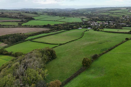
- Price
- Guide Price£320,000
- Size
- 32.21 acres
Land West of Greenford Lane, Maiden Newton, Dorchester, Frome Vauchurch, Dorset DT2 England
Added on 12/10/2026Agricultural Land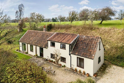
- Price
- Guide Price£600,000
- Size
- 7.11 acres
Chalmington, Dorchester, Dorset, Cattistock, Dorset DT2 England
Added on 14/05/2026Cottage
- Price
- Fixed Price£11,400
- Size
- 0.2 acres
Added on 09/07/2026Vacant Land
- Price
- Guide Price£140,000
- Size
- 13.97 acres
Lot 2 - Land Higher Woolcombe, Melbury Bubb, Dorchester, DT2, Dorchester, Dorset DT2 England
Added on 16/06/2026Pasture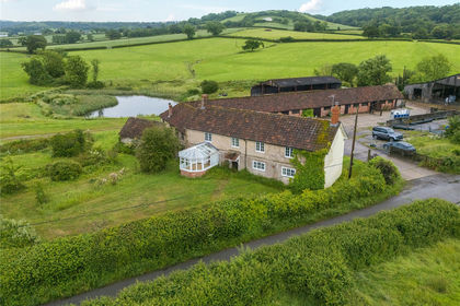
- Price
- Guide Price£1,110,000
- Size
- 16.91 acres
Melbury Bubb, Dorchester, DT2, Dorchester, Dorset DT2 England
Added on 16/06/2026Smallholding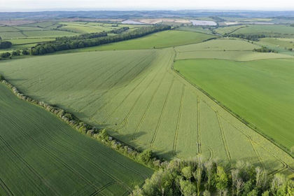
- Price
- Guide Price£1,300,000
- Size
- 134.07 acres
Coombe Road, Winterbourne Steepleton, Dorchester, Winterbourne Steepleton, Dorset DT2 England
Added on 06/10/2026Farmland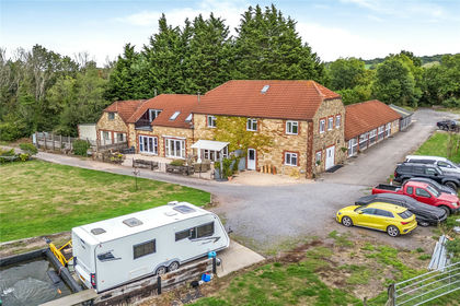
- Price
- Guide Price£1,275,000
- Size
- 7.71 acres
Added on 28/09/2026House with Land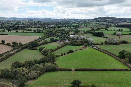
- Price
- Guide Price£210,000
- Size
- 14.87 acres
Land Opposite Winterhayes Farm, Yetminster, Sherborne, Yetminster, Dorset DT9 England
Added on 21/09/2026Agricultural Land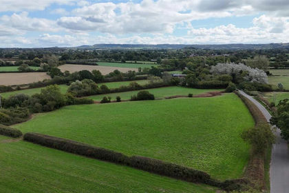
- Price
- Guide Price£55,000
- Size
- 5.55 acres
Land Opposite Winterhayes Farm, Yetminster, Sherborne, Yetminster, Dorset DT9 England
Added on 21/09/2026Pasture- Price
- Guide Price£125,000
- Size
- 7.48 acres
Land Opposite Winterhayes Farm, Yetminster, Sherborne, Yetminster, Dorset DT9 England
Added on 21/09/2026Agricultural Land