Directly adjacent to South Park and Athena School Lincoln LN5
Description
Nestled just south of South Park, Lincoln, Lot 100 presents a unique opportunity for discerning investors, community groups, and agricultural enthusiasts. This substantial freehold parcel, comprising amenity land, disused railway, mature woodland, and former allotments, is now available through Palace Auctions. With a guide price of only £5,000, this property offers exceptional value and versatility in one of Lincoln’s most sought-after green corridors. The site’s rare combination of natural beauty, historical resonance, and strategic location makes it a compelling prospect for a wide range of uses.
Location: South Park and Lincoln City Centre
The property is ideally situated in the LN5 postcode, directly adjacent to South Park and the renowned South Common. This area is celebrated for its panoramic views, biodiversity, and recreational appeal. Furthermore, the land is less than a mile from Lincoln city centre, ensuring easy access to shopping, dining, and cultural attractions. The proximity to the city’s vibrant core enhances the site’s appeal for commercial, community, and agricultural projects alike. In addition, the South Park area is well-served by local amenities, schools, and public transport, making it a practical and attractive location for a variety of ventures.
Transport Links: Connectivity at Its Best
One of the property’s standout features is its excellent connectivity. The site benefits from vehicular access via Skinnand Lane, while major road links such as the A46, A15, and A1 are all within easy reach. Lincoln train station, offering regular services to Nottingham, Sheffield, and London, is conveniently located nearby. Moreover, the area is served by a comprehensive bus network, ensuring seamless connections across the city and beyond. As a result, Lot 58 is perfectly positioned for both local and regional access, supporting commercial, recreational, and agricultural activities.
Natural Features: Woodland, Open Space, and Biodiversity
The land encompasses a diverse range of natural features, including mature woodland, open green space, and remnants of a disused railway. These elements create a rich tapestry of habitats, supporting local wildlife and enhancing the site’s ecological value. Additionally, the woodland offers opportunities for environmental projects, biodiversity enhancement, and outdoor recreation. The open spaces are ideal for community allotments, grazing, or leisure activities, while the former railway embankments add character and historical depth to the landscape.
Historical Significance: Echoes of Lincoln’s Railway Heritage
Lot 100 includes a section of the former Lincolnshire Loop Line, a historic railway that once played a vital role in the region’s development. The disused railway land is a tangible link to Lincoln’s industrial past, offering potential for heritage interpretation and community engagement. In contrast to many modern developments, this site retains a sense of place and continuity, making it especially attractive for projects that value local history and identity. The presence of former allotments further underscores the land’s longstanding role in supporting community wellbeing and self-sufficiency.
Planning and Development Potential
While there is currently no planning consent in place, the site is considered to have strong potential for future development. The Central Lincolnshire Local Plan emphasises the protection and enhancement of amenity land, woodland, and allotments, while also supporting sustainable growth and community benefit. Consequently, investors and developers may explore opportunities for residential, community, or mixed-use schemes, subject to obtaining the necessary permissions. The land’s size, location, and features make it a flexible canvas for innovative projects that align with local planning priorities.
Commercial Investment Appeal
For commercial investors, Lot 100 represents an accessible entry point into Lincoln’s dynamic property market. The guide price of £5,000 is highly competitive, offering scope for capital appreciation and future planning gains. Furthermore, the site’s proximity to the city centre, transport links, and established residential areas enhances its long-term value. Whether held as a strategic land bank or developed for income-generating uses, this parcel offers a rare blend of affordability, potential, and location.
Community and Recreational Use
Community groups and recreational organisations will find much to admire in Lot 58. The land’s natural features, open spaces, and historical context make it ideal for community gardens, allotments, outdoor classrooms, or nature reserves. Moreover, its adjacency to South Park and the South Common creates opportunities for collaborative projects that enhance local wellbeing and environmental stewardship. The site’s accessibility and visibility further support its use as a community asset, fostering social inclusion and active lifestyles. Agricultural and Allotment Potential Agricultural users and allotment societies can capitalise on the land’s fertile soils, open aspect, and established boundaries. The site is suitable for arable cultivation, grazing, or the creation of new allotment plots. In addition, the woodland areas may support small-scale forestry, coppicing, or agroforestry initiatives. The property’s freehold tenure ensures long-term security for those seeking to invest in sustainable food production or land-based enterprises.
Environmental and Biodiversity Opportunities
The property’s mix of woodland, grassland, and railway embankments provides a valuable habitat mosaic for wildlife. As a result, there is significant potential for biodiversity enhancement, ecological restoration, and environmental education. Local policies encourage the delivery of biodiversity net gain, making this site an attractive prospect for conservation groups, schools, or eco-minded investors. Furthermore, the land’s location within a green corridor amplifies its ecological significance, supporting pollinators, birds, and small mammals.
Local Amenities and Lifestyle
Residents and users of Lot 58 will benefit from a wealth of local amenities. The South Park area offers easy access to schools, shops, healthcare, and leisure facilities. Lincoln city centre, with its historic cathedral, vibrant markets, and cultural venues, is just a short walk or cycle away. Additionally, the nearby South Common provides extensive opportunities for walking, running, and wildlife observation. The area’s blend of urban convenience and natural beauty creates an enviable lifestyle for those seeking balance and wellbeing.
Educational and Community Facilities
Education is well catered for in the vicinity, with several highly regarded schools nearby, including Lincoln St Peter at Gowts Church of England Primary School. The area also benefits from community centres, sports clubs, and places of worship, fostering a strong sense of belonging and support. In addition, the site’s potential for outdoor learning, environmental education, and community engagement aligns with local priorities for inclusive and sustainable development.
Greater Lincolnshire Context
Lincoln serves as the principal city in Greater Lincolnshire, a region known for its agricultural heritage, economic growth, and strategic investment. The area is benefiting from significant infrastructure improvements, digital connectivity, and green growth initiatives. As a result, land in and around Lincoln is increasingly sought after for a range of uses, from commercial development to community projects. Lot 58 offers a rare chance to secure a foothold in this dynamic and evolving landscape.
Auction Details and Buying Process
The property will be offered for sale by Palace Auctions on 23rd September 2026 at 1:00pm with live and online bidding available from Claridge’s, London. The auction format ensures transparency, competitive pricing, and equal opportunity for all buyers. Interested parties are encouraged to register early, review the legal pack, and arrange site visits as needed. The freehold tenure provides full ownership rights, with no ongoing ground rent or service charges. This is a straightforward and accessible route to land ownership in a prime Lincoln location.
Map Location
Property details
- Tenure
- Freehold
- Council Tax Band
- Ask Agent
- Date Posted
- 2026-09-02
Utilities & Restrictions
Utilities
- Electricity
- Ask Agent
- Water
- Ask Agent
- Heating
- Ask Agent
- Broadband
- Ask Agent
- Sewerage
- Ask Agent
Rights & Restrictions
- Public Rights of Way
- Ask Agent
- Private Rights of Way
- Ask Agent
- Listed Property
- Ask Agent
- Restrictions
- Ask Agent
Listed status, conservation areas and planning constraints for this location are in the full report.
Property Features
- Accessibility
- Ask Agent
- Parking
- Ask Agent
- Garden
- Ask Agent
Beyond the particulars: planning activity, flood history, heritage and ground risks, checked for this exact spot.
Connectivity
Broadband
Fastest speed available at this postcode
5.5 Gbps
Gigabit full fibre
Suitable for
- 4K streaming on every screen
- Full-time home working
- Online gaming & big downloads
Fixed wireless access may also be an option here.
Mobile signal
Outdoor predictions; indoor signal depends on building materials.
Ofcom Connected Nations postcode-level predictions. Speeds and signal are modelled, not measured, and vary between addresses and providers.
Signal is the easy part. Planning activity, flood history and protected designations here are in the full report.
Nearest Schools
Primary
- The Lincoln Bishop King Church of England Primary School414 metresOfsted report card · Mar 2026
- Ages
- 3 to 11
- Pupils
- 434
- Type
- Voluntary aided school
- Faith
- Church of England
- The Lincoln St Peter at Gowts Church of England Primary School465 metresOfsted: Outstanding
- Ages
- 2 to 11
- Pupils
- 255
- Type
- Voluntary controlled school
- Faith
- Church of England
- Sir Francis Hill Community Primary School0.7 milesOfsted: Requires improvement *
- Ages
- 3 to 11
- Pupils
- 562
- Type
- Community school
- Bracebridge Infant and Nursery School0.9 milesOfsted: Good
- Ages
- 3 to 7
- Pupils
- 85
- Type
- Academy converter
- Lincoln Monks Abbey Primary School1.2 milesOfsted: Requires improvement *
- Ages
- 2 to 11
- Pupils
- 588
- Type
- Community school
Secondary
- The Priory Academy LSST0.6 milesOfsted: Good
- Ages
- 11 to 18
- Pupils
- 1,749
- Type
- Academy sponsor led
- St Peter and St Paul, Catholic Voluntary Academy1 mileOfsted: Requires improvement
- Ages
- 11 to 18
- Pupils
- 601
- Type
- Academy converter
- Faith
- Roman Catholic
- Lincoln UTC1.1 milesNo Ofsted rating
- Ages
- 14 to 19
- Pupils
- 389
- Type
- University technical college
- The Priory City of Lincoln Academy1.4 milesOfsted report card · Dec 2025
- Ages
- 11 to 18
- Pupils
- 922
- Type
- Academy sponsor led
- The Priory Witham Academy1.5 milesNo Ofsted rating
- Ages
- 2 to 18
- Pupils
- 1,068
- Type
- Academy sponsor led
* Latest graded judgement covers quality of education only; no overall grade was issued under the 2024-25 inspection framework.
Distances are straight-line from the advertised location. Source: the national school registers (DfE, Welsh Government, Scottish Government) and Ofsted.
Schools are just the start: sold prices nearby, planning activity and any flood history are in the full report.
Amenities
Supermarket
GP surgery
Pharmacy
Hospital
Green space
Straight-line distances from the advertised location. Sources: NHS records, Geolytix supermarket locations, OS Open Greenspace and the national trails registers.
The area stacks up? Now check the location itself: planning nearby, protected designations and past flooding.
Getting Around
Nearest station
Nearest bus stop
Typical drive times
Straight-line distances from the advertised location; drive times are typical free-flow times over OpenStreetMap road data, so allow more at peak. Public transport locations from DfT NaPTAN.
Easy to reach matters. So do planning activity, flood history and ground risks: all in the full report.
Flood Risk
From Environment Agency flood map open data, checked around the advertised map pin and allowing for the listed acreage where known. This summary comes from LandSale, the advertising platform, not from the listing agent, and is not part of the agent's particulars. Risk can vary across a single holding, so verify anything critical through your own searches before committing.
Rivers and the sea
Surface water
The detail behind these bandings
The full report pinpoints where this location sits on the flood maps, and runs the deeper checks that usually only surface after an offer.
- Exact flood zones & annual chances (included in the full report)
- Any recorded past flooding (included in the full report)
- Planning activity nearby (included in the full report)
- Heritage & conservation (included in the full report)
- Protected nature designations (included in the full report)
- Ground risks (included in the full report)
- Sold prices nearby (included in the full report)
£14.99 · one-off purchase
By LandSale, the platform. Not provided by the listing agent. Ready in about a minute.
Important notice: Information, maps and tags on this page are drawn from the advertising agent's marketing materials or generated automatically. LandSale has not verified them. Relying on these details is at your own risk, always carry out independent checks before committing to a purchase.
LandSale full disclaimer
Marketing information only - not formal particulars. The details on this website are provided for general guidance and do not constitute an offer or contract. Neither LandSale nor the advertising estate/land agent accepts responsibility for any inaccuracy.
1. Source of information
- Listing content: Core description, asking price, tenure, measurements, photographs and planning history originate from the marketing materials of the advertising estate or land agent. LandSale does not author this content and cannot guarantee its accuracy.
- Automated tags & categorisation: Property type, land-use class, acreage bands and similar labels may be applied by machine-learning models. They are intended as a helpful guide only and may not reflect the property's legal status or permitted use.
- Third-party & enriched data layers: Maps, boundary outlines, planning designations, soil reports, broadband coverage and other environmental or location-based insights are licensed from external suppliers. Such data are supplied “as is", may be incomplete or out of date and are subject to change without notice.
2. Verification required
Prospective purchasers must verify critical matters, including but not limited to planning permission, title boundaries, public rights of way, environmental constraints, acreage, services, access and VAT status, through their own inspections, specialist surveys, legal advisers and the selling agent before relying on the information or entering into any contract.
3. No warranty or liability
LandSale gives no warranty, express or implied, as to the accuracy, completeness or fitness for any particular purpose of the information displayed. LandSale shall not be liable for any loss, damage, cost or expense arising directly or indirectly from any use of or reliance on such information, save where liability may not be excluded by law.
4. Updates & feedback
If you believe any detail on this listing is inaccurate, please let us know. We will investigate and, where appropriate, update the listing or notify the agent.
© LandSale | Version 1.3 - August 2026
Listing agent
Palace Auctions (London) LTD, London
Contact Palace Auctions (London) LTD, London
View agent profileSimilar properties for sale
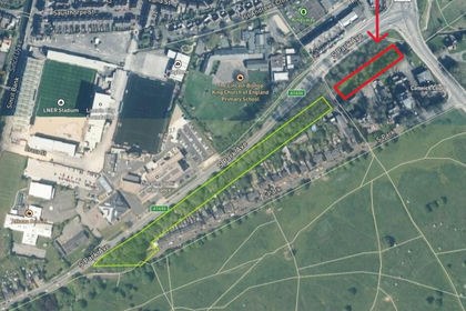
- Price
- Guide Price£5,000
Land opostie to south park gargae LN5, Lincoln, Lincolnshire LN5 England
Added on 01/09/2026Small Plot of Land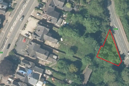
- Price
- Guide Price£10,000
St Catherines, Lincoln, Lincolnshire, Lincoln, Lincolnshire LN5 England
Added on 01/09/2026Amenity Land Added on 22/06/2026Redevelopment Land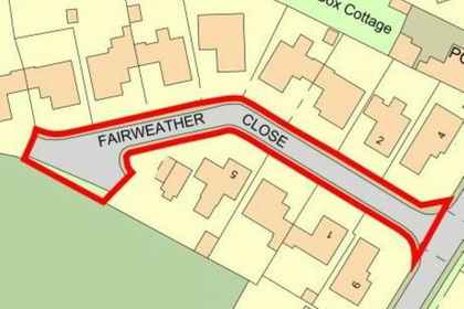
- Price
- Guide Price£1,000
Added on 29/01/2026Undeveloped Land
- Price
- Guide Price£2,000
- Size
- 0.15 acres
Added on 27/08/2026Small Plot of Land- Price
- Guide Price£2,000
- Size
- 0.15 acres
Added on 27/08/2026Small Plot of Land
- Price
- Guide Price£10,000
- Size
- 0.1 acres
Added on 27/08/2026Small Plot of Land
- Price
- Guide Price£5,000
Added on 19/08/2026Undeveloped Land
- Price
- Guide Price£5,000
Added on 27/08/2026Building Plot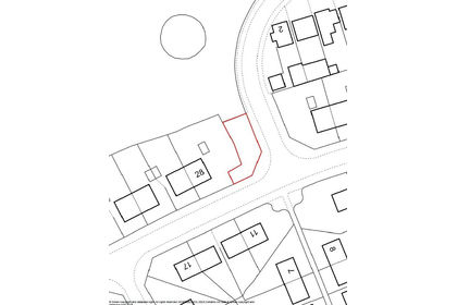
- Price
- Guide Price£7,500
Added on 12/08/2026Small Plot of Land