Badingham, Nr Woodbridge, Suffolk
- Land size
- 2.1 acres
- Bedrooms
- 3
- Bathrooms
- 2
Description
Hallway, kitchen/breakfast room, sitting/dining room, study, downstairs bathroom and utility room.
Three first floor bedrooms and en-suite bathroom.
Front and rear gardens with off road parking and garage. Meadow with buildings. In all 2.1 acres.
No forward chain.
Location
The popular village of Badingham benefits from a public house, The White Horse and a village hall. Within 4 miles is the market town of Framlingham, which offers an excellent range of facilities including public houses, restaurants, a Co-operative supermarket, a dentist and medical practice. The town also benefits from wellrespected schools in both the state and private sector. From the A1120 there is easy access to the Heritage Coast with its delightful villages and towns such as Aldeburgh, Thorpeness, Dunwich and Southwold. Ipswich is approximately 19 miles and here there are more comprehensive facilities as well as regular train services to London’s Liverpool Street station that take just over the hour.
Directions
Leaving Framlingham on the Badingham Road pass Shawsgate Vineyard on the left hand side. Continue for approximately 2 miles and at the junction with the A1120 turn right. On entering the village of Badingham turn left before the White Horse Public House onto Low Road. Take the next turning right onto Mill Road and continue on this lane for approximately 1.2 miles. Pound Farmhouse can be found on the left after passing the new houses.
For those using the What3Words app: ///reven.entitle.doors
Description
Pound Farmhouse is a detached period dwelling. The core is of timber frame construction with rendered elevations under a tiled roof. It is not listed.
Entering the property from the rear of the house, a door provides access to a hallway where doors lead to the kitchen/breakfast room, sitting/dining room and the utility room. This is home to the oil fired boiler, a handwash basin, high level cupboards and the space and plumbing for a washing machine. There is a window to the rear of the property . The sitting/dining room is dual aspect with windows to the front and side. It has exposed beams and studwork and at one end is a blocked fireplace. There is a door to the front of the property as well as a door into the kitchen/breakfast room. This is fitted with low level wall units and there is space for a fridge. In addition there is a double electric oven with 4 ring electric hob above. There is a wood block work surface and a stainless steel sink. The window overlooks the rear garden and there is a door to the exterior. A door opens to the downstairs bathroom that comprises a WC, handwash basin, bath and window to the rear of the property. Also on the ground floor is a dual aspect study or snug with window to the side and front and a blocked fire place. There are exposed timbers.
Stairs rise to first floor landing where there is access to the three bedrooms. The largest of the three is a spacious dual aspect double with exposed timbers. Bedroom two is a further double with dormer window to the front of the property and a door into a en-suite bathroom. This comprises a bath, WC and handwash basin. There is a window to the rear of the property and a storage cupboard. The third bedroom is a small double or large single with dormer window to the front and exposed timbers.
Outside
The property is approached from the lane onto to a concrete drive which leads to the rear of the house where there is off road parking and a garage. This measure 20’ x 10’. The enclosed rear garden measure approximately 110’ x 100’ with a front garden being 60’ x 40’. A narrow drive to the side of the house provides access to the outbuildings and meadow. The meadow which is currently accessed through one of the buildings, is enclosed by hedging and trees and in total measures 1.7 acres. It is laid to grass. As well as a summer house and sheds, there are also substantial buildings which are of scaffolding pole construction with steel profile sheet cladding and roofs. The first measure 37’ x 41’, The second, which adjoins, is
33’ x 17’. In addition is a further building which has scope to be used as a home office.
Viewing Strictly by appointment with the agent.
Services Mains water and electricity. Oil-fired central heating. Private drainage system (The seller has no knowledge of the system but it was emptied in December 2025. It is unlikely to comply with the modern General Binding Rules and a buyer may wish to budget to either install a new sewage treatment plant or connect the house on to the mains which are understood to be in the highway close to the property. The guide price takes into account the cost a buyer may need to bear to undertake this work).
Broadband To check the broadband coverage available in the area click this link –
Mobile Phones To check the mobile phone coverage in the area click this link –
EPC Rating D = (Copy available from the agents upon request).
Council Tax Band B; £ 1,700.04 payable per annum 2025/2026
Local Authority East Suffolk Council; East Suffolk House, Station Road, Melton, Woodbridge, Suffolk
IP12 1RT; Tel: .
NOTES
1. Every care has been taken with the preparation of these particulars, but complete accuracy cannot be guaranteed. If there is any point, which is of particular importance to you, please obtain professional confirmation. Alternatively, we will be pleased to check the information for you. These Particulars do not constitute a contract or part of a contract. All measurements quoted are approximate. The Fixtures, Fittings & Appliances have not been tested and therefore no guarantee can be given that they are in working order. Photographs are reproduced for general information and it cannot be inferred that any item shown is included. No guarantee can be given that any planning permission or listed building consent or building regulations have been applied for or approved. The agents have not been made aware of any covenants or restrictions that may impact the property, unless stated otherwise. Any site plans used in the particulars are indicative only and buyers should rely on the Land Registry/transfer plan.
2. The Money Laundering, Terrorist Financing and Transfer of Funds (Information on the Payer) Regulations 2017 require all Estate Agents to obtain sellers’ and buyers’ identity.
March 2026
Map Location
Property details
- Tenure
- Freehold
- Council Tax Band
- B
- Date Posted
- 2026-08-19
Market Value Analysis
Compared with 1,144 Homes with Land listings in East Anglia (1+ acres).
Utilities & Restrictions
Utilities
- Electricity
- Mains
- Water
- Mains
- Heating
- Oil Heating
- Broadband
- Ask Agent
- Sewerage
- Septic Tank / Private
Rights & Restrictions
- Public Rights of Way
- Ask Agent
- Private Rights of Way
- Ask Agent
- Listed Property
- Ask Agent
- Restrictions
- Ask Agent
Listed status, conservation areas and planning constraints for this location are in the full report.
Property Features
- Accessibility
- Ask Agent
- Parking
- Garage, Off-Street Parking
- Garden
- Private Garden
Beyond the particulars: planning activity, flood history, heritage and ground risks, checked for this exact spot.
Connectivity
Broadband
Fastest speed available at this postcode
1.8 Gbps
Gigabit full fibre
Suitable for
- 4K streaming on every screen
- Full-time home working
- Online gaming & big downloads
Mobile signal
Predicted 4G and 5G signal; indoor signal depends on building materials.
Ofcom Connected Nations postcode-level predictions. Speeds and signal are modelled, not measured, and vary between addresses and providers.
Signal is the easy part. Planning activity, flood history and protected designations here are in the full report.
Nearest Schools
Primary
- Dennington Church of England Primary School2.2 milesOfsted: Good
- Ages
- 4 to 11
- Pupils
- 66
- Type
- Academy converter
- Faith
- Church of England
- All Saints Church of England Primary School, Laxfield2.4 milesOfsted: Outstanding *
- Ages
- 4 to 11
- Pupils
- 97
- Type
- Academy converter
- Faith
- Church of England
- Framlingham Sir Robert Hitcham's Church of England Voluntary Aided Primary School3.9 milesOfsted: Good
- Ages
- 3 to 11
- Pupils
- 311
- Type
- Voluntary aided school
- Faith
- Church of England
- Wilby Church of England Primary School4.7 milesOfsted: Good
- Ages
- 3 to 11
- Pupils
- 99
- Type
- Academy converter
- Faith
- Church of England
- Yoxford & Peasenhall Primary Academy5.1 milesOfsted: Good
- Ages
- 3 to 11
- Pupils
- 88
- Type
- Academy sponsor led
Secondary
- Thomas Mills High School & Sixth Form3.9 milesOfsted: Good
- Ages
- 11 to 18
- Pupils
- 1,056
- Type
- Academy converter
- Stradbroke High School5.7 milesNo Ofsted rating
- Ages
- 11 to 16
- Pupils
- 353
- Type
- Academy converter
- Alde Valley Academy9.6 milesOfsted: Requires improvement
- Ages
- 11 to 16
- Pupils
- 645
- Type
- Academy sponsor led
- The Harleston Sancroft Academy (a 3-16 Church of England School)9.6 milesOfsted: Good *
- Ages
- 3 to 16
- Pupils
- 824
- Type
- Academy converter
- Faith
- Church of England
- Debenham High School9.8 milesOfsted: Good
- Ages
- 11 to 16
- Pupils
- 714
- Type
- Academy converter
- Faith
- Church of England
* Latest graded judgement covers quality of education only; no overall grade was issued under the 2024-25 inspection framework.
Distances are straight-line from the advertised location. Source: the national school registers (DfE, Welsh Government, Scottish Government) and Ofsted.
Schools are just the start: sold prices nearby, planning activity and any flood history are in the full report.
Amenities
Supermarket
GP surgery
Pharmacy
Hospital
Green space
Straight-line distances from the advertised location. Sources: NHS records, Geolytix supermarket locations, OS Open Greenspace and the national trails registers.
The area stacks up? Now check the location itself: planning nearby, protected designations and past flooding.
Getting Around
Nearest station
Nearest bus stop
Typical drive times
Straight-line distances from the advertised location; drive times are typical free-flow times over OpenStreetMap road data, so allow more at peak. Public transport locations from DfT NaPTAN.
Easy to reach matters. So do planning activity, flood history and ground risks: all in the full report.
Flood Risk
Environment Agency open data, checked around the advertised map pin for the listed acreage. Long-term risk counts flood defences; the planning map's flood zones do not. Provided by LandSale, not the listing agent, and not part of the agent's particulars. Risk varies across a holding, so verify before committing.
Rivers and the sea
Planning map: Flood Zone 1.
Surface water
Not at the pin: mapped about 20 metres away.
These bandings are the summary. Where this location sits on the flood maps, plus planning activity, heritage and ground risks, is in the full report.
Important notice: Information, maps and tags on this page are drawn from the advertising agent's marketing materials or generated automatically. LandSale has not verified them. Relying on these details is at your own risk, always carry out independent checks before committing to a purchase.
LandSale full disclaimer
Marketing information only - not formal particulars. The details on this website are provided for general guidance and do not constitute an offer or contract. Neither LandSale nor the advertising estate/land agent accepts responsibility for any inaccuracy.
1. Source of information
- Listing content: Core description, asking price, tenure, measurements, photographs and planning history originate from the marketing materials of the advertising estate or land agent. LandSale does not author this content and cannot guarantee its accuracy.
- Automated tags & categorisation: Property type, land-use class, acreage bands and similar labels may be applied by machine-learning models. They are intended as a helpful guide only and may not reflect the property's legal status or permitted use.
- Third-party & enriched data layers: Maps, boundary outlines, planning designations, soil reports, broadband coverage and other environmental or location-based insights are licensed from external suppliers. Such data are supplied “as is", may be incomplete or out of date and are subject to change without notice.
2. Verification required
Prospective purchasers must verify critical matters, including but not limited to planning permission, title boundaries, public rights of way, environmental constraints, acreage, services, access and VAT status, through their own inspections, specialist surveys, legal advisers and the selling agent before relying on the information or entering into any contract.
3. No warranty or liability
LandSale gives no warranty, express or implied, as to the accuracy, completeness or fitness for any particular purpose of the information displayed. LandSale shall not be liable for any loss, damage, cost or expense arising directly or indirectly from any use of or reliance on such information, save where liability may not be excluded by law.
4. Updates & feedback
If you believe any detail on this listing is inaccurate, please let us know. We will investigate and, where appropriate, update the listing or notify the agent.
© LandSale | Version 1.3 - August 2026
Listing agent
Clarke and Simpson, Framlingham
Well Close Square, Framlingham, IP13 9DU
View agent profileSimilar properties for sale
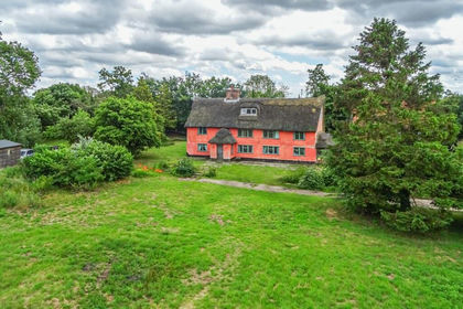
- Price
- Guide Price£675,000
- Size
- 2.8 acres
Added on 29/01/2026Farmhouse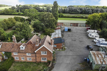
- Price
- Guide Price£650,000
- Size
- 3.5 acres
Glemham Road, Sweffling, Saxmundham, Suffolk, IP17, Swefling, Suffolk IP17 England
Added on 10/10/2026Cottage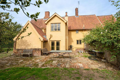
- Price
- Guide Price£525,000
- Size
- 1 acres
Added on 10/06/2026Farmhouse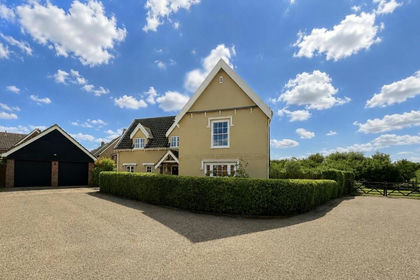
- Price
- Offers Over£685,000
- Size
- 1.3 acres
The Paddocks, Stradbroke, Eye, Stradbroke, Suffolk IP21 England
Added on 03/08/2026House with Land
- Price
- Guide Price£650,000
- Size
- 6.5 acres
Easton, Near Framlingham, Suffolk, Easton, Suffolk IP13 England
Added on 29/01/2026House with Land
- Price
- Guide Price£650,000
- Size
- 2.96 acres
Added on 27/08/2026House with Land
- Price
- Guide Price£675,000
- Size
- 1.5 acres
Added on 01/07/2026House with Land
- Price
- Guide Price£675,000
- Size
- 1.6 acres
Farnham, Near Saxmundham, Suffolk, Farnham, Suffolk IP17 England
Added on 01/07/2026House with Land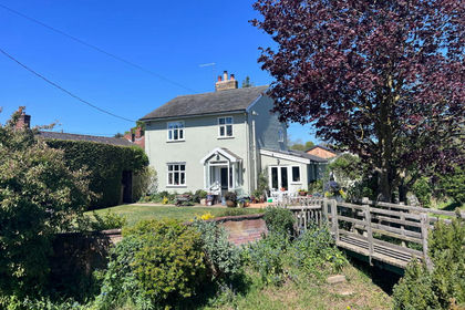
- Price
- Offers Over£600,000
- Size
- 3 acres
Added on 18/04/2026House with Land
- Price
- Guide Price£575,000
- Size
- 1 acres
Stone Street, Spexhall, Halesworth, Spexhall, Suffolk IP19 England
Added on 18/06/2026House with Land