Henley, Langport, Somerset, TA10
- Land size
- 18.58 acres
Key Features
- 18.58 Acres
- Level Permanent Pasture
- For Sale by Auction
- Direct road access
- Natural water supply
Description
An excellent opportunity to acquire an attractive block of permanent pasture land. In total extending to 18.58 acres or thereabouts.
** Legal Pack to be available shortly **
SITUATION
The land is situated on the outskirts of the hamlet of Henley.
Henley enjoys a rural setting whilst maintaining good connectivity to
the local area, being just 4 miles from the market towns of Langport
and Somerton both of which offer a fantastic range of day-to-day
amenities. Further amenities can be found in nearby Street with its famous
outlet store at Clarks Village. Bath and Bristol are both just over an
hours drive to the north. There are mainline rail links at Taunton and Castle Cary (Paddington
line), and Yeovil (Waterloo Line), while the M5 Motorway can be
accessed at Junction 25 Taunton (Northbound) and Junction 23
Bridgwater (Southbound). The A303 and A39 are easily accessible
providing swift access to the local area and the wider network.
DESCRIPTION
The land comprises two parcels of level permanent pasture land , in
total extending to 18.58 acres (7.52 Ha) or thereabouts. The land is
productive in nature and has been well maintained by grazing
livestock and taking cuts of hay/silage. The land is predominantly
bounded by Rhynes with some hedgerows in addition.
ACCESS
The land benefits from excellent access with two access
gateways directly from Nythe Road together with additional
access gateway directly from Henley Corner Drove along the
northern boundary of the land.
RIGHTS OF WAY, EASEMENTS
We understand there is a public footpath traversing the
southern boundary of the land together with a right of
access in favour of the drainage board. Other than this, the
land is sold as far as required by the vendor and will be
conveyed subject to all rights of way, easements and way
leaves of telegraphs poles, drains and wires, electric pylons
and cables, water and gas pipes at present erected on and
passing over or under the property and subject to the
agreements affecting the same (if any).
OUTGOINGS
We understand drainage rates are payable to the drainage
board at the prevailing rate. Other than this, we are not
aware of any outgoings on the land.
SERVICES
We understand the land benefits from natural watering.
Other than this we are not aware of any services to the land.
TENURE
The land is of freehold tenure with full vacant possession
available upon completion of the purchase.
DESIGNATIONS
We understand the land is designated as being Coastal and
Floodplain grazing marsh under the Priority Habitat
Inventory. Other than this we are not aware of any other
designations.
FLOOD ZONE
According to information from the Environment Agency,
parts of the subject property is designated as being at high
risk of flooding from rivers or seas without defences. The
vendor has made us aware that they have had no problems
with flooding whilst in their ownership.
FIXTURES & FITTINGS
All fixtures and fittings are to be excluded from the sale of the site, unless stated otherwise.
AGRI ENVIRONMENT SCHEMES
We understand the land is subject to a live Sustainable Farming Incentive agreement. The vendors will withdraw from this agreement prior to
completion, following this, prospective purchasers are free to enter the land into a scheme as and when they are available.
METHOD OF SALE
The property will be offered for sale by Public Auction and online livestream auction on Wednesday 16th September 2026 at Batch Country House, Lympsham, Nr Weston-super-Mare, BS24 0EX. It is possible the property may be sold prior to the action date therefore it is advisable for interested parties to register their interest with the Agents and it is their responsibility to check with the Agents whether the property will still be offered on the auction date.
Map Location
Property details
- Tenure
- Ask Agent
- Council Tax Band
- TBC
- Date Posted
- 2026-08-18
Market Value Analysis
Compared with 122 Farmland & Pasture listings in South West England (10+ acres).
Utilities & Restrictions
Utilities
- Electricity
- Ask Agent
- Water
- Ask Agent
- Heating
- Ask Agent
- Broadband
- Ask Agent
- Sewerage
- Ask Agent
Rights & Restrictions
- Public Rights of Way
- Ask Agent
- Private Rights of Way
- Ask Agent
- Listed Property
- Ask Agent
- Restrictions
- Ask Agent
Property Features
- Accessibility
- Ask Agent
- Parking
- Ask Agent
- Garden
- Ask Agent
Connectivity
Broadband
Fastest speed available at this postcode
1 Gbps
Gigabit full fibre
Suitable for
- 4K streaming on every screen
- Full-time home working
- Online gaming & big downloads
Mobile signal
Outdoor predictions; indoor signal depends on building materials.
Ofcom Connected Nations postcode-level predictions. Speeds and signal are modelled, not measured, and vary between addresses and providers.
Nearest Schools
Primary
- High Ham Church of England Primary School0.9 milesNo Ofsted rating
- Ages
- 4 to 11
- Pupils
- 173
- Type
- Voluntary controlled school
- Faith
- Church of England
- Othery Village School2.9 milesOfsted: Good
- Ages
- 2 to 11
- Pupils
- 62
- Type
- Academy converter
- Ashcott Primary School3.1 milesNo Ofsted rating
- Ages
- 4 to 11
- Pupils
- 117
- Type
- Community school
- Huish Episcopi Primary School3.3 milesOfsted: Good
- Ages
- 4 to 11
- Pupils
- 175
- Type
- Academy converter
- Walton Church of England Voluntary Controlled Primary School3.3 milesOfsted: Good
- Ages
- 4 to 11
- Pupils
- 129
- Type
- Voluntary controlled school
- Faith
- Church of England
Secondary
- Huish Episcopi Academy3.4 milesOfsted report card · May 2026
- Ages
- 11 to 18
- Pupils
- 1,192
- Type
- Academy converter
- Crispin School Academy4.7 milesNo Ofsted rating
- Ages
- 11 to 16
- Pupils
- 978
- Type
- Academy converter
- St Dunstan's School6.3 milesOfsted: Good
- Ages
- 11 to 16
- Pupils
- 529
- Type
- Academy converter
- Bridgwater College Academy7.8 milesOfsted report card · Mar 2026
- Ages
- 3 to 16
- Pupils
- 1,561
- Type
- Academy sponsor led
- Robert Blake School8.4 milesOfsted: Requires improvement
- Ages
- 11 to 16
- Pupils
- 1,014
- Type
- Foundation school
Distances are straight-line from the advertised location. Source: the national school registers (DfE, Welsh Government, Scottish Government) and Ofsted.
Amenities
Supermarket
GP surgery
Pharmacy
Hospital
Green space
Straight-line distances from the advertised location. Sources: NHS records, Geolytix supermarket locations, OS Open Greenspace and the national trails registers.
Getting Around
Nearest station
Nearest bus stop
Typical drive times
Straight-line distances from the advertised location; drive times are typical free-flow times over OpenStreetMap road data, so allow more at peak. Public transport locations from DfT NaPTAN.
Flood Risk
From Environment Agency flood map open data, checked around the advertised map pin and allowing for the listed acreage where known. This summary comes from LandSale, the advertising platform, not from the listing agent, and is not part of the agent's particulars. Risk can vary across a single holding, so verify anything critical through your own searches before committing.
Rivers and the sea
Mapped within the area searched, not at the advertised map pin itself.
Surface water
Mapped within the area searched, not at the advertised map pin itself.
The detail behind these bandings, including exact zones and annual chances, any recorded past flooding, plus planning, heritage, nature and ground checks, is in the .
Important notice: Information, maps and tags on this page are supplied by the advertising agent or generated automatically. LandSale has not verified them. Relying on these details is at your own risk, always carry out independent checks before committing to a purchase.
LandSale full disclaimer
Marketing information only - not formal particulars. The details on this website are provided for general guidance and do not constitute an offer or contract. Neither LandSale nor the advertising estate/land agent accepts responsibility for any inaccuracy.
1. Source of information
- Agent-supplied content: Core description, asking price, tenure, measurements, photographs and planning history are uploaded by the appointed agent, who remains solely responsible for their accuracy.
- Automated tags & categorisation: Property type, land-use class, acreage bands and similar labels may be applied by machine-learning models. They are intended as a helpful guide only and may not reflect the property's legal status or permitted use.
- Third-party & enriched data layers: Maps, boundary outlines, planning designations, soil reports, broadband coverage and other environmental or location-based insights are licensed from external suppliers. Such data are supplied “as is", may be incomplete or out of date and are subject to change without notice.
2. Verification required
Prospective purchasers must verify critical matters, including but not limited to planning permission, title boundaries, public rights of way, environmental constraints, acreage, services, access and VAT status, through their own inspections, specialist surveys, legal advisers and the selling agent before relying on the information or entering into any contract.
3. No warranty or liability
LandSale gives no warranty, express or implied, as to the accuracy, completeness or fitness for any particular purpose of the information displayed. LandSale shall not be liable for any loss, damage, cost or expense arising directly or indirectly from any use of or reliance on such information, save where liability may not be excluded by law.
4. Updates & feedback
If you believe any detail on this listing is inaccurate, please let us know. We will investigate and, where appropriate, update the listing or notify the agent.
© LandSale | Version 1.2 - January 2026
Listing agent
Greenslade Taylor Hunt, Yeovil
22 Princes Street, Yeovil, BA20 1EQ
Similar properties for sale
- Price
- £98,300
- Size
- 9.83 acres
Added on 22/06/2026Grazing Land
- Price
- Guide Price£105,000
- Size
- 12.36 acres
Dutch Road, Mark, Highbridge, Somerset, TA9, Mark, Somerset TA9 England
Added on 11/08/2026Agricultural Land
- Price
- Guide Price£110,000
- Size
- 11.12 acres
Whitestaunton, Chard, Somerset, Whitestaunton, Somerset TA20 England
Added on 22/06/2026Pasture
- Price
- Guide Price£150,000
- Size
- 11.63 acres
Whitestaunton, Chard, Somerset, Whitestaunton, Somerset TA20 England
Added on 22/06/2026Grazing Land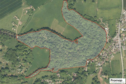
- Price
- Guide Price£150,000
- Size
- 37.3 acres
Holford, Bridgwater, Somerset, TA5, Holford, Somerset TA5 England
Added on 30/04/2026Undeveloped Land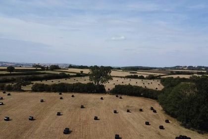
- Price
- Guide Price£145,000
- Size
- 24.49 acres
Hinton Blewett, Bristol, Somerset, BS39, Hinton Blewett, Bath and North East Somerset BS39 England
Added on 04/08/2026Agricultural Land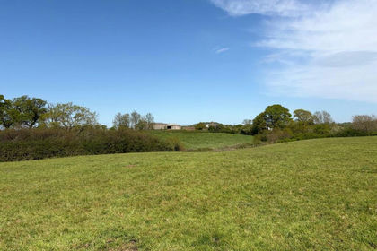
- Price
- Guide Price£140,000
- Size
- 13.97 acres
Melbury Bubb, Dorchester, Dorset, DT2, Melbury Bubb, Dorset DT2 England
Added on 16/06/2026Farmland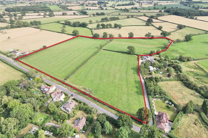
- Price
- Guide Price£100,000
- Size
- 10.55 acres
Packers Hill, Holwell, Sherborne, Holwell, Dorset DT9 England
Added on 28/07/2026Pasture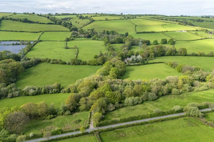
- Price
- Guide Price£100,000
- Size
- 29.81 acres
Shillingford, Tiverton, Devon, EX16, Bampton, Devon EX16 England
Added on 20/05/2026Grazing Land
- Price
- Guide Price£100,000
- Size
- 20.41 acres
Luxborough, Watchet, Somerset, TA23, Luxborough, Somerset TA23 England
Added on 12/07/2026Woodland