Kingsbridge, TQ7
- Land size
- 3.76 acres
- Dwelling size
- 5924 sqft
- Bedrooms
- 11
- Bathrooms
- 3
Key Features
- For sale by Formal Tender with a deadline date of Wednesday 27th August 2025 at 12 noon
- First time to the market in almost 100 years
- Secluded location
- Gross internal floor area of 5,924 square feet
- Major renovation work required
- Set within 3.76 acres (1.52 hectares) in all
- Extensive grounds
- No onward chain
- Sale by Formal Tender
Description
DIRECTIONS
From Kingsbridge, head north and take the A381 main road towards Totnes. Proceed along the A381 for approximately a mile and then then turn immediately right after Slade Cross. Continue down this entrance drive and after approximately 0.2 miles bear right to approach the property.
What3words Location:- crinkled.succumbs.trapdoor
SITUATION
Slade is located in the hamlet of Ledstone, which forms part of the village of Goveton, approximately one mile north of Kingsbridge, in the South Hams area of South Devon. The property lies within a designated National Landscape (formerly known as an Area of Outstanding Natural Beauty).
The property is within easy reach of the spectacular South Devon coast, including the popular holiday destination of Salcombe, just 7 miles to the south.
The nearest city of Plymouth being about 20 miles to the west. The A38 dual carriageway expressway, connecting to the M5 motorway and national road network, being about 12 miles to the north.
LOT 1 – SLADE (as outlined in red on the site plan)
DESCRIPTION
Slade comprises a spectacular eleven-bedroom detached property, occupying a secluded rural location with no near neighbours, set within approximately 2.74 acres (1.11 hectares) in all, of its own grounds to include an expansive garden on the east south and west boundaries.
ACCOMODATION
Not of Listed status, the original part of the property is believed to date from the early 1800s, the start of the Georgian era. The main part of the house is thought to have been built in two stages, the first being late-Victorian and the second stage being built in about 1930.
Slade presents a truly wonderful opportunity for those looking to put their own stamp on a property and create their dream rural home. Slade would benefit from significant modernisation and renovation to reinstate it to its former life as a truly spectacular country residence.
Whilst offering a peaceful rural setting, Slade remains extremely accessible, with direct access to the A381 main road, connecting Kingsbridge to Totnes.
The property is believed to be constructed of a rendered natural stone, possibly sandstone or limestone, under a slate roof. The total approximate gross internal floor area of Slade extends to 5,924 square feet (550 square metres) and the accommodation can be summarised as follows :-
Ground Floor
Entrance porch, entrance hall, dining room, drawing room, library, study, bathroom, kitchen, pantry, larder, morning room, separate WC, utility room (former kitchen).
Access to the cellar may be gained from this floor, but also from outside.
First Floor
Landing area, 11 bedrooms, 3 bathrooms, separate WC.
Outside
The property benefits from an encompassing garden surrounding the property on all sides. The garden has become overgrown in recent years and includes a mixture of lawned areas, shrubs, trees and a large gravelled parking area directly in front of the property on the east boundary as well as a smaller parking area found on the north side and at the rear of the property.
Services
Mains water, mains electric. The buyer will be required to install a new private drainage system.
Access
Access to the property is by means of the private entrance drive which leads off the A381 main road (as shaded in blue on the site plan).
Note
Japanese Knotweed is present within the grounds. Details of the professional management plan to address this are available in the legal pack.
LOT 2- FORMER COTTAGE & STONE OUTBUILDINGS (as outlined in green on the site plan)
Located immediately to the west and within close proximity of the house is a former cottage, walled garden and stone outbuildings situated in 1.02 acres (0.41 hectares). Available to purchase in conjunction with Lot 1.
The cottage and buildings offer potential for change of use to residential (or other uses) subject to planning and would sit well with the house and grounds.
In the event that only Lot 1 is sold Lot 2 will be retained by the vendor, and access will be gained to Lot 2 by means of a right of way at all times for all purposes over the lane to the north of Slade, shaded yellow and green on the site plan, for a period of 10 years.
Note
Japanese Knotweed has been identified in the grounds of Lot 2 surrounding the Former Cottage and Stone Outbuildings. A management plan to account for this is detailed within the legal pack.
PUBLIC FOOTPATHS
There are no public footpaths which cross the property as far as are known.
TENURE
The property is offered for sale on a freehold basis, with vacant possession being available on legal completion.
METHOD OF SALE
The land is being offered for sale by Formal Tender (unless sold prior), with a deadline date of Wednesday 27th August 2025 at 12 noon.
Tenders must be submitted to 62 Fore Street, Kingsbridge, TQ7 1PP in an envelope clearly marked ‘Slade’.
Buyers are invited to submit tenders for Lot 1 only or for Lots 1 and 2 combined. Please note that Lot 2 will not be sold separately.
Buyers who wish to submit a tender will be required to sign a legal contract, forming part of the legal pack being available from the Selling Agent and provide a deposit of 10% of their offer price, as their tender.
Moreover, the successful purchaser will be liable to pay an administration fee to Luscombe Maye amounting to 1% of the purchase price plus VAT, in addition to their tender on completion.
A tender which is accepted by the seller will be treated as a binding contract and immediately constitute an exchange of contracts. Legal completion and payment of the balance of the purchase price will follow approximately 3 months later (or earlier by arrangement) as documented within the legal pack.
The seller does not undertake to accept the highest or any of the offers and the seller reserves the right to withdraw, amend the way in which the property is offered for sale or potentially accept an offer prior to the closing date.
GUIDE PRICES
Lot 1 - £625,000
Lot 2 - £225,000
The Whole - £850,000
LOCAL AUTHORITY & COUNCIL TAX
South Hams District Council, Follaton House, Plymouth Road, Totnes, Devon, TQ9 5NE. Tel: 01803 861234.
Slade falls within Council Tax Band H and the amount payable for 2024/25 is £4,745.44.
VIEWING
Strictly by appointment with the Sole Agents, Luscombe Maye of 62 Fore Street, Kingsbridge, TQ7 1PP. Telephone 01548 800183 or email [email protected] to arrange an appointment to view.
Map Location
Property details
- Tenure
- Ask Agent
- Council Tax Band
- H
- Date Posted
- 2026-08-12
- Property Age
- Georgian
- Local Authority
- South Hams District Council
Market Value Analysis
Compared with 1,690 Homes with Land listings in South West England (1+ acres).
Energy Performance Certificate
Energy Efficiency Rating
Based on UK Energy Performance Certificate standards (EU Directive 2002/91/EC)
Running costs are one side. Planning activity, flood history and ground risks for this location are in the full report.
Property Brochure
Seen the details? The full report adds the independent checks: planning activity, flood history, heritage and ground.
Utilities & Restrictions
Utilities
- Electricity
- Ask Agent
- Water
- Ask Agent
- Heating
- Ask Agent
- Broadband
- Ask Agent
- Sewerage
- Ask Agent
Rights & Restrictions
- Public Rights of Way
- Ask Agent
- Private Rights of Way
- Ask Agent
- Listed Property
- Ask Agent
- Restrictions
- Ask Agent
Listed status, conservation areas and planning constraints for this location are in the full report.
Property Features
- Accessibility
- Ask Agent
- Parking
- Driveway
- Garden
- Large Garden
Beyond the particulars: planning activity, flood history, heritage and ground risks, checked for this exact spot.
Connectivity
Broadband
Fastest speed available at this postcode
1.8 Gbps
Gigabit full fibre · available to 50% of premises
Suitable for
- 4K streaming on every screen
- Full-time home working
- Online gaming & big downloads
Fixed wireless access may also be an option here.
Mobile signal
Outdoor predictions; indoor signal depends on building materials.
Ofcom Connected Nations postcode-level predictions. Speeds and signal are modelled, not measured, and vary between addresses and providers.
Signal is the easy part. Planning activity, flood history and protected designations here are in the full report.
Nearest Schools
Primary
- Kingsbridge Primary School1.5 milesOfsted: Requires improvement
- Ages
- 4 to 11
- Pupils
- 343
- Type
- Academy converter
- Loddiswell Primary School1.5 milesNo Ofsted rating
- Ages
- 4 to 11
- Pupils
- 118
- Type
- Community school
- East Allington Primary School2.1 milesOfsted: Good
- Ages
- 2 to 11
- Pupils
- 80
- Type
- Academy converter
- West Alvington Church of England Academy2.2 milesOfsted: Good
- Ages
- 2 to 11
- Pupils
- 34
- Type
- Academy converter
- Faith
- Church of England
- Aveton Gifford CofE Primary School2.8 milesOfsted report card · Jan 2026
- Ages
- 4 to 11
- Pupils
- 97
- Type
- Academy converter
- Faith
- Church of England
Secondary
- Kingsbridge Academy2.1 milesOfsted: Good
- Ages
- 11 to 18
- Pupils
- 1,199
- Type
- Academy converter
- Dartmouth Academy8.3 milesOfsted: Good
- Ages
- 3 to 19
- Pupils
- 435
- Type
- Academy sponsor led
- Ivybridge Community College8.5 milesOfsted: Good
- Ages
- 11 to 18
- Pupils
- 2,262
- Type
- Academy converter
- King Edward VI Community College9.5 milesNo Ofsted rating
- Ages
- 11 to 18
- Pupils
- 940
- Type
- Academy converter
- Churston Ferrers Grammar School Academy11 milesOfsted: Good
- Ages
- 11 to 18
- Pupils
- 1,062
- Type
- Academy converter
Distances are straight-line from the advertised location. Source: the national school registers (DfE, Welsh Government, Scottish Government) and Ofsted.
Schools are just the start: sold prices nearby, planning activity and any flood history are in the full report.
Amenities
Supermarket
GP surgery
Pharmacy
Hospital
Straight-line distances from the advertised location. Sources: NHS records, Geolytix supermarket locations, OS Open Greenspace and the national trails registers.
The area stacks up? Now check the location itself: planning nearby, protected designations and past flooding.
Getting Around
Nearest station
Nearest bus stop
Typical drive times
Straight-line distances from the advertised location; drive times are typical free-flow times over OpenStreetMap road data, so allow more at peak. Public transport locations from DfT NaPTAN.
Easy to reach matters. So do planning activity, flood history and ground risks: all in the full report.
Flood Risk
From Environment Agency flood map open data, checked around the advertised map pin and allowing for the listed acreage where known. This summary comes from LandSale, the advertising platform, not from the listing agent, and is not part of the agent's particulars. Risk can vary across a single holding, so verify anything critical through your own searches before committing.
Rivers and the sea
Surface water
The detail behind these bandings
The full report pinpoints where this location sits on the flood maps, and runs the deeper checks that usually only surface after an offer.
- Exact flood zones & annual chances (included in the full report)
- Any recorded past flooding (included in the full report)
- Planning activity nearby (included in the full report)
- Heritage & conservation (included in the full report)
- Protected nature designations (included in the full report)
- Ground risks (included in the full report)
- Sold prices nearby (included in the full report)
£14.99 · one-off purchase
By LandSale, the platform. Not provided by the listing agent. Ready in about a minute.
Important notice: Information, maps and tags on this page are drawn from the advertising agent's marketing materials or generated automatically. LandSale has not verified them. Relying on these details is at your own risk, always carry out independent checks before committing to a purchase.
LandSale full disclaimer
Marketing information only - not formal particulars. The details on this website are provided for general guidance and do not constitute an offer or contract. Neither LandSale nor the advertising estate/land agent accepts responsibility for any inaccuracy.
1. Source of information
- Listing content: Core description, asking price, tenure, measurements, photographs and planning history originate from the marketing materials of the advertising estate or land agent. LandSale does not author this content and cannot guarantee its accuracy.
- Automated tags & categorisation: Property type, land-use class, acreage bands and similar labels may be applied by machine-learning models. They are intended as a helpful guide only and may not reflect the property's legal status or permitted use.
- Third-party & enriched data layers: Maps, boundary outlines, planning designations, soil reports, broadband coverage and other environmental or location-based insights are licensed from external suppliers. Such data are supplied “as is", may be incomplete or out of date and are subject to change without notice.
2. Verification required
Prospective purchasers must verify critical matters, including but not limited to planning permission, title boundaries, public rights of way, environmental constraints, acreage, services, access and VAT status, through their own inspections, specialist surveys, legal advisers and the selling agent before relying on the information or entering into any contract.
3. No warranty or liability
LandSale gives no warranty, express or implied, as to the accuracy, completeness or fitness for any particular purpose of the information displayed. LandSale shall not be liable for any loss, damage, cost or expense arising directly or indirectly from any use of or reliance on such information, save where liability may not be excluded by law.
4. Updates & feedback
If you believe any detail on this listing is inaccurate, please let us know. We will investigate and, where appropriate, update the listing or notify the agent.
© LandSale | Version 1.3 - August 2026
Listing agent
Luscombe Maye Farms & Land, Kingsbridge
62 Fore Street Kingsbridge TQ7 1PP
Call agent
01548800183Similar properties for sale
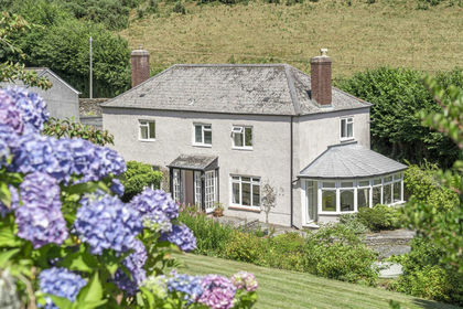
- Price
- Guide Price£700,000
- Size
- 3.5 acres
Added on 25/04/2026Farmhouse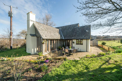
- Price
- Guide Price£995,000
- Size
- 5.87 acres
Added on 03/04/2026Farmhouse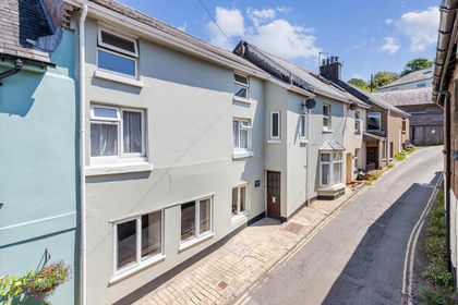
- Price
- Guide Price£895,000
- Size
- 3.5 acres
Bakers Hill, Aveton Gifford, Kingsbridge, Aveton Gifford, Devon TQ7 England
Added on 19/03/2026House with Land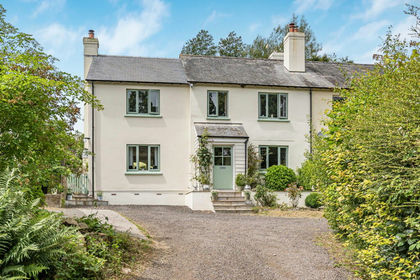
- Price
- Guide Price£795,000
- Size
- 1 acres
Added on 11/07/2026House with Land
- Price
- Guide Price£799,950
- Size
- 6.5 acres
Added on 22/06/2026House with Land
- Price
- Offers Over£1,000,000
- Size
- 1 acres
Bigbury, Kingsbridge, Devon, TQ7, Bigbury, Devon TQ7 England
Added on 02/07/2026House with Land
- Price
- Offers in Region of£699,000
- Size
- 1 acres
Added on 29/01/2026House with Land
- Price
- Guide Price£975,000
- Size
- 4 acres
Added on 29/01/2026House with Land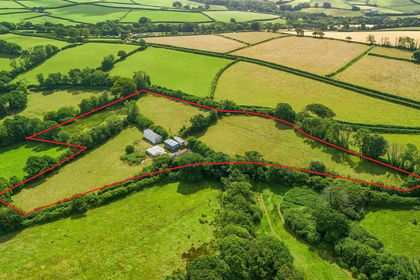
- Price
- Guide Price£800,000
- Size
- 6.5 acres
6.5 Acres - Modbury, Ivybridge, Devon, PL21, Modbury, Devon PL21 England
Added on 29/01/2026House with Land
- Price
- Guide Price£650,000
- Size
- 2 acres
East Portlemouth, Salcombe, East Portlemouth, Devon TQ8 England
Added on 28/03/2026Barn Conversion