Aberhosan, Machynlleth
- Land size
- 1190 acres
- Bedrooms
- 5
- Bathrooms
- 1
Description
Located in a desirable and noted agricultural area, a noted upland farm with enormous potential for future diversification uses subject to obtaining relevant consents.
A substantial mixed stock farm amounting to 1190 acres or thereabouts, offering a rare opportunity to acquire one of the largest farms to be offered for sale in Mid Wales in recent years.
For Sale By Formal Tender - A substantial mixed-stock holding extending to approximately 1,190 acres, presenting a rare opportunity to acquire one of the largest agricultural holdings to come to the market in Mid Wales in recent years.
RHOS Y GARREG
ABERHOSAN
MACHYNLLETH
POWYS
SY20 8SG
Joint Agents - Aled Ellis & Co Ltd, 16 Terrace Rd, Aberystwyth, Ceredigion, SY23 1NP. or Ref- RAE/JN
Farmers Marts (R G Jones), Llys Meirion, Smithfield Street, Dolgellau, LL40 1AB. – REF – RJ – Email -
Method Of Sale - The farm is offered for sale by formal tender. A legal pack and tender documents are available from our clients’ solicitors.
All tenders and Associated documents are to be submitted on the attached form and sent to Evans Roberts Solicitors, Trefeddyg, High St. Tywyn, LL36 9AD in a sealed envelope marked "Rhos Y Garreg" by Thursday 15th October 2026 at 12 Noon. To prevent the duplicate of offers, we recommend that the tender specifies a non-rounded (uneven) amount.
Closing Date For Tenders - Noon on 15th October 2026 (Please refer to the tender document)
Notification Date - On or before 22nd of October 2026 (Please refer to the tender document)
Completion Date - 28 days from the date of notification. (See tender document)
.
Vendors Solicitors - Evans Roberts Solicitors, Trefeddyg, High St, Tywyn. LL36 9AD. Tel – . Ref – BR. Email – .
Tenure - Freehold with vacant possession or completion. The farm is offered for sale with a Land Registry registered – Title No – see legal pack.
Sporting And Mineral Rights - Sporting and mineral rights belong to a third party.
Services - The property is serviced by a mains supply of electricity along with a private water supply, with waste managed via a private system.
Council Tax - The property is currently not registered for Council Tax
Powys County Council, County Hall, Spa Road East, Llandrindod Wells, Powys, LD1 5LG
Entitlements - Any rights (pro rata) under the B.P.S or S.F.S schemes will be transferred to the purchasers if the RPW determines whether the transfer in appropriate.
Rights Of Way, Way Leaves And Easements - The farm is sold subject to and with the benefit of any existing rights of way, drainage, water and other rights, easements and way leaves whether by writer agreement or otherwise.
Sheep Flock - The buyers will be required to purchase approximately 750 head of Welsh ewes (of flock ages) at valuation.
Retained Land - The purchasers will have a right of first refusal to acquire at valuation approximately 50 acres retained by the vendor.
Os Plan - A plan is included with these sales particulars for identification purposes with the boundaries highlighted in red. A copy of the Land Registry plan forms part of the legal pack, if there is any inconsistency between the OS plan and the Land registry plan the later shall prevail.
Farm Sale - A farm sale will be conducted at Rhos Y Garreg on Saturday 31st October 2026
Viewing - Strictly by appointment only arranged through the selling agents.
Land Transaction Tax - The purchase of this property may be subject to Land Transaction Tax (LTT), with the amount payable depending on the purchase price and the buyer’s circumstances. For an estimate, please use the Welsh Revenue Authority Land Transaction Tax calculator at and/or seek advice from your solicitor or financial adviser.
Particulars Of Sale -
Situation - The village of Aberhosan nearby is 5 miles inland from Machynlleth. The market town provides for a good range of facilities to include both primary school and secondary schools. Aberystwyth is 23 miles to the South, Llanidloes 16 miles inland and Dolgellau 21 miles to the North.
The Farmhouse - The farmhouse is mainly of traditional construction and is in need of renovation. The existing accommodation briefly comprises of;
.
.
Ground Floor -
Front Entrance Door To -
Reception Hallway - with stairs to first floor accommodation, quarry tiled floor and doors to
Sitting Room - 3.56m x 3.48m (11'8 x 11'5 ) - with tiled fireplace and window to fore.
Living Room - 3.86m x 3.99m (12'8 x 13'1 ) - with Victorian fireplace with recess cupboard to side. Window to fore.
Pantry - 3.56m x 1.42m (11'8 x 4'8 ) - with shelving and window to rear.
Dining Room - 4.62m x 5.21m (15'2 x 17'1 ) - Inglenook with tiled fireplace, slate floor and window to side.
Kitchen - 3.48m x 4.19m (11'5 x 13'9 ) - comprising sink unit, old stanley range and window to side. Room above
Cellar -
First Floor Accommodation -
Landing - access to roof space and doors to
Bedroom 1 - 3.84m x 2.26m (12'7 x 7'5 ) - with feature fireplace and window to rear.
Bedroom 2 - 3.86m x 2.87m (12'8 x 9'5 ) - with cast iron fireplace and window to fore.
Bedroom 3 - 4.65m x 3.35m (15'3 x 11' ) - with feature fireplace and window to fore.
Bedroom 4 - 4.27m x 3.35m (14' x 11' ) - with window to side.
Bedroom 5 - 3.45m x 3.56m (11'4 x 11'8 ) - with feature fireplace and window to side.
Bathroom - 2.44m x 1.85m (8' x 6'1 ) - comprising bath, wc and wash hand basin.
The Outbuildings - The outbuilding briefly comprises of: - (See drone pictures)
•Silage Pit 30 x 75
•Silage Pit 110 x 25
•2 x 60 x 35 outbuildings with feeding passage
•75 x 35 and 75 x 30 Simplex shed with side feeding passage.
•75 x 25 cubicle shed
•8 stables/ looseboxes
•52 x 35 Implement shed
•Sheep handling facilities
•Concreted yards etc
The Land - This expansive 1,190-acre holding presents a rare opportunity to acquire a highly successful livestock enterprise with clear potential for diversification into conservation or leisure pursuits. The land comprises a rich mosaic of pasture, woodland, and moorland, with selected areas designated as a Site of Special Scientific Interest (SSSI), reflecting its environmental significance.
The holding occupies an elevated position, with the farmstead situated at approximately 200 metres above sea level. Its highest points—Cipyn Du, Tarren Bwlch Gwyn, and Tarren y Gesail—rise to around 470 metres, offering dramatic upland scenery. The unimproved mountain land along the western boundary benefits from convenient access via the Dylife Road.
Although classified as Grade 4 and 5 agricultural land, the majority of the lower enclosures have been extensively improved and are now laid to clean permanent pasture. The in-bye fields are well suited to silage and hay production, further enhancing the holding’s versatility.
The land is broken down to the following classes:
• c. 252 acres of Productive Pastureland
• c. 199 acres of Ffriddland
• c. 695 acres of Rough Grazing and Enclosed Mountain Land
• c. 44 acres of Woodland
The land has been carefully and consistently managed and is in excellent heart. Boundaries are defined by a combination of well-maintained stock fencing and mature hedgerows, and the entire holding is ring-fenced. A strategically positioned internal track provides practical access to the more distant enclosures, supporting efficient day-to-day management. A generous natural water supply runs throughout the property, and a 33kV electricity line crosses the land.
Agents Comments - Seldom do large holdings of this nature become available in Mid Wales. The Hafod and Hendre system of farming has served our client well over the last 60 years. Rhos Y Garreg is noted for the livestock it produces and are always well sold through the livestock markets in the area.
Map Location
Property details
- Tenure
- Freehold
- Council Tax Band
- E
- Date Posted
- 2026-08-10
Utilities & Restrictions
Utilities
- Electricity
- Ask Agent
- Water
- Ask Agent
- Heating
- Ask Agent
- Broadband
- Ask Agent
- Sewerage
- Ask Agent
Rights & Restrictions
- Public Rights of Way
- Ask Agent
- Private Rights of Way
- Ask Agent
- Listed Property
- Ask Agent
- Restrictions
- Ask Agent
Listed status, conservation areas and planning constraints for this location are in the full report.
Property Features
- Accessibility
- Ask Agent
- Parking
- Ask Agent
- Garden
- Garden
Beyond the particulars: planning activity, flood history, heritage and ground risks, checked for this exact spot.
Connectivity
Broadband
Fastest speed available at this postcode
1.8 Gbps
Gigabit full fibre · available to 44% of premises
Suitable for
- 4K streaming on every screen
- Full-time home working
- Online gaming & big downloads
Mobile signal
Predicted 4G and 5G signal; indoor signal depends on building materials.
Ofcom Connected Nations postcode-level predictions. Speeds and signal are modelled, not measured, and vary between addresses and providers.
Signal is the easy part. Planning activity, flood history and protected designations here are in the full report.
Nearest Schools
Primary
- Ysgol Bro Hyddgen5 miles
- Pupils
- 441
- Type
- Middle (ages 4-19)
- Language
- Welsh medium school / provision (including transitional)
- Ysgol Gynradd Glantwymyn5.6 miles
- Pupils
- 78
- Type
- Nursery, Infants & Juniors
- Language
- Welsh medium school / provision (including transitional)
- Ysgol Llanbrynmair7.1 miles
- Pupils
- 35
- Type
- Nursery, Infants & Juniors
- Language
- Welsh medium school / provision (including transitional)
- Ysgol Gynradd Pennal7.4 miles
- Pupils
- 34
- Type
- Nursery, Infants & Juniors
- Language
- Welsh medium school / provision (including transitional)
- Ysgol Gynradd Dyffryn Dulas8.2 miles
- Pupils
- 33
- Type
- Nursery, Infants & Juniors
- Language
- Welsh medium school / provision (including transitional)
Secondary
- Ysgol Bro Hyddgen5 miles
- Pupils
- 441
- Type
- Middle (ages 4-19)
- Language
- Welsh medium school / provision (including transitional)
- Llanidloes High School11 miles
- Pupils
- 703
- Type
- Secondary (ages 11-19)
- Language
- Dual language school / provision (Welsh and English) (including transitional)
- Ysgol Uwchradd Tywyn14 miles
- Pupils
- 376
- Type
- Secondary (ages 11-16)
- Language
- Dual language school / provision (Welsh and English) (including transitional)
- Bro Idris14 miles
- Pupils
- 541
- Type
- Middle (ages 3-16)
- Language
- Welsh medium school / provision (including transitional)
- Penglais School16 miles
- Pupils
- 1,120
- Type
- Secondary (ages 11-19)
- Language
- English medium school / provision
Distances are straight-line from the advertised location. Source: the national school registers (DfE, Welsh Government, Scottish Government) and Ofsted.
Schools are just the start: sold prices nearby, planning activity and any flood history are in the full report.
Amenities
Supermarket
GP surgery
Pharmacy
Walking trail
Straight-line distances from the advertised location. Sources: NHS records, Geolytix supermarket locations, OS Open Greenspace and the national trails registers.
The area stacks up? Now check the location itself: planning nearby, protected designations and past flooding.
Getting Around
Nearest station
Nearest bus stop
Typical drive times
Straight-line distances from the advertised location; drive times are typical free-flow times over OpenStreetMap road data, so allow more at peak. Public transport locations from DfT NaPTAN.
Easy to reach matters. So do planning activity, flood history and ground risks: all in the full report.
Flood Risk
Natural Resources Wales open data, checked around the advertised map pin for the listed acreage. Long-term risk counts flood defences; the planning map's flood zones do not. Provided by LandSale, not the listing agent, and not part of the agent's particulars. Risk varies across a holding, so verify before committing.
Rivers and the sea
Not at the pin: mapped about 230 metres away.
Planning map: Flood Zone 3, about 230 metres away.
Surface water
Not at the pin: mapped about 40 metres away.
These bandings are the summary. Where this location sits on the flood maps, plus planning activity, heritage and ground risks, is in the full report.
Important notice: Information, maps and tags on this page are drawn from the advertising agent's marketing materials or generated automatically. LandSale has not verified them. Relying on these details is at your own risk, always carry out independent checks before committing to a purchase.
LandSale full disclaimer
Marketing information only - not formal particulars. The details on this website are provided for general guidance and do not constitute an offer or contract. Neither LandSale nor the advertising estate/land agent accepts responsibility for any inaccuracy.
1. Source of information
- Listing content: Core description, asking price, tenure, measurements, photographs and planning history originate from the marketing materials of the advertising estate or land agent. LandSale does not author this content and cannot guarantee its accuracy.
- Automated tags & categorisation: Property type, land-use class, acreage bands and similar labels may be applied by machine-learning models. They are intended as a helpful guide only and may not reflect the property's legal status or permitted use.
- Third-party & enriched data layers: Maps, boundary outlines, planning designations, soil reports, broadband coverage and other environmental or location-based insights are licensed from external suppliers. Such data are supplied “as is", may be incomplete or out of date and are subject to change without notice.
2. Verification required
Prospective purchasers must verify critical matters, including but not limited to planning permission, title boundaries, public rights of way, environmental constraints, acreage, services, access and VAT status, through their own inspections, specialist surveys, legal advisers and the selling agent before relying on the information or entering into any contract.
3. No warranty or liability
LandSale gives no warranty, express or implied, as to the accuracy, completeness or fitness for any particular purpose of the information displayed. LandSale shall not be liable for any loss, damage, cost or expense arising directly or indirectly from any use of or reliance on such information, save where liability may not be excluded by law.
4. Updates & feedback
If you believe any detail on this listing is inaccurate, please let us know. We will investigate and, where appropriate, update the listing or notify the agent.
© LandSale | Version 1.3 - August 2026
Listing agent
Aled Ellis & Co Ltd, Aberystwyth
16 Terrace Road, Aberystwyth, SY23 1NP
Similar properties for sale
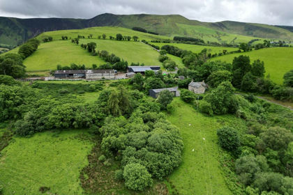
- Price
- Guide Price£4,500,000
- Size
- 1190 acres
Added on 18/08/2026Farm
- Price
- Offers in Region of£425,000
- Size
- 1.5 acres
Talywern, Machynlleth, Powys, SY20, Glantwymyn, Powys SY20 Wales
Added on 09/09/2026Cottage
- Price
- Offers in Region of£690,000
- Size
- 1.2 acres
Added on 11/04/2026House with Land
- Price
- Guide Price£625,000
- Size
- 9.4 acres
Pennant, Llanbrynmair, Powys, SY19, Llanbrynmair, Powys SY19 Wales
Added on 25/07/2026House with Land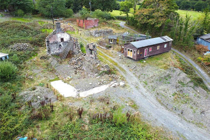
- Price
- Guide Price£120,000
- Size
- 0.85 acres
Tafolwern, Llanbrynmair, Powys, SY19, Llanbrynmair, Powys SY19 Wales
Added on 02/10/2026Derelict property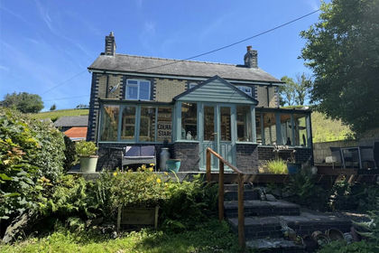
- Price
- Offers in Region of£585,000
- Size
- 2.5 acres
Cemmaes, Machynlleth, Powys, SY20, Glantwymyn, Powys SY20 Wales
Added on 29/01/2026Cottage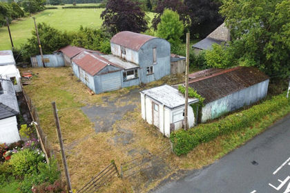
- Price
- Offers in Region of£160,000
Adj To The Glyn, Llanbrynmair, Powys, SY19, Llanbrynmair, Powys SY19 Wales
Added on 16/04/2026Building Plot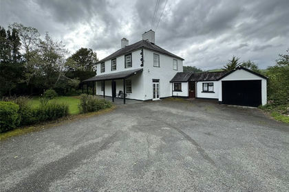
- Price
- £695,000
- Size
- 3 acres
Cemmaes, Machynlleth, Powys, SY20, Glantwymyn, Powys SY20 Wales
Added on 10/06/2026House with Land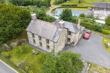
- Price
- £500,000
- Size
- 1.4 acres
Dolen Farm, Glandyfi, Machynlleth, SY20, Machynlleth, Ceredigion SY20 Wales
Added on 30/07/2026House with Land Added on 29/01/2026Barn Conversion