Chain Free Property in Wretton on 7.75 Acres, Offering Privacy and Seclusion
- Land size
- 7.75 acres
- Bedrooms
- 3
- Bathrooms
- 1
Key Features
- Offered with No Onward Chain
- Exceptional Privacy and Seclusion
- Approx. 7.75 Acres (STMS)
- Woodland, Paddocks and Garden
- Three-Bedroom Single Storey Home
- Adjoining Garage, Modern ‘Nissan Hut’ and Storage Container
- Gated Gravelled Driveway
- Excellent Self-Sufficiency/Smallholding Potential
Description
Enjoying a secluded and truly exceptional rural position, Sunray Farm is a wonderfully private single-storey home set within grounds of approximately 7.75 acres (stms), comprising a blend of woodland, paddocks and gardens. With no near neighbours, the setting offers a rare sense of peace and seclusion, creating the feeling of a true escape from the everyday, yet with the practicalities of village and market town life still within reach.
Approached via gravelled driveways, the house sits comfortably within its plot and enjoys a setting that feels both established and beautifully sheltered. The surrounding land gives this home enormous appeal for those seeking a more self-sufficient way of life, whether that means keeping animals, creating a smallholding, growing produce, or simply enjoying the freedom that comes with having space in abundance.
Inside, the accommodation extends to approximately 1,007 sq. ft. (stms) and is arranged over one level. The layout includes a generous sitting room, a well-proportioned kitchen/dining room, three bedrooms, a family bathroom, and an attached garage. The proportions are practical and easy to live in, while the outlook and setting elevate the property into something far more special than a straightforward country home.
Outside is where Sunray Farm truly comes into its own. The gardens and grounds wrap around the house beautifully, with open lawned areas giving way to paddocks and a delightful stretch of woodland beyond. The result is a property that offers not just a home, but a lifestyle - private, peaceful and immersed in nature, with the sort of setting that is increasingly hard to find.
WRETTON
Located amidst the serene landscapes of Norfolk, Wretton exudes a quiet charm that belies its historical significance. Nestled along the banks of the River Ouse, this village has preserved its rural character while offering a glimpse into its rich past.
Originally known for its agricultural roots, Wretton’s history stretches back centuries. Similar to nearby King’s Lynn, Wretton has seen its fair share of transformations. The village flourished in the Middle Ages, quietly sustaining itself through trade and local industry. Over time, its tranquil ambiance became a draw for those seeking a retreat from urban life.
Today, Wretton remains a picturesque haven, dotted with quaint cottages and historic landmarks. The village center is adorned with centuries-old buildings, each steeped in stories of its past. Its peaceful streets and friendly community reflect a simpler way of life, where time seems to slow down amid the Norfolk countryside.
For those seeking a blend of history and modern convenience, Wretton offers easy access to nearby Cambridge, Peterborough, and Norwich, each less than an hour’s drive away. Commuters also benefit from a direct rail link to London King’s Cross, making urban escapades remarkably accessible.
Whether exploring its tranquil riverbanks or delving into its historical treasures, Wretton invites visitors to embrace the beauty of rural Norfolk while savoring its timeless allure.
SERVICES CONNECTED
Mains electricity. Wood-burning stove with back boiler providing underfloor heating throughout. Borehole water supply and private sewerage treatment plant.
COUNCIL TAX
Band C.
ENERGY EFFICIENCY RATING
C. Ref:- 2136-0037-4600-0937-0296
To retrieve the Energy Performance Certificate for this property please visit and enter in the reference number above. Alternatively, the full certificate can be obtained through Sowerbys.
TENURE
Freehold.
LOCATION
What3words: ///dolly.vented.welfare
AGENTS NOTE
Planning granted for 5 eco-friendly yurts - Reference number 11/02075/F
WEBSITE TAGS
perfect-views
village-spirit
room-to-roam
EPC Rating: C
Parking - Garage
Parking - Driveway
Disclaimer
These particulars are provided as a guide only and do not form part of any offer or contract. Sowerbys and its representatives have no authority to make or give representations or warranties. All descriptions, measurements, photographs and plans are for guidance only and should not be relied upon as statements of fact. Buyers should satisfy themselves as to the accuracy of the information through inspection or professional advice. Services, appliances and equipment have not been tested and no warranty can be given as to their condition. Planning permissions, building regulations and other consents should be verified by the buyer’s legal adviser. In accordance with Anti-Money Laundering regulations, proceeding buyers must complete a digital ID check through our compliance partner. A charge of £48 including VAT per sale or purchase applies. Leasehold buyers should confirm ground rent, service charges and lease details with their legal adviser.
Map Location
Property details
- Tenure
- Freehold
- Council Tax Band
- C
- Date Posted
- 2026-08-09
Market Value Analysis
Compared with 197 Homes with Land listings in East Anglia (5+ acres).
Energy Performance Certificate
Energy Efficiency Rating
Based on UK Energy Performance Certificate standards (EU Directive 2002/91/EC)
Running costs are one side. Planning activity, flood history and ground risks for this location are in the full report.
Utilities & Restrictions
Utilities
- Electricity
- Mains
- Water
- Private Supply
- Heating
- Wood Burner
- Broadband
- Ask Agent
- Sewerage
- Septic Tank / Private
Rights & Restrictions
- Public Rights of Way
- Ask Agent
- Private Rights of Way
- Ask Agent
- Listed Property
- Ask Agent
- Restrictions
- Ask Agent
Listed status, conservation areas and planning constraints for this location are in the full report.
Property Features
- Accessibility
- Step-Free Access, Wide Doorways
- Parking
- Garage, Driveway
- Garden
- Private Garden
Beyond the particulars: planning activity, flood history, heritage and ground risks, checked for this exact spot.
Connectivity
Broadband
Fastest speed available at this postcode
60 Mbps
Superfast · available to 50% of premises
Suitable for
- HD streaming
- Video calls
- Web & social
Mobile signal
Predicted 4G and 5G signal; indoor signal depends on building materials.
Ofcom Connected Nations postcode-level predictions. Speeds and signal are modelled, not measured, and vary between addresses and providers.
Signal is the easy part. Planning activity, flood history and protected designations here are in the full report.
Nearest Schools
Primary
- All Saints Academy0.9 milesOfsted: Good
- Ages
- 4 to 11
- Pupils
- 97
- Type
- Academy converter
- Faith
- Church of England
- Hilgay Riverside Academy4.3 milesOfsted: Good
- Ages
- 4 to 11
- Pupils
- 75
- Type
- Academy converter
- Faith
- Church of England
- Duchy of Lancaster Methwold CofE Primary School4.5 milesOfsted: Good *
- Ages
- 5 to 11
- Pupils
- 91
- Type
- Academy converter
- Faith
- Church of England
- Downham Market, Hillcrest Primary School4.5 milesNo Ofsted rating
- Ages
- 5 to 11
- Pupils
- 404
- Type
- Community school
- Denver Voluntary Controlled Primary School4.5 milesOfsted: Good
- Ages
- 4 to 11
- Pupils
- 108
- Type
- Voluntary controlled school
- Faith
- Church of England
Secondary
- Iceni Secondary Academy4.4 milesOfsted: Requires improvement *
- Ages
- 11 to 16
- Pupils
- 555
- Type
- Academy sponsor led
- Downham Market Academy4.6 milesOfsted: Good
- Ages
- 11 to 18
- Pupils
- 1,329
- Type
- Academy sponsor led
- The Nicholas Hamond Academy9.6 milesOfsted report card · Mar 2026
- Ages
- 11 to 16
- Pupils
- 710
- Type
- Academy sponsor led
- Breckland School10 milesNo Ofsted rating
- Ages
- 11 to 16
- Pupils
- 615
- Type
- Free schools
- Vista Academy Littleport11 milesOfsted report card · Nov 2025
- Ages
- 11 to 16
- Pupils
- 547
- Type
- Academy sponsor led
* Latest graded judgement covers quality of education only; no overall grade was issued under the 2024-25 inspection framework.
Distances are straight-line from the advertised location. Source: the national school registers (DfE, Welsh Government, Scottish Government) and Ofsted.
Schools are just the start: sold prices nearby, planning activity and any flood history are in the full report.
Amenities
Supermarket
GP surgery
Pharmacy
Hospital
Green space
Straight-line distances from the advertised location. Sources: NHS records, Geolytix supermarket locations, OS Open Greenspace and the national trails registers.
The area stacks up? Now check the location itself: planning nearby, protected designations and past flooding.
Getting Around
Nearest station
Nearest bus stop
Typical drive times
Straight-line distances from the advertised location; drive times are typical free-flow times over OpenStreetMap road data, so allow more at peak. Public transport locations from DfT NaPTAN.
Easy to reach matters. So do planning activity, flood history and ground risks: all in the full report.
Flood Risk
Environment Agency open data, checked around the advertised map pin for the listed acreage. Long-term risk counts flood defences; the planning map's flood zones do not. Provided by LandSale, not the listing agent, and not part of the agent's particulars. Risk varies across a holding, so verify before committing.
Rivers and the sea
Planning map: Flood Zone 1.
Surface water
Not at the pin: mapped about 10 metres away.
These bandings are the summary. Where this location sits on the flood maps, plus planning activity, heritage and ground risks, is in the full report.
Important notice: Information, maps and tags on this page are drawn from the advertising agent's marketing materials or generated automatically. LandSale has not verified them. Relying on these details is at your own risk, always carry out independent checks before committing to a purchase.
LandSale full disclaimer
Marketing information only - not formal particulars. The details on this website are provided for general guidance and do not constitute an offer or contract. Neither LandSale nor the advertising estate/land agent accepts responsibility for any inaccuracy.
1. Source of information
- Listing content: Core description, asking price, tenure, measurements, photographs and planning history originate from the marketing materials of the advertising estate or land agent. LandSale does not author this content and cannot guarantee its accuracy.
- Automated tags & categorisation: Property type, land-use class, acreage bands and similar labels may be applied by machine-learning models. They are intended as a helpful guide only and may not reflect the property's legal status or permitted use.
- Third-party & enriched data layers: Maps, boundary outlines, planning designations, soil reports, broadband coverage and other environmental or location-based insights are licensed from external suppliers. Such data are supplied “as is", may be incomplete or out of date and are subject to change without notice.
2. Verification required
Prospective purchasers must verify critical matters, including but not limited to planning permission, title boundaries, public rights of way, environmental constraints, acreage, services, access and VAT status, through their own inspections, specialist surveys, legal advisers and the selling agent before relying on the information or entering into any contract.
3. No warranty or liability
LandSale gives no warranty, express or implied, as to the accuracy, completeness or fitness for any particular purpose of the information displayed. LandSale shall not be liable for any loss, damage, cost or expense arising directly or indirectly from any use of or reliance on such information, save where liability may not be excluded by law.
4. Updates & feedback
If you believe any detail on this listing is inaccurate, please let us know. We will investigate and, where appropriate, update the listing or notify the agent.
© LandSale | Version 1.3 - August 2026
Listing agent
Sowerbys, King's Lynn
23 Tuesday Market Place King's Lynn Norfolk PE30 1JJ
View agent profileSimilar properties for sale
- Price
- Guide Price£740,000
- Size
- 8.5 acres
Wisbech CAMBRIDGESHIRE, Marshland St. James, Norfolk PE14 England
Added on 08/10/2026Smallholding
- Price
- £565,000
- Size
- 2 acres
Weston Ditch, West Row, Bury St. Edmunds, Suffolk, IP28, West Row, Suffolk IP28 England
Added on 25/09/2026Smallholding
- Price
- Offers in Region of£594,000
- Size
- 2.25 acres
Added on 08/10/2026Barn Conversion
- Price
- Offers in Excess of£600,000
- Size
- 5 acres
Chatteris CAMBRIDGESHIRE, Manea, Cambridgeshire PE16 England
Added on 08/10/2026Smallholding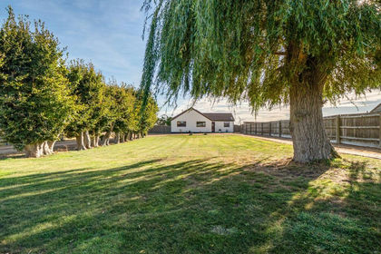
- Price
- Guide Price£750,000
- Size
- 10 acres
Turves CAMBRIDGESHIRE, Whittlesey, Cambridgeshire PE7 England
Added on 08/10/2026Kennels Property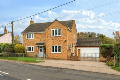
- Price
- Guide Price£765,000
- Size
- 4.6 acres
Somersham CAMBRIDGESHIRE, Somersham, Cambridgeshire PE28 England
Added on 08/10/2026Smallholding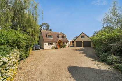
- Price
- Offers in Region of£650,000
- Size
- 3.5 acres
Dowsdale Bank CAMBRIDGESHIRE, Whaplode, Lincolnshire PE6 England
Added on 08/10/2026Smallholding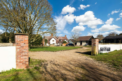
- Price
- Offers in Excess of£700,000
- Size
- 2 acres
Added on 21/07/2026House with Land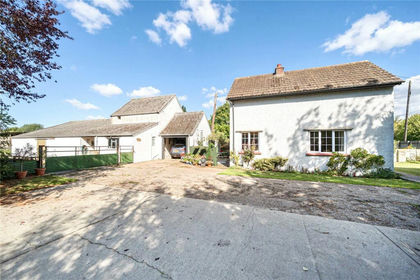
- Price
- Offers in Excess of£750,000
- Size
- 4.03 acres
Broad Road, Bacton, Stowmarket, Suffolk, IP14, Bacton, Suffolk IP14 England
Added on 29/01/2026Smallholding
- Price
- Guide Price£650,000
- Size
- 2.96 acres
Added on 27/08/2026House with Land