The Dingle, Leebotwood, Church Stretton, Shropshire
- Land size
- 1.14 acres
- Bedrooms
- 4
- Bathrooms
- 4
Key Features
- Detached Country 4 bedroomed residence with seperate 2 bedroomed annexed bungalow.
- Currently run as a successful holiday accommodation business
- Scope to erect outbuildings subject to planning permission
- Ideal for multi generational living
- Large gardens and grounds with ample parking
- Close to around 16000 acres of common land managed by The National Trust
- Viewing highly recommended - NO UPWARD CHAIN
Description
THE DINGLE AND LITTLE DINGLE
LEEBOTWOOD
CHURCH STRETTON
SY6 6LU
A rare opportunity to own an impressive and ideally located detached specious house with a separate detached two bedroom bungalow.
Both properties are currently used as profitable holiday accommodation businesses, with both dwellings available to be let individually or together and currently achieving average yearly gross income of around £60,000.
The properties also lend themselves for multi-generational living, with a large family house and bungalow for parents or younger family member.
The established gardens lie to all sides of the property extending in all to 1.14 acres.
There is a large parking area to the front with well established gardens to the side and rear that enjoy a sunny aspect. There are mature flowering shrubs, large lawn area and small woodland areas.
Leebotwood is a small village in south Shropshire. It is about 9 miles south of Shrewsbury and 3.5 miles north of Church Stretton. There is a village hall, church, and The Pound Inn/restaurant. The bus route between Shrewsbury and Ludlow passes through the village.
THE TOWN OF CHURCH STRETTON
Church Stretton lies amidst the south Shropshire Hills midway between the county town of
Shrewsbury (13 miles) and Ludlow (14 miles). It can claim to be one of the most beautifully situated towns in England and attracts walkers and country lovers from all over the UK.
This thriving community benefits from all types of societies, cafes, public houses and restaurants.
Being a popular market and tourist town it offers excellent shopping facilities, including a
supermarket, specialist shops, ladies and men’s fashion shops.
Including the picturesque neighbouring villages of All Stretton and Little Stretton it has a population of around 5,000.
There are churches, excellent schools, recreational facilities including 18-hole golf course, tennis, bowls and croquet.
The ‘Mayfair’ community centre and GP practice provide a range of health care.
There are good rail and bus services. Telford lies within easy commuting distance where the M54 gives access to the West Midlands and Birmingham
THE DINGLE ACCOMMODATION
(supplied with ample power points throughout)
Glazed UPVC front door with side windows to:-
RECEPTION HALL with tiled floor, radiator, storage/cloaks recess and adjacent.
CLOAKROOM/WC with tiled floor, front window, radiator, white suite including a WC, urinal, and washbasin with vanity cupboard below.
LIVING ROOM (7.6m x 4.3m approx)(25’ x 14’ approx) with laminate wood flooring, rear aspect bay window, three side windows and two front windows. TV aerial point and radiator.
Spacious KITCHEN/DINER (9.1m x 4.8m approx)(30’ x 15’8” approx) with laminate wood effect flooring, rear bay window with French doors to the garden, two side windows and two front windows.
A modern range of built in units comprising of eight floor cupboards (including drawers), granite worktops, two and half bowl stainless steel sink unit, integrated gas six ring hob with cooker hood over, a hot plate drawer, high level oven, slimline wine fridge, space for
dishwasher, fridge and freezer, and central island unit with granite worktop with drawers and cupboards below. Fireplace with log burner, two radiators, and glazed UPVC door
leading to:-
UTILITY/LAUNDRY ROOM (3.7m x 2.8m approx)(12’3” x 9’2” approx) Partly built of brick with UPVC conservatory windows and perspex roof. Built in floor cupboards, with spaces and plumbing for washer and dryer. Electric heater and glazed door to garden.
SNUG/STUDY(4.8m x 3.9m approx)(15’7” x 12’11” approx) with wooden flooring, recessed fireplace with log burner, TV aerial point, radiator, and door to inner hallway with door to garden room.
Glazed GARDEN ROOM (3.8m x 3.6m approx)(12’7” x 11’7”approx) with wood laminate flooring, TV aerial point, and double doors to the garden.
STAIRCASE with fitted carpet from reception hall ascends to the FIRST FLOOR
LANDING with fitted carpet, front window, radiator, and two built in cupboards.
BEDROOM 1 (4.8m x 4.8m approx) (15’9” x 15’9”approx) with fitted carpet, front window, skylight window, radiator, TV aerial point, and door to:-
EN SUITE BATH/ SHOWER ROOM with tiled floor, two skylight windows, suite comprising of a panelled bath with shower fitments, large walk-in shower with splashback walls, WC, bidet, and washbasin. Radiator and access to eaves storage space.
BEDROOM 2 ( 4.3m x 4m approx)(14’ x 13’approx) with fitted carpet, rear window, TV aerial point, radiator, and double wardrobe.
BEDROOM 3 (4m x 3.9m approx)(13’ x 12’11” approx) with fitted carpet, rear window, large double wardrobe, TV aerial point, and radiator.
BEDROOM 4 (3.1m x 2.5m approx)(10’3” x 8’4” approx) with fitted carpet, front window, TV aerial point, and radiator.
BATHROOM with vinyl flooring, front window, splashback boarded walls, white suite ‘p’ shaped bath with shower fittings, WC and washbasin, and heated towel rail.
THE ‘LITTLE ‘ DINGLE BUNGALOW
This detached traditionally constructed bungalow was refurbished in 2020 creating modern two bedroom accommodation ideal for a holiday let or home for family members, whether older or younger.
Parking to the front allows for easy access. There is also a westerly facing patio.
The accommodation in brief includes a living room, kitchen/diner, two bedrooms both having en suite showers/WC. (Please view floor plan).
TENURE We understand the Property is FREEHOLD
SERVICES We understand mains gas, electricity, water are connected. Septic tank drainage.
WATER AUTHORITY Severn Trent Water, Shelton, Shrewsbury SY3 8BJ Tel:
LOCAL AUTHORITY Shropshire Council, Shirehall, Shrewsbury, SY2 6ND Tel:
VIEWING By appointment through WRIGHTS ESTATE AGENTS telephone
Office opening hours Monday to Friday 9am to 5pm. Saturday 9am to 12 noon.
Email:
IMPORTANT NOTICE: Floor plan for illustrative purposes only, not to scale. All measurements and distances are approximate. The particulars are produced in good faith, are set out as a general guide only and do not constitute any part of a contract; no person in the employment of Wrights Estate Agents has any authority to make or give any representation or warranty whatever in relation to this property. We cannot verify the tenure, as we do not have access to the legal title; we cannot guarantee boundaries or rights of way so you must take the advice of your legal representative. If there is any point that is of particular importance to you, please contact the office and we will be pleased to check the information. Do so particularly if contemplating travelling some distance to view.
Map Location
Property details
- Tenure
- Freehold
- Council Tax Band
- Ask Agent
- Date Posted
- 2026-08-08
Market Value Analysis
Compared with 1,040 Homes with Land listings in West Midlands (1+ acres).
Utilities & Restrictions
Utilities
- Electricity
- Mains
- Water
- Mains
- Heating
- Ask Agent
- Broadband
- Ask Agent
- Sewerage
- Mains
Rights & Restrictions
- Public Rights of Way
- Ask Agent
- Private Rights of Way
- Ask Agent
- Listed Property
- Ask Agent
- Restrictions
- Ask Agent
Listed status, conservation areas and planning constraints for this location are in the full report.
Property Features
- Accessibility
- Ask Agent
- Parking
- Driveway
- Garden
- Front Garden, Patio, Rear Garden
Beyond the particulars: planning activity, flood history, heritage and ground risks, checked for this exact spot.
Connectivity
Broadband
Fastest speed available at this postcode
44 Mbps
Superfast · available to 33% of premises
Suitable for
- HD streaming
- Video calls
- Web & social
Fixed wireless access may also be an option here.
Mobile signal
Predicted 4G and 5G signal; indoor signal depends on building materials.
Ofcom Connected Nations postcode-level predictions. Speeds and signal are modelled, not measured, and vary between addresses and providers.
Signal is the easy part. Planning activity, flood history and protected designations here are in the full report.
Nearest Schools
Primary
- Longnor CofE Primary School1.8 milesOfsted: Outstanding
- Ages
- 3 to 11
- Pupils
- 116
- Type
- Voluntary controlled school
- Faith
- Church of England
- St Lawrence CofE Primary School2.6 milesNo Ofsted rating
- Ages
- 2 to 11
- Pupils
- 222
- Type
- Voluntary controlled school
- Faith
- Church of England
- St Edward's CofE Primary School3 milesOfsted report card · Jun 2026
- Ages
- 4 to 11
- Pupils
- 31
- Type
- Academy sponsor led
- Faith
- Church of England
- Rushbury CofE Primary School4.7 milesOfsted: Good
- Ages
- 4 to 11
- Pupils
- 64
- Type
- Voluntary controlled school
- Faith
- Church of England
- Church Preen Primary School5.1 milesOfsted: Good
- Ages
- 4 to 11
- Pupils
- 41
- Type
- Community school
Secondary
- Church Stretton School2.5 milesNo Ofsted rating
- Ages
- 11 to 16
- Pupils
- 539
- Type
- Academy converter
- Mary Webb School and Science College6.5 milesOfsted: Good
- Ages
- 11 to 16
- Pupils
- 632
- Type
- Academy converter
- Meole Brace School7.9 milesOfsted: Good
- Ages
- 11 to 16
- Pupils
- 1,316
- Type
- Academy converter
- The Priory School8.2 milesOfsted: Good
- Ages
- 11 to 16
- Pupils
- 852
- Type
- Academy converter
- Belvidere School9.4 milesOfsted: Requires improvement *
- Ages
- 11 to 16
- Pupils
- 830
- Type
- Academy converter
* Latest graded judgement covers quality of education only; no overall grade was issued under the 2024-25 inspection framework.
Distances are straight-line from the advertised location. Source: the national school registers (DfE, Welsh Government, Scottish Government) and Ofsted.
Schools are just the start: sold prices nearby, planning activity and any flood history are in the full report.
Amenities
Supermarket
GP surgery
Pharmacy
Hospital
Straight-line distances from the advertised location. Sources: NHS records, Geolytix supermarket locations, OS Open Greenspace and the national trails registers.
The area stacks up? Now check the location itself: planning nearby, protected designations and past flooding.
Getting Around
Nearest station
Nearest bus stop
Typical drive times
Straight-line distances from the advertised location; drive times are typical free-flow times over OpenStreetMap road data, so allow more at peak. Public transport locations from DfT NaPTAN.
Easy to reach matters. So do planning activity, flood history and ground risks: all in the full report.
Flood Risk
Environment Agency open data, checked around the advertised map pin for the listed acreage. Long-term risk counts flood defences; the planning map's flood zones do not. Provided by LandSale, not the listing agent, and not part of the agent's particulars. Risk varies across a holding, so verify before committing.
Rivers and the sea
Not at the pin: mapped about 40 metres away.
Planning map: Flood Zone 1.
Surface water
Not at the pin: mapped about 40 metres away.
These bandings are the summary. Where this location sits on the flood maps, plus planning activity, heritage and ground risks, is in the full report.
Important notice: Information, maps and tags on this page are drawn from the advertising agent's marketing materials or generated automatically. LandSale has not verified them. Relying on these details is at your own risk, always carry out independent checks before committing to a purchase.
LandSale full disclaimer
Marketing information only - not formal particulars. The details on this website are provided for general guidance and do not constitute an offer or contract. Neither LandSale nor the advertising estate/land agent accepts responsibility for any inaccuracy.
1. Source of information
- Listing content: Core description, asking price, tenure, measurements, photographs and planning history originate from the marketing materials of the advertising estate or land agent. LandSale does not author this content and cannot guarantee its accuracy.
- Automated tags & categorisation: Property type, land-use class, acreage bands and similar labels may be applied by machine-learning models. They are intended as a helpful guide only and may not reflect the property's legal status or permitted use.
- Third-party & enriched data layers: Maps, boundary outlines, planning designations, soil reports, broadband coverage and other environmental or location-based insights are licensed from external suppliers. Such data are supplied “as is", may be incomplete or out of date and are subject to change without notice.
2. Verification required
Prospective purchasers must verify critical matters, including but not limited to planning permission, title boundaries, public rights of way, environmental constraints, acreage, services, access and VAT status, through their own inspections, specialist surveys, legal advisers and the selling agent before relying on the information or entering into any contract.
3. No warranty or liability
LandSale gives no warranty, express or implied, as to the accuracy, completeness or fitness for any particular purpose of the information displayed. LandSale shall not be liable for any loss, damage, cost or expense arising directly or indirectly from any use of or reliance on such information, save where liability may not be excluded by law.
4. Updates & feedback
If you believe any detail on this listing is inaccurate, please let us know. We will investigate and, where appropriate, update the listing or notify the agent.
© LandSale | Version 1.3 - August 2026
Similar properties for sale
- Price
- Offers Over£595,000
- Size
- 1 acres
All Stretton, Church Stretton, Church Stretton, Shropshire SY6 England
Added on 28/07/2026House with Land
- Price
- Offers in Region of£595,000
1 Longnor Park Barns, Longnor, Shrewsbury, SY5, Longnor, Shropshire SY5 England
Added on 30/04/2026Barn Conversion
- Price
- Offers in Region of£550,000
Development Land west of Ye Olde Farm, Stapleton, Shrewsbury, Condover, Shropshire SY5 England
Added on 31/03/2026Building Plot
- Price
- Offers in Region of£450,000
Michaelmas Barn, Wrentnall, Pulverbatch, Shrewsbury, SY5, Church Pulverbatch, Shropshire SY5 England
Added on 05/07/2026Barn Conversion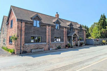
- Price
- Offers in Region of£445,000
The Old Barn, Longville, Much Wenlock, TF13, Rushbury, Shropshire TF13 England
Added on 29/01/2026Barn Conversion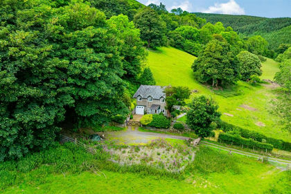
- Price
- Offers in Region of£495,000
- Size
- 1 acres
Birds Nest Cottage, Minton, Church Stretton, SY6, Church Stretton, Shropshire SY6 England
Added on 02/07/2026Cottage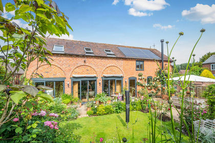
- Price
- £545,000
Added on 02/06/2026Barn Conversion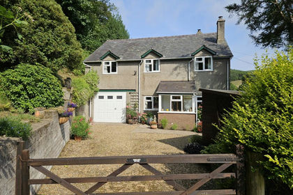
- Price
- Offers in Region of£495,000
- Size
- 1 acres
Birds Nest Cottage, Minton, Shropshire, Church Stretton, Shropshire SY6 England
Added on 16/07/2026Cottage
- Price
- Offers in Region of£625,000
Added on 11/08/2026Barn Conversion
- Price
- Offers in Region of£600,000
- Size
- 2 acres
Felhampton, Church Stretton, Wistanstow, Shropshire SY6 England
Added on 19/09/2026House with Land