East Allington, Totnes, Devon, TQ9
- Land size
- 1.41 acres
- Bedrooms
- 5
- Bathrooms
- 2
Key Features
- Well-appointed Victorian farmhouse
- Range of traditional agricultural buildings
- Subject to a long-established Agricultural Holdings Act 1986 tenancy with succession provisions
Description
A well-appointed Victorian farmhouse with range of traditional agricultural buildings arranged in a courtyard formation, occupying a secluded position within the picturesque South Devon landscape.
The property is offered for sale as a secure rural investment, subject to a long-established Agricultural Holdings Act 1986 tenancy.
INTRODUCTION
Higher Grimpstonleigh presents an attractive opportunity to acquire a rural investment comprising a substantial Victorian farmhouse and range of traditional agricultural buildings arranged around a central courtyard, situated in desirable rural setting. The property is offered for sale subject to a long-established Agricultural Holdings Act (AHA) 1986 tenancy, presenting purchasers with the opportunity to acquire a income-producing rural asset.
DESCRIPTION
Higher Grimpstonleigh comprises an attractive traditional farmstead centred around a characterful detached Victorian farmhouse, with range of traditional agricultural buildings arranged around a concrete courtyard.
Dating from the 18th century, the farmhouse is of traditional local stone construction beneath a natural slate roof and retains a wealth of period character, including exposed stone fireplaces and wood-burning stoves. The accommodation extends over two floors and provides five bedrooms, a kitchen/dining room, reception rooms, family bathroom and utility space. Whilst currently configured as two separate one-bedroom and four-bedroom units, the accommodation remains internally connected and functions as a single dwelling.
Externally, the property benefits from lawned gardens enclosed by mature hedgerows and traditional dry-stone walls, together with a gravelled parking area and access via a shared private driveway leading to the adjoining council-maintained highway. Areas of permanent grassland extends immediately south of the buildings and farmhouse, extending in total to 1.41 acres (0.57 hectares) or thereabouts as shown outlined in red on the sale plan.
Adjoining the farmhouse is an attractive range of traditional agricultural buildings of predominantly local stone construction beneath corrugated sheet roofs. The buildings comprise a mix of single and two-storey elements and are currently utilised for livestock housing and general agricultural storage, together with the adjoining concrete yard. The buildings do not benefit from any exterior curtilage to the north or east.
SITUATION
The property occupies an enviable rural position within the South Hams landscape, but remains highly accessible to local services and road networks, being located 3.8 miles northeast of Kingsbridge.
The town of Kingsbridge offers a range of everyday shopping and banking facilities, as well as primary and secondary education services, with the larger city of Plymouth being located 21.0 miles west and providing a wide range of commercial services.
The property is approximately 7.9 miles south-east of Ivybridge railway station, offering connection to mainline rail services to London and the national rail network. The A38 expressway provides connection to the M5 motorway at Exeter, with J31 of the M5 located 26.5 miles to the northeast.
SERVICES & OUTGOINGS
We understand mains single-phase electricity and shared private water services (by means of a spring supply) and LPG gas-fired central heating are available to the dwelling. We understand that the dwelling utilises septic tank foul drainage. We understand that mains single-phase electricity and shared private water services (by means of a spring supply) are available to the traditional buildings but are unsure of their operationality.
Prospective purchasers must make their own enquiries to verify the availability and suitability of services.
Council Tax: Higher Grimpstonleigh is listed as Band ‘E’ for Council tax purposes.
DIRECTIONS
From the town of Kingsbridge, take the A381 heading northeast out of the town towards Totnes. Approximatley 0.5 miles after passing the entrance to Torr Quarry Industrial Estate, turn left onto Torr Lane. Continue for circa 0.6 miles, before turning right onto an un-metalled track. Proceed along the track, where the property will be situated on the left. Strictly no access available from The Mounts.
ADDITIONAL INFORMATION
Broadband: No investigations have been made into the available broadband connections; prospective purchasers are directed to make their own investigations.
Mobile Coverage: Available via EE, O2, THREE and VODAFONE. For an indication of specific speeds and supply or coverage in the area we recommend contacting your own provider.
Flooding: The property is in an area at a VERY LOW RISK from River/Sea and Surface Water flooding (defined as the chance of flooding each year as less than 0.1%).
Tenure: The property is offered for sale freehold, subject to the existing Agricultural Holdings Act 1986 tenancy. Vacant possession will not be available on completion and, due to the tenancy’s succession provisions, may not become available for potentially two further generations.
Measurements and Testing: All measurements are approximate. Any field numbers and areas shown on the attached plan are based on the Ordnance Survey and are for identification purposes only. They do not necessarily correspond either with the National Grid plan numbers or with those produced on the Rural Land Register. Whilst we endeavour to make our sales particulars as accurate and reliable as possible, if there are any point which is of particular importance to you please contact the office, especially if you are contemplating travelling some distance to view the property. We have not tested any of the equipment, appliances, central heating or services.
Local Authority: South Hams District Council
Follaton House, Plymouth Road, Totnes, Devon, TQ9 5NE
Planning Permission: We believe that all elements have been constructed with planning consent or have been in place for sufficient time that a certificate of lawful existing use could be secured. Prospective purchasers are advised to make their own enquires on this matter.
Fixtures: All fixtures and fittings, unless specifically referred to within these sales particulars, are expressly excluded from the sale.
The property is offered subject to the existing Agricultural Holdings Act 1986 tenancy and purchasers should note that the ownership of fixtures, fittings, equipment and improvements may be governed by the terms of the tenancy agreement and the provisions of the Agricultural Holdings Act 1986. Certain tenant's improvements may give rise to statutory rights to compensation upon termination of the tenancy, where applicable. Prospective purchasers should satisfy themselves as to the ownership of any fixtures and fittings, together with any potential liabilities relating to tenant's improvements, by relying upon their own legal and professional advisers.
Map Location
Property details
- Tenure
- Freehold
- Council Tax Band
- E
- Date Posted
- 2026-07-31
Market Value Analysis
Compared with 260 Farmland & Pasture listings in South West England (1+ acres).
Energy Performance Certificate
Energy Efficiency Rating
Based on UK Energy Performance Certificate standards (EU Directive 2002/91/EC)
Running costs are one side. Planning activity, flood history and ground risks for this location are in the full report.
Utilities & Restrictions
Utilities
- Electricity
- Mains
- Water
- Private Supply
- Heating
- Gas Heating
- Broadband
- Ask Agent
- Sewerage
- Septic Tank / Private
Rights & Restrictions
- Public Rights of Way
- Ask Agent
- Private Rights of Way
- Ask Agent
- Listed Property
- Ask Agent
- Restrictions
- Ask Agent
Listed status, conservation areas and planning constraints for this location are in the full report.
Property Features
- Accessibility
- Ask Agent
- Parking
- Off-Street Parking
- Garden
- Garden
Beyond the particulars: planning activity, flood history, heritage and ground risks, checked for this exact spot.
Connectivity
Broadband
Fastest speed available at this postcode
71 Mbps
Superfast · available to 73% of premises
Suitable for
- HD streaming
- Video calls
- Web & social
Fixed wireless access may also be an option here.
Mobile signal
Outdoor predictions; indoor signal depends on building materials.
Ofcom Connected Nations postcode-level predictions. Speeds and signal are modelled, not measured, and vary between addresses and providers.
Signal is the easy part. Planning activity, flood history and protected designations here are in the full report.
Nearest Schools
Primary
- East Allington Primary School1.3 milesOfsted: Good
- Ages
- 2 to 11
- Pupils
- 80
- Type
- Academy converter
- Loddiswell Primary School1.8 milesNo Ofsted rating
- Ages
- 4 to 11
- Pupils
- 118
- Type
- Community school
- Kingsbridge Primary School2.9 milesOfsted: Requires improvement
- Ages
- 4 to 11
- Pupils
- 343
- Type
- Academy converter
- Blackawton Primary School3.5 milesNo Ofsted rating
- Ages
- 2 to 11
- Pupils
- 140
- Type
- Academy converter
- Aveton Gifford CofE Primary School3.6 milesOfsted report card · Jan 2026
- Ages
- 4 to 11
- Pupils
- 97
- Type
- Academy converter
- Faith
- Church of England
Secondary
- Kingsbridge Academy3.5 milesOfsted: Good
- Ages
- 11 to 18
- Pupils
- 1,199
- Type
- Academy converter
- Dartmouth Academy7.3 milesOfsted: Good
- Ages
- 3 to 19
- Pupils
- 435
- Type
- Academy sponsor led
- King Edward VI Community College8 milesNo Ofsted rating
- Ages
- 11 to 18
- Pupils
- 940
- Type
- Academy converter
- Ivybridge Community College8.3 milesOfsted: Good
- Ages
- 11 to 18
- Pupils
- 2,262
- Type
- Academy converter
- Churston Ferrers Grammar School Academy9.9 milesOfsted: Good
- Ages
- 11 to 18
- Pupils
- 1,062
- Type
- Academy converter
Distances are straight-line from the advertised location. Source: the national school registers (DfE, Welsh Government, Scottish Government) and Ofsted.
Schools are just the start: sold prices nearby, planning activity and any flood history are in the full report.
Amenities
Supermarket
GP surgery
Pharmacy
Hospital
Straight-line distances from the advertised location. Sources: NHS records, Geolytix supermarket locations, OS Open Greenspace and the national trails registers.
The area stacks up? Now check the location itself: planning nearby, protected designations and past flooding.
Getting Around
Nearest station
Nearest bus stop
Typical drive times
Straight-line distances from the advertised location; drive times are typical free-flow times over OpenStreetMap road data, so allow more at peak. Public transport locations from DfT NaPTAN.
Easy to reach matters. So do planning activity, flood history and ground risks: all in the full report.
Flood Risk
From Environment Agency flood map open data, checked around the advertised map pin and allowing for the listed acreage where known. This summary comes from LandSale, the advertising platform, not from the listing agent, and is not part of the agent's particulars. Risk can vary across a single holding, so verify anything critical through your own searches before committing.
Rivers and the sea
Surface water
The detail behind these bandings
The full report pinpoints where this location sits on the flood maps, and runs the deeper checks that usually only surface after an offer.
- Exact flood zones & annual chances (included in the full report)
- Any recorded past flooding (included in the full report)
- Planning activity nearby (included in the full report)
- Heritage & conservation (included in the full report)
- Protected nature designations (included in the full report)
- Ground risks (included in the full report)
- Sold prices nearby (included in the full report)
£14.99 · one-off purchase
By LandSale, the platform. Not provided by the listing agent. Ready in about a minute.
Important notice: Information, maps and tags on this page are drawn from the advertising agent's marketing materials or generated automatically. LandSale has not verified them. Relying on these details is at your own risk, always carry out independent checks before committing to a purchase.
LandSale full disclaimer
Marketing information only - not formal particulars. The details on this website are provided for general guidance and do not constitute an offer or contract. Neither LandSale nor the advertising estate/land agent accepts responsibility for any inaccuracy.
1. Source of information
- Listing content: Core description, asking price, tenure, measurements, photographs and planning history originate from the marketing materials of the advertising estate or land agent. LandSale does not author this content and cannot guarantee its accuracy.
- Automated tags & categorisation: Property type, land-use class, acreage bands and similar labels may be applied by machine-learning models. They are intended as a helpful guide only and may not reflect the property's legal status or permitted use.
- Third-party & enriched data layers: Maps, boundary outlines, planning designations, soil reports, broadband coverage and other environmental or location-based insights are licensed from external suppliers. Such data are supplied “as is", may be incomplete or out of date and are subject to change without notice.
2. Verification required
Prospective purchasers must verify critical matters, including but not limited to planning permission, title boundaries, public rights of way, environmental constraints, acreage, services, access and VAT status, through their own inspections, specialist surveys, legal advisers and the selling agent before relying on the information or entering into any contract.
3. No warranty or liability
LandSale gives no warranty, express or implied, as to the accuracy, completeness or fitness for any particular purpose of the information displayed. LandSale shall not be liable for any loss, damage, cost or expense arising directly or indirectly from any use of or reliance on such information, save where liability may not be excluded by law.
4. Updates & feedback
If you believe any detail on this listing is inaccurate, please let us know. We will investigate and, where appropriate, update the listing or notify the agent.
© LandSale | Version 1.3 - August 2026
Listing agent
Greenslade Taylor Hunt, Ivybridge
8 Erme Ct Leonards Road, Ivybridge, PL21 0SZ
Contact Greenslade Taylor Hunt, Ivybridge
8 Erme Ct Leonards Road, Ivybridge, PL21 0SZ
View agent profileSimilar properties for sale
- Price
- Guide Price£375,000
- Size
- 1.6 acres
Two Bridges, Yelverton, PL20, Dartmoor Forest, Devon PL20 England
Added on 04/06/2026House with LandLeasehold
- Price
- Offers in Region of£400,000
- Size
- 11 acres
Added on 24/06/2026Smallholding
- Price
- Guide Price£360,000
34.68 Acres - Bow, Crediton, Devon, EX17, Bow, Devon EX17 England
Added on 05/06/2026Farm
- Price
- Guide Price£295,000
- Size
- 33.03 acres
Added on 03/07/2026Farm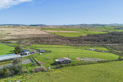
- Price
- Guide Price£350,000
- Size
- 2.5 acres
Middle Lordes Waste, Launceston, PL15, St. Neot, Cornwall PL15 England
Added on 20/03/2026Barn Conversion