High Street, Wallcrouch
- Land size
- 8.61 acres
Key Features
- Picturesque equestrian smallholding
- Permission for use as a riding school
- Land extending to some 8.61 acres
- Superb location
Description
BEST AND FINAL OFFERS BY NOON ON FRIDAY 21ST AUGUST 2026
A picturesque equestrian smallholding with permission for use as a riding school, with land extending in all to some 8.61 acres, situated in a superb location in between the villages of Ticehurst and Wadhurst in East Sussex.
DESCRIPTION
The Yard is situated in a semi-rural location in between the villages of Ticehurst and Wadhurst in East Sussex. The property offers a rare opportunity to purchase a well-equipped equestrian smallholding with permission for use as a riding school, with land extending in all to some 8.61 acres.
A secure gated access from the High Street (B2099) leads to a contained hardcore parking area. A further secure gated entrance leads along the driveway, which is lined with paddocks either side, to the yard, which is located at the rear of the site, away from the road. Situated around the yard are a significant range of timber frame stable blocks on a concrete base with concrete apron, providing 13 loose boxes, a tack room, together with a small pole barn to the rear for hay storage.
A 40m x 20m manège is also located adjacent to the stables, alongside a 20ft steel container and a toilet block, which will remain in situ.
Situated around the yard are six broadly level and well drained grazing paddocks, each with individual water troughs and sub-divided by stock proof fencing. To the rear of the yard is a small isolation paddock. Of the 8.61 acres, approximately 2.5 acres comprises woodland situated on the southern and western boundaries of the land.
Planning permission was granted under reference RR/2014/3109/P for the “Change of use of existing equestrian premises to a riding school”. This permission allows for five, one-hour, one-to-one lessons per day, 5 days per week.
DIRECTIONS
The nearest postcode is TN5 7JT. From Ticehurst, head west along the B2099/High Street. After 2 miles, the entrance to The Yard will be located on the left-hand side.
HACKING
The Bewl Water bridleway is accessible via a hack of just over one mile from The Yard, along the quiet Ward’s Lane.
WHAT3WORDS
Using the free What3Words app, the gated entrance to the property can be located at ///variously.sniff.smooth
ACCESS
Access to The Yard is via a private gated entrance off the B2099/High Street
VIEWING: Strictly by appointment only with the selling agent’s Wadhurst office on 01435 873999 Option 3. Contact Will Jex or Dan Page for more information.
METHOD OF SALE: The land is offered for sale by Private Treaty. The agent may set a deadline for Best and Final Offers, in the event that significant interest is received.
TENURE: The land is offered freehold with vacant possession on completion.
SERVICES & UTILITIES: Mains water is connected to the yard and paddocks, alongside a private drainage system servicing the toilet. The property is not currently connected to mains electricity, and the owners have used a generator to power lighting. Prospective purchasers should rely on their own enquiries with regards to local availability of any further service connections.
BROADBAND & MOBILE COVERAGE:
(Visit https://checker.ofcom.org.uk/en-gb/broadband-coverage or enquire with the office for more information).
LOCAL AUTHORITY: Rother District Council, Town Hall, London Rd, Bexhill-on-Sea TN39 3JX (Tel: 01424 787000).
FLOOD & EROSION RISK: The land is located within Flood Zone 1, an area with low risk of flooding.
(Visit flood-map-for-planning.service.gov.uk or enquire with the office for more information).
PARTICULARS, PLANS AND SCHEDULES: The particulars and acreages stated, together with the plans are believed but not guaranteed to be correct. They are given by the Agents to assist viewers but are specifically excluded from any contract. Prospective purchasers must satisfy themselves as to the information enclosed.
IMPORTANT NOTICE: Lambert & Foster themselves and the vendors and/or lessors of this property whose agents they are, give notice that: The particulars are set out as a general outline only for guidance and do not constitute part of an offer or contract. All descriptions, dimensions, references to condition and necessary permissions for the use and occupation and other details are given in good faith and are believed to be correct. Any intending purchasers/lessees should not rely on them as statements or presentations of fact but satisfy themselves by inspection or otherwise as to the correctness of each of them. If there are any points which are of particular importance to you, please contact the office and we will be pleased to check the information, particularly if you are travelling some distance to view the property.
In accordance with the Digital Market, Competiton and Consumers (DMCC) Act 2024, we must advise that we have not tested any of the main services, various electrical or gas appliances and fixtures which may be referred to in these sales particulars. Any prospective purchasers are strongly advised to satisfy themselves that such are in working order. No person in the employment of the Agents has any authority to make or give any representations or warranty whatever in relation to this property.
MONEY LAUNDERING REGULATION: In accordance with Money Laundering Regulations, we are now required to obtain proof of identification for all vendors and purchasers. You will need to supply information required for us to complete our identification checks which will include your date of birth, main residential address and a colour copy of your passport or photo driving licence. Lambert & Foster apologise for any inconvenience this may cause, but it is a legal requirement. Lambert & Foster will not be able to conclude a sale on your behalf to any person or people who are unable to provide confirmation of identification. Note: Lambert & Foster currently employs the services of Smartsearch to verify the identity and address of vendors/purchasers.
Map Location
Property details
- Tenure
- Freehold
- Council Tax Band
- Ask Agent
- Date Posted
- 2026-07-29
Market Value Analysis
Compared with 84 Equestrian listings in South East England (5+ acres).
Utilities & Restrictions
Utilities
- Electricity
- Ask Agent
- Water
- Ask Agent
- Heating
- Ask Agent
- Broadband
- Ask Agent
- Sewerage
- Ask Agent
Rights & Restrictions
- Public Rights of Way
- Ask Agent
- Private Rights of Way
- Ask Agent
- Listed Property
- Ask Agent
- Restrictions
- Ask Agent
Listed status, conservation areas and planning constraints for this location are in the full report.
Property Features
- Accessibility
- Ask Agent
- Parking
- Ask Agent
- Garden
- Ask Agent
Beyond the particulars: planning activity, flood history, heritage and ground risks, checked for this exact spot.
Connectivity
Broadband
Fastest speed available at this postcode
1.8 Gbps
Gigabit full fibre · available to 89% of premises
Suitable for
- 4K streaming on every screen
- Full-time home working
- Online gaming & big downloads
Mobile signal
Outdoor predictions; indoor signal depends on building materials.
Ofcom Connected Nations postcode-level predictions. Speeds and signal are modelled, not measured, and vary between addresses and providers.
Signal is the easy part. Planning activity, flood history and protected designations here are in the full report.
Nearest Schools
Primary
- Stonegate Church of England Primary School1.2 milesNo Ofsted rating
- Ages
- 4 to 11
- Pupils
- 116
- Type
- Voluntary controlled school
- Faith
- Church of England
- Wadhurst CofE Primary School and Nursery2 milesNo Ofsted rating
- Ages
- 2 to 11
- Pupils
- 269
- Type
- Voluntary controlled school
- Faith
- Church of England
- Ticehurst and Flimwell Church of England Primary School2.1 milesNo Ofsted rating
- Ages
- 4 to 11
- Pupils
- 103
- Type
- Voluntary controlled school
- Faith
- Church of England
- Lamberhurst St Mary's CofE (Voluntary Controlled) Primary School3.6 milesNo Ofsted rating
- Ages
- 4 to 11
- Pupils
- 201
- Type
- Voluntary controlled school
- Faith
- Church of England
- Burwash CofE School3.7 milesOfsted: Outstanding
- Ages
- 4 to 11
- Pupils
- 158
- Type
- Voluntary controlled school
- Faith
- Church of England
Secondary
- Uplands Academy1.5 milesNo Ofsted rating
- Ages
- 11 to 18
- Pupils
- 699
- Type
- Academy converter
- Robertsbridge Community College5.9 milesOfsted: Inadequate
- Ages
- 11 to 16
- Pupils
- 644
- Type
- Academy sponsor led
- Heathfield Community College6.9 milesOfsted: Good
- Ages
- 11 to 18
- Pupils
- 1,416
- Type
- Community school
- Skinners' Kent Academy7.2 milesOfsted: Good
- Ages
- 11 to 18
- Pupils
- 1,017
- Type
- Academy sponsor led
- The Skinners' School8 milesOfsted report card · Jan 2026
- Ages
- 11 to 18
- Pupils
- 1,149
- Type
- Academy converter
- Gender
- Boys
Distances are straight-line from the advertised location. Source: the national school registers (DfE, Welsh Government, Scottish Government) and Ofsted.
Schools are just the start: sold prices nearby, planning activity and any flood history are in the full report.
Amenities
Supermarket
GP surgery
Pharmacy
Hospital
Straight-line distances from the advertised location. Sources: NHS records, Geolytix supermarket locations, OS Open Greenspace and the national trails registers.
The area stacks up? Now check the location itself: planning nearby, protected designations and past flooding.
Getting Around
Nearest station
Nearest bus stop
Typical drive times
Straight-line distances from the advertised location; drive times are typical free-flow times over OpenStreetMap road data, so allow more at peak. Public transport locations from DfT NaPTAN.
Easy to reach matters. So do planning activity, flood history and ground risks: all in the full report.
Flood Risk
From Environment Agency flood map open data, checked around the advertised map pin and allowing for the listed acreage where known. This summary comes from LandSale, the advertising platform, not from the listing agent, and is not part of the agent's particulars. Risk can vary across a single holding, so verify anything critical through your own searches before committing.
Rivers and the sea
Surface water
Mapped within the area searched, not at the advertised map pin itself.
These bandings are the summary. Where this location sits on the flood maps, plus planning activity, heritage and ground risks, is in the full report.
Important notice: Information, maps and tags on this page are drawn from the advertising agent's marketing materials or generated automatically. LandSale has not verified them. Relying on these details is at your own risk, always carry out independent checks before committing to a purchase.
LandSale full disclaimer
Marketing information only - not formal particulars. The details on this website are provided for general guidance and do not constitute an offer or contract. Neither LandSale nor the advertising estate/land agent accepts responsibility for any inaccuracy.
1. Source of information
- Listing content: Core description, asking price, tenure, measurements, photographs and planning history originate from the marketing materials of the advertising estate or land agent. LandSale does not author this content and cannot guarantee its accuracy.
- Automated tags & categorisation: Property type, land-use class, acreage bands and similar labels may be applied by machine-learning models. They are intended as a helpful guide only and may not reflect the property's legal status or permitted use.
- Third-party & enriched data layers: Maps, boundary outlines, planning designations, soil reports, broadband coverage and other environmental or location-based insights are licensed from external suppliers. Such data are supplied “as is", may be incomplete or out of date and are subject to change without notice.
2. Verification required
Prospective purchasers must verify critical matters, including but not limited to planning permission, title boundaries, public rights of way, environmental constraints, acreage, services, access and VAT status, through their own inspections, specialist surveys, legal advisers and the selling agent before relying on the information or entering into any contract.
3. No warranty or liability
LandSale gives no warranty, express or implied, as to the accuracy, completeness or fitness for any particular purpose of the information displayed. LandSale shall not be liable for any loss, damage, cost or expense arising directly or indirectly from any use of or reliance on such information, save where liability may not be excluded by law.
4. Updates & feedback
If you believe any detail on this listing is inaccurate, please let us know. We will investigate and, where appropriate, update the listing or notify the agent.
© LandSale | Version 1.3 - August 2026
Listing agent
Lambert & Foster Ltd, Wadhurst
Helix House High Street Wadhurst TN5 6AA
View agent profileSimilar properties for sale
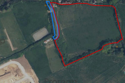
- Price
- Offers in Region of£250,000
- Size
- 4.91 acres
Ninfield, Battle, East Sussex, TN33, Ninfield, East Sussex TN33 England
Added on 09/04/2026Grazing Land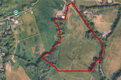
- Price
- Guide Price£400,000
- Size
- 15.1 acres
Henley Down, Catsfield, Battle, TN33, Catsfield, East Sussex TN33 England
Added on 08/09/2026Grazing Land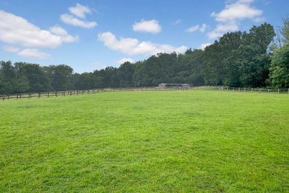
- Price
- Offers in Excess of£365,000
- Size
- 7.2 acres
Oldlands Hill, Uckfield, TN22, Maresfield, East Sussex TN22 England
Added on 16/09/2026Equestrian property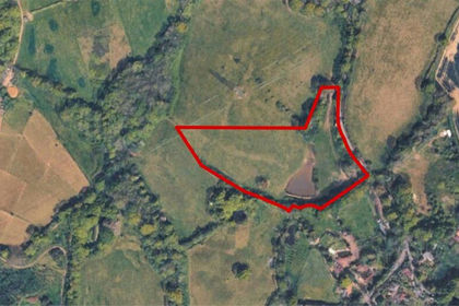
- Price
- Guide Price£300,000
- Size
- 5.21 acres
Henley Down, Catsfield, Battle, TN33, Catsfield, East Sussex TN33 England
Added on 08/09/2026Fishing Lake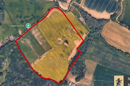
- Price
- Guide Price£400,000
- Size
- 21.51 acres
Wood Lane, Wartling, Hailsham, BN27, Wartling, East Sussex BN27 England
Added on 11/09/2026Agricultural Land
- Price
- Guide Price£400,000
- Size
- 13.5 acres
Added on 29/01/2026Pasture
- Price
- Guide Price£275,000
- Size
- 15.58 acres
Added on 17/08/2026Agricultural Land
- Price
- £300,000
- Size
- 15.73 acres
Lewes Road, Piddinghoe, Newhaven, BN9, Newhaven, East Sussex BN9 England
Added on 03/06/2026Derelict property
- Price
- £250,000
- Size
- 20.79 acres
Land at Green Acres Farm, Church Lane, Gravesend, Kent, Gravesham, Kent DA12 England
Added on 01/09/2026Arable Land
- Price
- Guide Price£400,000
- Size
- 7.32 acres
Added on 01/05/2026Agricultural Land