Westow, York
- Land size
- 3.25 acres
- Bedrooms
- 4
- Bathrooms
- 3
Description
An extended & much improved contemporary country house with excellent eco-credentials, occupying a stunning 3.25 acre site together with 1,300sq.ft workshop set within an area of outstanding natural beauty.
Badger Bank is a unique, contemporary residence occupying a superb 3.25 acre site between the villages of Westow and Kirkham Abbey. Designed by ecclesiastical Architect, Ronald Sims, the house is nestled into a hillside and enjoys a split-level floor plan with rooms that are flooded with natural light.
The design of the house is a response to its siting and has an appearance which is at once both traditional and contemporary. Constructed of local limestone under a blue slate roof, the property features a glass atrium to the rear elevation which fills the principal reception space with light and allows for uninterrupted views across its grounds and towards Badger Wood.
The property is a low-impact, sustainable home which takes full advantage of its unique setting. Attention to detail is evident throughout the main house with the use of natural materials such as underfloor heated limestone floors, ash-panelled ceilings, solid ash internal doors and iroko external joinery. It offers a versatile range of accommodation which amounts to almost 2,400sq.ft.
Within the last five years, the current owner has undertaken significant works to the property, to include the addition of a spectacular open-plan dining/kitchen/family room on the lower ground floor, with bi-fold doors seamlessly blending the outdoors and indoors. Externally, there has been extensive landscaping carried out, including stone paved terraces, a number of retaining walls, creation of a pond, and a detached double garage is in the course of construction.
Other notable features within the house include heat recovery ventilation, underfloor heating and a central vacuum system. Windows are double-glazed and high levels of insulation have been incorporated within the build. Badger Bank has the unusual advantage of being ‘off-grid’ having an alternative power source provided by PV solar panels and battery storage and a back-up generator.
As its name suggests, Badger Bank occupies a wonderful hillside position, with the 3.25 acre site creating a natural amphitheatre bound by mature, mixed woodland, attracting an abundance of wildlife, with deer regularly seen. A pond has been created within the stock-proofed paddock and makes for a very attractive focal point. There are various garden areas including mature shrubs, specimen trees, a productive vegetable patch, orchard and lawn which blends seamlessly into the pastureland beyond.
Westow is an attractive conservation village set in pleasant countryside, in an area where the landscape of the Howardian Hills opens out into the rolling hills of the Yorkshire Wolds. The village benefits from a highly regarded pub and restaurant, The Blacksmith’s Arms and has a well-supported cricket club. Badger Bank is discreetly positioned around half a mile west of the village, on the road leading to Kirkham with its famous abbey ruins.
The nearby market town of Malton located some 6 miles north offers a good range of amenities and has, in recent years, gained a reputation as ‘Yorkshire’s Food Capital’ with its high-profile food festivals, farmers market and artisan food producers. Malton railway station offers regular services to York from where London can be reached in less than 2 hours. York is easily accessible via the A64 and is approximately 14 miles south-west.
Sitting Room
Cast iron wood burning stove. Vaulted ceiling with exposed roof trusses and part-glazed roof and steps leading down to a lower section of the room with glazed wall, door to the garden and the kitchen. Exposed stonework. Limestone floor. Television point.
Open-Plan Kitchen / Dining / Family Room
Range of kitchen cabinets with quartz work surfaces incorporating a double bowl sink unit, multi-fuel range cooker with extractor hood. Integrated wine fridge. Island unit with breakfast bar. Housing for an American style fridge freezer. Cast iron wood burning stove with stone mantel and quarry tile hearth. Television point. Recessed spotlights. Lantern roof light, bi-fold doors onto the rear garden and casement windows to either side. Walk-in cupboard housing the oil-fired central heating boiler, hot water tank and vacuum collection point.
Inner Hall
Limestone floor. Steps leading to the upper and lower levels.
Laundry Room
Range of kitchen cabinets. Automatic washing machine point. Space for a tumble dryer. Cloakroom with coat hooks and bench seating. Limestone floor. Two casement windows to the front.
Utility Room
Limestone floor. Door and casement window to the side. Stainless steel sink unit. Automatic washing machine point.
Guest Cloakroom
Philippe Starck wall-hung WC and wash basin. Limestone floor. Casement window to the side.
Games Room / Bedroom Four
Vaulted ceiling. Limestone floor. Windows to three sides, four of which are full-length, plus a glazed door opening onto the terrace.
Bedroom Three
Limestone floor. Wall light. Two casement windows to the side. Fitted storage cupboard.
En-Suite Shower Room
White suite comprising walk-in shower cubicle, wash basin in vanity unit and low flush WC. Extractor fan. Heated towel rail.
Inner Lobby
Limestone floor.
Master Bedroom
Limestone floor. Two wall lights. Three casement windows to the rear and one to the side.
Dressing Room
Limestone floor. Casement window to the rear.
En-Suite Shower Room
Philippe Starck white suite comprising wall-hung wash basin, WC and double shower enclosure. Extractor fan. Limestone floor and tiled walls. Heated towel rail.
Bedroom Two
Limestone floor. Wall light. Casement windows to the front and side. Loft hatch with pull-down ladder to boarded storage.
House Bathroom
Philippe Starck white suite comprising wall-hung wash basin, WC and bath with shower attachment. Casement window to the front. Extractor fan. Limestone floor and tiled walls. Heated towel rail.
Gardens, Grounds & Land
The total site area extends to approximately 3.25 acres and includes delightful gardens, which are part-terraced and feature lawn, shrub borders, vegetable plot, fruit orchard and poly tunnel. The gardens blend seamlessly into the pastureland below the house, bordered by mixed woodland, providing year-round colour and interest. A driveway leads passes the house, leading to a good-sized parking area and an open-fronted double garage is in the course of construction.
Timber Frame Workshop
Divided internally into four rooms. The building is constructed of timber under a felt roof and started life as a classroom before being transported to Badger Bank.
Stone & Pantile Outbuilding
Serves as a plant room, housing the oil storage tank, back-up oil generator, battery storage and controls for the PV solar panels.
Neighbouring Cottage
A detached cottage, constructed of stone under a slate roof, is currently undergoing a full scheme of renovation, having been unoccupied for over 20 years. The property is not included in the sale, could be made available by further negotiation.
Map Location
Property details
- Tenure
- Freehold
- Council Tax Band
- F
- Date Posted
- 2026-07-26
Market Value Analysis
Compared with 696 Homes with Land listings in Yorkshire and The Humber (1+ acres).
Energy Performance Certificate
Energy Efficiency Rating
Based on UK Energy Performance Certificate standards (EU Directive 2002/91/EC)
Running costs are one side. Planning activity, flood history and ground risks for this location are in the full report.
Utilities & Restrictions
Utilities
- Electricity
- Ask Agent
- Water
- Ask Agent
- Heating
- Ask Agent
- Broadband
- Ask Agent
- Sewerage
- Ask Agent
Rights & Restrictions
- Public Rights of Way
- Ask Agent
- Private Rights of Way
- Ask Agent
- Listed Property
- Ask Agent
- Restrictions
- Ask Agent
Listed status, conservation areas and planning constraints for this location are in the full report.
Property Features
- Accessibility
- Ask Agent
- Parking
- Parking Available
- Garden
- Garden
Beyond the particulars: planning activity, flood history, heritage and ground risks, checked for this exact spot.
Connectivity
Broadband
Fastest speed available at this postcode
73 Mbps
Superfast
Suitable for
- HD streaming
- Video calls
- Web & social
Mobile signal
Outdoor predictions; indoor signal depends on building materials.
Ofcom Connected Nations postcode-level predictions. Speeds and signal are modelled, not measured, and vary between addresses and providers.
Signal is the easy part. Planning activity, flood history and protected designations here are in the full report.
Nearest Schools
Primary
- Welburn Community Primary School2.4 milesNo Ofsted rating
- Ages
- 3 to 11
- Pupils
- 47
- Type
- Academy converter
- Leavening Community Primary School2.7 milesOfsted: Good
- Ages
- 2 to 11
- Pupils
- 47
- Type
- Community school
- Langton Primary School3.2 milesNo Ofsted rating
- Ages
- 4 to 11
- Pupils
- 100
- Type
- Community school
- Foston Church of England Voluntary Controlled Primary School3.8 milesOfsted: Good *
- Ages
- 3 to 11
- Pupils
- 58
- Type
- Voluntary controlled school
- Faith
- Church of England
- Norton Community Primary School4.7 milesOfsted: Good
- Ages
- 3 to 11
- Pupils
- 545
- Type
- Community school
Secondary
- Norton School4.5 milesOfsted: Good
- Ages
- 11 to 18
- Pupils
- 651
- Type
- Academy converter
- Malton School4.6 milesOfsted: Good
- Ages
- 11 to 18
- Pupils
- 999
- Type
- Academy converter
- Joseph Rowntree School10 milesNo Ofsted rating
- Ages
- 11 to 18
- Pupils
- 1,248
- Type
- Voluntary controlled school
- Huntington School10 milesNo Ofsted rating
- Ages
- 11 to 18
- Pupils
- 1,505
- Type
- Community school
- Woldgate School and Sixth Form College11 milesNo Ofsted rating
- Ages
- 11 to 18
- Pupils
- 1,167
- Type
- Academy converter
* Latest graded judgement covers quality of education only; no overall grade was issued under the 2024-25 inspection framework.
Distances are straight-line from the advertised location. Source: the national school registers (DfE, Welsh Government, Scottish Government) and Ofsted.
Schools are just the start: sold prices nearby, planning activity and any flood history are in the full report.
Amenities
Supermarket
GP surgery
Pharmacy
Hospital
Green space
Straight-line distances from the advertised location. Sources: NHS records, Geolytix supermarket locations, OS Open Greenspace and the national trails registers.
The area stacks up? Now check the location itself: planning nearby, protected designations and past flooding.
Getting Around
Nearest station
Nearest bus stop
Typical drive times
Straight-line distances from the advertised location; drive times are typical free-flow times over OpenStreetMap road data, so allow more at peak. Public transport locations from DfT NaPTAN.
Easy to reach matters. So do planning activity, flood history and ground risks: all in the full report.
Flood Risk
From Environment Agency flood map open data, checked around the advertised map pin and allowing for the listed acreage where known. This summary comes from LandSale, the advertising platform, not from the listing agent, and is not part of the agent's particulars. Risk can vary across a single holding, so verify anything critical through your own searches before committing.
Rivers and the sea
Surface water
These bandings are the summary. Where this location sits on the flood maps, plus planning activity, heritage and ground risks, is in the full report.
Important notice: Information, maps and tags on this page are drawn from the advertising agent's marketing materials or generated automatically. LandSale has not verified them. Relying on these details is at your own risk, always carry out independent checks before committing to a purchase.
LandSale full disclaimer
Marketing information only - not formal particulars. The details on this website are provided for general guidance and do not constitute an offer or contract. Neither LandSale nor the advertising estate/land agent accepts responsibility for any inaccuracy.
1. Source of information
- Listing content: Core description, asking price, tenure, measurements, photographs and planning history originate from the marketing materials of the advertising estate or land agent. LandSale does not author this content and cannot guarantee its accuracy.
- Automated tags & categorisation: Property type, land-use class, acreage bands and similar labels may be applied by machine-learning models. They are intended as a helpful guide only and may not reflect the property's legal status or permitted use.
- Third-party & enriched data layers: Maps, boundary outlines, planning designations, soil reports, broadband coverage and other environmental or location-based insights are licensed from external suppliers. Such data are supplied “as is", may be incomplete or out of date and are subject to change without notice.
2. Verification required
Prospective purchasers must verify critical matters, including but not limited to planning permission, title boundaries, public rights of way, environmental constraints, acreage, services, access and VAT status, through their own inspections, specialist surveys, legal advisers and the selling agent before relying on the information or entering into any contract.
3. No warranty or liability
LandSale gives no warranty, express or implied, as to the accuracy, completeness or fitness for any particular purpose of the information displayed. LandSale shall not be liable for any loss, damage, cost or expense arising directly or indirectly from any use of or reliance on such information, save where liability may not be excluded by law.
4. Updates & feedback
If you believe any detail on this listing is inaccurate, please let us know. We will investigate and, where appropriate, update the listing or notify the agent.
© LandSale | Version 1.3 - August 2026
Similar properties for sale
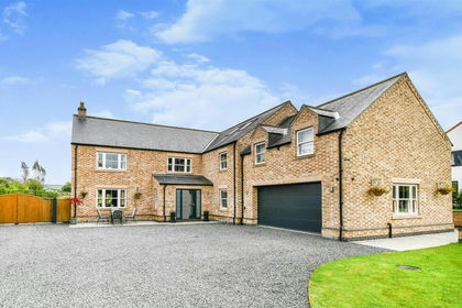
- Price
- £1,225,000
- Size
- 3 acres
The Old Manor, Leppington, Scrayingham, North Yorkshire YO17 England
Added on 29/01/2026House with Land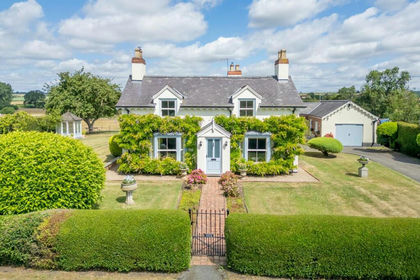
- Price
- £900,000
- Size
- 2 acres
Village Farm, Foston, York, Foston, North Yorkshire YO60 England
Added on 20/02/2026House with Land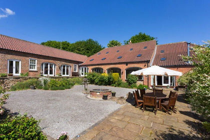
- Price
- £1,395,000
- Size
- 1.24 acres
Added on 08/08/2026Barn Conversion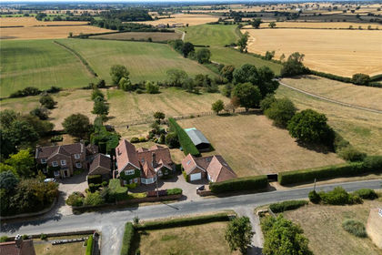
- Price
- Guide Price£1,000,000
- Size
- 2.75 acres
Main Street, Whenby, York, YO61, Whenby, North Yorkshire YO61 England
Added on 18/08/2026House with Land
- Price
- Offers in Excess of£1,250,000
- Size
- 2.17 acres
Bonny View, Marton In The Forest, Stillington, York, Marton-cum-Moxby, North Yorkshire YO61 England
Added on 06/08/2026House with Land
- Price
- Offers Over£1,350,000
- Size
- 5 acres
Added on 20/05/2026House with Land
- Price
- Guide Price£1,295,000
- Size
- 3 acres
Normanby, Sinnington, York, Normanby, North Yorkshire YO62 England
Added on 27/06/2026Barn Conversion
- Price
- Offers in Excess of£1,200,000
- Size
- 4 acres
High Gables, Normanby, York, Normanby, North Yorkshire YO62 England
Added on 04/04/2026House with Land
- Price
- £1,100,000
- Size
- 1.5 acres
Added on 03/05/2026House with Land
- Price
- £895,000
- Size
- 1 acres
Added on 03/06/2026House with Land