Byers Garth, Sherburn House, Durham, DH1
- Bedrooms
- 3
- Bathrooms
- 2
Key Features
- Beautifully presented three-bedroom stone-built barn conversion
- Character features including exposed stonework, timber beams and high ceilings
- Spacious dual-aspect open-plan lounge/dining room with French doors to the garden
- Fitted kitchen with integrated appliances, slate flooring and utility cupboard
- Principal bedroom with walk-in wardrobe and en suite shower room
- Generous rear garden with open views, patios, wildlife pond, greenhouse and driveway parking with EV charging point
Description
A beautifully presented and thoughtfully improved three-bedroom stone-built barn conversion, offering characterful accommodation with gas-fired central heating and double glazing throughout.
Enjoying a pleasant position with open views to the rear, the property retains a wealth of charming period features, including internal exposed stonework and timber beams. The accommodation includes an impressive entrance hallway with a high ceiling and exposed beams, leading into a delightful dual-aspect open-plan lounge and dining room. French doors open directly onto the rear garden, while a remote-control feature gas range stove creates an inviting focal point. The kitchen is fitted with a range of floor and wall units, incorporating a one-and-a-half bowl stainless steel sink and drainer, gas hob with extractor fan, separate electric oven, dishwasher, integrated fridge freezer and attractive stone flooring. A useful utility cupboard provides plumbing and space for a washer/dryer.
There are three bedrooms, with the principal bedroom benefitting from a walk-in wardrobe and en suite shower room. The en suite is fitted with a low-level WC, pedestal wash hand basin and shower cubicle with mains-fed wall-mounted shower, complemented by an extractor fan, radiator, shaver point, tiled flooring and underfloor heating. The family bathroom continues the cottage-style charm, featuring a refitted suite with high-level WC and pull chain, wash hand basin and a striking roll-top bath with cast iron feet.
Externally, the rear garden is a true gardener’s paradise, offering generous outdoor space with several lawned areas, pathways weaving through established flowering borders, and patio areas ideal for seating and entertaining. The garden also features a wildlife pond, productive vegetable area and greenhouse. To the front, a gravelled driveway provides off-street parking and includes a home EV charging point.
It is adjacent to the A(181) Highway which provides easy access to Durham City which is less than 10 minutes drive. It is also well placed for access to the A(19), A(690) and A1(M) Motorway making it well placed for commuting purposes.
MATERIAL INFORMATION:
In compliance with the Consumer Protection from Unfair Trading Regulations 2008 and National Trading Standards Estate and Letting Agency Team’s Material information in property listings Guidance
PART A
Local Authority – Durham County Council
Council Tax Band – E
Tenure – Freehold
PART B
Property Type – Terraced
Property Construction – Standard
Number & Types of Rooms – Please refer to the details and floorplan, all measurements taken being the maximum dimensions available between internal walls
Gas Supply- Mains
Electricity supply – Mains
Water Supply – Mains (metered)
Sewerage – communal septic tank. Cost is usually around £380 paid to Byers Garth Management Company Limited which is run by the property owners
Heating – Gas fired central heating via radiators- combi boiler fitted in December 2024
Estimated Mobile phone coverage – Please refer to the Ofcom Website -
Estimated Broadband Download speeds – please refer to the Ofcom Website –
Parking- driveway
PART C
Building Safety – (The Vendor is not aware of any Building Safety issues. However, we would recommend that the purchaser engages the services of a chartered surveyor to confirm)
Restrictions – Covenants which affect the property are contained within the Land Registry Title Register which is available for inspection.
Selective licencing area – no
Article 4 Planning Restricted area – the property is subject to Article 4 Direction
Rights & Easements- Owners have right of access across land to access the rear of the property. Right of access to the shared driveway from Mill Lane.
Flood risk – Rivers and seas: very low Surface water: very low
Coastal Erosion – N/A
Protected Trees - NA
Planning Permission – There are no current planning applications in the locality that we are aware of. Or planning details that are known
Accessibility/Adaptations – The property has not been altered for accessibility
Mining Area – Coal Mining Reporting Area, further searches may be required.
The bedroom curtains, hallway mirror, bathroom mirror, dishwasher, washing machine and garden benches will be taken.
The Greenhouse will remain
No other Material Information disclosures have been made by the vendor. This information has been compiled in good faith using resources readily available online and by enquiry of the vendor prior to marketing. However, such information could change after compilation of the data, so J W Wood cannot be held liable for any changes post compilation or any accidental errors or omissions.
Furthermore, J W Wood are not legally qualified and conveyancing documents are often complicated, necessitating judgement on our part about which parts are “Material Information” to be disclosed. If any information provided, or other matter relating to the property, is of particular importance to you, please do seek verification from a legal advisor before committing to expenditure.
HMRC supervises the legal obligation for all estate agents to conduct identity checks on their customers, this includes buyers when their offer is accepted. This must be completed, per purchaser, who in the transaction will result in being the legal owner(s) of the property. There is a £35 (inc VAT) administration fee per individual purchaser, for these checks.
Map Location
Property details
- Tenure
- Freehold
- Council Tax Band
- E
- Date Posted
- 2026-07-23
Energy Performance Certificate
Energy Efficiency Rating
Based on UK Energy Performance Certificate standards (EU Directive 2002/91/EC)
Running costs are one side. Planning activity, flood history and ground risks for this location are in the full report.
Utilities & Restrictions
Utilities
- Electricity
- Ask Agent
- Water
- Ask Agent
- Heating
- Ask Agent
- Broadband
- Ask Agent
- Sewerage
- Ask Agent
Rights & Restrictions
- Public Rights of Way
- Ask Agent
- Private Rights of Way
- Ask Agent
- Listed Property
- Ask Agent
- Restrictions
- Ask Agent
Listed status, conservation areas and planning constraints for this location are in the full report.
Property Features
- Accessibility
- Ask Agent
- Parking
- Parking Available
- Garden
- Garden
Beyond the particulars: planning activity, flood history, heritage and ground risks, checked for this exact spot.
Connectivity
Broadband
Fastest speed available at this postcode
1.8 Gbps
Gigabit full fibre · available to 94% of premises
Suitable for
- 4K streaming on every screen
- Full-time home working
- Online gaming & big downloads
Mobile signal
Outdoor predictions; indoor signal depends on building materials.
Ofcom Connected Nations postcode-level predictions. Speeds and signal are modelled, not measured, and vary between addresses and providers.
Signal is the easy part. Planning activity, flood history and protected designations here are in the full report.
Nearest Schools
Primary
- Sherburn Primary School1 mileNo Ofsted rating
- Ages
- 3 to 11
- Pupils
- 176
- Type
- Community school
- Shincliffe CofE (Controlled) Primary School1.4 milesOfsted report card · May 2026
- Ages
- 4 to 11
- Pupils
- 195
- Type
- Voluntary controlled school
- Faith
- Church of England
- St Thomas More Primary School, Belmont1.6 milesOfsted: Good
- Ages
- 3 to 11
- Pupils
- 107
- Type
- Academy converter
- Faith
- Roman Catholic
- Belmont CofE (Controlled) Primary School1.7 milesOfsted report card · Jan 2026
- Ages
- 2 to 11
- Pupils
- 261
- Type
- Voluntary controlled school
- Faith
- Church of England
- Belmont Cheveley Park Primary School1.8 milesOfsted: Good
- Ages
- 3 to 11
- Pupils
- 206
- Type
- Community school
Secondary
- Belmont Community School1.7 milesNo Ofsted rating
- Ages
- 11 to 16
- Pupils
- 887
- Type
- Community school
- St Leonard's Catholic School, Durham3.5 milesOfsted: Outstanding *
- Ages
- 11 to 18
- Pupils
- 1,293
- Type
- Academy converter
- Faith
- Roman Catholic
- Durham Johnston Comprehensive School3.7 milesOfsted: Good *
- Ages
- 11 to 18
- Pupils
- 1,667
- Type
- Community school
- Framwellgate School Durham3.9 milesOfsted: Requires improvement *
- Ages
- 11 to 18
- Pupils
- 1,204
- Type
- Academy converter
- Hetton Academy4.3 milesOfsted: Good *
- Ages
- 11 to 16
- Pupils
- 681
- Type
- Academy converter
* Latest graded judgement covers quality of education only; no overall grade was issued under the 2024-25 inspection framework.
Distances are straight-line from the advertised location. Source: the national school registers (DfE, Welsh Government, Scottish Government) and Ofsted.
Schools are just the start: sold prices nearby, planning activity and any flood history are in the full report.
Amenities
Supermarket
GP surgery
Pharmacy
Hospital
Straight-line distances from the advertised location. Sources: NHS records, Geolytix supermarket locations, OS Open Greenspace and the national trails registers.
The area stacks up? Now check the location itself: planning nearby, protected designations and past flooding.
Getting Around
Nearest station
Nearest bus stop
Typical drive times
Straight-line distances from the advertised location; drive times are typical free-flow times over OpenStreetMap road data, so allow more at peak. Public transport locations from DfT NaPTAN.
Easy to reach matters. So do planning activity, flood history and ground risks: all in the full report.
Flood Risk
From Environment Agency flood map open data, checked around the advertised map pin and allowing for the listed acreage where known. This summary comes from LandSale, the advertising platform, not from the listing agent, and is not part of the agent's particulars. Risk can vary across a single holding, so verify anything critical through your own searches before committing.
Rivers and the sea
Surface water
The detail behind these bandings
The full report pinpoints where this location sits on the flood maps, and runs the deeper checks that usually only surface after an offer.
- Exact flood zones & annual chances (included in the full report)
- Any recorded past flooding (included in the full report)
- Planning activity nearby (included in the full report)
- Heritage & conservation (included in the full report)
- Protected nature designations (included in the full report)
- Ground risks (included in the full report)
- Sold prices nearby (included in the full report)
£14.99 · one-off purchase
By LandSale, the platform. Not provided by the listing agent. Ready in about a minute.
Important notice: Information, maps and tags on this page are drawn from the advertising agent's marketing materials or generated automatically. LandSale has not verified them. Relying on these details is at your own risk, always carry out independent checks before committing to a purchase.
LandSale full disclaimer
Marketing information only - not formal particulars. The details on this website are provided for general guidance and do not constitute an offer or contract. Neither LandSale nor the advertising estate/land agent accepts responsibility for any inaccuracy.
1. Source of information
- Listing content: Core description, asking price, tenure, measurements, photographs and planning history originate from the marketing materials of the advertising estate or land agent. LandSale does not author this content and cannot guarantee its accuracy.
- Automated tags & categorisation: Property type, land-use class, acreage bands and similar labels may be applied by machine-learning models. They are intended as a helpful guide only and may not reflect the property's legal status or permitted use.
- Third-party & enriched data layers: Maps, boundary outlines, planning designations, soil reports, broadband coverage and other environmental or location-based insights are licensed from external suppliers. Such data are supplied “as is", may be incomplete or out of date and are subject to change without notice.
2. Verification required
Prospective purchasers must verify critical matters, including but not limited to planning permission, title boundaries, public rights of way, environmental constraints, acreage, services, access and VAT status, through their own inspections, specialist surveys, legal advisers and the selling agent before relying on the information or entering into any contract.
3. No warranty or liability
LandSale gives no warranty, express or implied, as to the accuracy, completeness or fitness for any particular purpose of the information displayed. LandSale shall not be liable for any loss, damage, cost or expense arising directly or indirectly from any use of or reliance on such information, save where liability may not be excluded by law.
4. Updates & feedback
If you believe any detail on this listing is inaccurate, please let us know. We will investigate and, where appropriate, update the listing or notify the agent.
© LandSale | Version 1.3 - August 2026
Similar properties for sale
- Price
- £425,000
- Size
- 1.1 acres
Added on 28/01/2026Development Land
- Price
- Offers in Region of£450,000
Sacriston Lane, Witton Gilbert, Durham, DH7, Witton Gilbert, County Durham DH7 England
Added on 12/05/2026Barn Conversion
- Price
- Offers Over£350,000
Picktree Barn, Picktree, Washington, North Lodge, County Durham NE38 England
Added on 25/08/2026Barn Conversion
- Price
- Guide Price£365,000
- Size
- 5.2 acres
Gray Terrace, Stanley, County Durham, DH9, Stanley, County Durham DH9 England
Added on 29/01/2026Self Build Plot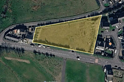
- Price
- Offers in Excess of£350,000
- Size
- 1.21 acres
Added on 29/08/2026Building Plot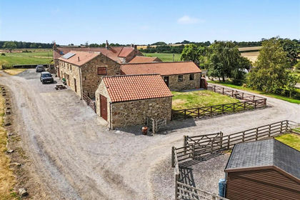
- Price
- Offers Over£400,000
Evenwood Gate, Bishop Auckland, Evenwood and Barony, County Durham DL14 England
Added on 24/07/2026Barn Conversion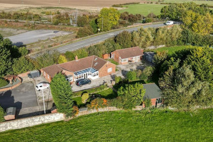
- Price
- £465,000
- Size
- 1 acres
Burtree Lane, Darlington, DL3, Whessoe, Darlington DL3 England
Added on 08/06/2026House with Land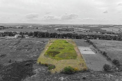
- Price
- Offers Over£400,000
- Size
- 3 acres
Grange Barn East, Grange Farm, Medomsley, Consett, Blaydon and Consett, County Durham DH8 England
Added on 29/01/2026Barn Conversion
- Price
- Offers in Region of£450,000
Added on 31/03/2026Building Plot
- Price
- Guide Price£425,000
Town End House, 2 Stobb Hill, Gainford, County Durham, Gainford, County Durham DL2 England
Added on 04/09/2026Barn Conversion