Frith Common, Eardiston, WR15
- Land size
- 0.86 acres
- Bedrooms
- 4
- Bathrooms
- 2
Key Features
- Large sitting room with a wood-burning stove and private courtyard access.
- 0.857-acre plot with a paddock, decking, and breathtaking countryside views.
- Open-plan kitchen/dining room with exposed beams, a central island, and premium appliances.
- Enclosed courtyard with a hot tub and decking, plus a landscaped lawn.
- Grade II listed barn conversion with exceptional character and spacious family living.
- Four double bedrooms, including a luxurious master suite with fitted wardrobes.
- Stylish bathrooms, featuring a walk-in rainfall shower and a freestanding roll-top bath.
- Detached garage (used as a gym) and allocated parking for two vehicles.
Description
As you approach, the gravelled driveway and well-kept communal courtyard create a wonderful sense of arrival, with private parking for two vehicles and a detached garage (currently used as a gym).
Stepping inside, you are greeted by a spacious reception hall, where the flagstone flooring, curved exposed brick wall, and ceiling spotlights immediately set the tone for the character and quality found throughout the home. Just off the hall, a contemporary cloakroom with a sleek finish offers convenience for guests.
Moving through to the large sitting room, you’ll find a wonderfully inviting space, complete with a full-height brick fireplace housing a wood-burning stove—the perfect spot for cosy evenings. Natural light floods in through large windows, offering stunning countryside views, while a door leads directly to the enclosed courtyard garden, seamlessly blending indoor and outdoor living.
The heart of the home is undoubtedly the magnificent open-plan kitchen and dining area. This striking space combines rustic charm with modern elegance, featuring exposed timber beams, natural stone flooring, and a large central island with a wine cooler. The bespoke fitted cabinetry and Silestone worktops provide plenty of storage, while the electric range cooker, set within a charming brick inglenook, and a fitted AEG American-style fridge freezer make it a dream kitchen for cooking and entertaining. A stable door leads outside, adding to the farmhouse feel.
Just off the kitchen, a practical utility room provides additional cabinetry, a laundry area, and houses the oil-fired central heating boiler.
A characterful staircase leads to the first-floor landing, where a dedicated desk area creates the perfect work-from-home space.
The master bedroom is a true sanctuary—incredibly spacious, with a range of fitted Hammond wardrobes, a central island unit, and dual-aspect windows offering spectacular views. The ensuite shower room is finished to an exceptional standard, featuring a large walk-in rainfall shower, slate tiling, and a floating vanity unit for a sleek, contemporary feel.
Three further generously sized double bedrooms all feature Hammond fitted wardrobes, and two showcase exposed timber beams that add to the home’s rustic charm. A stylish family bathroom completes the upper level, featuring a freestanding roll-top bath—perfect for soaking in after a long day.
The enclosed courtyard garden is an ideal private retreat, complete with composite decking and a perfectly positioned hot tub—a fantastic space to unwind and entertain.
To the front of the property, a lawned garden with mature planting and a stone patio offers a peaceful spot to enjoy the views.
On the opposite side of the driveway, a good-sized paddock enclosed by post and rail fencing provides fantastic versatility, with a gravel hardstanding and a raised timber decked area, perfect for summer dining or simply admiring the beautiful countryside that surrounds Goose Barn.
Agents Note:
There is a shared sewage treatment plant, which all properties in the development contribute to. It is currently £420 per annum, and covers the maintenance & insurances for sewage treatment, court yard lighting & pump station for water supply.
Disclaimer
Buyer and Seller Protection Available
Buyers Compliance Administration Fee: In accordance with The
Money Laundering Regulations 2007, Agents are required to carry
out due diligence on all Clients to confirm their identity, including
eventual buyers of a property. The Agents use electronic verification
system to verify Clients’ identity. This is not a credit check so will
have no effect on credit history though may check details you supply
against any particulars on any database to which they have access.
By placing an offer on a property you agree that if your offer is
accepted, subject to contract, we as Agents for the seller can
complete this check for a fee of £75 inc VAT (£62.50 + VAT) per
property transaction, non-refundable under any circumstance. A
record of the search will be retained by the Agents. This is only applicable to properties sold via private treaty, please call us if you have any questions.
Map Location
Property details
- Tenure
- Freehold
- Council Tax Band
- F
- Date Posted
- 2026-07-22
Utilities & Restrictions
Utilities
- Electricity
- Mains
- Water
- Mains
- Heating
- Oil Heating
- Broadband
- Standard Copper (ADSL)
- Sewerage
- Septic Tank / Private
Rights & Restrictions
- Public Rights of Way
- Ask Agent
- Private Rights of Way
- Ask Agent
- Listed Property
- Ask Agent
- Restrictions
- Ask Agent
Listed status, conservation areas and planning constraints for this location are in the full report.
Property Features
- Accessibility
- Ask Agent
- Parking
- Parking Available
- Garden
- Garden
Beyond the particulars: planning activity, flood history, heritage and ground risks, checked for this exact spot.
Connectivity
Broadband
Fastest speed available at this postcode
11 Mbps
Standard (10-30 Mbps)
Suitable for
- Web & social
- Music streaming
- Standard video calls
Fixed wireless access may also be an option here.
Mobile signal
Outdoor predictions; indoor signal depends on building materials.
Ofcom Connected Nations postcode-level predictions. Speeds and signal are modelled, not measured, and vary between addresses and providers.
Signal is the easy part. Planning activity, flood history and protected designations here are in the full report.
Nearest Schools
Primary
- Lindridge St Lawrence CE Primary School1.6 milesOfsted: Good
- Ages
- 2 to 11
- Pupils
- 70
- Type
- Voluntary aided school
- Faith
- Church of England
- Bayton CofE Primary School1.9 milesOfsted: Good *
- Ages
- 3 to 11
- Pupils
- 95
- Type
- Voluntary controlled school
- Faith
- Church of England
- Abberley Parochial VC Primary School3.3 milesOfsted: Good *
- Ages
- 4 to 11
- Pupils
- 102
- Type
- Voluntary controlled school
- Faith
- Church of England
- Far Forest Lea Memorial CofE Primary School3.4 milesOfsted: Good *
- Ages
- 2 to 11
- Pupils
- 86
- Type
- Academy converter
- Faith
- Church of England
- Cleobury Mortimer Primary School4 milesOfsted: Good
- Ages
- 2 to 11
- Pupils
- 240
- Type
- Academy converter
Secondary
- The Lacon Childe School4 milesOfsted: Requires improvement
- Ages
- 11 to 16
- Pupils
- 563
- Type
- Academy converter
- The Bewdley School6.6 milesOfsted: Good *
- Ages
- 11 to 18
- Pupils
- 970
- Type
- Foundation school
- Tenbury High Ormiston Academy6.7 milesOfsted: Good
- Ages
- 11 to 16
- Pupils
- 453
- Type
- Academy sponsor led
- The Chantry School7.2 milesOfsted: Good
- Ages
- 11 to 16
- Pupils
- 881
- Type
- Academy converter
- The Stourport High School and Sixth Form College7.3 milesOfsted: Good
- Ages
- 11 to 18
- Pupils
- 1,039
- Type
- Academy converter
* Latest graded judgement covers quality of education only; no overall grade was issued under the 2024-25 inspection framework.
Distances are straight-line from the advertised location. Source: the national school registers (DfE, Welsh Government, Scottish Government) and Ofsted.
Schools are just the start: sold prices nearby, planning activity and any flood history are in the full report.
Amenities
Supermarket
GP surgery
Pharmacy
Hospital
Straight-line distances from the advertised location. Sources: NHS records, Geolytix supermarket locations, OS Open Greenspace and the national trails registers.
The area stacks up? Now check the location itself: planning nearby, protected designations and past flooding.
Getting Around
Nearest station
Nearest bus stop
Typical drive times
Straight-line distances from the advertised location; drive times are typical free-flow times over OpenStreetMap road data, so allow more at peak. Public transport locations from DfT NaPTAN.
Easy to reach matters. So do planning activity, flood history and ground risks: all in the full report.
Flood Risk
From Environment Agency flood map open data, checked around the advertised map pin and allowing for the listed acreage where known. This summary comes from LandSale, the advertising platform, not from the listing agent, and is not part of the agent's particulars. Risk can vary across a single holding, so verify anything critical through your own searches before committing.
Rivers and the sea
Surface water
These bandings are the summary. Where this location sits on the flood maps, plus planning activity, heritage and ground risks, is in the full report.
Important notice: Information, maps and tags on this page are drawn from the advertising agent's marketing materials or generated automatically. LandSale has not verified them. Relying on these details is at your own risk, always carry out independent checks before committing to a purchase.
LandSale full disclaimer
Marketing information only - not formal particulars. The details on this website are provided for general guidance and do not constitute an offer or contract. Neither LandSale nor the advertising estate/land agent accepts responsibility for any inaccuracy.
1. Source of information
- Listing content: Core description, asking price, tenure, measurements, photographs and planning history originate from the marketing materials of the advertising estate or land agent. LandSale does not author this content and cannot guarantee its accuracy.
- Automated tags & categorisation: Property type, land-use class, acreage bands and similar labels may be applied by machine-learning models. They are intended as a helpful guide only and may not reflect the property's legal status or permitted use.
- Third-party & enriched data layers: Maps, boundary outlines, planning designations, soil reports, broadband coverage and other environmental or location-based insights are licensed from external suppliers. Such data are supplied “as is", may be incomplete or out of date and are subject to change without notice.
2. Verification required
Prospective purchasers must verify critical matters, including but not limited to planning permission, title boundaries, public rights of way, environmental constraints, acreage, services, access and VAT status, through their own inspections, specialist surveys, legal advisers and the selling agent before relying on the information or entering into any contract.
3. No warranty or liability
LandSale gives no warranty, express or implied, as to the accuracy, completeness or fitness for any particular purpose of the information displayed. LandSale shall not be liable for any loss, damage, cost or expense arising directly or indirectly from any use of or reliance on such information, save where liability may not be excluded by law.
4. Updates & feedback
If you believe any detail on this listing is inaccurate, please let us know. We will investigate and, where appropriate, update the listing or notify the agent.
© LandSale | Version 1.3 - August 2026
Similar properties for sale
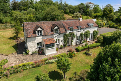
- Price
- Guide Price£745,000
- Size
- 1.4 acres
Added on 10/07/2026Cottage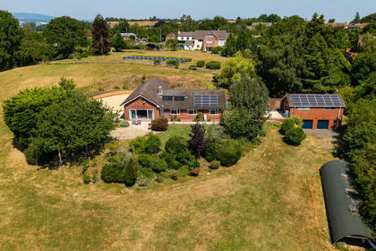
- Price
- Offers in Excess of£700,000
- Size
- 4 acres
Mamble Road, Clows Top, Kidderminster, Mamble, Worcestershire DY14 England
Added on 22/07/2026House with Land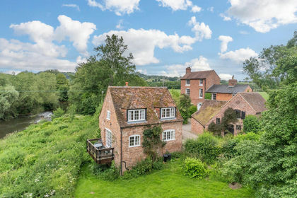
- Price
- Guide Price£700,000
- Size
- 1.77 acres
Eardiston, Tenbury Wells, Worcestershire, WR15, Stanford with Orleton, Worcestershire WR6 England
Added on 08/07/2026Country Home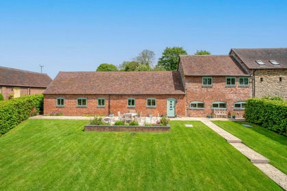
- Price
- Offers Over£500,000
Clows Top, Kidderminster, DY14, Bayton, Worcestershire DY14 England
Added on 21/05/2026Barn Conversion
- Price
- Offers in Excess of£600,000
- Size
- 1 acres
Holly Well Lane, Clows Top, Kidderminster, Bayton, Worcestershire DY14 England
Added on 21/07/2026House with Land
- Price
- Offers in Excess of£750,000
- Size
- 1 acres
Neen Sollars, Kidderminster, Neen Sollars, Shropshire DY14 England
Added on 21/07/2026Residential
- Price
- Offers in Excess of£700,000
- Size
- 3 acres
Eastham, Tenbury Wells, Eastham, Worcestershire WR15 England
Added on 18/09/2026House with Land
- Price
- £700,000
- Size
- 1 acres
#WelcomeHome to: Southacre, Callow Hill, Rock, DY14, Rock, Worcestershire DY14 England
Added on 12/06/2026House with Land
- Price
- Guide Price£650,000
Added on 15/09/2026Barn Conversion
- Price
- Guide Price£695,000
- Size
- 1.3 acres
Callow Hill, Kidderminster, Rock, Worcestershire DY14 England
Added on 24/08/2026House with Land