Baldock Road, Royston, SG8
- Land size
- 3.25 acres
- Bedrooms
- 3
- Bathrooms
- 2
Key Features
- Detached Period Cottage On Approximately 3.25 Acres
- No Onward Chain
- Three Bedrooms & Detached Self-Contained One-Bedroom Annexe
- Private Gated Driveway With Open Field Views
- Newly Installed Solar Panels
- Private Well Water Supply
- Timber Stable Block & Former Ménage
- Hot Tub & Private Decking To The Annexe
- Potential To Extend Or Remodel (STPP)
- Outskirts Of Royston, Close To Ashwell & Morden Station
Description
Property Insight
Set within approximately 3.25 acres of Hertfordshire countryside on the outskirts of Royston, Jockey Cottage is a detached period home in a secluded, private setting, approached via a gated driveway and enjoying far-reaching views across open fields. The cottage offers approximately 1,312 sq ft of characterful accommodation with three bedrooms, and is accompanied by a beautifully finished detached one-bedroom annexe, a timber stable block and a former ménage within the grounds. Offered with no onward chain, and with excellent potential to extend or remodel (STPP), this is a genuinely individual home for those seeking rural space and flexibility close to the town.
Approached through a private gated entrance, the driveway opens onto a generous gravelled frontage screened by mature trees, giving the home a real sense of seclusion and privacy. The cottage itself carries all the character of its period, with painted rendered elevations, a tiled roof and twin chimneys. There is scope here for new owners to update and put their own stamp on the main house, or to extend and reconfigure subject to the usual permissions (STPP).
The Lounge/Dining Room is a wonderfully generous open space and the heart of the cottage, full of period charm with exposed timber framing, a feature brick fireplace, wood-effect flooring and ample room for both lounge and dining furniture. An arched opening leads through to a rear utility room, which enjoys French doors and a skylight opening onto the garden — an ideal spot for kicking off muddy boots after a walk in the grounds.
The kitchen is fitted with solid oak wall and base units, granite worktops, a tiled splashback, an electric oven and hob, and space for further appliances — a warm, characterful space with the option to modernise over time. The ground floor also offers a well-proportioned third bedroom, currently used as a reception room and home office and easily flexible to suit however you need to live, along with a ground-floor bathroom comprising a shower cubicle, hand wash basin and storage, and a separate WC.
Upstairs, the cottage offers two further well-proportioned bedrooms, both full of character with sloping ceilings, exposed timber detailing and traditional plank doors, and both enjoying a lovely outlook over the surrounding greenery.
A standout feature of the property is the detached self-contained annexe — a contemporary, well-insulated building finished to a high standard, with a striking dark weatherboard exterior and its own solar panels. Inside it offers a lounge, a kitchen, a double bedroom and a modern bathroom, with French doors opening onto a private decking area with hot tub and views across the grounds. It lends itself well to multi-generational living, guest accommodation, or a potential income opportunity such as a small-scale holiday let (subject to the relevant permissions).
Outside, the mature grounds extend to approximately 3.25 acres, with a mix of formal gardens, open lawns and woodland — a peaceful backdrop for outdoor living, entertaining and recreation. A timber stable block provides excellent storage or potential equestrian use, and the former ménage could be reinstated or repurposed, offering further scope for outdoor enthusiasts or those seeking a smallholding lifestyle. The home also benefits from newly installed solar panels, generating the majority of its electricity, and a private well providing an environmentally friendly, cost-efficient water supply.
Contact the team today to arrange your private viewing appointment.
ONLINE VIEWING & 3D VIRTUAL REALITY 360° TOUR
Explore this property in full 360° reality. 3D virtual reality marketing now comes as part of our standard marketing, don't hesitate to call us if we can help you.
Anti-Money Laundering (AML) Checks:
In line with the Money Laundering Regulations 2017, we are legally required to carry out identity and AML checks on all buyers. A fee of £25 (inc. VAT) per buyer is payable once an offer has been formally accepted. This fee is mandatory and forms part of our regulatory compliance obligations.
LOCATION - THERFIELD
We encourage you to visit Therfield to see if it's the location of your forever home. It's a small, peaceful village, and certainly one not to miss!
Further amenities can be accessed a stone's throw away in the town of Royston, such as a leisure centre and a variety of sports clubs, including the golf club on Royston Heath. There are a variety of excellent schools to choose from, doctors and dentist surgeries, shops and supermarkets, all surrounded by beautiful countryside and many other pretty villages to explore. The A1M and M11 are within a 20-minute drive via the A10/A505, and London Stansted and Luton Airports are both 30-minutes away.
The Church of St. Mary has existed since the 13th Century and holds regular services and events, and the Fox and Duck public house offers fine food, the warmest of welcomes, and a wonderful countryside atmosphere. There is also a primary school, pre-school, and a cricket club with a large open green.
The village has a lot to offer residents who are looking to relax and escape into the countryside, while also being a very short distance to the nearest town and railways offering fast services directly into Cambridge or London.
Therfield is a small and peaceful north Hertfordshire village, situated upon the chalk range, 3 miles southwest of the town of Royston, and 6 miles northeast of the town of Baldock. The village is locally famous for its beautiful church, chapel and country pub, with the nature reserve of Therfield Heath lying a mile to the north of the village. From here, on a clear day, it's possible to see over 20 miles into the horizon, all the way over to Ely Cathedral.
EPC Rating: E
Map Location
Property details
- Tenure
- Freehold
- Council Tax Band
- F
- Date Posted
- 2026-07-22
Price history
| Date | Change | Price |
|---|---|---|
| 14 Sep 2026 | Reduced 2.2% (−£19,950) | £880,000 |
| Until 14 Sep 2026 | Asking price | £899,950 |
Market Value Analysis
Compared with 1,137 Homes with Land listings in East Anglia (1+ acres).
Energy Performance Certificate
Energy Efficiency Rating
Based on UK Energy Performance Certificate standards (EU Directive 2002/91/EC)
Running costs are one side. Planning activity, flood history and ground risks for this location are in the full report.
Utilities & Restrictions
Utilities
- Electricity
- Ask Agent
- Water
- Ask Agent
- Heating
- Oil Heating
- Broadband
- Ask Agent
- Sewerage
- Ask Agent
Rights & Restrictions
- Public Rights of Way
- Ask Agent
- Private Rights of Way
- Ask Agent
- Listed Property
- Ask Agent
- Restrictions
- Ask Agent
Listed status, conservation areas and planning constraints for this location are in the full report.
Property Features
- Accessibility
- Ask Agent
- Parking
- Parking Available
- Garden
- Garden
Beyond the particulars: planning activity, flood history, heritage and ground risks, checked for this exact spot.
Connectivity
Broadband
Fastest speed available at this postcode
31 Mbps
Superfast · available to 50% of premises
Suitable for
- HD streaming
- Video calls
- Web & social
Mobile signal
Predicted 4G and 5G signal; indoor signal depends on building materials.
Ofcom Connected Nations postcode-level predictions. Speeds and signal are modelled, not measured, and vary between addresses and providers.
Signal is the easy part. Planning activity, flood history and protected designations here are in the full report.
Nearest Schools
Primary
- Therfield First School1.7 milesOfsted: Good
- Ages
- 4 to 9
- Pupils
- 69
- Type
- Community school
- Tannery Drift School2.6 milesOfsted: Good *
- Ages
- 3 to 9
- Pupils
- 320
- Type
- Community school
- Steeple Morden CofE VC Primary School2.8 milesOfsted report card · Apr 2026
- Ages
- 4 to 11
- Pupils
- 141
- Type
- Voluntary controlled school
- Faith
- Church of England
- St Mary Roman Catholic Primary School2.9 milesOfsted: Good *
- Ages
- 3 to 11
- Pupils
- 227
- Type
- Academy converter
- Faith
- Roman Catholic
- Bassingbourn Primary School3 milesOfsted: Requires improvement *
- Ages
- 5 to 11
- Pupils
- 326
- Type
- Community school
Secondary
- Bassingbourn Village College3 milesNo Ofsted rating
- Ages
- 11 to 16
- Pupils
- 652
- Type
- Academy converter
- King James Academy Royston3.4 milesOfsted: Good
- Ages
- 9 to 18
- Pupils
- 947
- Type
- Academy converter
- The Knights Templar School5.6 milesNo Ofsted rating
- Ages
- 11 to 18
- Pupils
- 1,375
- Type
- Academy converter
- Melbourn Village College5.7 milesOfsted: Requires improvement *
- Ages
- 11 to 16
- Pupils
- 559
- Type
- Academy converter
- Freman College6.2 milesNo Ofsted rating
- Ages
- 13 to 18
- Pupils
- 1,049
- Type
- Academy converter
* Latest graded judgement covers quality of education only; no overall grade was issued under the 2024-25 inspection framework.
Distances are straight-line from the advertised location. Source: the national school registers (DfE, Welsh Government, Scottish Government) and Ofsted.
Schools are just the start: sold prices nearby, planning activity and any flood history are in the full report.
Amenities
Supermarket
GP surgery
Pharmacy
Hospital
Straight-line distances from the advertised location. Sources: NHS records, Geolytix supermarket locations, OS Open Greenspace and the national trails registers.
The area stacks up? Now check the location itself: planning nearby, protected designations and past flooding.
Getting Around
Nearest station
Nearest bus stop
Typical drive times
Straight-line distances from the advertised location; drive times are typical free-flow times over OpenStreetMap road data, so allow more at peak. Public transport locations from DfT NaPTAN.
Easy to reach matters. So do planning activity, flood history and ground risks: all in the full report.
Flood Risk
Environment Agency open data, checked around the advertised map pin for the listed acreage. Long-term risk counts flood defences; the planning map's flood zones do not. Provided by LandSale, not the listing agent, and not part of the agent's particulars. Risk varies across a holding, so verify before committing.
Rivers and the sea
Planning map: Flood Zone 1.
Surface water
Not at the pin: mapped about 50 metres away.
These bandings are the summary. Where this location sits on the flood maps, plus planning activity, heritage and ground risks, is in the full report.
Important notice: Information, maps and tags on this page are drawn from the advertising agent's marketing materials or generated automatically. LandSale has not verified them. Relying on these details is at your own risk, always carry out independent checks before committing to a purchase.
LandSale full disclaimer
Marketing information only - not formal particulars. The details on this website are provided for general guidance and do not constitute an offer or contract. Neither LandSale nor the advertising estate/land agent accepts responsibility for any inaccuracy.
1. Source of information
- Listing content: Core description, asking price, tenure, measurements, photographs and planning history originate from the marketing materials of the advertising estate or land agent. LandSale does not author this content and cannot guarantee its accuracy.
- Automated tags & categorisation: Property type, land-use class, acreage bands and similar labels may be applied by machine-learning models. They are intended as a helpful guide only and may not reflect the property's legal status or permitted use.
- Third-party & enriched data layers: Maps, boundary outlines, planning designations, soil reports, broadband coverage and other environmental or location-based insights are licensed from external suppliers. Such data are supplied “as is", may be incomplete or out of date and are subject to change without notice.
2. Verification required
Prospective purchasers must verify critical matters, including but not limited to planning permission, title boundaries, public rights of way, environmental constraints, acreage, services, access and VAT status, through their own inspections, specialist surveys, legal advisers and the selling agent before relying on the information or entering into any contract.
3. No warranty or liability
LandSale gives no warranty, express or implied, as to the accuracy, completeness or fitness for any particular purpose of the information displayed. LandSale shall not be liable for any loss, damage, cost or expense arising directly or indirectly from any use of or reliance on such information, save where liability may not be excluded by law.
4. Updates & feedback
If you believe any detail on this listing is inaccurate, please let us know. We will investigate and, where appropriate, update the listing or notify the agent.
© LandSale | Version 1.3 - August 2026
Similar properties for sale
- Price
- Guide Price£725,000
- Size
- 27.74 acres
Mettle Hill Farm, Kneesworth Road, Meldreth, Royston, SG8, Royston, Cambridgeshire SG8 England
Added on 15/10/2026Small Farm
- Price
- Guide Price£975,000
- Size
- 4 acres
Langley Lower Green, Nr Saffron Walden, Essex, CB11, Langley, Essex CB11 England
Added on 03/10/2026House with Land
- Price
- £1,100,000
- Size
- 1.6 acres
Water Lane, Renhold, Bedfordshire, MK41, Renhold, Bedford MK41 England
Added on 10/09/2026Farmhouse
- Price
- Offers in Excess of£1,000,000
- Size
- 3 acres
Cotton End Road, Wilstead, MK45, Wilshamstead, Bedford MK45 England
Added on 03/06/2026House with Land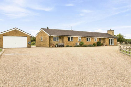
- Price
- Offers Over£950,000
- Size
- 1.75 acres
Hill Top, Old Mead Lane, Henham, Essex, Henham, Essex CM22 England
Added on 15/09/2026House with Land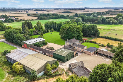
- Price
- Guide Price£745,000
- Size
- 49.62 acres
Lot 2 - West End Farm, Fenstanton, Huntingdon, Fenstanton, Cambridgeshire PE28 England
Added on 09/09/2026Agricultural Land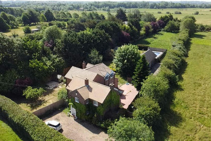
- Price
- Offers Over£900,000
- Size
- 1.19 acres
Mill Road, Buckden, PE19, Buckden, Cambridgeshire PE19 England
Added on 11/06/2026House with Land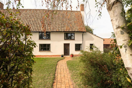
- Price
- £695,000
- Size
- 2 acres
North End, Bletsoe, Bedfordshire (with Stables and Land), MK44, Bletsoe, Bedford MK44 England
Added on 22/04/2026Cottage
- Price
- Guide Price£950,000
- Size
- 1.2 acres
Added on 11/04/2026House with Land
- Price
- Guide Price£899,950
- Size
- 2.8 acres
Added on 24/09/2026House with Land