Tinkler Green Farm, South Side, Butterknowle, County Durham, DL13
- Land size
- 9.76 acres
- Bedrooms
- 5
- Bathrooms
- 5
Key Features
- Exquisite Detached House
- Set Within 9.76 Acres
- Extensive Outbuildings
- No Onward Chain
- Recently Renovated
- Substantially Extended
- Flexible Living Accomodation
- 5 Bedrooms & 5 Bathrooms
- Spectacular Views
Description
Welcome to Tinkler Green Farm, an exquisite, detached 5 bedroom / 5 bathroom residence with versatile living options. Nestled within approximately 9.76 acres including picturesque house, gardens, extensive outbuildings, and land located in South Side, Butterknowle (DL13 5JN). This beautifully very recently renovated and substantially extended property harmoniously unites the charm of its original farmhouse with striking contemporary enhancements, creating a seamless blend of old and new.
Internally, the home has been finished to an exceptional standard. Thoughtful lighting, quality solid wood doors, and exposed beams and stonework flow throughout, offering a sense of timeless character. Modern comforts abound, including oil-fired central heating and underfloor heating to part, double glazed sash windows, and sockets with charging points throughout. Spectacular views to the rear draw in the landscapes, providing a tranquil outlook across paddocks and meadows.
On the ground floor, a welcoming reception hall is accessed via glazed entrance doors with limestone flooring and oak staircase/balustrade accessing the main first floor accommodation. From here, the new wing unfolds into an expansive living room featuring two double French doors onto the rear garden, two full height feature windows with ambient floor lighting, striking media wall with a real flame effect fire, and access to a bespoke dining kitchen. The kitchen is perfect for family and entertaining, with bespoke handmade rustic pine soft close units, granite worktop and upstands, a Rangemaster cooker with granite splashback, Belfast sink, and vast space for dining beneath dual aspect windows and skylights. A utility room adds practical convenience, with stable door access, plumbing for washing machine, and chic bathroom nearby.
Upstairs, the main landing leads to three generously sized bedrooms. The master suite boasts floor to ceiling windows incorporating blackout blinds, enjoying views over the grounds. A stylish Jack and Jill bathroom with freestanding bath, built-in television, walk-in shower, and luxurious fittings. The remaining bedrooms each offer unique features, from exposed beams and stone to remarkable outlooks and feature walls, a further family bathroom with freestanding bath perfectly positioned for relaxing taking in the scenic views.
A door from the reception hall leads into the restored original farmhouse. Here, a lounge with a large inglenook fireplace and multi-fuel stove and useful understairs storage, with an adjoining room which would make an ideal playroom, office, or snug having its own stable door access to the front limestone entrance and adjacent front parking area. Upstairs, a charming double bedroom with Velux windows, exposed beams, and its own en suite bathroom.
Beyond the living room there is a series of rooms which could be annexed off and features its own open-plan kitchen/living room—complete with fitted units, wood-effect worktops, integrated appliances, breakfast bar, and living area with inglenook fireplace. French doors open out to the garden, enhancing the sense of space and connection to the outdoors. A further ground floor, double bedroom, utility room, and additional shower room ad flexibility and comfort.
Externally, this impressive property offers a wealth of amenities for both lifestyle, business and hobby pursuits. The beautifully landscaped rear gardens are accessible from several points within the house and lead onto expansive lawns bordered by mature trees and shrubs. A substantial stone patio is ideal for al fresco dining and relaxation, while the cobbled entry and ample parking areas ensure convenient access for vehicles.
A selection of outbuildings, including three large buildings with electric roller shutter door. An additional timber-clad open shed currently used as a carport with secure storage. A stable providing three generous stalls, a field shelter, and enclosed paddock with direct access, ensuring both space and security for horses or livestock All outbuildings and stable block, have power supply / L.E.D Lighting / water supply. 24 hour, CCTV system monitoring throughout the property, easily accessible from home or mobile.
Tinkler Green Farm is surrounded by rolling countryside and sits on the doorstep of some of County Durham's most breathtaking scenery. The surrounding village of Butterknowle boasts a warm sense of community and is just a short distance from popular market towns such as Bishop Auckland and Barnard Castle, famed for their historic attractions, boutique shopping, and amenities. Local schools, country inns, and farm shops enrich the area, while nearby Hamsterley Forest offers woodland walks, horse riding, and cycling trails for lovers of the outdoors.
This is a truly remarkable opportunity to acquire a beautifully restored and appointed country residence, perfect for family living, multi-generational households, or those seeking income potential through holiday letting. Experience the magic of rural living, combined with exceptional comfort and convenience.
Arrange your viewing today to fully appreciate all this outstanding home has to offer.
PRICE
£1,295,000
PROPERTY INFORMATION
Council Tax Band: E
Annual Cost: £3,205
Land Registry Title Number: DU358638
Tenure: Freehold
Local Authority: Durham
Flood Risk Very low
Conservation Area :No
Predicted Broadband Speed: Basic: 21 Mbps Ultrafast: 8500 Mbps
Satellite / Fibre TV Availability: BT: Sky: Virgin:
PLANNING
Ref: - DM/20/02345/FPA Decided - 20/08/2020 Two Storey Side Extension. Creation Of Annex.
Ref: - DM/20/02345/FPA Not Available Two Storey Side Extension To Form Annex.
LAND
The land is made up of a number of paddocks totalling 8.85 acres.
EASEMENTS, WAYLEAVES & RIGHTS OF WAY
The land is sold subject to and with the benefit of all rights of way, drainage, water courses, light and other easements, quasi or reputed easements and rights of adjoining landowners (if any) affecting the same and all matters registerable by any competent authority pursuant subject to statute.
OVERAGE
The land is sold subject to a development clawback provision (in favour of the vendors and their successors in title). The payment due being equivalent to 25% of the uplift in value arising on the grant of a planning permission for anything other than an agricultural or equestrian use for a term of 50 years.
METHOD OF SALE
The land is offered for sale by private treaty.
SURVEY
We have not undertaken a survey of the property and therefore are unable to comment on its structural condition.
BROCHURE
Details and photographs taken July 2026
Map Location
Property details
- Tenure
- Freehold
- Council Tax Band
- E
- Date Posted
- 2026-07-20
Market Value Analysis
Compared with 24 Farms & Smallholdings listings in North East England (5+ acres).
Utilities & Restrictions
Utilities
- Electricity
- Ask Agent
- Water
- Ask Agent
- Heating
- Ask Agent
- Broadband
- Ask Agent
- Sewerage
- Ask Agent
Rights & Restrictions
- Public Rights of Way
- Ask Agent
- Private Rights of Way
- Ask Agent
- Listed Property
- Ask Agent
- Restrictions
- Ask Agent
Listed status, conservation areas and planning constraints for this location are in the full report.
Property Features
- Accessibility
- Ask Agent
- Parking
- Parking Available
- Garden
- Garden
Beyond the particulars: planning activity, flood history, heritage and ground risks, checked for this exact spot.
Connectivity
Broadband
Fastest speed available at this postcode
8.5 Gbps
Gigabit full fibre
Suitable for
- 4K streaming on every screen
- Full-time home working
- Online gaming & big downloads
Mobile signal
Predicted 4G and 5G signal; indoor signal depends on building materials.
Ofcom Connected Nations postcode-level predictions. Speeds and signal are modelled, not measured, and vary between addresses and providers.
Signal is the easy part. Planning activity, flood history and protected designations here are in the full report.
Nearest Schools
Primary
- Butterknowle Primary School0.9 milesOfsted report card · Feb 2026
- Ages
- 3 to 11
- Pupils
- 54
- Type
- Community school
- Woodland Primary School2.1 milesOfsted: Good
- Ages
- 3 to 11
- Pupils
- 25
- Type
- Community school
- Cockfield Primary School2.1 milesOfsted: Good
- Ages
- 2 to 11
- Pupils
- 115
- Type
- Community school
- Hamsterley Primary School2.5 milesOfsted: Requires improvement *
- Ages
- 4 to 11
- Pupils
- 36
- Type
- Community school
- Ramshaw Primary School3 milesNo Ofsted rating
- Ages
- 4 to 11
- Pupils
- 54
- Type
- Community school
Secondary
- Staindrop Academy4.4 milesOfsted: Good
- Ages
- 11 to 16
- Pupils
- 504
- Type
- Academy sponsor led
- St John's Catholic School & Sixth Form College5.9 milesNo Ofsted rating
- Ages
- 11 to 18
- Pupils
- 1,229
- Type
- Academy converter
- Faith
- Roman Catholic
- Bishop Barrington Academy6 milesOfsted: Good
- Ages
- 11 to 16
- Pupils
- 599
- Type
- Academy converter
- Wolsingham School6.7 milesNo Ofsted rating
- Ages
- 11 to 16
- Pupils
- 774
- Type
- Academy converter
- Teesdale School and Sixth Form6.8 milesNo Ofsted rating
- Ages
- 11 to 18
- Pupils
- 684
- Type
- Academy sponsor led
* Latest graded judgement covers quality of education only; no overall grade was issued under the 2024-25 inspection framework.
Distances are straight-line from the advertised location. Source: the national school registers (DfE, Welsh Government, Scottish Government) and Ofsted.
Schools are just the start: sold prices nearby, planning activity and any flood history are in the full report.
Amenities
Supermarket
GP surgery
Pharmacy
Hospital
Straight-line distances from the advertised location. Sources: NHS records, Geolytix supermarket locations, OS Open Greenspace and the national trails registers.
The area stacks up? Now check the location itself: planning nearby, protected designations and past flooding.
Getting Around
Nearest station
Nearest bus stop
Typical drive times
Straight-line distances from the advertised location; drive times are typical free-flow times over OpenStreetMap road data, so allow more at peak. Public transport locations from DfT NaPTAN.
Easy to reach matters. So do planning activity, flood history and ground risks: all in the full report.
Flood Risk
Environment Agency open data, checked around the advertised map pin for the listed acreage. Long-term risk counts flood defences; the planning map's flood zones do not. Provided by LandSale, not the listing agent, and not part of the agent's particulars. Risk varies across a holding, so verify before committing.
Rivers and the sea
Planning map: Flood Zone 1.
Surface water
Not at the pin: mapped about 60 metres away.
These bandings are the summary. Where this location sits on the flood maps, plus planning activity, heritage and ground risks, is in the full report.
Important notice: Information, maps and tags on this page are drawn from the advertising agent's marketing materials or generated automatically. LandSale has not verified them. Relying on these details is at your own risk, always carry out independent checks before committing to a purchase.
LandSale full disclaimer
Marketing information only - not formal particulars. The details on this website are provided for general guidance and do not constitute an offer or contract. Neither LandSale nor the advertising estate/land agent accepts responsibility for any inaccuracy.
1. Source of information
- Listing content: Core description, asking price, tenure, measurements, photographs and planning history originate from the marketing materials of the advertising estate or land agent. LandSale does not author this content and cannot guarantee its accuracy.
- Automated tags & categorisation: Property type, land-use class, acreage bands and similar labels may be applied by machine-learning models. They are intended as a helpful guide only and may not reflect the property's legal status or permitted use.
- Third-party & enriched data layers: Maps, boundary outlines, planning designations, soil reports, broadband coverage and other environmental or location-based insights are licensed from external suppliers. Such data are supplied “as is", may be incomplete or out of date and are subject to change without notice.
2. Verification required
Prospective purchasers must verify critical matters, including but not limited to planning permission, title boundaries, public rights of way, environmental constraints, acreage, services, access and VAT status, through their own inspections, specialist surveys, legal advisers and the selling agent before relying on the information or entering into any contract.
3. No warranty or liability
LandSale gives no warranty, express or implied, as to the accuracy, completeness or fitness for any particular purpose of the information displayed. LandSale shall not be liable for any loss, damage, cost or expense arising directly or indirectly from any use of or reliance on such information, save where liability may not be excluded by law.
4. Updates & feedback
If you believe any detail on this listing is inaccurate, please let us know. We will investigate and, where appropriate, update the listing or notify the agent.
© LandSale | Version 1.3 - August 2026
Listing agent
Addisons Chartered Surveyors, Barnard Castle
13 Galgate, Barnard Castle, DL12 8EQ
View agent profileSimilar properties for sale
- Price
- Guide Price£1,200,000
- Size
- 10.18 acres
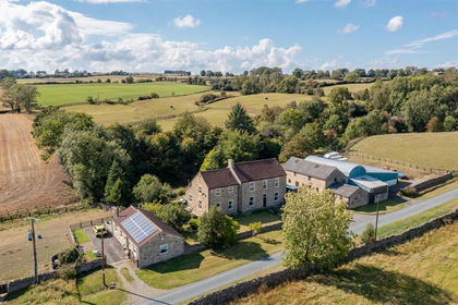
Glenholme Farm, Hamsterley, County Durham, Hamsterley, County Durham DL13 England
Added on 31/07/2026House with Land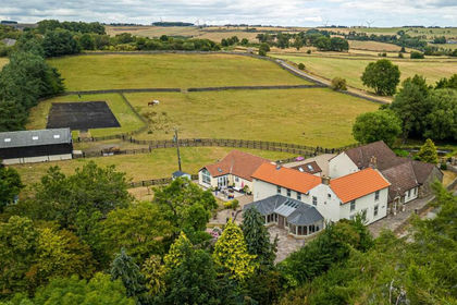
- Price
- Guide Price£1,500,000
- Size
- 9.94 acres
Redgate Head, Wolsingham, County Durham, Wolsingham, County Durham DL13 England
Added on 03/09/2026House with Land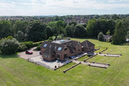
- Price
- Offers in Region of£1,209,000
- Size
- 6.05 acres
Rushyford, Ferryhill, County Durham, DL17, Great Aycliffe, County Durham DL17 England
Added on 18/06/2026Residential
- Price
- Guide Price£975,000
- Size
- 4.3 acres
Added on 29/01/2026Smallholding
- Price
- Guide Price£1,200,000
- Size
- 7.35 acres
Manor Park Farm, Hudswell, Richmond, Hudswell, North Yorkshire DL11 England
Added on 08/09/2026House with Land
- Price
- Guide Price£1,400,000
- Size
- 75.07 acres
Dovecote Farm, Elwick, Hartlepool, Elwick, Hartlepool TS27 England
Added on 04/07/2026Farm
- Price
- £1,495,000
- Size
- 77.11 acres
Syke Side Farm, Soulby, Kirkby Stephen, Cumbria, CA17, Soulby, Westmorland and Furness CA17 England
Added on 29/01/2026Farm
- Price
- Offers Over£995,000
- Size
- 5.5 acres
Wharton, Kirkby Stephen, CA17, Wharton, Westmorland and Furness CA17 England
Added on 20/08/2026Smallholding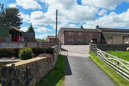
- Price
- Guide Price£1,250,000
- Size
- 43.08 acres
Soulby, Kirkby Stephen, CA17, Soulby, Westmorland and Furness CA16 England
Added on 26/06/2026Smallholding
- Price
- £1,250,000
- Size
- 13.3 acres
Alston, Cumbria, Alston Moor, Westmorland and Furness CA9 England
Added on 21/03/2026Country Home