Potential Development Site - Caddon Haugh, Galashiels, Selkirkshire, TD1
- Land size
- 2.01 acres
- Use Class
- Use Class: 9
Key Features
- Potential Development Site
- Rare Opportunity to acquire a site in the Scottish orders
- Residential Potential
Description
Potential Development Site
A rare opportunity to acquire a site in the central Scottish Borders with Residential Development Potential.
0.815 Ha (2.01 acres). Previous application for six houses reference 15/01064/FUL recommended for approval*
For Sale Offers Over £165,000
*Deemed Withdrawal May 2018
BRIEF RESUME
- Approx 0.815 ha (2.01 acre)
- Developable area relatively level
- Access of established development
- Edge of village location - Mature woodland shelter belt to 3 sides
- Previous 6 house development
application recommended for approval
THE SITE
Positioned on the edge of the sought-after village of Clovenfords, this prime potential development site extends to approximately 0.815 hectares (2.01 acres) and offers an exceptional opportunity for residential development in a scenic semi-rural setting. It represents the final phase of the Caddon Haugh development, a well-regarded residential scheme of 18 homes completed in the early 2000s, a proven and desirable location.
Located within the defined development boundary and enjoying an accessible yet peaceful position, this is a unique opportunity for housebuilders, developers, or investors seeking land in an area with strong market demand and appealing lifestyle credentials.
The developable area is relatively flat with a mature tree-lined shelter belt around three sides off the site providing natural screening as a formal buffer to the development boundary and enhancing privacy.
The site has a southerly aspect which may be capitalised on for solar orientation for energy-efficient design.
LOCATION
Clovenfords is a charming and historic Borders village, nestled amid rolling hills and picturesque countryside, just a short distance from Galashiels and approximately an hour's drive from Edinburgh.
Originally established around a key bridging point over the Caddon Water, the village retains its distinctive character and community feel. At its heart is the well-known Clovenfords Hotel, and the village supports a primary school, local shop and Post Office.
Transport links are excellent. Clovenfords benefits from regular bus services to Galashiels, Melrose and Edinburgh, and lies within 10 minutes' drive of Tweedbank railway station, providing direct connections to Edinburgh Waverley.
The area boasts significant natural and ecological appeal, with parts of the Caddon Water designated a Special Area of Conservation. Proximity to green corridors and open landscapes makes it an attractive setting for residential living while requiring thoughtful and sustainable development.
SERVICES
Access: Via existing estate road which was designed to accommodate this later phase of development.
Mains services are presumed to be available within reasonable cost parameters but purchasers will need to make their own enquiries in this regard.
AREAS
The site has been measured from an OS based mapping system based on our assumptions as to boundaries to an approximate area of 0.815 ha (2.01 acre) or thereby.
The site is registered under Title Number SEL894.
BROADBAND COVERAGE
Ofcom states this area has access to Ultrafast broadband services, with maximum download speeds of 1,800 Mbps and upload speeds of 220 Mbps.
DEVELOPMENT PLAN
The site was designated as Site Reference EC2 'Caddonhaugh' in the earlier Local Development Plan and remains inside the development boundary in the most recent LDP2.
Key requirements outlined by the planning authority include:
Flood Risk Assessment due to proximity to floodplain
Mitigation for River Tweed Special Area of Conservation
Vehicular and pedestrian access from Caddon Haugh road
Retention and protection of existing mature trees
Ecological and contamination assessments
Sensitive design to complement existing housing and exploit the site's southerly aspect for energy efficiency
PLANNING HISTORY
Application 15/01064/FUL was submitted in 2015 in relation to proposals for Six detached houses consisting of a mix of single and two-storey units. This was recommended for approval in 2017, subject to legal agreements. It was deemed withdrawn in May 2018
Planning Portal Link
SUMMARY SPECIFICATION
The previously proposed development included high-quality external finishes such as:
Rendered walls with natural stone and vertical larch cladding
Grey double-glazed units with zinc-clad extruded surrounds
Pitched roofs with flat Marley tiles or equivalent
Traditional-style PVC rainwater goods
There is clear scope for a bespoke, high-quality development that blends harmoniously with the surrounding built environment and natural landscape.
GROUND CONDITIONS
Basic due diligence and pre-development surveys are advised. It is understood that mains services are available nearby, and servicing can be achieved via the established residential infrastructure of the Caddon Haugh estate.
TENURE
The site is held under Absolute Ownership (equivalent to Freehold).
METHOD OF SALE
The property is offered for sale as a whole, with vacant possession, via Private Treaty.
OFFERS
Offers over £165,000 are invited.
All offers should clearly state:
Purchaser identity and legal representative
Offer price and funding source
Any conditions attached to the offer
Proposed timescale for missives, completion and payment
A closing date may be set. Interested parties are strongly encouraged to formally register their interest with the selling agents.
VALUE ADDED TAX
The property is not currently elected for VAT.
VIEWINGS AND FURTHER INFORMATION
Strictly by appointment with the sole selling agents:
Edwin Thompson LLP
76 Overhaugh Street
Galashiels
TD1 1DP
Tel:
Email:
IMPORTANT NOTICE
Edwin Thompson for themselves and for the Vendor of this property, whose Agents they are, give notice that:
1. The particulars are set out as a general outline only for the guidance of intending purchasers and do not constitute, nor constitute part of, any offer or contract.
2. All descriptions, dimensions, plans, reference to condition and necessary conditions for use and occupation and other details are given in good faith and are believed to be correct, but any intending purchasers should not rely on them as statements or representations of fact but must satisfy themselves by inspection or otherwise as to their correctness.
3. No person in the employment of Edwin Thompson has any authority to make or give any representation or warranty whatsoever in relation to this property or these particulars, nor to enter into any contract relating to the property on behalf of the Agents, nor into any contract on behalf of the Vendor.
4. No responsibility can be accepted for loss or expense incurred in viewing the property or in any other way in the event of the property being sold or withdrawn.
5.Edwin Thompson is the generic trading name for Edwin Thompson Property Services Limited, a Limited Company registered in England and Wales (no.07428207)
Registered office:28 St John's Street, Keswick, Cumbria, CA12 5AF
Map Location
Property details
- Tenure
- Ask Agent
- Council Tax Band
- Ask Agent
- Date Posted
- 2026-07-17
Market Value Analysis
Compared with 148 Development Land listings in Scotland (1+ acres).
Utilities & Restrictions
Utilities
- Electricity
- Ask Agent
- Water
- Ask Agent
- Heating
- Ask Agent
- Broadband
- Ask Agent
- Sewerage
- Ask Agent
Rights & Restrictions
- Public Rights of Way
- Ask Agent
- Private Rights of Way
- Ask Agent
- Listed Property
- Ask Agent
- Restrictions
- Ask Agent
Listed status, conservation areas and planning constraints for this location are in the full report.
Property Features
- Accessibility
- Ask Agent
- Parking
- Ask Agent
- Garden
- Ask Agent
Beyond the particulars: planning activity, flood history, heritage and ground risks, checked for this exact spot.
Connectivity
Broadband
Fastest speed available at this postcode
1.8 Gbps
Gigabit full fibre
Suitable for
- 4K streaming on every screen
- Full-time home working
- Online gaming & big downloads
Mobile signal
Predicted 4G and 5G signal; indoor signal depends on building materials.
Ofcom Connected Nations postcode-level predictions. Speeds and signal are modelled, not measured, and vary between addresses and providers.
Signal is the easy part. Planning activity, flood history and protected designations here are in the full report.
Nearest Schools
Primary
- Clovenfords Primary School171 metres
- Pupils
- 117
- Type
- Non-denominational
- Balmoral Primary School2.2 miles
- Pupils
- 96
- Type
- Non-denominational
- St Margaret's RC Primary School (Galashiels)2.5 miles
- Pupils
- 103
- Type
- Roman Catholic
- Glendinning Terrace Primary School2.6 miles
- Pupils
- 58
- Type
- Non-denominational
- Burgh Primary School2.6 miles
- Pupils
- 192
- Type
- Non-denominational
Secondary
- Galashiels Academy2.6 miles
- Pupils
- 874
- Type
- Non-denominational
- Selkirk High School5 miles
- Pupils
- 423
- Type
- Non-denominational
- Earlston High School8.6 miles
- Pupils
- 1,090
- Type
- Non-denominational
- Peebles High School12 miles
- Pupils
- 1,342
- Type
- Non-denominational
- Hawick High School14 miles
- Pupils
- 756
- Type
- Non-denominational
Distances are straight-line from the advertised location. Source: the national school registers (DfE, Welsh Government, Scottish Government) and Ofsted.
Schools are just the start: planning activity, heritage and any flood history here are in the full report.
Amenities
Supermarket
GP surgery
Pharmacy
Green space
Straight-line distances from the advertised location. Sources: NHS records, Geolytix supermarket locations, OS Open Greenspace and the national trails registers.
The area stacks up? Now check the location itself: planning nearby, protected designations and past flooding.
Getting Around
Nearest station
Nearest bus stop
Typical drive times
Straight-line distances from the advertised location; drive times are typical free-flow times over OpenStreetMap road data, so allow more at peak. Public transport locations from DfT NaPTAN.
Easy to reach matters. So do planning activity, flood history and ground risks: all in the full report.
Flood Risk
SEPA open data, checked around the advertised map pin for the listed acreage. The map pin for this listing marks the postcode area rather than the exact location, so these readings describe the surrounding area. Provided by LandSale, not the listing agent, and not part of the agent's particulars. Risk varies across a holding, so verify before committing.
Rivers and the sea
Surface water
Not at the pin: mapped about 40 metres away.
These bandings are the summary. Where this location sits on the flood maps, plus planning activity, heritage and ground risks, is in the full report.
Important notice: Information, maps and tags on this page are drawn from the advertising agent's marketing materials or generated automatically. LandSale has not verified them. Relying on these details is at your own risk, always carry out independent checks before committing to a purchase.
LandSale full disclaimer
Marketing information only - not formal particulars. The details on this website are provided for general guidance and do not constitute an offer or contract. Neither LandSale nor the advertising estate/land agent accepts responsibility for any inaccuracy.
1. Source of information
- Listing content: Core description, asking price, tenure, measurements, photographs and planning history originate from the marketing materials of the advertising estate or land agent. LandSale does not author this content and cannot guarantee its accuracy.
- Automated tags & categorisation: Property type, land-use class, acreage bands and similar labels may be applied by machine-learning models. They are intended as a helpful guide only and may not reflect the property's legal status or permitted use.
- Third-party & enriched data layers: Maps, boundary outlines, planning designations, soil reports, broadband coverage and other environmental or location-based insights are licensed from external suppliers. Such data are supplied “as is", may be incomplete or out of date and are subject to change without notice.
2. Verification required
Prospective purchasers must verify critical matters, including but not limited to planning permission, title boundaries, public rights of way, environmental constraints, acreage, services, access and VAT status, through their own inspections, specialist surveys, legal advisers and the selling agent before relying on the information or entering into any contract.
3. No warranty or liability
LandSale gives no warranty, express or implied, as to the accuracy, completeness or fitness for any particular purpose of the information displayed. LandSale shall not be liable for any loss, damage, cost or expense arising directly or indirectly from any use of or reliance on such information, save where liability may not be excluded by law.
4. Updates & feedback
If you believe any detail on this listing is inaccurate, please let us know. We will investigate and, where appropriate, update the listing or notify the agent.
© LandSale | Version 1.3 - August 2026
Listing agent
EDWIN THOMPSON PROPERTY SERVICES LIMITED, Galashiels
Contact EDWIN THOMPSON PROPERTY SERVICES LIMITED, Galashiels
View agent profileSimilar properties for sale
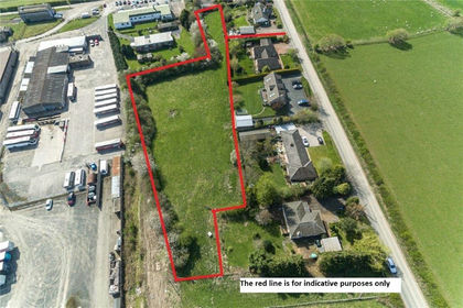
- Price
- Offers Over£185,000
- Size
- 1.24 acres
Added on 29/01/2026Building Plot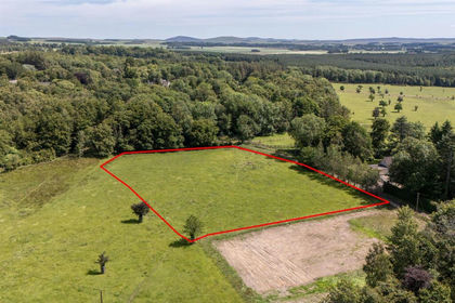
- Price
- Offers Over£180,000
- Size
- 1.3 acres
Added on 29/01/2026Building Plot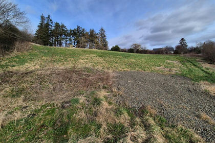
- Price
- Offers Over£140,000
- Size
- 1.38 acres
Mansefield, Denholm, Berwickshire, Roxburgh and Selkirk, Scottish Borders TD9 Scotland
Added on 04/02/2026Building Plot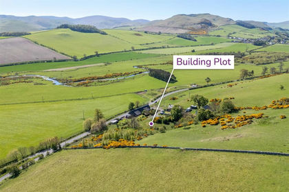
- Price
- Offers Over£140,000
- Size
- 1.45 acres
Added on 16/05/2026Building Plot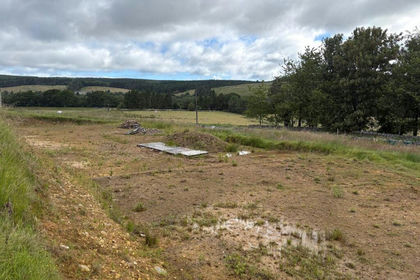
- Price
- Guide Price£175,000
- Size
- 1.62 acres
Added on 08/07/2026Building Plot