Ogdens, Fordingbridge, Hampshire, SP6
- Land size
- 1.3 acres
- Bedrooms
- 4
- Bathrooms
- 2
Key Features
- Exceptional rural views
- 1.3 acres of garden & paddock
- Well appointed 4 bedroom detached chalet residence
- No onward chain
Description
An impressive detached four bedroom chalet residence in gardens and paddocks totalling 1.3 acres in possibly one of the finest elevated locations within the New Forest National Park offering spectacular rural views.
Summary of Accommodation
*RECEPTION HALL/DRAWING ROOM * SITTING ROOM * KITCHEN/DINING/BREAKFAST ROOM * SEPARATE UTILITY ROOM * CLOAKROOM/W.C. * GROUND FLOOR BEDROOM AND EN-SUITE SHOWER ROOM/W.C. * THREE BEDROOMS AND FAMILY BATHROOM/SHOWER ROOM ON FIRST FLOOR * DOUBLE GLAZING * OIL FIRED CENTRAL HEATING * DETACHED SINGLE GARAGE * ADDITIONAL OFF ROAD PARKING * GARDENS AND PADDOCK TOTALLING 1.3 ACRES*
DESCRIPTION AND CONSTRUCTION:
This detached chalet residence is believed to date back to the 1960’s. The current owners have substantially enhanced this chalet residence during their ownership. The property is extremely well presented and offers generous accommodation on two floors The views are exceptional, possibly the finest in the entire area, offering panoramic views across the gardens, paddocks and New Forest National Park beyond.
AGENTS NOTE: In our opinion, to fully appreciate the location and presentation of the property, a viewing is highly recommended.
SITUATION:
Badgers Haunt is set within a secluded and elevated gardens and separate paddock, in all totalling 1.3 acres and offering some of the most spectacular rural views across the New Forest National Park Local facilities include Hyde primary school and the Potting Shed garden centre and tearooms. Local shopping facilities are catered for at Fordingbridge, and Burgate senior school provides a major educational hub.
DIRECTIONAL NOTE:
What3Words confirms that Badgers Haunt can be found using // formed.blankets.educates.
Travelling north from Ringwood along the A338 Salisbury Road (towards Fordingbridge) passing the Old Beams Inn. Upon reaching the junction, (prior to Bickton) sign posted to Hyde and Hungerford turn right onto Hern Lane. Proceed over the cattlegrid and continue up Hyde Hill passing Hyde Club on the right hand side. At the top of the hill, adjacent to Hyde primary school turn right and continue along this lane for a short distance turning left prior to the entrance to The Potting Shed onto the lane leading to Ogdens. Continue for a short distance whereupon there is a sign on the left hand side erected by Hampshire County Council stating ‘access to private properties only, no parking’ Continue along this track and as at it bears around to the right follow the track toward the bottom whereupon the entrance to Badgers Haunt will be found immediately in front.
THE ACCOMMODATION COMPRISES:
DOUBLE OPENING DOUBLE GLAZED CASEMENT DOORS ON THE SOUTHERN ELEVATION LEADING TO:
RECEPTION HALL/DRAWING ROOM: 14’6” (4.44m) x 11’7” (3.55m). Panoramic rural views across gardens and forest beyond. Radiator. 2 wall light points. Telephone point. Opaque glazed door on the eastern elevation leading to covered pergola. Within the drawing room and without loss of measurement, door to full height cloaks cupboard and understairs storage cupboard.
FROM THE DRAWING ROOM, DOOR TO:
SITTING ROOM: 18’4” (5.61m) x 13’4” (4.09m) maximum, narrowing to: 11’10” (3.63m) to front of chimney breast. Dual aspect to the south and east. Double glazed picture windows providing panoramic views across the gardens, paddock and forest beyond. Stone fireplace, matching hearth and mantel, open grate. 2 wall light points. 2 radiators. T.V. point. Door to:
KITCHEN: 10’11” (3.33m) x 9’10” (3.02m). Custom built kitchen units comprising wall to wall, roll top laminate work surface with inset one & a quarter bowl, single drainer stainless steel sink unit with h & c mixer. Floor storage cupboard. Integrated dishwasher. The work surface extends on the return wall & incorporates integrated fridge & freezer, plus Neff 4 burner electric hob with electric oven and grill beneath. Neff stainless steel canopy extractor fan above with down lights. Matching range of eye level store cupboards with cornice and architrave plus above counter lighting. Attractive tiled wall surrounds. Radiator. Laminate floor. Down lights. Without loss of measurement to the kitchen full height shelved larder store.
FROM THE KITCHEN, ARCHWAY TO:
DINING/BREAKFAST ROOM: 12’ (3.66m) x 9’3” (2.82m). Dual aspect to the north and east. Double glazed windows and door providing view/ access onto gardens. Laminate floor. Radiator. Down lights. Door to:
UTILITY ROOM: 6’2” (1.89m) x 5’9” (1.78m). Dual aspect to the north and west. Double glazed window and door providing view/access onto gardens. Roll top laminate work surface with inset stainless steel sink unit with h & c mixer. Floor storage cupboard beneath. Recess for washing machine with plumbing available. Tiled floor. Down lights. Full height cupboard housing pressurised hot water cylinder.
FROM THE UTILITY ROOM, DOOR TO:
CLOAKROOM: 5’9” (1.76m) x 2’9” (0.85m). Aspect to the west. Opaque double glazed window. White suite comprising low level w.c. with concealed cistern, wash basin, tiled splash back, h & c mixer. Tiled floor. Cupboard at ceiling height housing RCD fuse box.
FROM THE DRAWING ROOM/RECEPTION HALL, GLAZED SLIDING DOOR TO:
INNER LOBBY, WITH DOOR TO:
GROUND FLOOR BEDROOM: 18’4” (5.60m) x 10’11” (3.33m) maximum, narrowing to: 8’7” (2.63m). Dual aspect to the south and west. Double glazed picture windows providing panoramic views across the gardens and forest beyond. 2 ceiling light points. Radiator. Without loss of measurement to the room, full height single built-in wardrobe.
FROM THE BEDROOM, DOOR TO:
EN-SUITE SHOWER ROOM: 7’9” (2.38m) x 7’3” (2.22m) maximum into shower cubicle, narrowing to: 4’11” (1.51m). Aspect to the north. Opaque double glazed window. White suite comprising close coupled low level w.c. Pedestal wash basin. Large walk-in fully tiled shower cubicle with thermostatic shower. Half tiled walls in contrast to the tiled floor. Chrome vertical heated ladder style towel rail. Down lights.
FROM THE INNER LOBBY, RETURN FLIGHT STAIRCASE TO:
FIRST FLOOR GALLERIED LANDING: Access to under eaves storage. Hatch to loft area. Double built-in airing cupboard with fitted shelving.
FROM THE LANDING, DOOR TO:
BEDROOM 2: 16’1” (4.92m) maximum, narrowing to: 14’1” (4.30m) x 11’2” (3.41m). Dual aspect to the north & east. Panoramic view on the eastern elevation, through Velux skylight, across paddock and forest beyond. Under eaves storage access. Radiator. T.V. and telephone points.
FROM THE LANDING, DOOR TO:
BEDROOM 3: 13’5” (4.10m) x 9’11” (3.04m). Aspect to the east. Double glazed picture windows providing stunning far-reaching view across garden, paddock and forest beyond. Under eaves storage access. Radiator.
FROM THE LANDING, DOOR TO:
BEDROOM 4: 10’11” (3.35m) x 6’5” (1.96m) to the main part of the bedroom with two twin recesses for storage purposes. Aspect to the south. Double glazed picture window providing stunning, panoramic across garden and forest beyond. Radiator. Telephone point. Twin under eaves storage access points.
FROM THE LANDING, DOOR TO:
BATHROOM/SHOWER ROOM: 10’11” (3.33m) x 7’10” (2.41m) maximum, narrowing to: 4’8” (1.43m) to front of shower cubicle. Aspect to the west. Double glazed picture window overlooking gardens and forest beyond. White suite comprising panelled bath, twin hand grips, tiled wall surround. Wash basin set in vanity surround with double floor storage cupboard beneath. Strip light and shaver point. Close coupled low level w.c. Fully tiled walk-in shower cubicle. Radiator.
OUTSIDE:
The property is approached across a forest track (owned by Hampshire County Council), which in turn leads across a private cattle grid to a concrete drive and hardstanding area which in turn gives access to:
DETACHED SINGLE GARAGE plus additional off road parking for trailer etc. .
The gardens and paddock, which total 1.3 acres, surround the property on all four sides of the property offering spectacular views across the adjoining paddock and surrounding forest. A brick paviour path leads across the northern side of the property to a lower section via steps, which in turn leads to a patio adjacent to the dining/breakfast room. Within this area there is an aluminium framed GREENHOUSE.
The path continues along the eastern side of the property where the principal area of lawn is located on a terraced basis adjacent to an external pergola with substantial wisteria providing shade and colour.
Within the garden there are a variety of flower shrubs, trees and bushes providing a spectacular array of colour throughout the seasons in addition to quite simply the finest elevated rural views within this part of the forest.
A picket gate gives access, on the south western corner of the garden, onto the lane and is well screened by an impressive magnolia. The paddock is accessed from the gardens via a five bar gate on the eastern boundary and can also be accessed, via the lane, in the south eastern corner, adjacent to a thatched rustic BARN and an adjoining open fronted PONY SHELTER. The boundaries of the paddock are well defined with post and wire fencing together with mature hedging.
To the rear of the utility room there is an external Grant oil fired boiler and oil tank.
COUNCIL TAX BAND: F
EPC LINK:
Consumer Protection from Unfair Trading Regulations 2008
These details are for guidance only and complete accuracy cannot be guaranteed. If there is any point, which is of particular importance, verification should be obtained. They do not constitute a contract or part of a contract. All measurements are approximate. No guarantee can be given with regard to planning permissions or fitness for purpose. No apparatus, equipment, fixture or fitting has been tested. Items shown in photographs are NOT necessarily included. Interested Parties are advised to check availability and make an appointment to view before travelling to see a property.
The Data Protection Act 1998
Please note that all personal information provided by customers wishing to receive information and/or services from the estate agent will be processed by the estate agent, the team Association Consortium Company of which it is a member and team Association Limited for the purpose of providing services associated with the business of an estate agent and for the additional purposes set out in the privacy policy (copies available on request) but specifically excluding mailings or promotions by a third party. If you do not wish your personal information to be used for any of these purposes, please notify your estate agent. For further information about the Consumer Protection from Unfair Trading Regulations 2008 see
Map Location
Property details
- Tenure
- Freehold
- Council Tax Band
- F
- Date Posted
- 2026-07-17
Market Value Analysis
Compared with 1,736 Homes with Land listings in South East England (1+ acres).
Energy Performance Certificate
Energy Efficiency Rating
Based on UK Energy Performance Certificate standards (EU Directive 2002/91/EC)
Running costs are one side. Planning activity, flood history and ground risks for this location are in the full report.
Utilities & Restrictions
Utilities
- Electricity
- Ask Agent
- Water
- Ask Agent
- Heating
- Ask Agent
- Broadband
- Ask Agent
- Sewerage
- Ask Agent
Rights & Restrictions
- Public Rights of Way
- Ask Agent
- Private Rights of Way
- Ask Agent
- Listed Property
- Ask Agent
- Restrictions
- Ask Agent
Listed status, conservation areas and planning constraints for this location are in the full report.
Property Features
- Accessibility
- Ask Agent
- Parking
- Parking Available
- Garden
- Garden
Beyond the particulars: planning activity, flood history, heritage and ground risks, checked for this exact spot.
Connectivity
Broadband
Fastest speed available at this postcode
1.8 Gbps
Gigabit full fibre
Suitable for
- 4K streaming on every screen
- Full-time home working
- Online gaming & big downloads
Mobile signal
Predicted 4G and 5G signal; indoor signal depends on building materials.
Ofcom Connected Nations postcode-level predictions. Speeds and signal are modelled, not measured, and vary between addresses and providers.
Signal is the easy part. Planning activity, flood history and protected designations here are in the full report.
Nearest Schools
Primary
- Hyde Church of England Primary School708 metresOfsted: Good
- Ages
- 4 to 11
- Pupils
- 33
- Type
- Voluntary controlled school
- Faith
- Church of England
- Fordingbridge Junior School2.5 milesOfsted: Good
- Ages
- 7 to 11
- Pupils
- 217
- Type
- Community school
- Fordingbridge Infant School2.5 milesNo Ofsted rating
- Ages
- 4 to 7
- Pupils
- 160
- Type
- Community school
- St James' Church of England First School and Nursery, Alderholt3.5 milesNo Ofsted rating
- Ages
- 2 to 9
- Pupils
- 125
- Type
- Academy converter
- Faith
- Church of England
- Breamore Church of England Primary School3.6 milesOfsted: Good *
- Ages
- 4 to 11
- Pupils
- 77
- Type
- Voluntary controlled school
- Faith
- Church of England
Secondary
- The Burgate School and Sixth Form2.4 milesNo Ofsted rating
- Ages
- 11 to 18
- Pupils
- 1,073
- Type
- Academy converter
- Ringwood School Academy4.5 milesNo Ofsted rating
- Ages
- 11 to 18
- Pupils
- 1,592
- Type
- Academy converter
- The Trafalgar School at Downton5.5 milesOfsted: Good
- Ages
- 11 to 16
- Pupils
- 808
- Type
- Academy converter
- Emmanuel Church of England Middle School6.3 milesOfsted: Good
- Ages
- 9 to 13
- Pupils
- 434
- Type
- Academy sponsor led
- Faith
- Church of England
- Cranborne Middle School7.4 milesNo Ofsted rating
- Ages
- 9 to 13
- Pupils
- 265
- Type
- Community school
* Latest graded judgement covers quality of education only; no overall grade was issued under the 2024-25 inspection framework.
Distances are straight-line from the advertised location. Source: the national school registers (DfE, Welsh Government, Scottish Government) and Ofsted.
Schools are just the start: sold prices nearby, planning activity and any flood history are in the full report.
Amenities
Supermarket
GP surgery
Pharmacy
Hospital
Green space
Straight-line distances from the advertised location. Sources: NHS records, Geolytix supermarket locations, OS Open Greenspace and the national trails registers.
The area stacks up? Now check the location itself: planning nearby, protected designations and past flooding.
Getting Around
Nearest station
Nearest bus stop
Typical drive times
Straight-line distances from the advertised location; drive times are typical free-flow times over OpenStreetMap road data, so allow more at peak. Public transport locations from DfT NaPTAN.
Easy to reach matters. So do planning activity, flood history and ground risks: all in the full report.
Flood Risk
Environment Agency open data, checked around the advertised map pin for the listed acreage. Long-term risk counts flood defences; the planning map's flood zones do not. Provided by LandSale, not the listing agent, and not part of the agent's particulars. Risk varies across a holding, so verify before committing.
Rivers and the sea
Planning map: Flood Zone 1.
Surface water
Not at the pin: mapped about 30 metres away.
These bandings are the summary. Where this location sits on the flood maps, plus planning activity, heritage and ground risks, is in the full report.
Important notice: Information, maps and tags on this page are drawn from the advertising agent's marketing materials or generated automatically. LandSale has not verified them. Relying on these details is at your own risk, always carry out independent checks before committing to a purchase.
LandSale full disclaimer
Marketing information only - not formal particulars. The details on this website are provided for general guidance and do not constitute an offer or contract. Neither LandSale nor the advertising estate/land agent accepts responsibility for any inaccuracy.
1. Source of information
- Listing content: Core description, asking price, tenure, measurements, photographs and planning history originate from the marketing materials of the advertising estate or land agent. LandSale does not author this content and cannot guarantee its accuracy.
- Automated tags & categorisation: Property type, land-use class, acreage bands and similar labels may be applied by machine-learning models. They are intended as a helpful guide only and may not reflect the property's legal status or permitted use.
- Third-party & enriched data layers: Maps, boundary outlines, planning designations, soil reports, broadband coverage and other environmental or location-based insights are licensed from external suppliers. Such data are supplied “as is", may be incomplete or out of date and are subject to change without notice.
2. Verification required
Prospective purchasers must verify critical matters, including but not limited to planning permission, title boundaries, public rights of way, environmental constraints, acreage, services, access and VAT status, through their own inspections, specialist surveys, legal advisers and the selling agent before relying on the information or entering into any contract.
3. No warranty or liability
LandSale gives no warranty, express or implied, as to the accuracy, completeness or fitness for any particular purpose of the information displayed. LandSale shall not be liable for any loss, damage, cost or expense arising directly or indirectly from any use of or reliance on such information, save where liability may not be excluded by law.
4. Updates & feedback
If you believe any detail on this listing is inaccurate, please let us know. We will investigate and, where appropriate, update the listing or notify the agent.
© LandSale | Version 1.3 - August 2026
Listing agent
Grants Of Ringwood, Ringwood
14A The Furlong, Ringwood, BH24 1AT
Similar properties for sale
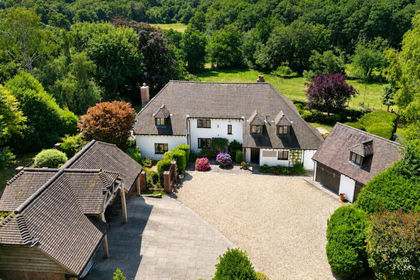
- Price
- Guide Price£1,700,000
- Size
- 3.59 acres
Godshill Wood, Fordingbridge, Hampshire, SP6, Godshill, Hampshire SP6 England
Added on 29/01/2026House with Land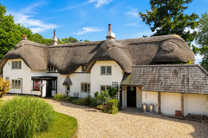
- Price
- £1,700,000
- Size
- 1.3 acres
Rockford, Ringwood, BH24, Ellingham, Harbridge and Ibsley, Hampshire BH24 England
Added on 01/07/2026Cottage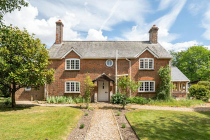
- Price
- Guide Price£1,200,000
- Size
- 1.2 acres
Rockford, Ringwood, BH24, Ellingham, Harbridge and Ibsley, Hampshire BH24 England
Added on 28/05/2026Cottage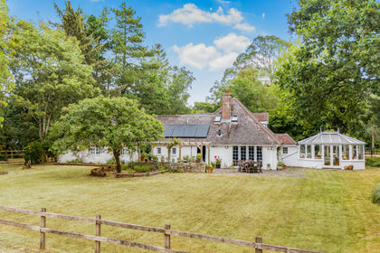
- Price
- Guide Price£1,250,000
- Size
- 3 acres
Hale Purlieu, Fordingbridge, Hampshire, SP6, Hale, Hampshire SP6 England
Added on 07/09/2026Equestrian property
- Price
- Guide Price£1,350,000
- Size
- 1 acres
Crow Hill, New Forest, BH24, Ringwood, Hampshire BH24 England
Added on 29/01/2026Country Home
- Price
- Guide Price£1,195,000
- Size
- 3.1 acres
New Forest near Ringwood, Hampshire, Ringwood, Hampshire BH24 England
Added on 22/06/2026Equestrian property
- Price
- Guide Price£1,695,000
- Size
- 1.75 acres
Tyrells Lane, Burley, Ringwood, Hampshire, BH24, Burley, Hampshire BH24 England
Added on 06/03/2026House with Land
- Price
- £1,695,000
- Size
- 1.75 acres
Tyrells Lane, Burley, Ringwood, BH24, Burley, Hampshire BH24 England
Added on 24/03/2026House with Land
- Price
- Guide Price£1,750,000
- Size
- 3 acres
Added on 02/10/2026Country Home
- Price
- £1,650,000
- Size
- 1 acres
Mill Lane, Burley, Ringwood, BH24, Burley, Hampshire BH24 England
Added on 24/06/2026House with Land