Chilmead Lane, Nutfield
- Bedrooms
- 3
- Bathrooms
- 2
Key Features
- Guide price: £700,000 to £750,000
- The Byre is a beautiful barn conversion where contemporary interiors combine with rustic charm
- Unique layout, including a flexible ground floor room for a dedicated study or fourth bedroom
- Contemporary kitchen design with utility area and views out onto the charming courtyard
- Open plan reception room with bar and dining room in front of bifold doors
- A beautiful landscaped garden, designed for relaxation and entertainment
- Annexe/outbuilding with large family room, creating a cosy retreat to host guests
- Equidistant to Nutfield's charming village and Merstham's convenient hub
Description
Tucked between Nutfield and Merstham, this barn conversion feels removed from the fast pace of everyday life. Inside, there is an immediate sense of character and calm — exposed beams, soaring ceilings and carefully considered interiors combining to create a home that feels grounded yet contemporary. Renovated throughout, the house unfolds in an unexpectedly playful way, with each room revealing another thoughtful detail, another inviting corner, another reason to linger a little longer.
At its centre is a generous open plan living space designed for modern family life and easy entertaining. The log-burning effect gas fire anchors the room beautifully, bringing warmth and atmosphere through the colder months, while bifold doors draw the garden into the house during summer. Tucked to one side, the snug alcove and bar area gives the space a more intimate rhythm — somewhere to gather with friends after supper or retreat with a glass of wine at the end of the day. Dining spills naturally outdoors here; long lunches become evening drinks on the terrace, framed by landscaped planting and birdsong.
The kitchen balances practicality with quiet drama. Flooded with natural light from a striking full-height window overlooking the courtyard, it's practical with clean contemporary finishes sitting comfortably against the home’s original architectural features. Beyond, the utility area and cleverly designed boot and coat storage bring a level of functionality perfectly suited to country living — especially after muddy walks across the surrounding fields.
The layout itself is part of this home’s charm. Rather than a conventional arrangement, the bedrooms are thoughtfully positioned to create privacy and flexibility for family and guests alike. The ground floor bedroom works equally well as a peaceful study or guest suite, while upstairs the principal bedroom enjoys calming garden views and fitted cabinetry that keeps the space feeling elegant and uncluttered. A second bedroom benefits from its own spacious en suite, while the separate stairwell leading to the eaves room creates a tucked-away retreat with an almost cottage-like feel, complete with its own bathroom and dressing area.
Outside of the main house, the annexe offers yet another layer of versatility. With its tall vaulted ceilings and exposed beams, it avoids feeling secondary or purely practical. Instead, it becomes an extension of the lifestyle this property encourages, a relaxed entertaining space, cinema room, studio, games room or somewhere teenagers and guests can claim as their own.
What makes this home particularly compelling is the balance it strikes. It delivers the romance and architectural charm of a converted barn, yet it has been renovated with modern living firmly in mind. The result is a house that feels characterful without being precious, stylish without trying too hard, and entirely suited to the rhythm of contemporary family life.
Life here is shaped as much by the setting as the house itself. Chilmead Lane enjoys a wonderfully semi-rural atmosphere, surrounded by open countryside, woodland walks and quiet lanes ideal for weekend cycling or early morning dog walks. Just a short stroll away, Inn on the Pond remains one of Surrey’s most loved country pubs, overlooking the village cricket green and offering the sort of easy summer afternoons that feel increasingly hard to find. Nearby Mercers Lake adds another dimension to outdoor living, with paddleboarding, open-water swimming and a lakeside café with uninterrupted water views.
Nutfield itself retains a genuine village feel, with local shops, traditional pubs and a close-knit community at its heart. Nearby Bletchingley offers a charming historic high street lined with antique shops, cafés and independent businesses, while Redhill provides a more comprehensive selection of shopping, restaurants, leisure facilities and everyday amenities just a short drive away.
For families, the area is exceptionally well placed, with a number of highly regarded schools nearby including Nutfield Church Primary School, St Bede’s School, The Hawthorns and Caterham School. Commuters are equally well served, with Merstham station offering direct services into London Bridge and Victoria, while the M25 is easily accessible for journeys further afield. It is this combination of countryside living, strong connectivity and enduring village charm that continues to make this pocket of Surrey so sought after.
Map Location
Property details
- Tenure
- Freehold
- Council Tax Band
- F
- Date Posted
- 2026-07-17
Utilities & Restrictions
Utilities
- Electricity
- Ask Agent
- Water
- Ask Agent
- Heating
- Ask Agent
- Broadband
- Ask Agent
- Sewerage
- Ask Agent
Rights & Restrictions
- Public Rights of Way
- Ask Agent
- Private Rights of Way
- Ask Agent
- Listed Property
- Ask Agent
- Restrictions
- Ask Agent
Listed status, conservation areas and planning constraints for this location are in the full report.
Property Features
- Accessibility
- Ask Agent
- Parking
- Covered Parking
- Garden
- Garden
Beyond the particulars: planning activity, flood history, heritage and ground risks, checked for this exact spot.
Connectivity
Broadband
Fastest speed available at this postcode
25 Mbps
Standard (10-30 Mbps)
Suitable for
- Web & social
- Music streaming
- Standard video calls
Mobile signal
Outdoor predictions; indoor signal depends on building materials.
Ofcom Connected Nations postcode-level predictions. Speeds and signal are modelled, not measured, and vary between addresses and providers.
Signal is the easy part. Planning activity, flood history and protected designations here are in the full report.
Nearest Schools
Primary
- Lime Tree Primary School and Nursery1 mileOfsted: Outstanding
- Ages
- 2 to 11
- Pupils
- 445
- Type
- Academy sponsor led
- Furzefield Primary Academy1.1 milesOfsted: Good
- Ages
- 3 to 11
- Pupils
- 403
- Type
- Academy converter
- Merstham Primary School1.2 milesOfsted: Good
- Ages
- 2 to 11
- Pupils
- 236
- Type
- Academy converter
- Nutfield Church CofE Primary School1.2 milesNo Ofsted rating
- Ages
- 5 to 11
- Pupils
- 202
- Type
- Voluntary aided school
- Faith
- Church of England
- St Matthew's CofE Primary School1.2 milesOfsted: Good
- Ages
- 3 to 11
- Pupils
- 363
- Type
- Academy sponsor led
- Faith
- Church of England
Secondary
- Merstham Park School0.8 milesOfsted: Good
- Ages
- 11 to 16
- Pupils
- 711
- Type
- Free schools
- Carrington School0.9 milesOfsted: Good
- Ages
- 11 to 16
- Pupils
- 1,012
- Type
- Academy converter
- St Bede's School1.4 milesNo Ofsted rating
- Ages
- 11 to 18
- Pupils
- 1,918
- Type
- Voluntary aided school
- Faith
- Church of England/Roman Catholic
- Royal Alexandra and Albert School1.7 milesOfsted: Good
- Ages
- 7 to 18
- Pupils
- 984
- Type
- Voluntary aided school
- Reigate School2.7 milesOfsted: Good
- Ages
- 11 to 16
- Pupils
- 1,252
- Type
- Academy converter
Distances are straight-line from the advertised location. Source: the national school registers (DfE, Welsh Government, Scottish Government) and Ofsted.
Schools are just the start: sold prices nearby, planning activity and any flood history are in the full report.
Amenities
Supermarket
GP surgery
Pharmacy
Hospital
Green space
Straight-line distances from the advertised location. Sources: NHS records, Geolytix supermarket locations, OS Open Greenspace and the national trails registers.
The area stacks up? Now check the location itself: planning nearby, protected designations and past flooding.
Getting Around
Nearest station
Nearest bus stop
Typical drive times
Straight-line distances from the advertised location; drive times are typical free-flow times over OpenStreetMap road data, so allow more at peak. Public transport locations from DfT NaPTAN.
Easy to reach matters. So do planning activity, flood history and ground risks: all in the full report.
Flood Risk
From Environment Agency flood map open data, checked around the advertised map pin and allowing for the listed acreage where known. This summary comes from LandSale, the advertising platform, not from the listing agent, and is not part of the agent's particulars. Risk can vary across a single holding, so verify anything critical through your own searches before committing.
Rivers and the sea
Surface water
The detail behind these bandings
The full report pinpoints where this location sits on the flood maps, and runs the deeper checks that usually only surface after an offer.
- Exact flood zones & annual chances (included in the full report)
- Any recorded past flooding (included in the full report)
- Planning activity nearby (included in the full report)
- Heritage & conservation (included in the full report)
- Protected nature designations (included in the full report)
- Ground risks (included in the full report)
- Sold prices nearby (included in the full report)
£14.99 · one-off purchase
By LandSale, the platform. Not provided by the listing agent. Ready in about a minute.
Important notice: Information, maps and tags on this page are drawn from the advertising agent's marketing materials or generated automatically. LandSale has not verified them. Relying on these details is at your own risk, always carry out independent checks before committing to a purchase.
LandSale full disclaimer
Marketing information only - not formal particulars. The details on this website are provided for general guidance and do not constitute an offer or contract. Neither LandSale nor the advertising estate/land agent accepts responsibility for any inaccuracy.
1. Source of information
- Listing content: Core description, asking price, tenure, measurements, photographs and planning history originate from the marketing materials of the advertising estate or land agent. LandSale does not author this content and cannot guarantee its accuracy.
- Automated tags & categorisation: Property type, land-use class, acreage bands and similar labels may be applied by machine-learning models. They are intended as a helpful guide only and may not reflect the property's legal status or permitted use.
- Third-party & enriched data layers: Maps, boundary outlines, planning designations, soil reports, broadband coverage and other environmental or location-based insights are licensed from external suppliers. Such data are supplied “as is", may be incomplete or out of date and are subject to change without notice.
2. Verification required
Prospective purchasers must verify critical matters, including but not limited to planning permission, title boundaries, public rights of way, environmental constraints, acreage, services, access and VAT status, through their own inspections, specialist surveys, legal advisers and the selling agent before relying on the information or entering into any contract.
3. No warranty or liability
LandSale gives no warranty, express or implied, as to the accuracy, completeness or fitness for any particular purpose of the information displayed. LandSale shall not be liable for any loss, damage, cost or expense arising directly or indirectly from any use of or reliance on such information, save where liability may not be excluded by law.
4. Updates & feedback
If you believe any detail on this listing is inaccurate, please let us know. We will investigate and, where appropriate, update the listing or notify the agent.
© LandSale | Version 1.3 - August 2026
Listing agent
Stone Estate Agency, Surrey & Sussex
14 West Street, Reigate, RH2 9BS
Similar properties for sale
- Price
- Guide Price£525,000
Added on 29/01/2026Development Land
- Price
- Guide Price£525,000
Added on 12/03/2026Development Land
- Price
- £825,000
- Size
- 3 acres
Smallfield Road, Horley, Surrey, RH6, Horley, Surrey RH6 England
Added on 02/05/2026Cottage
- Price
- Guide Price£825,000
Church Road, Horley, Surrey, RH6, Horley, Surrey RH6 England
Added on 29/01/2026Development Land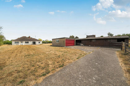
- Price
- Guide Price£700,000
- Size
- 1.3 acres
Nursery Lane, Hookwood, Horley, Surrey, RH6, Charlwood, Surrey RH6 England
Added on 24/08/2026House with Land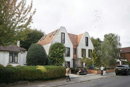
- Price
- Offers in Excess of£660,000
Northwood Avenue, Purley, CR8, Croydon South, Croydon CR8 England
Added on 07/07/2026Development Land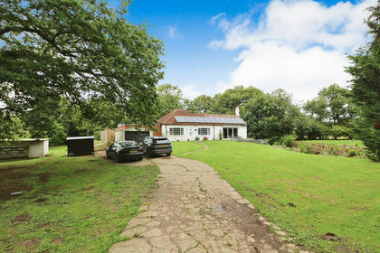
- Price
- £825,000
- Size
- 1.5 acres
Church Lane, Burstow, Horley, Surrey. RH6, Burstow, Surrey RH6 England
Added on 29/01/2026House with Land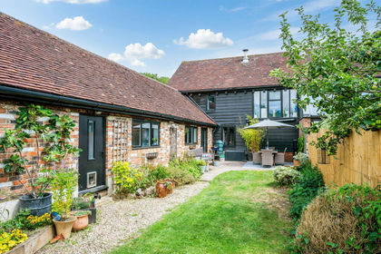
- Price
- Guide Price£783,950
Added on 08/08/2026Barn Conversion
- Price
- Offers in Excess of£850,000
Development Plot, Purley, Surrey CR8, Croydon South, Croydon CR8 England
Added on 29/01/2026Development Land
- Price
- Guide Price£825,000
Staplehurst Road, Carshalton Beeches, Carshalton and Wallington, Sutton SM5 England
Added on 21/03/2026Development Land