Sun Inn, Newton Reigny, Westmorland And Furness
Key Features
- Picturesque village of Newton Reigny
- Close to Lake District National Park
- Bar (45), Restaurant (50)
- 5 letting rooms
- Car Park & riverside beer garden
- Net sales YE 31 March 2025 - £709,329
- SELLER REF 2819
Description
Newton Reigny is a small village located in the county of Cumbria. It is situated on the banks of the River Petteril, surrounded by beautiful countryside, in an affluent village known for its picturesque scenery.
The area is popular with tourists who are attracted to its natural beauty. Other notable attractions include the village’s Grade II listed church which dates from the 12th century. The property lies on the Coast-to-Coast (C2C) cycle route.
Newton Reigny is located three miles northwest of Penrith and is served by junction 41 of the M6 motorway. The B5305 to the north of the village provides access to Carlisle and the A66 to the south provides connections to the Lake District National Park and West Cumbria.
The Sun Inn, which dates from the 17th century, was originally a coaching inn. It is a detached, brick-built property under a pitched slate roof. It offers spacious trade areas, five letting rooms, owners’ accommodation, a wood cabin which comprises a village shop and a hairdresser’s, and a riverside beer garden. The property briefly comprises:
Entrance leading to MAIN BAR AREA with sofa and loose seating for 45, a darts throw, an interconnecting brick fireplace with log burner and a well-equipped, wood constructed BAR SERVERY with Altro flooring and a back bar. This trade space has much character and charm and retains many of its original features including exposed brickwork and beams. It provides customers with a cosy and welcoming environment. LADIES’, GENTLEMEN’S and DISABLED ACCESS/BABY CHANGING TOILETS. Behind the bar is the MANAGER’S OFFICE, a STOREROOM, a UTILITY ROOM and an on-level CELLAR with external access.
RESTAURANT AREA with 50 covers, a BAR SERVERY and access to the beer garden. Good sized TRADE KITCHEN with Altro nonslip flooring, a wash area and multiple prep areas. The kitchen is fully equipped with kitchen appliances and effects. Separate pot wash room and walk-in fridge.
Owners’ Accommodation
KITCHEN, LOUNGE, MASTER BEDROOM, DOUBLE BEDROOM and BATHROOM.
FIRST FLOOR
External access to both the owners’ accommodation and the letting accommodation.
Letting Accommodation
FIRST FLOOR
LETTING ROOM 1 ‘Yan’, a double with en suite.
LETTING ROOM 2 ‘Tyan’, a deluxe double with en suite.
LETTING ROOM 3 ‘Tethera’, a deluxe double with en suite.
LETTING ROOM 4 ‘Methera’, a bunk room which sleeps six.
LETTING ROOM 5 ‘Pip’, a double with en suite.
Two SHOWER ROOMS/WCs which serve letting room 4.
External
BEER GARDEN to the rear (adjacent to the River Ythan) with lawn and decking areas and seating for 60+. Seating to the front of the public house for 20. CAR PARK for 24 vehicles.
WOOD CABIN to the car park area; the left-hand side of which is currently used as a hairdressing salon whilst the right-hand side houses the village shop.
There is also a mobile FOOD CATERING VAN which is not included in the sale but can be made available by separate negotiation.
The Sun Inn is a traditional village free house offering a locally sourced food menu, real ales and letting accommodation. The public house is popular with the local community and residents of the surrounding villages and supports numerous darts teams. It also hosts quiz nights and bingo. The cabin provides the local community with a village shop and a hairdresser’s.
Being close to the Lake District National Park, the public house is very popular with tourists in the spring and summer months. It is also on the Coast-to-Coast (C2C) cycle route which runs from Whitehaven (Cumbria) in the west to Tyneside in the east.
Our clients now wish to offer the property for sale and retire. The Sun Inn would provide an excellent opportunity for an experienced operator to build upon the success of a multifaceted business. Net sales for the year ended 31 March 2025 were £709,329, with good levels of profit. Full trading information can be made available upon request. Website
FREEHOLD £650,000 to include goodwill, fixtures and fittings. Stock at valuation in addition.
VAT will apply on the sale of this property and will be levied on 90% of the sale price of the freehold at the standard rate. Purchasers may wish to satisfy themselves with independent, professional advice that this VAT may be reclaimed.
Note: the cabin businesses are run by the pub’s operators. No lease is in place and the cabin will come with vacant possession upon completion.
No direct approach to be made to the business; please direct all communications through Sidney Phillips. Viewing strictly by appointment only.
A Premises Licence is held for the retail of alcohol.
Mains water, electricity and drainage are connected. LPG gas for kitchen and heating.
Rateable Value: £41,300 from 1st April 2026.
Local Authority: Westmoreland & Furness Council, .
Map Location
Property details
- Tenure
- Freehold
- Council Tax Band
- Ask Agent
- Date Posted
- 2026-07-17
Utilities & Restrictions
Utilities
- Electricity
- Ask Agent
- Water
- Ask Agent
- Heating
- Ask Agent
- Broadband
- Ask Agent
- Sewerage
- Ask Agent
Rights & Restrictions
- Public Rights of Way
- Ask Agent
- Private Rights of Way
- Ask Agent
- Listed Property
- Ask Agent
- Restrictions
- Ask Agent
Listed status, conservation areas and planning constraints for this location are in the full report.
Property Features
- Accessibility
- Ask Agent
- Parking
- Ask Agent
- Garden
- Ask Agent
Beyond the particulars: planning activity, flood history, heritage and ground risks, checked for this exact spot.
Connectivity
Broadband
Fastest speed available at this postcode
10 Gbps
Gigabit full fibre · available to 79% of premises
Suitable for
- 4K streaming on every screen
- Full-time home working
- Online gaming & big downloads
Fixed wireless access may also be an option here.
Mobile signal
Outdoor predictions; indoor signal depends on building materials.
Ofcom Connected Nations postcode-level predictions. Speeds and signal are modelled, not measured, and vary between addresses and providers.
Signal is the easy part. Planning activity, flood history and protected designations here are in the full report.
Nearest Schools
Primary
- St Catherine's Catholic Primary School, Penrith2.3 milesOfsted: Good
- Ages
- 4 to 11
- Pupils
- 104
- Type
- Academy converter
- Faith
- Roman Catholic
- Stainton CofE Primary School2.3 milesNo Ofsted rating
- Ages
- 3 to 11
- Pupils
- 112
- Type
- Voluntary aided school
- Faith
- Church of England
- Brunswick School2.4 milesNo Ofsted rating
- Ages
- 3 to 7
- Pupils
- 140
- Type
- Community school
- Greystoke Primary School2.5 milesOfsted report card · Apr 2026
- Ages
- 3 to 11
- Pupils
- 51
- Type
- Community school
- Beaconside CofE Primary School2.8 milesNo Ofsted rating
- Ages
- 3 to 11
- Pupils
- 445
- Type
- Voluntary aided school
- Faith
- Church of England
Secondary
- Queen Elizabeth Grammar School Penrith2.5 milesOfsted: Good
- Ages
- 11 to 18
- Pupils
- 1,026
- Type
- Academy converter
- Ullswater Community College2.8 milesOfsted: Good
- Ages
- 11 to 18
- Pupils
- 1,520
- Type
- Foundation school
- Caldew School13 milesOfsted: Good
- Ages
- 11 to 18
- Pupils
- 990
- Type
- Academy converter
- Appleby Grammar School14 milesOfsted report card · May 2026
- Ages
- 11 to 18
- Pupils
- 357
- Type
- Academy converter
- Keswick School14 milesOfsted: Outstanding
- Ages
- 11 to 18
- Pupils
- 1,208
- Type
- Academy converter
Distances are straight-line from the advertised location. Source: the national school registers (DfE, Welsh Government, Scottish Government) and Ofsted.
Schools are just the start: sold prices nearby, planning activity and any flood history are in the full report.
Amenities
Supermarket
GP surgery
Pharmacy
Hospital
Straight-line distances from the advertised location. Sources: NHS records, Geolytix supermarket locations, OS Open Greenspace and the national trails registers.
The area stacks up? Now check the location itself: planning nearby, protected designations and past flooding.
Getting Around
Nearest station
Nearest bus stop
Typical drive times
Straight-line distances from the advertised location; drive times are typical free-flow times over OpenStreetMap road data, so allow more at peak. Public transport locations from DfT NaPTAN.
Easy to reach matters. So do planning activity, flood history and ground risks: all in the full report.
Flood Risk
From Environment Agency flood map open data, checked around the advertised map pin and allowing for the listed acreage where known. This summary comes from LandSale, the advertising platform, not from the listing agent, and is not part of the agent's particulars. Risk can vary across a single holding, so verify anything critical through your own searches before committing.
Rivers and the sea
Surface water
The detail behind these bandings
The full report pinpoints where this location sits on the flood maps, and runs the deeper checks that usually only surface after an offer.
- Exact flood zones & annual chances (included in the full report)
- Any recorded past flooding (included in the full report)
- Planning activity nearby (included in the full report)
- Heritage & conservation (included in the full report)
- Protected nature designations (included in the full report)
- Ground risks (included in the full report)
- Sold prices nearby (included in the full report)
£14.99 · one-off purchase
By LandSale, the platform. Not provided by the listing agent. Ready in about a minute.
Important notice: Information, maps and tags on this page are drawn from the advertising agent's marketing materials or generated automatically. LandSale has not verified them. Relying on these details is at your own risk, always carry out independent checks before committing to a purchase.
LandSale full disclaimer
Marketing information only - not formal particulars. The details on this website are provided for general guidance and do not constitute an offer or contract. Neither LandSale nor the advertising estate/land agent accepts responsibility for any inaccuracy.
1. Source of information
- Listing content: Core description, asking price, tenure, measurements, photographs and planning history originate from the marketing materials of the advertising estate or land agent. LandSale does not author this content and cannot guarantee its accuracy.
- Automated tags & categorisation: Property type, land-use class, acreage bands and similar labels may be applied by machine-learning models. They are intended as a helpful guide only and may not reflect the property's legal status or permitted use.
- Third-party & enriched data layers: Maps, boundary outlines, planning designations, soil reports, broadband coverage and other environmental or location-based insights are licensed from external suppliers. Such data are supplied “as is", may be incomplete or out of date and are subject to change without notice.
2. Verification required
Prospective purchasers must verify critical matters, including but not limited to planning permission, title boundaries, public rights of way, environmental constraints, acreage, services, access and VAT status, through their own inspections, specialist surveys, legal advisers and the selling agent before relying on the information or entering into any contract.
3. No warranty or liability
LandSale gives no warranty, express or implied, as to the accuracy, completeness or fitness for any particular purpose of the information displayed. LandSale shall not be liable for any loss, damage, cost or expense arising directly or indirectly from any use of or reliance on such information, save where liability may not be excluded by law.
4. Updates & feedback
If you believe any detail on this listing is inaccurate, please let us know. We will investigate and, where appropriate, update the listing or notify the agent.
© LandSale | Version 1.3 - August 2026
Listing agent
Sidney Phillips Limited, Northern
Northern
Similar properties for sale
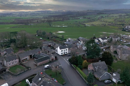
- Price
- Offers in Region of£750,000
The Dog & Gun Inn, Skelton, Cumbria, Skelton, Westmorland and Furness CA11 England
Added on 30/01/2026Pub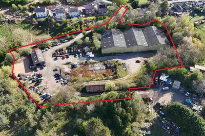
- Price
- Guide Price£500,000
- Size
- 3.23 acres
The Old Tile Works, Culgaith, Penrith, Cumbria CA10, Culgaith, Westmorland and Furness CA10 England
Added on 17/07/2026Commercial Land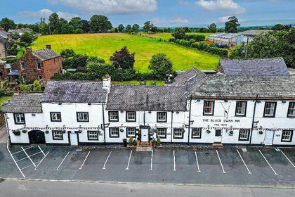
- Price
- £550,000
Black Swan, Culgaith, Penrith, Cumbria, CA10, Culgaith, Westmorland and Furness CA10 England
Added on 29/01/2026Commercial Land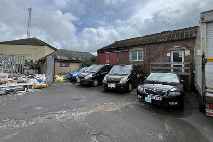
- Price
- £600,000
- Size
- 0.34 acres
Added on 17/07/2026Industrial Land Added on 14/07/2026Pub
- Price
- Offers Invited
Added on 29/01/2026Pub
- Price
- Offers in Excess of£650,000
The Ancient Unicorn, Bowes, Barnard Castle, DL12, Bowes, County Durham DL12 England
Added on 17/07/2026Commercial Land