The Old Tile Works, Culgaith, Penrith, Cumbria CA10
- Land size
- 3.23 acres
Key Features
- commercial
- light industrial
- set in 3.23 acres
Description
Commercial Land and Buildings For Sale
The Old Tile Works, Culgaith, Penrith, Cumbria CA10 1QE
• Commercial site extending to 1.34 hectares (3.23 acres) overall in close proximity to the a66
• Substantial warehouse extending to 2,084 m2 (22,436 sq ft)
• Workshop measuring 194.33 m2 (2,092 sq ft)
• Part income generating offering commercial and storage opportunities or alternative uses, subject to consents
• Guide price £500,000 exclusive
LOCATION
The site is located in the village of Culgaith, within the Eden Valley in the Westmorland and Furness district of Cumbria, in the North West of England.
Culgaith is a desirable village which according to the 2021 Census, has a population of 857 and benefits from a range of local amenities including a primary school and public house.
The B6412 road links Culgaith to the A66 to the south and the village of Langwathby to the north west and benefits from good connectivity to the A66, providing access to Junction 40 of the M6 motorway approximately 8 miles away at Penrith, and to the A1 at Scotch Corner to the east
The subject site is located to the south western edge of the village, close to the River Eden, in an areas of mixed commercial, agricultural and emerging residential uses.
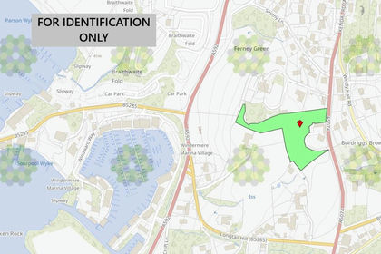
The attached location plan shows the position of the land and property (for identification purposes only).
DESCRIPTION
Site
The site, formerly a tile works, has been in continuous ownership by the same family since the 1970s and has historically been used for a range of industrial purposes, including haulage operations, storage, and workshop use.
The total site area extends to approximately 1.34 hectares (3.23 acres). It comprises a substantial warehouse facility located in the south-east portion of the site, along with a detached workshop unit situated to the north-west as follows:
Warehouse
The warehouse is of steel portal frame construction, arranged over three bays beneath a multi-pitched, double-skin fibre cement roof incorporating translucent roof lights. The elevations are clad in profile single-skin sheeting, with a concrete floor throughout. We are advised this building was recently let for £35,000 per annum.
It has a maximum height of 8.00 metres and a minimum eaves height of 5.67 metres. Access is provided via two large doors to the front elevation, measuring 9.18m (w) x 5.67m (h) and 3.67m (w) x 3.86m (h).
Workshop
The workshop comprises a steel portal frame with rendered blockwork infill walls beneath a pitched fibre cement roof. A single-storey lean-to provides ancillary accommodation, albeit in a dilapidated condition.
Currently occupied by a garage user, the unit includes an inspection pit at ground level and a fixed rear mezzanine used for office and breakout space. The eaves height is 5.71 metres, with an access door measuring 7.10m (w) x 4.12m (h).
In addition to the buildings, the site includes extensive areas of cleared and undeveloped land, as well as a dilapidated building. Parts of the site are currently utilised by the tenant occupying the workshop unit for vehicle parking.
We understand there are established rights of access over the site from the highway along the northern boundary and also providing access to a compound in separate ownership to the southern boundary.
ACCOMMODATION
The property provides the following approximate Gross Internal Areas:
Warehouse 2,084 m2 (22,436 sq ft)
Workshop 194.33 m2 (2,092 sq ft)
Site Area 3.23 acres (1.34 ha)
SERVICES
It is understood that mains electricity and water are supplied to the site, with the yard having a stop tap. We are advised that the Workshop is connected to a private drainage system.
It is the responsibility of the purchaser to determine the exact position of existing services and to arrange for any connections of these to the subject site in consultation with the relevant services providers.
RATEABLE VALUES
The Warehouse has a Rateable Value of £48,750 and is described as warehouse and premises.
The Workshop has a Rateable Value of £5,500 and is described as workshop and premises.
CURRENT LEASE
The workshop is occupied by Daniel Cunningham Ltd T/A Autolusso at a passing rent of £5,200 per annum exclusive. The original lease was granted for a term of 3 years from 22 October 2014 on effective Full Repairing and Insuring Terms being contracted out of the provision of Section 24-28 of the Landlord and Tenant Act 1954.
The property is defined under the lease to comprise the garage/workshop extending to 1,730 sq ft being part of the Landlords Estate, with the right to pass on foot and with vehicles at all times across the access road leading into the Estate from the highway.
In addition to the area demised under the lease, the tenant currently occupies further areas of land for car parking and storage.
A copy of the lease is available to bona fide enquirers upon request.
PLANNING
The land and property are undesignated in the adopted Local Plan. a new emerging Local Plan is being developed.
The existing commercial uses are understood to be long established and benefit from the appropriate consents.
Parties should make their own enquiries with Westmorland and Furness Council on .
Given the sites proximity to the River Eden, the Environment Agency records indicate that the subject land and property falls within both Flood Zone 2 and Flood Zone 3. The Client has confirmed that the site has been affected by flooding in the past.
PROPOSAL
The property comprises a substantial range of commercial land and buildings, partly income generating, and offers a variety of opportunities for both owner occupiers and investors.
The site is strategically located, benefiting from strong logistics connectivity with excellent access to the A66 and Junction 40 of the M6.
There is potential for further development the site, subject to the necessary planning consents.
The Unconditional offers are being sought for the freehold (Title Number: CU305781) subject to the current lease off a Guide Price of £500,000 exclusive.
As the property is being sold for existing commercial use, the sale will be subject to a clawback provision, to be incorporated within the contract, securing a share of any uplift in value arising from a more valuable alternative use for the seller.
ENERGY PERFORMANCE CERTIFICATE
EPCs are available upon request.
MONEY LAUNDERING LEGISLATION
Edwin Thompson is required to comply with Anti-Money Laundering legislation. As part of this process, all prospective buyers must provide proof of identity, proof of address, and evidence of funds and, where required, information relating to the source of funds. This information will be requested during the transaction process and must be supplied before a sale can proceed.
EASEMENTS, WAYLEAVES AND RIGHTS OF WAY
The land and property are sold subject to and with the benefit of all rights of way, rights of light, drainage, cables, pylons and other easements, restrictions or obligations, whether public or private, and whether or not specifically referred to in these particulars.
VAT
All figures quoted are exclusive of VAT where applicable.
LEGAL COSTS
Each party to bear their own legal costs in the preperation and settlement of the sale documentation together with any VAT thereon.
VIEWING
The property is available to view by prior appointment with the Carlisle Office of Edwin Thompson LLP. Contact:
Hugh Hodgson – h.
Ruth Richardson – r.
Joe Ellis – j.
Tel:
what3words: ///surnames.records.geology
IMPORTANT NOTICE
Edwin Thompson for themselves and for the Vendor of this property, whose Agents they are, give notice that:
1. The particulars are set out as a general outline only for the guidance of intending purchasers and do not constitute, nor constitute part of, any offer or contract.
2. All descriptions, dimensions, plans, reference to condition and necessary conditions for use and occupation and other details are given in good faith and are believed to be correct, but any intending purchasers should not rely on them as statements or representations of fact but must satisfy themselves by inspection or otherwise as to their correctness.
3. No person in the employment of Edwin Thompson has any authority to make or give any representation or warranty whatsoever in relation to this property or these particulars, nor to enter into any contract relating to the property on behalf of the Agents, nor into any contract on behalf of the Vendor.
4. No responsibility can be accepted for loss or expense incurred in viewing the property or in any other way in the event of the property being sold or withdrawn.
5. These particulars were prepared in April 2026
Map Location
Property details
- Tenure
- Ask Agent
- Council Tax Band
- Ask Agent
- Date Posted
- 2026-07-17
Utilities & Restrictions
Utilities
- Electricity
- Ask Agent
- Water
- Ask Agent
- Heating
- Ask Agent
- Broadband
- Ask Agent
- Sewerage
- Ask Agent
Rights & Restrictions
- Public Rights of Way
- Ask Agent
- Private Rights of Way
- Ask Agent
- Listed Property
- Ask Agent
- Restrictions
- Ask Agent
Listed status, conservation areas and planning constraints for this location are in the full report.
Property Features
- Accessibility
- Ask Agent
- Parking
- Ask Agent
- Garden
- Ask Agent
Beyond the particulars: planning activity, flood history, heritage and ground risks, checked for this exact spot.
Connectivity
Broadband
Fastest speed available at this postcode
950 Mbps
Gigabit full fibre
Suitable for
- 4K streaming on every screen
- Full-time home working
- Online gaming & big downloads
Mobile signal
Predicted 4G and 5G signal; indoor signal depends on building materials.
Ofcom Connected Nations postcode-level predictions. Speeds and signal are modelled, not measured, and vary between addresses and providers.
Signal is the easy part. Planning activity, flood history and protected designations here are in the full report.
Nearest Schools
Primary
- Culgaith CofE School0.7 milesOfsted: Good
- Ages
- 2 to 11
- Pupils
- 56
- Type
- Voluntary aided school
- Faith
- Church of England
- Temple Sowerby CofE Primary School1.5 milesNo Ofsted rating
- Ages
- 3 to 11
- Pupils
- 49
- Type
- Voluntary controlled school
- Faith
- Church of England
- Kirkby Thore School2.8 milesOfsted: Inadequate
- Ages
- 3 to 11
- Pupils
- 33
- Type
- Academy sponsor led
- Milburn School3.2 milesNo Ofsted rating
- Ages
- 3 to 11
- Pupils
- 19
- Type
- Community school
- Langwathby CofE Primary School3.8 milesNo Ofsted rating
- Ages
- 3 to 11
- Pupils
- 169
- Type
- Voluntary controlled school
- Faith
- Church of England
Secondary
- Ullswater Community College5.4 milesOfsted: Good
- Ages
- 11 to 18
- Pupils
- 1,520
- Type
- Foundation school
- Queen Elizabeth Grammar School Penrith5.8 milesOfsted: Good
- Ages
- 11 to 18
- Pupils
- 1,026
- Type
- Academy converter
- Appleby Grammar School7 milesOfsted report card · May 2026
- Ages
- 11 to 18
- Pupils
- 357
- Type
- Academy converter
- Samuel King's School13 milesNo Ofsted rating
- Ages
- 11 to 16
- Pupils
- 113
- Type
- Foundation school
- Kirkby Stephen Grammar School16 milesOfsted: Good
- Ages
- 11 to 18
- Pupils
- 377
- Type
- Academy converter
Distances are straight-line from the advertised location. Source: the national school registers (DfE, Welsh Government, Scottish Government) and Ofsted.
Schools are just the start: sold prices nearby, planning activity and any flood history are in the full report.
Amenities
Supermarket
GP surgery
Pharmacy
Hospital
Green space
Straight-line distances from the advertised location. Sources: NHS records, Geolytix supermarket locations, OS Open Greenspace and the national trails registers.
The area stacks up? Now check the location itself: planning nearby, protected designations and past flooding.
Getting Around
Nearest station
Nearest bus stop
Typical drive times
Straight-line distances from the advertised location; drive times are typical free-flow times over OpenStreetMap road data, so allow more at peak. Public transport locations from DfT NaPTAN.
Easy to reach matters. So do planning activity, flood history and ground risks: all in the full report.
Flood Risk
Environment Agency open data, checked around the advertised map pin for the listed acreage. Long-term risk counts flood defences; the planning map's flood zones do not. Provided by LandSale, not the listing agent, and not part of the agent's particulars. Risk varies across a holding, so verify before committing.
Rivers and the sea
Planning map: Flood Zone 1.
Surface water
Not at the pin: mapped about 60 metres away.
These bandings are the summary. Where this location sits on the flood maps, plus planning activity, heritage and ground risks, is in the full report.
Important notice: Information, maps and tags on this page are drawn from the advertising agent's marketing materials or generated automatically. LandSale has not verified them. Relying on these details is at your own risk, always carry out independent checks before committing to a purchase.
LandSale full disclaimer
Marketing information only - not formal particulars. The details on this website are provided for general guidance and do not constitute an offer or contract. Neither LandSale nor the advertising estate/land agent accepts responsibility for any inaccuracy.
1. Source of information
- Listing content: Core description, asking price, tenure, measurements, photographs and planning history originate from the marketing materials of the advertising estate or land agent. LandSale does not author this content and cannot guarantee its accuracy.
- Automated tags & categorisation: Property type, land-use class, acreage bands and similar labels may be applied by machine-learning models. They are intended as a helpful guide only and may not reflect the property's legal status or permitted use.
- Third-party & enriched data layers: Maps, boundary outlines, planning designations, soil reports, broadband coverage and other environmental or location-based insights are licensed from external suppliers. Such data are supplied “as is", may be incomplete or out of date and are subject to change without notice.
2. Verification required
Prospective purchasers must verify critical matters, including but not limited to planning permission, title boundaries, public rights of way, environmental constraints, acreage, services, access and VAT status, through their own inspections, specialist surveys, legal advisers and the selling agent before relying on the information or entering into any contract.
3. No warranty or liability
LandSale gives no warranty, express or implied, as to the accuracy, completeness or fitness for any particular purpose of the information displayed. LandSale shall not be liable for any loss, damage, cost or expense arising directly or indirectly from any use of or reliance on such information, save where liability may not be excluded by law.
4. Updates & feedback
If you believe any detail on this listing is inaccurate, please let us know. We will investigate and, where appropriate, update the listing or notify the agent.
© LandSale | Version 1.3 - August 2026
Listing agent
EDWIN THOMPSON PROPERTY SERVICES LIMITED, Carlisle
Contact EDWIN THOMPSON PROPERTY SERVICES LIMITED, Carlisle
View agent profileSimilar properties for sale
- Price
- Guide Price£455,000
- Size
- 2.4 acres
Added on 17/09/2026Development Land
- Price
- Offers in Excess of£650,000
The Ancient Unicorn, Bowes, Barnard Castle, DL12, Bowes, County Durham DL12 England
Added on 17/07/2026Commercial Land Added on 14/07/2026Pub
- Price
- Offers in Region of£700,000
- Size
- 1.2 acres
Added on 01/10/2026Warehouse
- Price
- Offers in Region of£450,000
Penny Bridge, Ulverston, Egton with Newland, Westmorland and Furness LA12 England
Added on 29/01/2026Pub
- Price
- Guide Price£325,000
- Size
- 1.26 acres
Milton Street, Crook, Durham, DL15, Bishop Auckland, County Durham DL15 England
Added on 29/01/2026Development Land Added on 24/09/2026Pub
- Price
- Offers in Excess of£349,950
Added on 17/07/2026Pub
- Price
- Guide Price£650,000
Greencroft Industrial Park, County Durham, DH9, Stanley, County Durham DH9 England
Added on 29/01/2026Development Land
- Price
- Guide Price£400,000
- Size
- 1.04 acres
Former Processing Unit, Langholm, DG13, Langholm, Dumfries and Galloway DG13 Scotland
Added on 29/01/2026Development Land