Desborough Road, Stoke Albany
- Bedrooms
- 4
- Bathrooms
- 3
Key Features
- Superb Barn Conversion
- 2,163sq ft of Accommodation
- 'A' Rated EPC
- Independent Annex if required
- Stunning Eve Height Sitting Room
- Three or Four Bedrooms
- Three Bathrooms
- Kitchen/Dining Room
- Office/Snug
- Garaging & Driveway Parking
Description
Superb barn conversion, over 2,150 sq ft, with independent annex which could be included into main house if required. Immaculately presented, 'A' Rated EPC, south west facing garden. Super easy access to the road and rail networks.
SITUATION
The village of Stoke Albany is located very close to the borders of Northamptonshire and Leicestershire; surrounded by rolling countryside the village has a pub, village hall and church, whilst the next villages have village shop/Post Office (Wilbarston) and farm shop (Ashley). Nearby are East Carlton Countryside Park, Dingley Point to Point Races, Eyebrook and Rutland Water, numerous golf courses, etc.
SCHOOLS
There is a wide selection of state and independent schooling in the area including the local Wilbarston Primary School & Bringhurst Primary School. Secondary schooling is available locally at Market Harborough, Uppingham or Corby, whilst notable private secondary schooling options are available at Uppingham, Oakham, Oundle and Stamford Schools.
TRANSPORT
Market Harborough (London St Pancras from 55 minutes) & Corby train stations are easily accessed making the area an excellent location for those wishing to travel regularly to London for leisure or work purposes. Northampton, Kettering, Leicester are easily accessible via the vast midlands road network.
GROUND FLOOR
With exposed beams, brick walls, wooden doors and floors the flexible accommodation is immaculately presented, and comprises of entrance hall opening to the boot room, and to the large inner hall with staircase and double-glazed door to the stunning sitting room. This room has a wonderful brick-built fireplace housing a log burning stove, is open into the eves, with highly attractive exposed beams. Beyond the sitting room is a useful office from which a door could be put through to allow access from the main house to the annex. Off from the hallway in the other direction is the generous sized living/dining kitchen, a cloaks cupboard, the utility room and a cloakroom with wc. A fabulous family home.
FIRST FLOOR
A beautiful wooden staircase leads for the large hallway to the first-floor galleried landing. Off which three double bedrooms, the Master with ensuite shower room and the family bathroom.
ANNEX
This useful independent annex comprises a double bedroom, shower room and living/dining kitchen. This can easily be opened into the main house via the office and has previously been used to provide rental income.
OUTSIDE
The enclosed gravelled driveway provides parking for a number of cars. The garage can be accessed via double doors from the street and also through a pedestrian door from the driveway. The garden is wonderfully sunny being south and west facing, is mainly lawned with matures shrubs, attractive stone walling and a newly planted hedge to the far boundary. There is an attractive bricked seating area from which to enjoy the sun, a useful wooden summerhouse and log store.
SERVICES
'A' Rated EPC.
Solar Panels. 11kw battery
Electric car charger.
Gas fired central heating. Underfloor heating throughout
Wired ethernet connections every room.
All mains services are connected.
COUNCIL TAX
Band B
TENURE
Freehold
EPC
Rated A
VIEWINGS
Viewing by prior appointment with the Agents - McCALLUM MARSH on or
IMPORTANT NOTICES
Whilst every care has been taken in the preparation of these particulars, all parties should note: i The description and photographs are for guidance only and are not a complete representation of the property. ii Plans are not to scale; are for guidance only and do not form part of the contract. iii Services and any appliances referred to have not been tested and cannot be verified as being in working order. iv No survey of any part of the property has been carried out by the Vendor or McCallum Marsh. v Measurements are approximate and must not be relied upon. Maximum appropriate room sizes are generally given to the nearest 0.1 metres. Outbuildings are measured externally (unless otherwise stated) to the nearest 0.5 metres; an approximate Imperial equivalent is also given. vi Only those items referred to in the text of these particulars are included. vii Nothing in these particulars or any related discussions forms part of any contract unless expressly incorporated within a...
Map Location
Property details
- Tenure
- Freehold
- Council Tax Band
- B
- Date Posted
- 2026-07-14
Utilities & Restrictions
Utilities
- Electricity
- Ask Agent
- Water
- Ask Agent
- Heating
- Ask Agent
- Broadband
- Ask Agent
- Sewerage
- Ask Agent
Rights & Restrictions
- Public Rights of Way
- Ask Agent
- Private Rights of Way
- Ask Agent
- Listed Property
- Ask Agent
- Restrictions
- Ask Agent
Listed status, conservation areas and planning constraints for this location are in the full report.
Property Features
- Accessibility
- Ask Agent
- Parking
- Parking Available
- Garden
- Garden
Beyond the particulars: planning activity, flood history, heritage and ground risks, checked for this exact spot.
Connectivity
Broadband
Fastest speed available at this postcode
1.8 Gbps
Gigabit full fibre
Suitable for
- 4K streaming on every screen
- Full-time home working
- Online gaming & big downloads
Mobile signal
Outdoor predictions; indoor signal depends on building materials.
Ofcom Connected Nations postcode-level predictions. Speeds and signal are modelled, not measured, and vary between addresses and providers.
Signal is the easy part. Planning activity, flood history and protected designations here are in the full report.
Nearest Schools
Primary
- Wilbarston Church of England Primary School764 metresOfsted: Good
- Ages
- 4 to 11
- Pupils
- 62
- Type
- Academy converter
- Faith
- Church of England
- Havelock Infant School2.6 milesNo Ofsted rating
- Ages
- 5 to 7
- Pupils
- 175
- Type
- Academy converter
- Havelock Junior School2.7 milesNo Ofsted rating
- Ages
- 7 to 11
- Pupils
- 306
- Type
- Academy converter
- Loatlands Primary School2.7 milesNo Ofsted rating
- Ages
- 3 to 11
- Pupils
- 446
- Type
- Academy converter
- Cottingham Church of England Primary School2.8 milesNo Ofsted rating
- Ages
- 4 to 11
- Pupils
- 146
- Type
- Academy converter
- Faith
- Church of England
Secondary
- Kingswood Secondary Academy3.4 milesNo Ofsted rating
- Ages
- 11 to 18
- Pupils
- 1,208
- Type
- Academy sponsor led
- Montsaye Academy3.9 milesOfsted: Inadequate
- Ages
- 11 to 18
- Pupils
- 1,017
- Type
- Academy converter
- Lodge Park Academy4.1 milesOfsted report card · Apr 2026
- Ages
- 11 to 18
- Pupils
- 703
- Type
- Academy sponsor led
- Brooke Weston Academy4.4 milesOfsted: Good
- Ages
- 11 to 18
- Pupils
- 1,154
- Type
- Academy sponsor led
- The Robert Smyth Academy4.7 milesNo Ofsted rating
- Ages
- 11 to 19
- Pupils
- 1,349
- Type
- Academy converter
Distances are straight-line from the advertised location. Source: the national school registers (DfE, Welsh Government, Scottish Government) and Ofsted.
Schools are just the start: sold prices nearby, planning activity and any flood history are in the full report.
Amenities
Supermarket
GP surgery
Pharmacy
Hospital
Green space
Straight-line distances from the advertised location. Sources: NHS records, Geolytix supermarket locations, OS Open Greenspace and the national trails registers.
The area stacks up? Now check the location itself: planning nearby, protected designations and past flooding.
Getting Around
Nearest station
Nearest bus stop
Typical drive times
Straight-line distances from the advertised location; drive times are typical free-flow times over OpenStreetMap road data, so allow more at peak. Public transport locations from DfT NaPTAN.
Easy to reach matters. So do planning activity, flood history and ground risks: all in the full report.
Flood Risk
From Environment Agency flood map open data, checked around the advertised map pin and allowing for the listed acreage where known. This summary comes from LandSale, the advertising platform, not from the listing agent, and is not part of the agent's particulars. Risk can vary across a single holding, so verify anything critical through your own searches before committing.
Rivers and the sea
Surface water
The detail behind these bandings
The full report pinpoints where this location sits on the flood maps, and runs the deeper checks that usually only surface after an offer.
- Exact flood zones & annual chances (included in the full report)
- Any recorded past flooding (included in the full report)
- Planning activity nearby (included in the full report)
- Heritage & conservation (included in the full report)
- Protected nature designations (included in the full report)
- Ground risks (included in the full report)
- Sold prices nearby (included in the full report)
£14.99 · one-off purchase
By LandSale, the platform. Not provided by the listing agent. Ready in about a minute.
Important notice: Information, maps and tags on this page are drawn from the advertising agent's marketing materials or generated automatically. LandSale has not verified them. Relying on these details is at your own risk, always carry out independent checks before committing to a purchase.
LandSale full disclaimer
Marketing information only - not formal particulars. The details on this website are provided for general guidance and do not constitute an offer or contract. Neither LandSale nor the advertising estate/land agent accepts responsibility for any inaccuracy.
1. Source of information
- Listing content: Core description, asking price, tenure, measurements, photographs and planning history originate from the marketing materials of the advertising estate or land agent. LandSale does not author this content and cannot guarantee its accuracy.
- Automated tags & categorisation: Property type, land-use class, acreage bands and similar labels may be applied by machine-learning models. They are intended as a helpful guide only and may not reflect the property's legal status or permitted use.
- Third-party & enriched data layers: Maps, boundary outlines, planning designations, soil reports, broadband coverage and other environmental or location-based insights are licensed from external suppliers. Such data are supplied “as is", may be incomplete or out of date and are subject to change without notice.
2. Verification required
Prospective purchasers must verify critical matters, including but not limited to planning permission, title boundaries, public rights of way, environmental constraints, acreage, services, access and VAT status, through their own inspections, specialist surveys, legal advisers and the selling agent before relying on the information or entering into any contract.
3. No warranty or liability
LandSale gives no warranty, express or implied, as to the accuracy, completeness or fitness for any particular purpose of the information displayed. LandSale shall not be liable for any loss, damage, cost or expense arising directly or indirectly from any use of or reliance on such information, save where liability may not be excluded by law.
4. Updates & feedback
If you believe any detail on this listing is inaccurate, please let us know. We will investigate and, where appropriate, update the listing or notify the agent.
© LandSale | Version 1.3 - August 2026
Listing agent
McCallum Marsh, Market Harborough
The Old Bank, 40 The Square, Market Harborough, Leicestershire, LE16 7PA
Contact McCallum Marsh, Market Harborough
The Old Bank, 40 The Square, Market Harborough, Leicestershire, LE16 7PA
View agent profileSimilar properties for sale
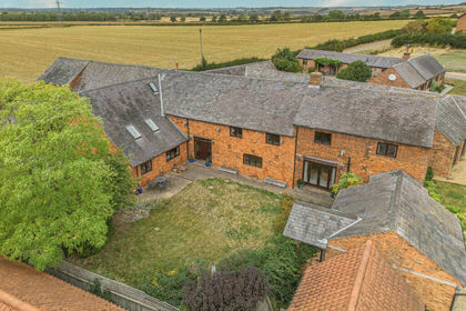
- Price
- Offers in Excess of£800,000
Added on 29/01/2026Barn Conversion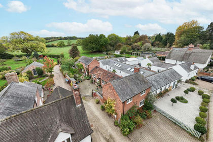
- Price
- Offers Over£800,000
Main Street, Great Bowden, Great Bowden, Leicestershire LE16 England
Added on 29/01/2026Barn Conversion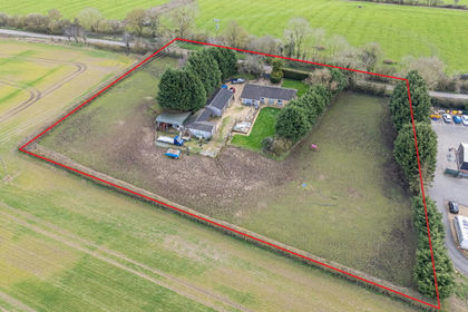
- Price
- £795,000
- Size
- 2 acres
Added on 20/07/2026Smallholding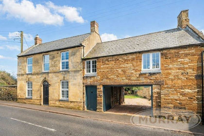
- Price
- Offers Over£775,000
- Size
- 1.1 acres
Main Street, Caldecott, Market Harborough, Caldecott, Rutland LE16 England
Added on 24/06/2026House with Land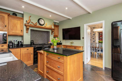 Added on 31/03/2026Barn Conversion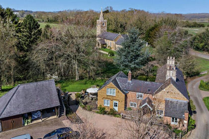
- Price
- Offers in Excess of£900,000
- Size
- 1 acres
Uppingham Road, East Norton, Leicester, East Norton, Leicestershire LE7 England
Added on 08/04/2026House with Land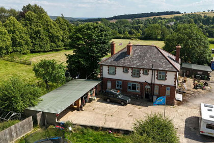
- Price
- £650,000
- Size
- 2.5 acres
Greenacres Farm, Belton In Rutland, Belton-in-Rutland, Rutland LE15 England
Added on 19/08/2026House with Land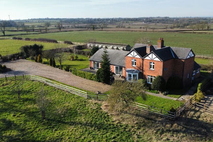
- Price
- Guide Price£875,000
- Size
- 1.7 acres
Laughton Lodge Farm, Laughton, Leicestershire, Laughton, Leicestershire LE17 England
Added on 22/04/2026Farmhouse
- Price
- £775,000
- Size
- 1.22 acres
Cranford Road, KETTERING, Barton Seagrave, North Northamptonshire NN15 England
Added on 29/01/2026Development Land
- Price
- Guide Price£550,000
- Size
- 1.5 acres
Weldon Road, Upper Benefield, Northamptonshire, PE8, Benefield, North Northamptonshire PE8 England
Added on 30/07/2026House with Land