
Mains of Paithnick, Crossroads, Keith, AB55
- Land size
- 147 acres
- Bedrooms
- 4
- Bathrooms
- 1
Key Features
- IACS registered Grade 3(2) agricultural land extending to 147 acres or thereby
- Range of modern and traditional buildings
- Spacious three/four bedroom farmhouse
- Situated in an area well known for livestock production and fertile farm land
- Accessible location a short distance from the town of Keith
Description
CLOSING DATE THURSDAY 13TH AUGUST AT 12 NOON
Local Information
Mains of Paithnick lies in a scenic rural yet accessible location around 3.5 miles northeast of Keith in the county of Moray. Keith has a good range of shops including supermarkets, together with business, banking and leisure facilities which include tennis courts, cricket and bowling clubs, a sports and community centre and swimming pool. Keith Golf Club has an 18-hole parkland golf course with other popular courses in the area including Buckpool at Buckie, Banff, Cullen, Maverstone and Lossiemouth.
The catchment for primary education is Keith Primary School, with secondary education at Keith Grammar School. Inverness and Aberdeen Airports are easily reached via the A96 and Inverness (60 miles) and Aberdeen (53 miles) provide all the facilities expected of major cities. There is a railway station in Keith on the Aberdeen to Inverness line, easing longer-distance travel by public transport.
The Keith Country Show held at Seafield park is a popular annual event attracting interest from the farming and wider community. Keith is also the start of the ever-popular Malt Whisky Trail.
Elgin, 21 miles in distance, provides a wide range of services and facilities as the principal Moray town. Moray is well served by agricultural merchants and grain merchants and there is a successful local machinery ring which can provide additional farming resources as required.
The Moray coast, about 10 miles to the north, is famed for its high levels of sunshine, beautiful beaches, dolphins, wonderful sailing, traditional fishing villages and towns, such as Cullen and Portsoy. To the southwest lie the Cairngorms, offering wonderful walking and mountaineering. There is skiing at The Lecht ski centre and at Cairngorm Mountain near Aviemore.
Mains of Paithnick is a productive mixed farm located in a quiet and peaceful setting yet benefitting from a very accessible position northeast of Keith. In recent years the farm has operated as a mixed livestock and arable unit. The predominant cropping has been grass for silage, hay and grazing together with spring barley.
Land
The IACS registered land at Mains of Paithnick extends to 147 acres (59 hectares) or thereby in total, consisting of 12 field parcels as per the plan attached. Classified by the James Hutton Institute as Grade 3(2), the land is presently in grass and arable cropping and is in good heart. Fields are stockproof fenced and supplied by water. The land ranges in altitude from 110m, where the land bounds the Burn of Paithnick to the east, to 150m above sea level at its highest point to the west, and has a gently undulating easterly aspect.
Farm Buildings
Mains of Paithnick is served by a range of useful traditional and more modern buildings providing livestock accommodation and general storage extending to 1645m2 or thereby in total. These include:
Traditional U-shaped steading
To the rear of the farmhouse with infill court
Cattle Court (20.9m x 6m)
Concrete block and timber frame construction
Dutch Barn (18.6m x 9.7m)
Timber frame construction
Lambing Shed (27.9m x 9.7m)
Steel portal frame construction
General Purpose Shed (18.8m x 9.4m)
Steel portal frame construction
Farmhouse
Mains of Paithnick farmhouse is a traditional stone and slate built farmhouse providing spacious and flexible accommodation over two floors. The east facing farmhouse enjoys lovely views over the well-tended garden and surrounding farmland.
Accommodation on the ground floor comprises kitchen/breakfast room, dining room, family room, lounge, conservatory and bedroom/study. On the first floor are three bedrooms and a bathroom.
The farmhouse is complimented by a generous, well-kept garden on its east side which is mainly laid to lawn, mature shrubs and trees, together with a gravel driveway. Adjoining the farmhouse on the north side is a useful outbuilding constructed of block walls and profile sheet roof.
Property Details
EPC:
Band G
Council Tax:
Band C
Windows & Doors:
Double glazed windows. uPVC doors.
Services:
Mains water and private drainage to septic tank. Mains electricity. Heating and hot water from oil Rayburn. Wood burning stove in family room.
Included in Sale:
All floor coverings, curtains, blinds and light fittings.
Basic Payment Scheme (BPS)
BPS Entitlements are not included in the asking price but are available for sale by negotiation.
The land is classified as BPS Region 1. All LFA Disadvantaged (D)
Access
From the B9018 public road, the property is accessed over a private tarred road.
Viewings
By appointment only. To arrange a viewing, contact Aberdeen & Northern Estates
Local Authority:
Moray Council Office, High Street, Elgin, Moray, IV30 1BX
Entry:
By arrangement
Sporting and Mineral Rights:
Included in the sale, insofar as they are owned.
Note:
Prospective purchasers should note that unless their interest in the property is formally intimated to the selling agents following inspection, the agents cannot guarantee that notice of a closing date for offers will be advised and consequently the property may be sold without notice.
Anti Money Laundering Compliance:
In accordance with The Money Laundering, Terrorist Financing and Transfer of Funds (Information on the Payer) Regulations 2017, we are required to carry out checks and due diligence on property purchasers. If an offer has been accepted, the purchaser(s) will need to provide proof of identity, residence and proof of funds, as a minimum, prior to any transaction proceeding.
Offers:
Formal offers, in the acceptable Scottish form should be submitted, along with the relevant anti-money laundering paperwork in accordance with The Money Laundering, Terrorist Financing and Transfer of Funds (Information on the Payer) Regulations 2017, through a Scottish Solicitor, to the Selling Agent.
Servitude Rights, Burdens and Wayleaves:
The property is sold subject to and with the benefit of all servitude rights, including rights of access and rights of way, whether public or private. The buyer(s) will be held to have satisfied himself/themselves as to the nature of all such servitude rights and others.
Title:
The buyer(s) shall be bound to accept the title as it presently stands in the name of the seller(s) and the conveyance in favour of the buyer(s) shall be subject to all the exceptions, reservations, burdens and conditions presently contained in the title deeds. There shall be excepted from warrandice in the conveyance in favour of the buyer(s) any leases, tenancies, tenants' rights, missives, agreements, rights of possession, rights of way, access rights, and sewerage and drainage facilities, and all other servitudes and other rights without prejudice to the right of the buyer(s) to quarrel or impugn the same on any ground not inferring warrandice against the seller(s).
Map Location
Property details
- Tenure
- Freehold
- Council Tax Band
- Ask Agent
- Date Posted
- 2026-07-10
Market Value Analysis
Compared with 29 Farms & Smallholdings listings in Scotland (100+ acres).
Utilities & Restrictions
Utilities
- Electricity
- Ask Agent
- Water
- Ask Agent
- Heating
- Ask Agent
- Broadband
- Ask Agent
- Sewerage
- Ask Agent
Rights & Restrictions
- Public Rights of Way
- Ask Agent
- Private Rights of Way
- Ask Agent
- Listed Property
- Ask Agent
- Restrictions
- Ask Agent
Listed status, conservation areas and planning constraints for this location are in the full report.
Property Features
- Accessibility
- Ask Agent
- Parking
- Parking Available
- Garden
- Garden
Beyond the particulars: planning activity, flood history, heritage and ground risks, checked for this exact spot.
Connectivity
Broadband
Fastest speed available at this postcode
1.8 Gbps
Gigabit full fibre · available to 75% of premises
Suitable for
- 4K streaming on every screen
- Full-time home working
- Online gaming & big downloads
Mobile signal
Predicted 4G and 5G signal; indoor signal depends on building materials.
Ofcom Connected Nations postcode-level predictions. Speeds and signal are modelled, not measured, and vary between addresses and providers.
Signal is the easy part. Planning activity, flood history and protected designations here are in the full report.
Nearest Schools
Primary
- Newmill Primary School2.5 miles
- Pupils
- 67
- Type
- Non-denominational
- Keith Primary School2.8 miles
- Pupils
- 325
- Type
- Non-denominational
- St Thomas RC Primary School3.2 miles
- Pupils
- 38
- Type
- Roman Catholic
- Cairney School5.1 miles
- Pupils
- 22
- Type
- Non-denominational
- Rothiemay Primary School5.4 miles
- Pupils
- 55
- Type
- Non-denominational
Secondary
- Keith Grammar School2.7 miles
- Pupils
- 370
- Type
- Non-denominational
- Buckie High School8.3 miles
- Pupils
- 826
- Type
- Non-denominational
- The Gordon Schools8.5 miles
- Pupils
- 665
- Type
- Non-denominational
- Milne's High School8.8 miles
- Pupils
- 477
- Type
- Non-denominational
- Speyside High School14 miles
- Pupils
- 395
- Type
- Non-denominational
Distances are straight-line from the advertised location. Source: the national school registers (DfE, Welsh Government, Scottish Government) and Ofsted.
Schools are just the start: planning activity, heritage and any flood history here are in the full report.
Amenities
Supermarket
GP surgery
Pharmacy
Straight-line distances from the advertised location. Sources: NHS records, Geolytix supermarket locations, OS Open Greenspace and the national trails registers.
The area stacks up? Now check the location itself: planning nearby, protected designations and past flooding.
Getting Around
Nearest station
Nearest bus stop
Typical drive times
Straight-line distances from the advertised location; drive times are typical free-flow times over OpenStreetMap road data, so allow more at peak. Public transport locations from DfT NaPTAN.
Easy to reach matters. So do planning activity, flood history and ground risks: all in the full report.
Flood Risk
SEPA open data, checked around the advertised map pin for the listed acreage. The map pin for this listing is approximate, so these readings describe the surrounding area. Provided by LandSale, not the listing agent, and not part of the agent's particulars. Risk varies across a holding, so verify before committing.
Rivers and the sea
Not at the pin: mapped about 340 metres away.
Surface water
Not at the pin: mapped about 50 metres away.
These bandings are the summary. Where this location sits on the flood maps, plus planning activity, heritage and ground risks, is in the full report.
Important notice: Information, maps and tags on this page are drawn from the advertising agent's marketing materials or generated automatically. LandSale has not verified them. Relying on these details is at your own risk, always carry out independent checks before committing to a purchase.
LandSale full disclaimer
Marketing information only - not formal particulars. The details on this website are provided for general guidance and do not constitute an offer or contract. Neither LandSale nor the advertising estate/land agent accepts responsibility for any inaccuracy.
1. Source of information
- Listing content: Core description, asking price, tenure, measurements, photographs and planning history originate from the marketing materials of the advertising estate or land agent. LandSale does not author this content and cannot guarantee its accuracy.
- Automated tags & categorisation: Property type, land-use class, acreage bands and similar labels may be applied by machine-learning models. They are intended as a helpful guide only and may not reflect the property's legal status or permitted use.
- Third-party & enriched data layers: Maps, boundary outlines, planning designations, soil reports, broadband coverage and other environmental or location-based insights are licensed from external suppliers. Such data are supplied “as is", may be incomplete or out of date and are subject to change without notice.
2. Verification required
Prospective purchasers must verify critical matters, including but not limited to planning permission, title boundaries, public rights of way, environmental constraints, acreage, services, access and VAT status, through their own inspections, specialist surveys, legal advisers and the selling agent before relying on the information or entering into any contract.
3. No warranty or liability
LandSale gives no warranty, express or implied, as to the accuracy, completeness or fitness for any particular purpose of the information displayed. LandSale shall not be liable for any loss, damage, cost or expense arising directly or indirectly from any use of or reliance on such information, save where liability may not be excluded by law.
4. Updates & feedback
If you believe any detail on this listing is inaccurate, please let us know. We will investigate and, where appropriate, update the listing or notify the agent.
© LandSale | Version 1.3 - August 2026
Listing agent
Aberdeen & Northern (Estates) Ltd, Inverurie
Thainstone Agricultural Centre, Inverurie, AB51 5XZ
View agent profileSimilar properties for sale
- Price
- Offers Over£595,000
- Size
- 7 acres
Added on 09/10/2026Kennels Property
- Price
- Offers in Excess of£665,000
- Size
- 28 acres
Drybridge MORAY COAST, Aberdeenshire North and Moray East, Moray AB56 Scotland
Added on 08/10/2026Equestrian property
- Price
- Offers Over£950,000
- Size
- 1.5 acres
Obliston, Fochabers, IV32, Moray West, Nairn and Strathspey, Moray IV32 Scotland
Added on 23/05/2026Country Home
- Price
- Offers in Excess of£650,000
- Size
- 2 acres
Meft Road, Elgin, Scotland, IV30, Moray West, Nairn and Strathspey, Moray IV30 Scotland
Added on 08/03/2026Historic House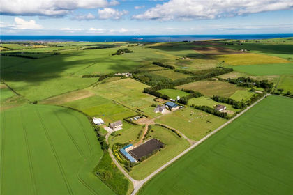
- Price
- Offers Over£585,000
- Size
- 12 acres
Added on 29/01/2026Equestrian property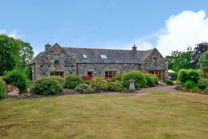
- Price
- Offers Over£585,000
- Size
- 1 acres
Arlo House, Oyne, Insch, AB52, Gordon and Buchan, Aberdeenshire AB52 Scotland
Added on 29/01/2026House with Land
- Price
- Offers Over£550,000
- Size
- 2 acres
Birk Lodge, Birkhills, AB53, Gordon and Buchan, Aberdeenshire AB53 Scotland
Added on 01/08/2026House with Land
- Price
- Offers in Region of£575,000
- Size
- 2 acres
Millbrex, Turriff, AB53, Gordon and Buchan, Aberdeenshire AB53 Scotland
Added on 29/01/2026House with Land
- Price
- Offers in Region of£625,000
- Size
- 3 acres
Briach Farmhouse, Rafford IV36, Moray West, Nairn and Strathspey, Moray IV36 Scotland
Added on 18/08/2026Smallholding
- Price
- Offers Over£595,000
- Size
- 4 acres
Kinloss, Upper Hempriggs, IV36, Moray West, Nairn and Strathspey, Moray IV36 Scotland
Added on 01/09/2026House with Land