Bleak Street, Pen Selwood, Wincanton, Somerset, BA9
- Land size
- 7.73 acres
- Bedrooms
- 4
Key Features
- Spacious 4 bedroom two storey barn conversion
- 2 bedroom annexe
- Stables and useful outbuildings
- Post and rail fence manege
- Beautiful private garden
- Well fenced paddocks
- Superb off road hacking
- Easily accessible, peaceful rural setting
- Available as a whole or in 2 lots
- In all about 7.73 acres
Description
Well located family home with annexe and equestrian facilities set in 7.73 acres
The Barn was bought by the current owners approximately 27 years ago and has since been well maintained and enjoyed by them as a family home.
The Barn comprises a Mid-19th Century stone barn which was sympathetically converted in 1993 to a charming two storey dwelling full of original features and well proportioned rooms many of which are dual aspect.
Approached from the road there is a large walled courtyard parking area in front of the house and annexe, the drive then continues up to the stables and outbuildings as well as the land.
The enclosed porch with double doors leads to the front door and into the central Dining Hall with oak floor. From the Dining Hall a door leads you through to the dual aspect Living Room and steps then lead up to the Kitchen. The spacious dual aspect Kitchen has an electric Aga and leads to the useful Utility Room with WC, with views to the stable yard.
At the other end of the house is a Study or fourth Bedroom with wood-burning stove and floor-to-ceiling bookcase along the end wall.
Stairs from the Dining Hall lead up to the first floor landing. The landing and the bedrooms all have exposed beams which add to the charm and character of the property On the first floor can be found; the Master Bedroom with en-suite Bathroom and extensive fitted wardrobes and linen cupboard, plus two further Bedrooms and a Family Bathroom.
There is a large established enclosed garden at the rear of the house, with a secluded paved seating area and colourful mature borders as well as a number of fruit trees. There is also a vegetable garden and a timber clad Garden Room which could be used for a number of different purposes.
THE ANNEXE
Adjacent to the house, is a charming two bedroom single storey stone annexe which has planning consent to be used as ancillary accommodation to the principal dwelling, under a Section 106 Agreement.
The entrance porch leads through to the spacious vaulted living area which has the necessary space to add a kitchen (subject to the necessary consents). There are two good sized Bedrooms and a Bathroom.
The annexe could be used as ancillary accommodation to the main house for multi-generation living purposes, guest accommodation or subject to planning to provide a useful source of income.
STABLING AND OUTBUILDINGS
The stable block has been well positioned so that it is not only visible from the house but also easily accessible by vehicles if required. The stable block comprises two loose boxes with a post and rail fenced concrete yard.
There is also a useful timber frame, concrete block building containing another two loose boxes and space used as a hay and bedding store.
Former bull pen now used as a secure tack room.
At the rear of the stable block is the post and rail fenced 20m x 40m sand school with a sand and plastic surface.
The land is free draining pasture land divided into manageable sized paddocks which are post and rail fenced with mature hedges and water troughs, ideal for grazing horses and sheep. The two larger paddocks are equipped with timber field shelters.
LOT 2 – 3.03 ACRES
Lot 2 comprises an attractive post and railed paddock of approximately 3.03 acres.
Council Tax Band – F
Oil fired central heating, mains water and electricity. Drainage is private. Wessex Ultrafast broadband. Solar panels (2.3kW system) installed in 2010 owned outright with 9 years remaining on the FiT.
From the A303 heading west, take the B3081 signposted to Bruton, Wincanton Racecourse and Pen Selwood. Take the first right which takes you under the A303. At the T-Junction turn right, then take the first left to Pen Selwood. Follow this road and take the first left which will take you to Pen Selwood. At the junction turn right along Field Lane and Bleak Street. The entrance to The Barn is on the right hand side next to the former red phone box now a defibrillator
POSTCODE
BA9 8LZ
WHAT3WORDS
///grower.ages.prouder
he Barn is located in the highly desirable and sought after village of Pen Selwood, bordering the counties of Somerset/Dorset/Wiltshire and located within the Cranborne Chase National Landscape (formerly AONB). The nearby towns of Wincanton (3.5 miles), Gillingham (5.5 miles) and Bruton (7.5 miles) provide most daily amenities; GP surgeries, dentists and opticians as well as a choice of supermarkets including Waitrose in Gillingham. The villages of Bourton and Zeals are a short drive away with a pub each (The White Lion and The Bell and Crown), post offices and a petrol station.
Communications by road are excellent, with the A303 (1 mile) linking to the M3, and the A350. Mainline railway stations are at Castle Cary, 20 minutes by car, providing services to London Paddington (1h 30m) and Gillingham, 15 minutes, to London Waterloo (2h).
The local countryside provides an extensive network of bridleways and footpaths, straight from the door with over eleven miles of footpaths and bridleways within the Parish of Pen Selwood alone. The riding from the property is second to none, with miles and miles of off-road riding with an extensive network of bridleways, across the neighbouring countryside and Stourhead West and Stavordale Estates.
Local attractions include the gardens at The Newt in Somerset, and Stourhead (National Trust). Dining options include Da Costa at Hauser and Wirth art gallery, At the Chapel in Bruton and the Michelin starred Osip at Hardway.
The area is well-known for its excellent choice of state and private Primary and Secondary schools.
Map Location
Property details
- Tenure
- Freehold
- Council Tax Band
- TBC
- Date Posted
- 2026-07-03
Market Value Analysis
Compared with 462 Homes with Land listings in South West England (5+ acres).
Energy Performance Certificate
Energy Efficiency Rating
Based on UK Energy Performance Certificate standards (EU Directive 2002/91/EC)
Running costs are one side. Planning activity, flood history and ground risks for this location are in the full report.
Utilities & Restrictions
Utilities
- Electricity
- Ask Agent
- Water
- Ask Agent
- Heating
- Ask Agent
- Broadband
- Ask Agent
- Sewerage
- Ask Agent
Rights & Restrictions
- Public Rights of Way
- Ask Agent
- Private Rights of Way
- Ask Agent
- Listed Property
- Ask Agent
- Restrictions
- Ask Agent
Listed status, conservation areas and planning constraints for this location are in the full report.
Property Features
- Accessibility
- Ask Agent
- Parking
- Parking Available
- Garden
- Garden
Beyond the particulars: planning activity, flood history, heritage and ground risks, checked for this exact spot.
Connectivity
Broadband
Fastest speed available at this postcode
1 Gbps
Gigabit full fibre
Suitable for
- 4K streaming on every screen
- Full-time home working
- Online gaming & big downloads
Mobile signal
Predicted 4G and 5G signal; indoor signal depends on building materials.
Ofcom Connected Nations postcode-level predictions. Speeds and signal are modelled, not measured, and vary between addresses and providers.
Signal is the easy part. Planning activity, flood history and protected designations here are in the full report.
Nearest Schools
Primary
- St George's Church of England School, Bourton0.7 milesOfsted: Good *
- Ages
- 2 to 11
- Pupils
- 142
- Type
- Academy converter
- Faith
- Church of England
- Whitesheet Church of England Primary Academy1.3 milesOfsted report card · May 2026
- Ages
- 4 to 11
- Pupils
- 52
- Type
- Academy sponsor led
- Faith
- Church of England
- Milton-on-Stour Church of England Primary School2.9 milesOfsted: Good
- Ages
- 4 to 11
- Pupils
- 119
- Type
- Academy converter
- Faith
- Church of England
- Our Lady of Mount Carmel Catholic Primary3.4 milesOfsted: Requires improvement *
- Ages
- 4 to 11
- Pupils
- 107
- Type
- Academy converter
- Faith
- Roman Catholic
- Wincanton Primary School3.5 milesOfsted: Good
- Ages
- 4 to 11
- Pupils
- 388
- Type
- Community school
Secondary
- King Arthur's School3.9 milesOfsted: Requires improvement *
- Ages
- 11 to 16
- Pupils
- 450
- Type
- Academy sponsor led
- Gillingham School4.3 milesOfsted: Good
- Ages
- 11 to 18
- Pupils
- 1,684
- Type
- Voluntary controlled school
- Sexey's School5.5 milesOfsted: Good
- Ages
- 11 to 18
- Pupils
- 633
- Type
- Academy converter
- Faith
- Church of England
- Ansford Academy7.5 milesOfsted report card · Feb 2026
- Ages
- 11 to 16
- Pupils
- 469
- Type
- Academy converter
- Shaftesbury School8.6 milesOfsted: Good
- Ages
- 11 to 18
- Pupils
- 782
- Type
- Academy converter
- Faith
- Church of England
* Latest graded judgement covers quality of education only; no overall grade was issued under the 2024-25 inspection framework.
Distances are straight-line from the advertised location. Source: the national school registers (DfE, Welsh Government, Scottish Government) and Ofsted.
Schools are just the start: sold prices nearby, planning activity and any flood history are in the full report.
Amenities
Supermarket
GP surgery
Pharmacy
Hospital
Green space
Straight-line distances from the advertised location. Sources: NHS records, Geolytix supermarket locations, OS Open Greenspace and the national trails registers.
The area stacks up? Now check the location itself: planning nearby, protected designations and past flooding.
Getting Around
Nearest station
Nearest bus stop
Typical drive times
Straight-line distances from the advertised location; drive times are typical free-flow times over OpenStreetMap road data, so allow more at peak. Public transport locations from DfT NaPTAN.
Easy to reach matters. So do planning activity, flood history and ground risks: all in the full report.
Flood Risk
Environment Agency open data, checked around the advertised map pin for the listed acreage. Long-term risk counts flood defences; the planning map's flood zones do not. Provided by LandSale, not the listing agent, and not part of the agent's particulars. Risk varies across a holding, so verify before committing.
Rivers and the sea
Planning map: Flood Zone 1.
Surface water
Not at the pin: mapped about 40 metres away.
These bandings are the summary. Where this location sits on the flood maps, plus planning activity, heritage and ground risks, is in the full report.
Important notice: Information, maps and tags on this page are drawn from the advertising agent's marketing materials or generated automatically. LandSale has not verified them. Relying on these details is at your own risk, always carry out independent checks before committing to a purchase.
LandSale full disclaimer
Marketing information only - not formal particulars. The details on this website are provided for general guidance and do not constitute an offer or contract. Neither LandSale nor the advertising estate/land agent accepts responsibility for any inaccuracy.
1. Source of information
- Listing content: Core description, asking price, tenure, measurements, photographs and planning history originate from the marketing materials of the advertising estate or land agent. LandSale does not author this content and cannot guarantee its accuracy.
- Automated tags & categorisation: Property type, land-use class, acreage bands and similar labels may be applied by machine-learning models. They are intended as a helpful guide only and may not reflect the property's legal status or permitted use.
- Third-party & enriched data layers: Maps, boundary outlines, planning designations, soil reports, broadband coverage and other environmental or location-based insights are licensed from external suppliers. Such data are supplied “as is", may be incomplete or out of date and are subject to change without notice.
2. Verification required
Prospective purchasers must verify critical matters, including but not limited to planning permission, title boundaries, public rights of way, environmental constraints, acreage, services, access and VAT status, through their own inspections, specialist surveys, legal advisers and the selling agent before relying on the information or entering into any contract.
3. No warranty or liability
LandSale gives no warranty, express or implied, as to the accuracy, completeness or fitness for any particular purpose of the information displayed. LandSale shall not be liable for any loss, damage, cost or expense arising directly or indirectly from any use of or reliance on such information, save where liability may not be excluded by law.
4. Updates & feedback
If you believe any detail on this listing is inaccurate, please let us know. We will investigate and, where appropriate, update the listing or notify the agent.
© LandSale | Version 1.3 - August 2026
Listing agent
Woolley & Wallis, Shaftsbury Farm & Rural
Minster House The Commons, Shaftesbury, SP7 8JU
Contact Woolley & Wallis, Shaftsbury Farm & Rural
Minster House The Commons, Shaftesbury, SP7 8JU
View agent profileSimilar properties for sale
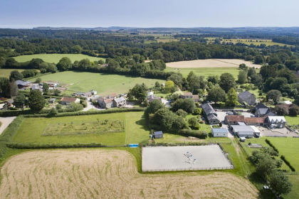
- Price
- Guide Price£1,100,000
- Size
- 4.7 acres
Bleak Street, Pen Selwood, Wincanton, Somerset, BA9, Pen Selwood, Somerset BA9 England
Added on 04/07/2026Barn Conversion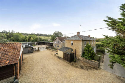
- Price
- Guide Price£1,100,000
- Size
- 8.7 acres
Stoke Trister, Somerset, Stoke Trister, Somerset BA9 England
Added on 17/09/2026Equestrian property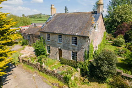
- Price
- Guide Price£1,450,000
- Size
- 43 acres
Farm-43 acres, Horwood, Wincanton, BA9, Wincanton, Somerset BA9 England
Added on 29/01/2026Farm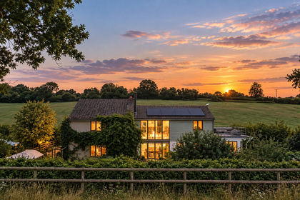
- Price
- Guide Price£1,050,000
- Size
- 6.3 acres
Shepherd's Hill, Buckhorn Weston, Gillingham, SP8, Gillingham, Dorset SP8 England
Added on 30/09/2026Smallholding
- Price
- Guide Price£1,050,000
- Size
- 6.3 acres
Vespers Hollow, Shepherds Hill, Buckhorn Weston, Buckhorn Weston, Dorset SP8 England
Added on 25/09/2026House with Land
- Price
- Guide Price£1,375,000
- Size
- 17.28 acres
Added on 14/08/2026Smallholding
- Price
- Guide Price£1,100,000
- Size
- 13.62 acres
Added on 10/09/2026Smallholding
- Price
- Guide Price£1,200,000
- Size
- 27 acres
Eccliffe Equestrian, Gillingham, Gillingham, Dorset SP8 England
Added on 22/09/2026Equestrian property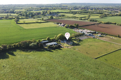
- Price
- Offers Over£900,000
- Size
- 18 acres
Standpitts Lane, Madjeston, Gillingham, SP8, Gillingham, Dorset SP8 England
Added on 22/06/2026House with Land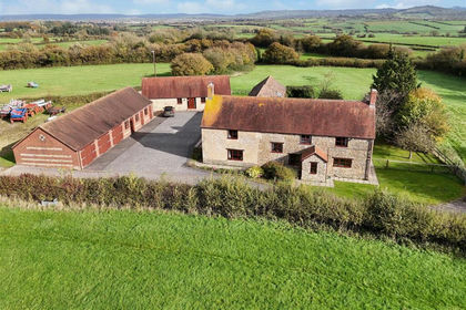
- Price
- Guide Price£1,425,000
- Size
- 13.13 acres
Kington Magna, Gillingham, Kington Magna, Dorset SP8 England
Added on 29/04/2026Smallholding