Barn North West of West Leigh Farm, Modbury, PL21
- Land size
- 0.5 acres
- Bedrooms
- 1
- Bathrooms
- 1
Key Features
- Class Q Planning
- Two-storey Linhay Barn
- Half Acre plot (approx.)
- Stunning countryside location
- Short distance from Modbury
- Approx 90 sqm
Description
LOCATION
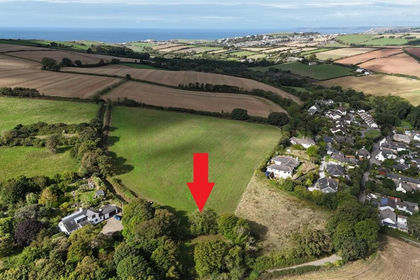
Situated in a peaceful rural setting with views towards the rolling South Hams countryside and views towards Dartmoor National Park, yet moments from the A379 and A38.The existing building consists of a an open fronted, stone faced barn.
What3words ///cashiers.stylists.expansion
CONNECTIVITY
Modbury – 0.8 mile (2 min drive / 15 min walk), A38 Devon Expressway – 4.5 miles, Ivybridge Railway Station – 6.2 miles (London Paddington in 3 hrs), Plymouth – 12 miles, Exeter – 34 miles. Local services in Modbury include a primary school, independent shops, pubs, post office and bus connections to Plymouth and Kingsbridge.
THE OPPORTUNITY
The site comprises a traditional linhay barn benefitting from detailed design proposals for conversion into a well-appointed residential dwelling. This design carefully integrates both retention and enhancement of the existing structure (including slate columns and stonework), high-quality contemporary interventions and efficient internal layout over two floors. The layout maximises the natural light, volume of character and views across the surrounding countryside. A detailed construction package is available upon request.
PROPOSED ACCOMMODATION
Ground Floor
Entrance and circulation hall
Bedroom suite with en-suite bathroom
Secondary living/snug space
Plant and service areas
First Floor
Open plan kitchen / dining / living area
Feature wood-burning stove
Additional WC
South Hams District Council Application Reference: 2531/23/PDM
SITE & SETTING
Access from the public highway via a shared private track leading to a defined entrance drive with enclosed curtilage with garden area, dedicated biodiversity enhancement land with native planting in a rural position with strong amenity value.
Sustainability & Specification Highlights
ENERGY & SERVICES
Air Source Heat Pump system
EV charging provision
High thermal performance building envelope
CONSTRUCTION & FABRIC
Enhanced insulation to walls and existing stone structure
Airtightness target of < 3 m³/hr/m²
Sustainable internal finishes (low VOC paints specified)
ENVIRONMENTAL MEASURES
Radon protection system (barrier + sump)
Sustainable drainage including soakaways
Biodiversity net gain through retained grassland and planting
AGENTS NOTE
Some of the images are Computer Generated Images (CGIs) and are indicative only. They have been produced for illustrative purposes. They are intended to provide a general impression of the development and may be subject to change during the detailed design and construction process. External materials, finishes, landscaping, and surrounding context are subject to planning and specification and may vary.
Luscombe Maye have created our marketing brochure from details provided by architects and other third parties, these details including Images, plans and descriptions are therefore indicative only.
MATERIAL INFORMATION
Verified Material Information
Costs and tenure
Tenure: Freehold
Council tax band: Not banded
EPC rating: No Certificate
The building
Detached other, standard brick and block construction
Loft access: no
Outside areas: Front garden, Rear garden, and Side garden
No spray foam insulation
Services
No mains electricity - connection possible 150m away
No mains water. Private bore hole drilled for water
Foul drainage: Not known
No mains surface water drainage
Heating: None
Broadband: None
Parking: Driveway
Not in a controlled parking zone
No disabled parking available
Risks and restrictions
Not a listed building
Not in a conservation area
Tree preservation order present
No environmental risks recorded
No specialist issues recorded
Onward chain: no
All information is provided without warranty. Contains HM Land Registry data © Crown copyright and database right 2021. This data is licensed under the Open Government Licence v3.0.
The information contained is intended to help you decide whether the property is suitable for you. You should verify any answers which are important to you with your property lawyer or surveyor or ask for quotes from the appropriate trade experts: builder, plumber, electrician, damp, and timber expert.
Viewing: Strictly by appointment with Luscombe Maye, Modbury
Map Location
Property details
- Tenure
- Freehold
- Council Tax Band
- Ask Agent
- Date Posted
- 2026-07-03
Utilities & Restrictions
Utilities
- Electricity
- Ask Agent
- Water
- Ask Agent
- Heating
- Ask Agent
- Broadband
- Ask Agent
- Sewerage
- Ask Agent
Rights & Restrictions
- Public Rights of Way
- Ask Agent
- Private Rights of Way
- Ask Agent
- Listed Property
- Ask Agent
- Restrictions
- Ask Agent
Listed status, conservation areas and planning constraints for this location are in the full report.
Property Features
- Accessibility
- Ask Agent
- Parking
- Driveway
- Garden
- Private Garden
Beyond the particulars: planning activity, flood history, heritage and ground risks, checked for this exact spot.
Connectivity
Broadband
Fastest speed available at this postcode
11 Mbps
Standard (10-30 Mbps)
Suitable for
- Web & social
- Music streaming
- Standard video calls
Fixed wireless access may also be an option here.
Mobile signal
Predicted 4G and 5G signal; indoor signal depends on building materials.
Ofcom Connected Nations postcode-level predictions. Speeds and signal are modelled, not measured, and vary between addresses and providers.
Signal is the easy part. Planning activity, flood history and protected designations here are in the full report.
Nearest Schools
Primary
- Modbury Primary School1.5 milesOfsted: Good
- Ages
- 4 to 11
- Pupils
- 152
- Type
- Community school
- Ugborough Primary School2.1 milesNo Ofsted rating
- Ages
- 4 to 11
- Pupils
- 114
- Type
- Academy converter
- Ermington Primary School2.7 milesOfsted: Good
- Ages
- 4 to 11
- Pupils
- 85
- Type
- Academy converter
- Aveton Gifford CofE Primary School3.1 milesOfsted report card · Jan 2026
- Ages
- 4 to 11
- Pupils
- 97
- Type
- Academy converter
- Faith
- Church of England
- Loddiswell Primary School3.4 milesNo Ofsted rating
- Ages
- 4 to 11
- Pupils
- 118
- Type
- Community school
Secondary
- Ivybridge Community College3.6 milesOfsted: Good
- Ages
- 11 to 18
- Pupils
- 2,262
- Type
- Academy converter
- Kingsbridge Academy6.2 milesOfsted: Good
- Ages
- 11 to 18
- Pupils
- 1,199
- Type
- Academy converter
- Plympton Academy8.9 milesOfsted: Requires improvement
- Ages
- 11 to 18
- Pupils
- 984
- Type
- Academy converter
- King Edward VI Community College9 milesNo Ofsted rating
- Ages
- 11 to 18
- Pupils
- 940
- Type
- Academy converter
- Hele's School9.6 milesNo Ofsted rating
- Ages
- 11 to 18
- Pupils
- 1,378
- Type
- Academy converter
Distances are straight-line from the advertised location. Source: the national school registers (DfE, Welsh Government, Scottish Government) and Ofsted.
Schools are just the start: sold prices nearby, planning activity and any flood history are in the full report.
Amenities
Supermarket
GP surgery
Pharmacy
Hospital
Straight-line distances from the advertised location. Sources: NHS records, Geolytix supermarket locations, OS Open Greenspace and the national trails registers.
The area stacks up? Now check the location itself: planning nearby, protected designations and past flooding.
Getting Around
Nearest station
Nearest bus stop
Typical drive times
Straight-line distances from the advertised location; drive times are typical free-flow times over OpenStreetMap road data, so allow more at peak. Public transport locations from DfT NaPTAN.
Easy to reach matters. So do planning activity, flood history and ground risks: all in the full report.
Flood Risk
Environment Agency open data, checked around the advertised map pin for the listed acreage. Long-term risk counts flood defences; the planning map's flood zones do not. Provided by LandSale, not the listing agent, and not part of the agent's particulars. Risk varies across a holding, so verify before committing.
Rivers and the sea
Planning map: Flood Zone 1.
Surface water
Not at the pin: mapped about 10 metres away.
These bandings are the summary. Where this location sits on the flood maps, plus planning activity, heritage and ground risks, is in the full report.
Important notice: Information, maps and tags on this page are drawn from the advertising agent's marketing materials or generated automatically. LandSale has not verified them. Relying on these details is at your own risk, always carry out independent checks before committing to a purchase.
LandSale full disclaimer
Marketing information only - not formal particulars. The details on this website are provided for general guidance and do not constitute an offer or contract. Neither LandSale nor the advertising estate/land agent accepts responsibility for any inaccuracy.
1. Source of information
- Listing content: Core description, asking price, tenure, measurements, photographs and planning history originate from the marketing materials of the advertising estate or land agent. LandSale does not author this content and cannot guarantee its accuracy.
- Automated tags & categorisation: Property type, land-use class, acreage bands and similar labels may be applied by machine-learning models. They are intended as a helpful guide only and may not reflect the property's legal status or permitted use.
- Third-party & enriched data layers: Maps, boundary outlines, planning designations, soil reports, broadband coverage and other environmental or location-based insights are licensed from external suppliers. Such data are supplied “as is", may be incomplete or out of date and are subject to change without notice.
2. Verification required
Prospective purchasers must verify critical matters, including but not limited to planning permission, title boundaries, public rights of way, environmental constraints, acreage, services, access and VAT status, through their own inspections, specialist surveys, legal advisers and the selling agent before relying on the information or entering into any contract.
3. No warranty or liability
LandSale gives no warranty, express or implied, as to the accuracy, completeness or fitness for any particular purpose of the information displayed. LandSale shall not be liable for any loss, damage, cost or expense arising directly or indirectly from any use of or reliance on such information, save where liability may not be excluded by law.
4. Updates & feedback
If you believe any detail on this listing is inaccurate, please let us know. We will investigate and, where appropriate, update the listing or notify the agent.
© LandSale | Version 1.3 - August 2026
Similar properties for sale
- Price
- Guide Price£150,000
- Size
- 0.17 acres
Added on 14/09/2026Building Plot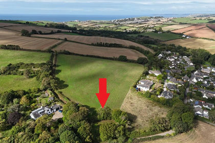
- Price
- Guide Price£150,000
- Size
- 0.17 acres
Building Plot at South Milton, Kingsbridge, Devon TQ7, South Milton, Devon TQ7 England
Added on 15/09/2026Building Plot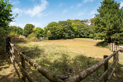
- Price
- Guide Price£185,000
- Size
- 0.3 acres
LOT 3 - Paddock at Brixton House, Brixton, Devon PL8 England
Added on 13/10/2026Small Plot of Land
- Price
- Guide Price£150,000
- Size
- 16.83 acres
Chillington, Kingsbridge - Lot 1, TQ7, Kingsbridge, Devon TQ7 England
Added on 02/10/2026Undeveloped Land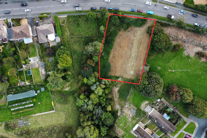
- Price
- £200,000
Land at Fort Austin Avenue, Crownhill, Plymouth, Plymouth Moor View, Plymouth PL6 England
Added on 29/01/2026Development Land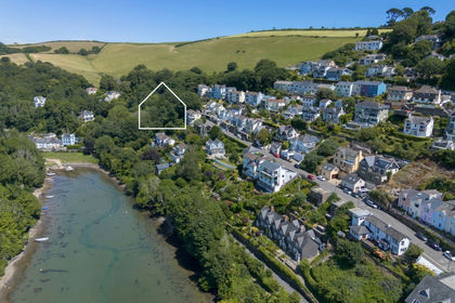
- Price
- Guide Price£160,000
Added on 23/09/2026Development Land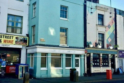
- Price
- Offers Over£165,000
63 Union Street, Plymouth, Plymouth Sutton and Devonport, Plymouth PL1 England
Added on 01/07/2026Commercial Land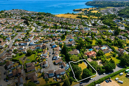
- Price
- Guide Price£175,000
- Size
- 0.35 acres
SINGLE BUILDING PLOT, Brixham Road, Paignton, Devon, TQ4, South Devon, Torbay TQ4 England
Added on 21/07/2026Self Build Plot
- Price
- Offers in Excess of£200,000
Added on 05/06/2026Building Plot
- Price
- £195,000
Added on 22/06/2026Development Land