Munden Road, Dane End, Ware, SG12
- Land size
- 15 acres
- Bedrooms
- 9
- Bathrooms
- 6
Key Features
- 12977 sq ft Country Home
- 2696 sq ft
- 15 acres
Description
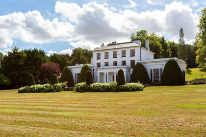
This grand property benefits from a wealth of original features throughout with sumptuous receptions, bedrooms and additional accommodation ideal for staff. The beautifully maintained grounds with tennis court and swimming pool provide a wonderful environment for relaxation and entertaining.
Dane End House is a distinguished Hertfordshire residence of impressive scale and character—an exceptional opportunity for those seeking a landmark home in a picturesque countryside location.
The ground floor is arranged around a series of generous reception rooms, including a magnificent dual aspect drawing room, elegant dining room, large family room and a kitchen/breakfast room with adjoining pantry and utility areas. A series of additional reception spaces, studies and garden facing rooms ensures the home functions effortlessly for both entertaining and day to day living.
The bedroom accommodation is equally impressive, with multiple bedroom suites arranged across the first and second floors. The principal suite enjoys exceptional
proportions, dressing room and a luxurious bathroom. Further suites provide ideal guest, family or multi generational living options, while a separate bedroom wing offers additional privacy and flexibility, ideal for staff.
A detached Coach House is available by separate negotiation.
Outside
Approached via a gated sweeping driveway, the house presents a striking façade and an inviting sense of arrival. The beautifully maintained grounds extend to 15 acres with expansive lawn bordered by a wide variety of mature specimen trees and hedging providing privacy and seclusion. To the side of the property is a terrace with pool and pool house, whilst to the front is an all-weather tennis court. Garaging and a range of outbuildings add a rare level of versatility, providing substantial ancillary space to adapt to suit individual requirements. Mature woodland is situated at the rear of the grounds.
Situation
Nestled within the peaceful Hertfordshire countryside, the village of Dane End offers an idyllic rural setting.
Despite its tranquil position, Dane End benefits from convenient access to the historic market town of Ware, just a short drive away. Ware offers an excellent range of independent shops, cafés, restaurants and essential amenities, along with riverside walks along the Lea Navigation. Broader shopping, leisure and cultural facilities are also found in nearby Hertford, providing further choice for dining, schooling and services.
The area is well regarded for its educational options, including a number of sought after state and independent schools. For commuters, the location is particularly attractive, with stations at Ware, Hertford North and Hertford East providing direct rail links into London. Road connections are equally favourable, with easy access to the A10 and A1(M), making travel across Hertfordshire and beyond straightforward.
Property Ref Number:
HAM-64013Additional Information
LOCAL AUTHORITY East Herts District Council
COUNCIL TAX BAND H
SERVICES Mains water. Oil fired central heating. Private
drainage.
Map Location
Property details
- Tenure
- Freehold
- Council Tax Band
- H
- Date Posted
- 2026-07-02
Market Value Analysis
Compared with 85 Homes with Land listings in East Anglia (10+ acres).
Utilities & Restrictions
Utilities
- Electricity
- Ask Agent
- Water
- Ask Agent
- Heating
- Ask Agent
- Broadband
- Ask Agent
- Sewerage
- Ask Agent
Rights & Restrictions
- Public Rights of Way
- Ask Agent
- Private Rights of Way
- Ask Agent
- Listed Property
- Ask Agent
- Restrictions
- Ask Agent
Property Features
- Accessibility
- Ask Agent
- Parking
- Garage
- Garden
- Private Garden
Connectivity
Broadband
Fastest speed available at this postcode
1.8 Gbps
Gigabit full fibre
Suitable for
- 4K streaming on every screen
- Full-time home working
- Online gaming & big downloads
Mobile signal
Outdoor predictions; indoor signal depends on building materials.
Ofcom Connected Nations postcode-level predictions. Speeds and signal are modelled, not measured, and vary between addresses and providers.
Nearest Schools
Primary
- Little Munden Church of England Voluntary Controlled Primary School512 metresNo Ofsted rating
- Ages
- 3 to 11
- Pupils
- 78
- Type
- Voluntary controlled school
- Faith
- Church of England
- Puller Memorial, Church of England, Voluntary Aided Primary School2.4 milesOfsted: Good
- Ages
- 3 to 11
- Pupils
- 45
- Type
- Voluntary aided school
- Faith
- Church of England
- Watton-at-Stone Primary and Nursery School2.6 milesNo Ofsted rating
- Ages
- 2 to 11
- Pupils
- 235
- Type
- Community school
- Benington Church of England Primary School2.7 milesNo Ofsted rating
- Ages
- 4 to 11
- Pupils
- 94
- Type
- Voluntary controlled school
- Faith
- Church of England
- Thundridge Church of England Primary School2.9 milesOfsted: Good
- Ages
- 3 to 11
- Pupils
- 91
- Type
- Voluntary controlled school
- Faith
- Church of England
Secondary
- Ralph Sadleir School3.7 milesOfsted: Requires improvement
- Ages
- 9 to 13
- Pupils
- 283
- Type
- Academy converter
- The Chauncy School4.2 milesNo Ofsted rating
- Ages
- 11 to 18
- Pupils
- 1,515
- Type
- Academy converter
- Barnwell School4.8 milesOfsted report card · Jan 2026
- Ages
- 11 to 18
- Pupils
- 1,270
- Type
- Foundation school
- Presdales School5.1 milesOfsted: Outstanding
- Ages
- 11 to 18
- Pupils
- 1,167
- Type
- Academy converter
- Gender
- Girls
- The Nobel School5.2 milesNo Ofsted rating
- Ages
- 11 to 18
- Pupils
- 1,475
- Type
- Foundation school
Distances are straight-line from the advertised location. Source: the national school registers (DfE, Welsh Government, Scottish Government) and Ofsted.
Amenities
Supermarket
GP surgery
Pharmacy
Hospital
Green space
Straight-line distances from the advertised location. Sources: NHS records, Geolytix supermarket locations, OS Open Greenspace and the national trails registers.
Getting Around
Nearest station
Nearest bus stop
Typical drive times
Straight-line distances from the advertised location; drive times are typical free-flow times over OpenStreetMap road data, so allow more at peak. Public transport locations from DfT NaPTAN.
Flood Risk
From Environment Agency flood map open data, checked around the advertised map pin and allowing for the listed acreage where known. This summary comes from LandSale, the advertising platform, not from the listing agent, and is not part of the agent's particulars. Risk can vary across a single holding, so verify anything critical through your own searches before committing.
Rivers and the sea
Mapped within the area searched, not at the advertised map pin itself.
Surface water
Mapped within the area searched, not at the advertised map pin itself.
The detail behind these bandings, including exact zones and annual chances, any recorded past flooding, plus planning, heritage, nature and ground checks, is in the .
Important notice: Information, maps and tags on this page are supplied by the advertising agent or generated automatically. LandSale has not verified them. Relying on these details is at your own risk, always carry out independent checks before committing to a purchase.
LandSale full disclaimer
Marketing information only - not formal particulars. The details on this website are provided for general guidance and do not constitute an offer or contract. Neither LandSale nor the advertising estate/land agent accepts responsibility for any inaccuracy.
1. Source of information
- Agent-supplied content: Core description, asking price, tenure, measurements, photographs and planning history are uploaded by the appointed agent, who remains solely responsible for their accuracy.
- Automated tags & categorisation: Property type, land-use class, acreage bands and similar labels may be applied by machine-learning models. They are intended as a helpful guide only and may not reflect the property's legal status or permitted use.
- Third-party & enriched data layers: Maps, boundary outlines, planning designations, soil reports, broadband coverage and other environmental or location-based insights are licensed from external suppliers. Such data are supplied “as is", may be incomplete or out of date and are subject to change without notice.
2. Verification required
Prospective purchasers must verify critical matters, including but not limited to planning permission, title boundaries, public rights of way, environmental constraints, acreage, services, access and VAT status, through their own inspections, specialist surveys, legal advisers and the selling agent before relying on the information or entering into any contract.
3. No warranty or liability
LandSale gives no warranty, express or implied, as to the accuracy, completeness or fitness for any particular purpose of the information displayed. LandSale shall not be liable for any loss, damage, cost or expense arising directly or indirectly from any use of or reliance on such information, save where liability may not be excluded by law.
4. Updates & feedback
If you believe any detail on this listing is inaccurate, please let us know. We will investigate and, where appropriate, update the listing or notify the agent.
© LandSale | Version 1.2 - January 2026
Listing agent
Hamptons, Hertford
10/11 Market Place, Hertford, SG14 1DG
Similar properties for sale
- Price
- £5,000,000
- Size
- 16 acres
Munden Road, Dane End, WARE, Little Munden, Hertfordshire SG12 England
Added on 08/07/2026Country Estate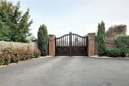
- Price
- £4,999,000
- Size
- 8.5 acres
Added on 14/02/2026Country Home
- Price
- Guide Price£6,000,000
- Size
- 28 acres
Ashendene Road, Bayford, SG13, Bayford, Hertfordshire SG13 England
Added on 29/01/2026Country Home
- Price
- Guide Price£5,950,000
- Size
- 15 acres
Epping Upland, Epping, CM16, Epping Upland, Essex CM16 England
Added on 12/04/2026Estate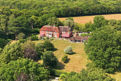
- Price
- £4,475,000
- Size
- 16.6 acres
Beggar Hill, Fryerning, CM4, Ingatestone and Fryerning, Essex CM4 England
Added on 13/02/2026Country Estate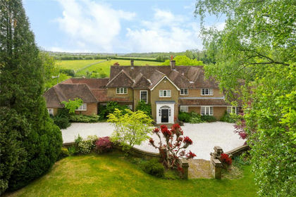
- Price
- Guide Price£4,000,000
- Size
- 13 acres
Cholesbury Road, Cholesbury, Hertfordshire, HP23, Tring, Hertfordshire HP23 England
Added on 28/05/2026Equestrian property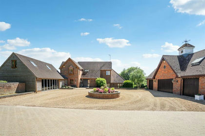
- Price
- £3,750,000
- Size
- 29 acres
Great Brickhill Road, Soulbury, Buckinghamshire, Soulbury, Buckinghamshire LU7 England
Added on 28/01/2026Equestrian property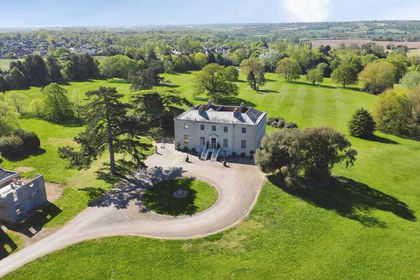
- Price
- £5,200,000
- Size
- 43 acres
Church Road, Hatfield Peverel, Chelmsford, Hatfield Peverel, Essex CM3 England
Added on 13/06/2026Country Estate
- Price
- £4,500,000
- Size
- 40 acres
Gorse Hill, Farningham, Dartford, DA4, Farningham, Kent DA4 England
Added on 13/06/2026Country Home