Crookhall, Consett, County Durham, DH8
- Land size
- 1 acres
- Bedrooms
- 4
- Bathrooms
- 4
Description
A superb barn conversion situated on the rural outskirts of Consett which has a paddock and three stables, Ideal for purchasers with equestrian interests.
4 acres of extra grazing land available by separate negotiation.
Built in 2005 "Southcott" is one of the finest properties of its type in Derwentside, forming part of a courtyard development of three conversions with private electronic gated access. Built to a high specification, the property occupies a site of approximately 1 acre with formal gardens, hardstanding/ parking for multiple vehicles, a larger than average double garage and outside bar/ summerhouse for entertaining. The accommodation is arranged over two floors, comprising on the ground floor, a large sun-lounge overlooking the garden, a spacious kitchen dining room with marble worktops, induction 5 ring hob, extractor hood, built in oven fridge/freezer, dishwasher and wine cooler. A boot room with fitted units leading to a utility and cloakroom w.c. An inner hallway leads to a study area, a second reception room, two bedrooms with access to a Jack & Jill ensuite, a further ground floor bedroom with en-suite. On the first floor is the main bedroom with ensuite and storage.
High specification includes:
Heat recovery system which cleans air and removes condensation, recirculates heat back into air.
Smart central vacume system connection point in wall in each room unit in garage.
Electric charge point for car.
Home entertainment system speakers in each room.
CCTV & Burglar alarm.
Gated access via intercom.
Garden lawn sprinkler system.
Log cabin with electric power points & outside sockets.
External drive lights.
Central light control.
Electric garage doors.
Jacuzzi bath upstairs ensuite, to bedroom.
Steam room/shower downstairs ensuite to bedroom.
Lock up with ride on lawnmower electric points & lights. Generator hook up point, electric roller door.
Stables x 3 with lights and plug sockets, cctv camera and water point, paddock with hard stand for parking trailers
MATERIAL INFORMATION:
In compliance with the Consumer Protection from Unfair Trading Regulations 2008 and National Trading Standards Estate and Letting Agency Team’s Material information in property listings Guidance
PART A
Local Authority – Durham County Council.
Council Tax Band – E
Tenure – Freehold
PART B
Property Type – Terraced barn conversion
Property Construction – Standard
Number & Types of Rooms – Please refer to the details and floorplan, all measurements taken being the maximum dimensions available between internal walls
Gas Supply- Mains
Electricity supply – Mains and Photovoltaic solar panels. Feed in tariff produces approximately £2200 per year.
Water Supply – Mains (metered)
Sewerage – Mains
Heating – Gas fired central heating - under floor heating (ground & first floor) and some towel radiators and Thermal solar panels. Multi-fuel stove in sun lounge.
Estimated Mobile phone coverage – Please refer to the Ofcom Website -
Estimated Broadband Download speeds – please refer to the Ofcom Website –
Parking- Garage and driveway
PART C
Building Safety – (The Vendor is not aware of any Building Safety issues. However, we would recommend that the purchaser engages the services of a chartered surveyor to confirm)
Restrictions – Covenants which affect the property are contained within the Land Registry Title Register which is available for inspection.
Selective licencing area – NO
Article 4 Planning Restricted area – the property is subject to Article 4 Direction
Conservation Area – N/A
Rights & Easements- NONE
Flood risk – Rivers and seas: Very low. Surface water: Very low.
Coastal Erosion – N/A
Protected Trees – N/A
Planning Permission – There are no current planning applications in the locality that we are aware of. Or planning details that are known
Accessibility/Adaptations – The property has not been altered for accessibility
Mining Area – Coal Mining Reporting Area, further searches may be required.
There is a shared intercom gated access.
No other Material Information disclosures have been made by the vendor. This information has been compiled in good faith using resources readily available online and by enquiry of the vendor prior to marketing. However, such information could change after compilation of the data, so J W Wood cannot be held liable for any changes post compilation or any accidental errors or omissions.
Furthermore, J W Wood are not legally qualified and conveyancing documents are often complicated, necessitating judgement on our part about which parts are “Material Information” to be disclosed. If any information provided, or other matter relating to the property, is of particular importance to you, please do seek verification from a legal advisor before committing to expenditure.
HMRC supervises the legal obligation for all estate agents to conduct identity checks on their customers, this includes buyers when their offer is accepted. This must be completed, per purchaser, who in the transaction will result in being the legal owner(s) of the property. There is a £35 (inc VAT) administration fee per individual purchaser, for these checks.
Map Location
Property details
- Tenure
- Freehold
- Council Tax Band
- E
- Date Posted
- 2026-06-26
Market Value Analysis
Compared with 203 Homes with Land listings in North East England (1+ acres).
Energy Performance Certificate
Energy Efficiency Rating
Based on UK Energy Performance Certificate standards (EU Directive 2002/91/EC)
Running costs are one side. Planning activity, flood history and ground risks for this location are in the full report.
Utilities & Restrictions
Utilities
- Electricity
- Ask Agent
- Water
- Ask Agent
- Heating
- Ask Agent
- Broadband
- Ask Agent
- Sewerage
- Ask Agent
Rights & Restrictions
- Public Rights of Way
- Ask Agent
- Private Rights of Way
- Ask Agent
- Listed Property
- Ask Agent
- Restrictions
- Ask Agent
Listed status, conservation areas and planning constraints for this location are in the full report.
Property Features
- Accessibility
- Ask Agent
- Parking
- Parking Available
- Garden
- Garden
Beyond the particulars: planning activity, flood history, heritage and ground risks, checked for this exact spot.
Connectivity
Broadband
Fastest speed available at this postcode
1.8 Gbps
Gigabit full fibre · available to 20% of premises
Suitable for
- 4K streaming on every screen
- Full-time home working
- Online gaming & big downloads
Mobile signal
Predicted 4G and 5G signal; indoor signal depends on building materials.
Ofcom Connected Nations postcode-level predictions. Speeds and signal are modelled, not measured, and vary between addresses and providers.
Signal is the easy part. Planning activity, flood history and protected designations here are in the full report.
Nearest Schools
Primary
- Leadgate Primary School - Split Site809 metresNo Ofsted rating
- Ages
- 2 to 11
- Pupils
- 180
- Type
- Community school
- Consett Junior School986 metresNo Ofsted rating
- Ages
- 7 to 11
- Pupils
- 228
- Type
- Community school
- Delves Lane Primary School0.7 milesOfsted report card · Jun 2026
- Ages
- 2 to 11
- Pupils
- 274
- Type
- Community school
- Consett Infant School0.7 milesNo Ofsted rating
- Ages
- 4 to 7
- Pupils
- 153
- Type
- Community school
- St Patrick's Catholic Primary School, Consett0.8 milesNo Ofsted rating
- Ages
- 3 to 11
- Pupils
- 372
- Type
- Academy converter
- Faith
- Roman Catholic
Secondary
- Consett Academy0.8 milesOfsted: Good
- Ages
- 11 to 18
- Pupils
- 1,493
- Type
- Academy sponsor led
- St Bede's Catholic School and Sixth Form College, Lanchester3 milesOfsted report card · Mar 2026
- Ages
- 11 to 18
- Pupils
- 1,240
- Type
- Academy converter
- Faith
- Roman Catholic
- Tanfield School4.6 milesOfsted: Good *
- Ages
- 11 to 16
- Pupils
- 739
- Type
- Academy sponsor led
- North Durham Academy5.1 milesOfsted: Good
- Ages
- 11 to 16
- Pupils
- 935
- Type
- Academy sponsor led
- Prudhoe Community High School7.4 milesNo Ofsted rating
- Ages
- 13 to 19
- Pupils
- 680
- Type
- Academy converter
* Latest graded judgement covers quality of education only; no overall grade was issued under the 2024-25 inspection framework.
Distances are straight-line from the advertised location. Source: the national school registers (DfE, Welsh Government, Scottish Government) and Ofsted.
Schools are just the start: sold prices nearby, planning activity and any flood history are in the full report.
Amenities
Supermarket
GP surgery
Pharmacy
Hospital
Green space
Straight-line distances from the advertised location. Sources: NHS records, Geolytix supermarket locations, OS Open Greenspace and the national trails registers.
The area stacks up? Now check the location itself: planning nearby, protected designations and past flooding.
Getting Around
Nearest station
Nearest bus stop
Typical drive times
Straight-line distances from the advertised location; drive times are typical free-flow times over OpenStreetMap road data, so allow more at peak. Public transport locations from DfT NaPTAN.
Easy to reach matters. So do planning activity, flood history and ground risks: all in the full report.
Flood Risk
Environment Agency open data, checked around the advertised map pin for the listed acreage. Long-term risk counts flood defences; the planning map's flood zones do not. The map pin for this listing marks the postcode area rather than the exact location, so these readings describe the surrounding area. Provided by LandSale, not the listing agent, and not part of the agent's particulars. Risk varies across a holding, so verify before committing.
Rivers and the sea
Planning map: Flood Zone 1.
Surface water
Not at the pin: mapped about 10 metres away.
These bandings are the summary. Where this location sits on the flood maps, plus planning activity, heritage and ground risks, is in the full report.
Important notice: Information, maps and tags on this page are drawn from the advertising agent's marketing materials or generated automatically. LandSale has not verified them. Relying on these details is at your own risk, always carry out independent checks before committing to a purchase.
LandSale full disclaimer
Marketing information only - not formal particulars. The details on this website are provided for general guidance and do not constitute an offer or contract. Neither LandSale nor the advertising estate/land agent accepts responsibility for any inaccuracy.
1. Source of information
- Listing content: Core description, asking price, tenure, measurements, photographs and planning history originate from the marketing materials of the advertising estate or land agent. LandSale does not author this content and cannot guarantee its accuracy.
- Automated tags & categorisation: Property type, land-use class, acreage bands and similar labels may be applied by machine-learning models. They are intended as a helpful guide only and may not reflect the property's legal status or permitted use.
- Third-party & enriched data layers: Maps, boundary outlines, planning designations, soil reports, broadband coverage and other environmental or location-based insights are licensed from external suppliers. Such data are supplied “as is", may be incomplete or out of date and are subject to change without notice.
2. Verification required
Prospective purchasers must verify critical matters, including but not limited to planning permission, title boundaries, public rights of way, environmental constraints, acreage, services, access and VAT status, through their own inspections, specialist surveys, legal advisers and the selling agent before relying on the information or entering into any contract.
3. No warranty or liability
LandSale gives no warranty, express or implied, as to the accuracy, completeness or fitness for any particular purpose of the information displayed. LandSale shall not be liable for any loss, damage, cost or expense arising directly or indirectly from any use of or reliance on such information, save where liability may not be excluded by law.
4. Updates & feedback
If you believe any detail on this listing is inaccurate, please let us know. We will investigate and, where appropriate, update the listing or notify the agent.
© LandSale | Version 1.3 - August 2026
Listing agent
J W Wood, Consett
16 Middle Street, Consett, DH8 5QJ
Similar properties for sale
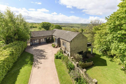
- Price
- Guide Price£635,000
Added on 29/05/2026Barn Conversion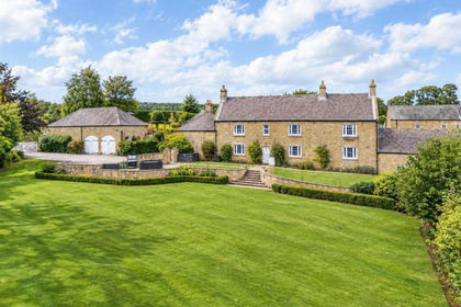
- Price
- £750,000
- Size
- 4.5 acres
High Waskley Farm, Shotley Bridge, Consett, Blaydon and Consett, County Durham DH8 England
Added on 01/10/2026House with Land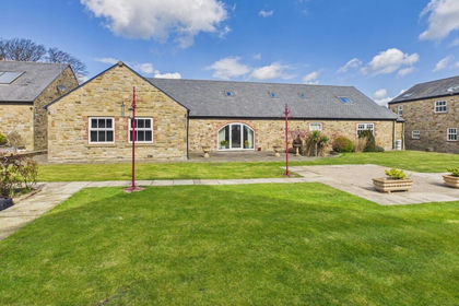
- Price
- Guide Price£735,000
Added on 21/09/2026Barn Conversion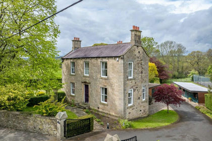
- Price
- Offers Over£850,000
- Size
- 2.5 acres
Vindomora Road, Ebchester, Consett, DH8, Blaydon and Consett, County Durham DH8 England
Added on 27/05/2026House with Land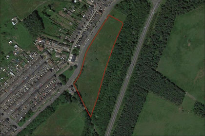
- Price
- Guide Price£600,000
- Size
- 4.3 acres
Annfield Plain, Stanley, County Durham, DH9, Stanley, County Durham DH9 England
Added on 29/01/2026Building Plot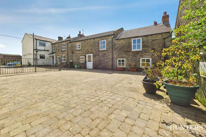
- Price
- £595,000
- Size
- 2.5 acres
Ivory & Farthing Cottage, Penny Lane, Satley, Satley, County Durham DL13 England
Added on 22/07/2026House with Land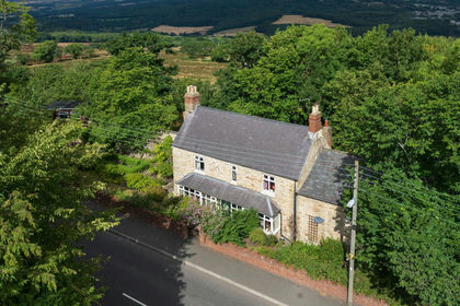
- Price
- £750,000
- Size
- 4.66 acres
High Friarside Farmhouse, Burnopfield, Blaydon and Consett, County Durham NE16 England
Added on 13/08/2026Farmhouse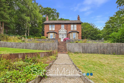
- Price
- Offers in Region of£800,000
- Size
- 1 acres
Orchard Road, Rowlands Gill, NE39, Blaydon and Consett, Gateshead NE39 England
Added on 01/09/2026House with Land
- Price
- Guide Price£790,000
- Size
- 3.43 acres
Satley, Bishop Auckland, County Durham, DL13, Satley, County Durham DL13 England
Added on 03/07/2026House with Land
- Price
- Offers in Excess of£925,000
- Size
- 2.1 acres
Bullions Farm, Nr Minsteracres, Northumberland, DH8, Shotley Low Quarter, Northumberland DH8 England
Added on 10/08/2026Barn Conversion