At The Lower Yard, Llwyngwair Home Farm, SA42
Key Features
- Range of Traditional (Listed Grade II) Stone Buildings benefiting from Detailed Planning Consent for conversion into 3 Dwellings.
- The Buildings concerned include The Stables, The Dairy and The Pigsty.
- • Each Barn Conversion benefits from a large area of ground, can be purchased in it’s entirety, alternatively, offers will be considered for the Properties on an individual basis.
- The Barns are accessed over a One Third of a Mile Tarmacadamed road leading to Llwyngwair Home Farm & Pontnewydd also providing a secondary access to Llwyngwair Manor.
Description
Enjoying a delightful south and west facing location, a range of Traditional (Listed Grade II) Stone Buildings benefiting from Detailed Planning Consent for conversion into 3 Dwellings.
The Barns are accessed over a One Third of a Mile Tarmacadamed road which leads to Llwyngwair Home Farm and Pontnewydd and also providing a secondary access to Llwyngwair Manor.
The Buildings concerned include The Stables, The Dairy and The Pigsty.
Each Barn Conversion benefits from a large area of ground which can be purchased in it’s entirety as One Lot, or alternatively, offers will be considered for the Properties on an individual basis.
Traditional Stone Barns of this calibre benefiting from delightful rural views rarely appear on the Open Market and the opportunity to purchase should not be missed. Inspection essential.
Situation
The Barns at Felin Llwyngwair are situated within a Third of a Mile or so of the Main A487 Fishguard to Cardigan Road and are within a mile and a half or so of the popular Coastal Town of Newport. Newport being close by, has the benefit of a good range of Shops, a Primary School, Church, Chapels, Public Houses, Hotels, Restaurants, Cafes, Take-Away’s, a Memorial/Community Hall, Post Office, Library/Tourist Information Centre, Dental Surgery and a Health Centre. Within a mile or so by road is the picturesque village at Nevern which is renowned for it’s Church, Bleeding Yew Tree, Celtic Cross and it’s Castle remains.
Nevern is within a half a mile walk along Sandy Lane. The River Nevern is within a short walk and provides excellent Salmon, Sewin (Sea Trout) and Trout Fishing. Carningli Mountain and Common are also close by and provide excellent Walking, Rambling, Pony Trekking and Hacking facilities.
Market Towns
The well known Market Town of Cardigan is 10 miles or so north east has the benefit of an excellent Shopping Centre and a wide range of amenities and facilities including Secondary and Primary Schools, Churches, Chapels, Banks, Building Societies, Hotels, Restaurants, Public Houses, Cafes, Take-Away’s, a Post Office, Library, Petrol Filling Stations, Supermarkets, a Further Education College and a newly built Day Hospital. Some 8 miles or so south west is the Market Town of Fishguard and some 20 miles or so south is the County and Market Town of Haverfordwest. Haverfordwest has an excellent Shopping Centre as well as Comprehensive and Primary Schools, Churches, Chapels, Banks, Building Societies, Hotels, Restaurants, Public Houses, Cafes, Take-Away’s, Art Galleries, Supermarkets, Garages, Petrol Filling Stations, a Further Education College, Leisure Centre, The County Council Offices and a Hospital at Withybush.
Pembrokeshire Coastline
The Pembrokeshire Coastline at The Parrog, Newport is within 2 miles or so and also close by are the other well known sandy beaches and coves at Newport Sands, Ceibwr Bay, Poppit Sands, Cwm, Aber Rhigian, Aberfforest, Cwm-yr-Eglwys, Pwllgwaelod and Aberbach.
Road, Rail and Bus Links
There are good road links along the Main A40 from Fishguard to Haverfordwest and Carmarthen and the A48 and M4 to Cardiff and London as well as good rail links from both Fishguard and Haverfordwest to Carmarthen, Cardiff, London Paddington and the rest of the UK. There is also a good Bus Service along the Main A487 Road north east to Cardigan and Aberaeron and south west to Fishguard and south to Haverfordwest.
Directions from Fishguard
From Fishguard, take the Main A487 Road north east for some 7 miles passing through the Town of Newport and a mile or so further on, take the turning on the left (adjacent to The Lodge) towards Llwyngwair Farm i.e. Not the turning leading to Llwyngwair Manor. A “For Sale” direction board is erected at this point. A one third of a mile tarmacadamed road leads to the Property.
Directions from Cardigan
Take the Main A487 Road south west for some 8 miles passing through the village of Felindre Farchog and continue on this road for a mile and a half or so and take the second turning on the right (just prior to the turning to Llwyngwair Manor) towards Llwyngwair Farm. A “For Sale” direction board is erected at this point. A one third of a mile tarmacadamed road leads to the Lower Yard Buildings. A “For Sale” Board is erected on site.
Description
The Traditional Stone Ranges at Llwyngwair Home Farm are in the main of solid stone construction with Slate and corrugated Asbestos/Cement Fibre roofs. Planning Consent has been granted in accordance with the attached Plans for the conversion of The Stables (former Coach House), The Dairy and The Pigsty into 3 Dwellings of Full Residential Use.
Plans and Drawings
Attached herewith are copies of the Site Plan in relation to the entirety as well as copies of the Elevations Drawings and Ground and First Floor Layout Plans of the accommodation.
NB
The Properties can be purchased as a whole or alternatively, offers will be considered for Stables, The Dairy and The Pigsty individually.
Services
Mains Electricity is available in the vicinity of the Property. Water will be from a Borehole to the Properties as we understand that the nearest Mains Water Supply is close to Pwll Farm entrance which is on the southern side of the Main A487 Road. (Vendors Solicitors to verify). Drainage will be to individual Sewage Treatment Plants.
Rights of Ways
Vehicular and Pedestrian Access Rights of Ways will exist in favour of the Properties over the tarmacadamed (single track) road which leads to Llwyngawir Home Farm, Pont Newydd and also giving a secondary/delivery access to Llwyngwair Manor.
Tenure
The entire Property is of Freehold Tenure.
Listed Buildings
The Buildings concerned are Listed Grade II. Application Number NP/25/0146/LBA. A copy of the Planning Consent is available upon request.
Planning
Planning Consent has been granted to convert the Traditional Stone Outbuildings at the Lower Yard, Llwyngwair Home Farm, Newport, Pembrokeshire, SA42 0LX into 3 Dwellings of Full Residential Use on the 3rd December, 2025. Application Number NP/25/0143/FUL. A copy of the Planning Consent is available upon request. A copy of the Planning Portfolio is available upon request via email.
Plans
Copies of Site Plans, Elevation Drawings, Ground and First Floor Layout Plans of all 3 Barns are attached.
Anti Money Laundering and Ability to Purchase
Please note when making an offer we will require information to enable us to confirm all parties identities as required by Anti Money Laundering (AML) Regulations. We may also conduct a digital search to confirm your identity. We will also require full proof of funds such as a mortgage agreement in principle, proof of cash deposit or if no mortgage is required, we will require sight of a bank statement. Should the purchase be funded through the sale of another property, we will require confirmation the sale is sufficient enough to cover the purchase.
Remarks
Rarely to Traditional Stone Ranges of this calibre (on the North Pembrokeshire Coastline) which benefit from a delightful Rural setting and views appear on the Open Market and the opportunity to purchase should not be missed. The 3 Barns are available as an entity in One Lot, or alternatively offers will be considered for each Property individually, i.e. The Stables, The Dairy and The Pigsty. Early inspection strongly advised.
Price Guides
Individual Prices Guides are as follows:-
1) The Stables - £285,000 (Two Hundred and Eighty Five Thousand Pounds)
2) The Dairy - £285,000 (Two Hundred and Eighty Five Thousand Pounds)
3) The Pigsty - £265,000 (Two Hundred and Sixty Five Thousand Pounds)
Disclaimer
These particulars are provided for guidance only and do not constitute any part of an offer or contract. Whilst every effort has been made to ensure the accuracy of the information, descriptions, measurements, floor plans, and other details provided, they should not be relied upon as statements of fact. Prospective purchasers should satisfy themselves by inspection and other enquiries as to their accuracy.
Photographs, drone imagery, virtual tours, and other marketing images are for illustrative purposes only and may have been digitally enhanced, edited, or altered to improve presentation. Such images should not be relied upon as an exact representation of the property’s current condition, appearance, boundaries, or surroundings.
Services, appliances, and fittings have not been tested, and no warranty is given as to their condition or suitability. All measurements and distances are approximate. Purchasers should seek independent professional advice before proceeding with any trans...
Map Location
Property details
- Tenure
- Freehold
- Council Tax Band
- Ask Agent
- Date Posted
- 2026-06-22
Utilities & Restrictions
Utilities
- Electricity
- Ask Agent
- Water
- Ask Agent
- Heating
- Ask Agent
- Broadband
- Ask Agent
- Sewerage
- Ask Agent
Rights & Restrictions
- Public Rights of Way
- Ask Agent
- Private Rights of Way
- Ask Agent
- Listed Property
- Ask Agent
- Restrictions
- Ask Agent
Listed status, conservation areas and planning constraints for this location are in the full report.
Property Features
- Accessibility
- Ask Agent
- Parking
- Parking Available
- Garden
- Garden
Beyond the particulars: planning activity, flood history, heritage and ground risks, checked for this exact spot.
Connectivity
Broadband
Fastest speed available at this postcode
1.8 Gbps
Gigabit full fibre · available to 54% of premises
Suitable for
- 4K streaming on every screen
- Full-time home working
- Online gaming & big downloads
Mobile signal
Predicted 4G and 5G signal; indoor signal depends on building materials.
Ofcom Connected Nations postcode-level predictions. Speeds and signal are modelled, not measured, and vary between addresses and providers.
Signal is the easy part. Planning activity, flood history and protected designations here are in the full report.
Nearest Schools
Primary
- Ysgol Bro Ingli0.8 miles
- Pupils
- 104
- Type
- Nursery, Infants & Juniors
- Language
- Welsh medium school / provision (including transitional)
- Ysgol Llanychllwydog4.1 miles
- Pupils
- 29
- Type
- Nursery, Infants & Juniors
- Language
- Welsh medium school / provision (including transitional)
- Ysgol Gynradd Gymunedol Eglwyswrw4.4 miles
- Pupils
- 90
- Type
- Infants & Juniors
- Language
- Welsh medium school / provision (including transitional)
- Puncheston Community Primary School7.1 miles
- Pupils
- 76
- Type
- Infants & Juniors
- Language
- Welsh medium school / provision (including transitional)
- Ysgol Llandudoch7.2 miles
- Pupils
- 77
- Type
- Nursery, Infants & Juniors
- Language
- Welsh medium school / provision (including transitional)
Secondary
- Ysgol Bro Gwaun7.6 miles
- Pupils
- 574
- Type
- Secondary (ages 11-16)
- Language
- Dual language school / provision (Welsh and English) (including transitional)
- Ysgol Bro Preseli7.8 miles
- Pupils
- 932
- Type
- Middle (ages 3-19)
- Language
- Welsh medium school / provision (including transitional)
- Ysgol Uwchradd Aberteifi8.3 miles
- Pupils
- 614
- Type
- Secondary (ages 11-19)
- Language
- Welsh medium school / provision (including transitional)
- Ysgol Gyfun Emlyn15 miles
- Pupils
- 502
- Type
- Secondary (ages 11-19)
- Language
- Dual language school / provision (Welsh and English) (including transitional)
- Ysgol Caer Elen15 miles
- Pupils
- 907
- Type
- Middle (ages 3-16)
- Language
- Welsh medium school / provision (including transitional)
Distances are straight-line from the advertised location. Source: the national school registers (DfE, Welsh Government, Scottish Government) and Ofsted.
Schools are just the start: sold prices nearby, planning activity and any flood history are in the full report.
Amenities
Supermarket
GP surgery
Pharmacy
Walking trail
Straight-line distances from the advertised location. Sources: NHS records, Geolytix supermarket locations, OS Open Greenspace and the national trails registers.
The area stacks up? Now check the location itself: planning nearby, protected designations and past flooding.
Getting Around
Nearest station
Nearest bus stop
Typical drive times
Straight-line distances from the advertised location; drive times are typical free-flow times over OpenStreetMap road data, so allow more at peak. Public transport locations from DfT NaPTAN.
Easy to reach matters. So do planning activity, flood history and ground risks: all in the full report.
Flood Risk
Natural Resources Wales open data, checked around the advertised map pin for the listed acreage. Long-term risk counts flood defences; the planning map's flood zones do not. Provided by LandSale, not the listing agent, and not part of the agent's particulars. Risk varies across a holding, so verify before committing.
Rivers and the sea
Not at the pin: mapped about 10 metres away.
Planning map: Flood Zone 3, about 10 metres away.
Surface water
These bandings are the summary. Where this location sits on the flood maps, plus planning activity, heritage and ground risks, is in the full report.
Important notice: Information, maps and tags on this page are drawn from the advertising agent's marketing materials or generated automatically. LandSale has not verified them. Relying on these details is at your own risk, always carry out independent checks before committing to a purchase.
LandSale full disclaimer
Marketing information only - not formal particulars. The details on this website are provided for general guidance and do not constitute an offer or contract. Neither LandSale nor the advertising estate/land agent accepts responsibility for any inaccuracy.
1. Source of information
- Listing content: Core description, asking price, tenure, measurements, photographs and planning history originate from the marketing materials of the advertising estate or land agent. LandSale does not author this content and cannot guarantee its accuracy.
- Automated tags & categorisation: Property type, land-use class, acreage bands and similar labels may be applied by machine-learning models. They are intended as a helpful guide only and may not reflect the property's legal status or permitted use.
- Third-party & enriched data layers: Maps, boundary outlines, planning designations, soil reports, broadband coverage and other environmental or location-based insights are licensed from external suppliers. Such data are supplied “as is", may be incomplete or out of date and are subject to change without notice.
2. Verification required
Prospective purchasers must verify critical matters, including but not limited to planning permission, title boundaries, public rights of way, environmental constraints, acreage, services, access and VAT status, through their own inspections, specialist surveys, legal advisers and the selling agent before relying on the information or entering into any contract.
3. No warranty or liability
LandSale gives no warranty, express or implied, as to the accuracy, completeness or fitness for any particular purpose of the information displayed. LandSale shall not be liable for any loss, damage, cost or expense arising directly or indirectly from any use of or reliance on such information, save where liability may not be excluded by law.
4. Updates & feedback
If you believe any detail on this listing is inaccurate, please let us know. We will investigate and, where appropriate, update the listing or notify the agent.
© LandSale | Version 1.3 - August 2026
Listing agent
JJ Morris, Fishguard
21 West Street, Fishguard, SA65 9AL
Similar properties for sale
- Price
- Offers Over£1,000,000
- Size
- 2.4 acres
Adj To Feidr Pen Y Bont, Newport, SA42, Newport, Pembrokeshire SA42 Wales
Added on 29/01/2026Development Land
- Price
- £895,000
- Size
- 9 acres
Greystone, Cilgwyn Road, Newport SA42, Newport, Pembrokeshire SA42 Wales
Added on 07/03/2026Small Farm
- Price
- £725,000
- Size
- 1.6 acres
Added on 02/04/2026House with Land
- Price
- £785,000
- Size
- 15 acres
Plas Preseli Brynberian Crymych SA41, Nevern, Pembrokeshire SA41 Wales
Added on 28/01/2026Smallholding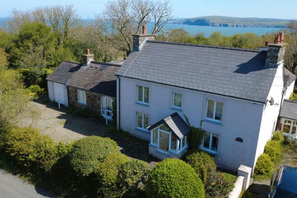
- Price
- Guide Price£895,000
- Size
- 10 acres
Soar Hill Farm, Cwm-yr-Eglwys, Dinas Cross, Newport, SA42, Dinas Cross, Pembrokeshire SA42 Wales
Added on 15/05/2026Farmhouse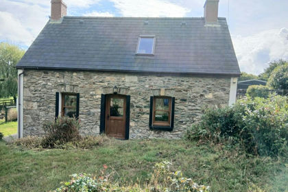
- Price
- £650,000
- Size
- 5.47 acres
Brynberian, Near Newport, SA41, Eglwyswrw, Pembrokeshire SA41 Wales
Added on 26/06/2026Smallholding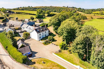
- Price
- £900,000
- Size
- 4 acres
Eglwyswrw, Crymych, SA41, Eglwyswrw, Pembrokeshire SA41 Wales
Added on 29/01/2026Holiday Let Property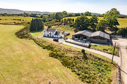
- Price
- £1,000,000
- Size
- 50 acres
Eglwyswrw, Crymych, SA41, Eglwyswrw, Pembrokeshire SA41 Wales
Added on 30/05/2026Farm
- Price
- Offers Over£650,000
- Size
- 4 acres
Gwynfa, Moylegrove, Cardigan, SA43, Cardigan, Pembrokeshire SA43 Wales
Added on 06/07/2026Farmhouse
- Price
- Offers in Region of£650,000
- Size
- 4 acres
Added on 28/05/2026House with Land