Llanblethian, Cowbridge, CF71
- Land size
- 12.71 acres
Key Features
- For Sale by Online Auction - Approximately 12.71 acres of Land
- Edge of Cowbridge and Llanblethian
- For Sale by Online Auction
- The Auction end date is Friday 31st July 2026 at 12 Noon
- No Development Clawback
Description
FOR SALE BY AUCTION *
Situation
The land is situated on the edge of Cowbridge town and Llanblethian village. The land is conveniently located being situated approximately 6.4 miles east of Bridgend and approximately 16.20 miles west of Cardiff. Please see the attached location plan.
Description
The land comprises a total of approximately 12.71 acres of land (5.14 hectares) as outlined in red on the attached site plan.
The property is currently grazed as one parcel but is divided by The River Thaw. Generally, the property comprises undulating pastureland suitable for mowing and grazing purposes with potential considered for agricultural, equestrian and amenity use. The land benefits from a 12ft access gate with a small cattle holding pen.
The land may have long-term strategic value for non-agricultural use, but the majority is presently designated in a low flood risk zone.
The property is currently grazed as one parcel with two adjoining additional parcels of land. There is no physical boundary between the subject property and the two adjoining parcels. These boundaries are marked B - C & D – E with the adjoining parcels being owned by separate third parties.
Please note, the adjoining parcel of land south of points B – C may be for sale in the future.
Generally, the property comprises level pastureland suitable for mowing and grazing purposes with potential considered for agricultural, equestrian and amenity use.
Access
Access to the land is from a 12ft galvanised field gate off Constitution Hill marked A on the attached site plan.
Plan
The plans attached to these particulars are shown for identification purposes only and, whilst every care has been taken, its contents cannot be guaranteed.
Services
The land benefits from natural water. We are aware that mains water is available within the vicinity.
For further information, prospective purchasers are able to make their own enquiries with Dwr Cymru Welsh Water and National Grid.
Basic Payment Scheme
The land is being sold without the benefit of Basic Payment Scheme Entitlements.
Wayleave/Easements/Rights of Way
The property is being sold subject to and with the benefit of all rights including: rights of way, whether public or private, light, support, drainage, water and electricity supplies and other rights and obligations, easements and quasi-easements and restrictive covenants and all existing and proposed wayleaves for masts, pylons, stays, cables, drains, water and gas and other pipes whether referred to in these particulars or not. There are two footpaths crossing the land.
Boundaries
The purchaser(s) shall be deemed to have full knowledge of all boundaries and neither the vendor nor the vendors agents will be responsible for defining the boundaries of the ownership thereof.
There is no physical boundary between B – C & D – E. The adjoining land is owned by separate third parties. Please note, the adjoining parcel of land south of points B – C may be for sale in the future.
Tenure and Possession
Freehold.
A claim of tenancy rights has been asserted over the land and that more details can be provided on request. All correspondence is within the legal pack. We would recommend all prospective buyers obtain their own legal advice.
Guide Price
£185,000
Health and Safety
Given the potential hazards of agricultural land, we ask you to be as vigilant as possible when making your inspection for your own personal safety.
Method of Sale
The property will be offered for sale by Online Auction (unless sold prior.) The Auction end date is:
Friday 31st July 2026 ending at 12 noon.
The Vendor reserves the right to withdraw or alter the property for sale prior to auction end date.
Vendor Solicitors
Berry Smith Lawyers, Haywood House, Dumfries Place, Cardiff, CF10 3GA.
Buyers and Administration Fee
The successful purchaser(s) will be liable to pay the sum of £4,800.00 per sale lot. From this a buyer’s fee of £3,960.00 is retained by Bamboo as a contribution towards the online platform costs.
Legal Pack & Special Conditions of Sale
Please review all information within the Legal Pack. We would especially highlight the Special Conditions of Sale within the Legal Pack, referring to other charges in addition to the purchase price which shall become payable by the successful purchaser(s). Such costs may include search fees, reimbursement of Sellers costs and legal fees and Transfer Fees amongst others.
Full auction details, legal pack, and registration information are available at:
Completion Date
The completion date will be as dictated by the solicitor and included in the legal pack, shown as 20 working days after the auction.
Directions
What3Words:lordship.clinked.servicing
Postcode: CF71 7JB
From Herbert R Thomas Cowbridge, take a right turn off Cowbridge High Street onto Church Street. Continue on Church Street then Town Mill Road for approximately 0.3 miles. Continue round the bend onto Constitution Hill. The land will be situated on the right-hand side opposite Mill Park.
Disclaimer
These particulars are provided as a general guide only and do not form part of any contract or offer. While believed to be accurate, they are not guaranteed. Some images may include CGI or digitally enhanced furnishings for illustrative purposes only and are not included in the sale. All negotiations must be conducted through Herbert R Thomas.
Map Location
Property details
- Tenure
- Freehold
- Council Tax Band
- Ask Agent
- Date Posted
- 2026-06-22
Market Value Analysis
Compared with 193 Farmland & Pasture listings in Wales (10+ acres).
Utilities & Restrictions
Utilities
- Electricity
- Ask Agent
- Water
- Private Supply
- Heating
- Ask Agent
- Broadband
- Ask Agent
- Sewerage
- Ask Agent
Rights & Restrictions
- Public Rights of Way
- Ask Agent
- Private Rights of Way
- Ask Agent
- Listed Property
- Ask Agent
- Restrictions
- Ask Agent
Listed status, conservation areas and planning constraints for this location are in the full report.
Property Features
- Accessibility
- Ask Agent
- Parking
- Ask Agent
- Garden
- Ask Agent
Beyond the particulars: planning activity, flood history, heritage and ground risks, checked for this exact spot.
Connectivity
Broadband
Fastest speed available at this postcode
80 Mbps
Superfast
Suitable for
- HD streaming
- Video calls
- Web & social
Mobile signal
Outdoor predictions; indoor signal depends on building materials.
Ofcom Connected Nations postcode-level predictions. Speeds and signal are modelled, not measured, and vary between addresses and providers.
Signal is the easy part. Planning activity, flood history and protected designations here are in the full report.
Nearest Schools
Primary
- Y Bont Faen Primary School471 metres
- Pupils
- 269
- Type
- Nursery, Infants & Juniors
- Language
- English medium school / provision
- Ysgol Iolo Morganwg616 metres
- Pupils
- 195
- Type
- Nursery, Infants & Juniors
- Language
- Welsh medium school / provision (including transitional)
- Cowbridge School0.8 miles
- Pupils
- 1,559
- Type
- Middle (ages 3-19)
- Language
- English medium school / provision
- Llanfair Primary School1.5 miles
- Pupils
- 142
- Type
- Nursery, Infants & Juniors
- Language
- English medium school / provision
- Llangan Primary School2.3 miles
- Pupils
- 123
- Type
- Nursery, Infants & Juniors
- Language
- English medium school / provision
Secondary
- Cowbridge School0.8 miles
- Pupils
- 1,559
- Type
- Middle (ages 3-19)
- Language
- English medium school / provision
- Ysgol Llanhari3.7 miles
- Pupils
- 647
- Type
- Middle (ages 3-19)
- Language
- Welsh medium school / provision (including transitional)
- Llantwit Major School3.8 miles
- Pupils
- 980
- Type
- Secondary (ages 11-19)
- Language
- English medium school / provision
- Pencoed Comprehensive4.6 miles
- Pupils
- 882
- Type
- Secondary (ages 11-19)
- Language
- English medium school / provision
- Archbishop McGrath Catholic High School5.6 miles
- Pupils
- 825
- Type
- Secondary (ages 11-19)
- Language
- English medium school / provision
Distances are straight-line from the advertised location. Source: the national school registers (DfE, Welsh Government, Scottish Government) and Ofsted.
Schools are just the start: sold prices nearby, planning activity and any flood history are in the full report.
Amenities
Supermarket
GP surgery
Pharmacy
Green space
Straight-line distances from the advertised location. Sources: NHS records, Geolytix supermarket locations, OS Open Greenspace and the national trails registers.
The area stacks up? Now check the location itself: planning nearby, protected designations and past flooding.
Getting Around
Nearest station
Nearest bus stop
Typical drive times
Straight-line distances from the advertised location; drive times are typical free-flow times over OpenStreetMap road data, so allow more at peak. Public transport locations from DfT NaPTAN.
Easy to reach matters. So do planning activity, flood history and ground risks: all in the full report.
Flood Risk
From Natural Resources Wales flood map open data, checked around the advertised map pin and allowing for the listed acreage where known. This summary comes from LandSale, the advertising platform, not from the listing agent, and is not part of the agent's particulars. Risk can vary across a single holding, so verify anything critical through your own searches before committing.
Rivers and the sea
Mapped within the area searched, not at the advertised map pin itself.
Surface water
The detail behind these bandings
The full report pinpoints where this location sits on the flood maps, and runs the deeper checks that usually only surface after an offer.
- Exact flood zones & annual chances (included in the full report)
- Any recorded past flooding (included in the full report)
- Planning activity nearby (included in the full report)
- Heritage & conservation (included in the full report)
- Protected nature designations (included in the full report)
- Ground risks (included in the full report)
- Sold prices nearby (included in the full report)
£14.99 · one-off purchase
By LandSale, the platform. Not provided by the listing agent. Ready in about a minute.
Important notice: Information, maps and tags on this page are drawn from the advertising agent's marketing materials or generated automatically. LandSale has not verified them. Relying on these details is at your own risk, always carry out independent checks before committing to a purchase.
LandSale full disclaimer
Marketing information only - not formal particulars. The details on this website are provided for general guidance and do not constitute an offer or contract. Neither LandSale nor the advertising estate/land agent accepts responsibility for any inaccuracy.
1. Source of information
- Listing content: Core description, asking price, tenure, measurements, photographs and planning history originate from the marketing materials of the advertising estate or land agent. LandSale does not author this content and cannot guarantee its accuracy.
- Automated tags & categorisation: Property type, land-use class, acreage bands and similar labels may be applied by machine-learning models. They are intended as a helpful guide only and may not reflect the property's legal status or permitted use.
- Third-party & enriched data layers: Maps, boundary outlines, planning designations, soil reports, broadband coverage and other environmental or location-based insights are licensed from external suppliers. Such data are supplied “as is", may be incomplete or out of date and are subject to change without notice.
2. Verification required
Prospective purchasers must verify critical matters, including but not limited to planning permission, title boundaries, public rights of way, environmental constraints, acreage, services, access and VAT status, through their own inspections, specialist surveys, legal advisers and the selling agent before relying on the information or entering into any contract.
3. No warranty or liability
LandSale gives no warranty, express or implied, as to the accuracy, completeness or fitness for any particular purpose of the information displayed. LandSale shall not be liable for any loss, damage, cost or expense arising directly or indirectly from any use of or reliance on such information, save where liability may not be excluded by law.
4. Updates & feedback
If you believe any detail on this listing is inaccurate, please let us know. We will investigate and, where appropriate, update the listing or notify the agent.
© LandSale | Version 1.3 - August 2026
Similar properties for sale
- Price
- Guide Price£200,000
- Size
- 6.06 acres
Added on 20/03/2026Agricultural Land
- Price
- Guide Price£160,000
- Size
- 20.45 acres
Added on 08/08/2026Agricultural Land
- Price
- Guide Price£210,000
- Size
- 10.31 acres
Approximately 10.31 acres of land Hendre Road, Pencoed, CF35, Coity Higher, Bridgend CF35 Wales
Added on 14/08/2026Farmland- Price
- Guide Price£150,000
- Size
- 8.2 acres
Added on 14/08/2026Pasture
- Price
- Offers in Region of£160,000
- Size
- 11.63 acres
Michaelston-Y-Fedw, Cefn Mably, Rudry, Caerphilly CF83 Wales
Added on 29/01/2026Grazing Land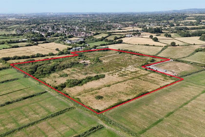
- Price
- Guide Price£150,000
- Size
- 18.32 acres
18.32 Acres of Land at Ty Mawr Lane, Marshfield, Marshfield, Newport CF3 Wales
Added on 19/08/2026Agricultural Land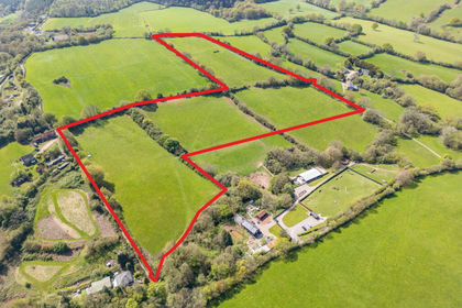
- Price
- Guide Price£200,000
- Size
- 18.86 acres
Land at Cwrt Bach, Henllys, Cwmbran, NP44, Henllys, Torfaen NP44 Wales
Added on 04/06/2026Pasture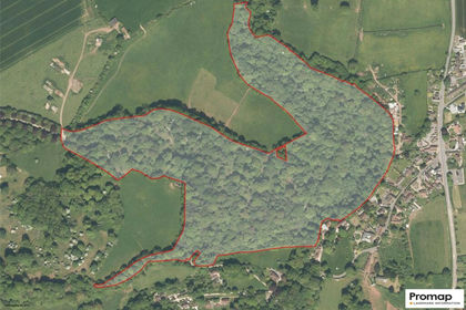
- Price
- Guide Price£150,000
- Size
- 37.3 acres
Holford, Bridgwater, Somerset, TA5, Holford, Somerset TA5 England
Added on 30/04/2026Undeveloped Land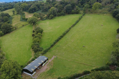
- Price
- Guide Price£165,000
- Size
- 10.75 acres
Added on 18/03/2026PastureLeasehold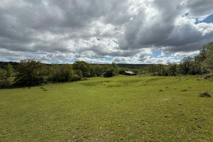
- Price
- Guide Price£165,000
- Size
- 31.28 acres
Land at Glyn Mawr, Ynyswen, Penycae, SA9, Penycae, Powys SA9 Wales
Added on 08/06/2026Grazing Land