Rural Charm in Syderstone
- Bedrooms
- 3
- Bathrooms
- 2
Key Features
- Semi-Detached Cottage
- Large Garden
- Character Features
- Large Hall Entrance
- Boutique Style Bedroom with Roll-Top Bath and Kitchenette
- Spacious Kitchen/Dining Room and Living Space
- Three Double Bedrooms
- Village Location
Description
Tucked away in the heart of the ever-popular village of Syderstone, 9 The Street is a charming three-bedroom semi-detached period cottage that effortlessly blends character, space and individuality.
From the moment you step inside, the property reveals its unique personality. A spacious and welcoming hallway sets the tone, offering far more than first meets the eye and creating a wonderful sense of arrival. The main living accommodation flows into a generous kitchen/dining room and living space, perfect for everyday family life as well as entertaining, with room to cook, dine and relax together.
One of the home’s most distinctive features is the integral converted barn, now forming bedroom three. This exceptional space offers real versatility and a touch of indulgence, complete with a kitchenette and a striking freestanding roll-top bath, making it ideal as a guest suite, creative studio or private retreat.
The property is warmed by oil-fired central heating, ensuring comfort throughout the seasons, while its period features and thoughtful layout give it a cosy yet spacious feel.
Set within lovely Syderstone village, known for its rural charm and strong community spirit, this delightful cottage offers a rare opportunity to enjoy village living with a truly unique twist - a home full of character, comfort and possibility.
SYDERSTONE
Being only nine miles from the north Norfolk coast, Syderstone is well-known for its nature reserve and country walks. There is also St Mary’s - a 900 year old round-towered church.
The nearest pub is the recently refurbished gastro pub, The Ostrich, in the next door village of South Creake. Burnham Market and Fakenham, both have a wide variety of shops and facilities, and are only a short drive away.
Main line trains to London Kings Cross run from King’s Lynn. Golf courses are to be found at Brancaster, Hunstanton and Fakenham.
Within easy reach of the sea, Fakenham is top of the list when it comes to market towns. While sandy beaches are just ten miles away, Fakenham is perfectly positioned halfway between King’s Lynn and Norwich with easy reach to Holt and Swaffham, making for an easy commute.
Out of working hours, there’s plenty to keep you entertained including the thriving independent Central Cinema, a perennial favourite with locals. Enjoy a fun glass-blowing session with the kids at Langham Glass, reconnect with nature at Pensthorpe or blow the cobwebs with a walk at nearby Sculthorpe Moor.
For something fancier, dress up to the nines and enjoy a day out and a flutter at Fakenham Racecourse, or team up with your playing pals for a round at Fakenham Golf Club, set in and around the racecourse. And Thursford is just four miles away with its magnificent collection of steam engines and organs – a visit to its Christmas spectacular gives a West End theatre excursion a run for its money.
SERVICES CONNECTED
Mains electricity, water and drainage. Oil fired central heating.
COUNCIL TAX
Band A.
ENERGY EFFICIENCY RATING
F. Ref: 7200-1114-0322-7491-3143
To retrieve the Energy Performance Certificate for this property please visit and enter in the reference number above. Alternatively, the full certificate can be obtained through Sowerbys.
TENURE
Freehold.
LOCATION
What3words: ///quoted.budding.realm
WEBSITE TAGS
cosy-cottages
village-spirit
historical-homes
EPC Rating: F
Disclaimer
These particulars are provided as a guide only and do not form part of any offer or contract. Sowerbys and its representatives have no authority to make or give representations or warranties. All descriptions, measurements, photographs and plans are for guidance only and should not be relied upon as statements of fact. Buyers should satisfy themselves as to the accuracy of the information through inspection or professional advice. Services, appliances and equipment have not been tested and no warranty can be given as to their condition. Planning permissions, building regulations and other consents should be verified by the buyer’s legal adviser. In accordance with Anti-Money Laundering regulations, proceeding buyers must complete a digital ID check through our compliance partner. A charge of £48 including VAT per sale or purchase applies. Leasehold buyers should confirm ground rent, service charges and lease details with their legal adviser.
Map Location
Property details
- Tenure
- Freehold
- Council Tax Band
- A
- Date Posted
- 2026-06-22
Energy Performance Certificate
Energy Efficiency Rating
Based on UK Energy Performance Certificate standards (EU Directive 2002/91/EC)
Running costs are one side. Planning activity, flood history and ground risks for this location are in the full report.
Utilities & Restrictions
Utilities
- Electricity
- Mains
- Water
- Mains
- Heating
- Oil Heating, Wood Burner
- Broadband
- Ask Agent
- Sewerage
- Mains
Rights & Restrictions
- Public Rights of Way
- Ask Agent
- Private Rights of Way
- Ask Agent
- Listed Property
- Ask Agent
- Restrictions
- Ask Agent
Listed status, conservation areas and planning constraints for this location are in the full report.
Property Features
- Accessibility
- Ask Agent
- Parking
- Ask Agent
- Garden
- Private Garden
Beyond the particulars: planning activity, flood history, heritage and ground risks, checked for this exact spot.
Connectivity
Broadband
Fastest speed available at this postcode
80 Mbps
Superfast
Suitable for
- HD streaming
- Video calls
- Web & social
Mobile signal
Outdoor predictions; indoor signal depends on building materials.
Ofcom Connected Nations postcode-level predictions. Speeds and signal are modelled, not measured, and vary between addresses and providers.
Signal is the easy part. Planning activity, flood history and protected designations here are in the full report.
Nearest Schools
Primary
- Blenheim Park Academy0.8 milesOfsted: Good
- Ages
- 5 to 11
- Pupils
- 70
- Type
- Academy sponsor led
- Rudham CofE Primary Academy3 milesNo Ofsted rating
- Ages
- 4 to 11
- Pupils
- 59
- Type
- Academy converter
- Faith
- Church of England
- Sculthorpe Church of England Primary Academy4.3 milesOfsted: Good
- Ages
- 3 to 11
- Pupils
- 61
- Type
- Academy converter
- Faith
- Church of England
- Docking Church of England Primary Academy and Nursery4.9 milesNo Ofsted rating
- Ages
- 3 to 11
- Pupils
- 109
- Type
- Academy converter
- Faith
- Church of England
- Harpley CofE VC Primary School5 milesOfsted report card · Jan 2026
- Ages
- 4 to 11
- Pupils
- 50
- Type
- Voluntary controlled school
- Faith
- Church of England
Secondary
- Fakenham Academy5.4 milesNo Ofsted rating
- Ages
- 11 to 18
- Pupils
- 723
- Type
- Academy sponsor led
- Alderman Peel High School8.3 milesOfsted: Good
- Ages
- 11 to 16
- Pupils
- 606
- Type
- Academy converter
- Litcham School10 milesOfsted: Good
- Ages
- 4 to 16
- Pupils
- 727
- Type
- Academy converter
- Smithdon High School11 milesOfsted: Good
- Ages
- 11 to 16
- Pupils
- 579
- Type
- Academy sponsor led
- Springwood High School14 milesNo Ofsted rating
- Ages
- 11 to 18
- Pupils
- 1,988
- Type
- Academy converter
Distances are straight-line from the advertised location. Source: the national school registers (DfE, Welsh Government, Scottish Government) and Ofsted.
Schools are just the start: sold prices nearby, planning activity and any flood history are in the full report.
Amenities
Supermarket
GP surgery
Pharmacy
Hospital
Green space
Straight-line distances from the advertised location. Sources: NHS records, Geolytix supermarket locations, OS Open Greenspace and the national trails registers.
The area stacks up? Now check the location itself: planning nearby, protected designations and past flooding.
Getting Around
Nearest station
Nearest bus stop
Typical drive times
Straight-line distances from the advertised location; drive times are typical free-flow times over OpenStreetMap road data, so allow more at peak. Public transport locations from DfT NaPTAN.
Easy to reach matters. So do planning activity, flood history and ground risks: all in the full report.
Flood Risk
From Environment Agency flood map open data, checked around the advertised map pin and allowing for the listed acreage where known. This summary comes from LandSale, the advertising platform, not from the listing agent, and is not part of the agent's particulars. Risk can vary across a single holding, so verify anything critical through your own searches before committing.
Rivers and the sea
Surface water
The detail behind these bandings
The full report pinpoints where this location sits on the flood maps, and runs the deeper checks that usually only surface after an offer.
- Exact flood zones & annual chances (included in the full report)
- Any recorded past flooding (included in the full report)
- Planning activity nearby (included in the full report)
- Heritage & conservation (included in the full report)
- Protected nature designations (included in the full report)
- Ground risks (included in the full report)
- Sold prices nearby (included in the full report)
£14.99 · one-off purchase
By LandSale, the platform. Not provided by the listing agent. Ready in about a minute.
Important notice: Information, maps and tags on this page are drawn from the advertising agent's marketing materials or generated automatically. LandSale has not verified them. Relying on these details is at your own risk, always carry out independent checks before committing to a purchase.
LandSale full disclaimer
Marketing information only - not formal particulars. The details on this website are provided for general guidance and do not constitute an offer or contract. Neither LandSale nor the advertising estate/land agent accepts responsibility for any inaccuracy.
1. Source of information
- Listing content: Core description, asking price, tenure, measurements, photographs and planning history originate from the marketing materials of the advertising estate or land agent. LandSale does not author this content and cannot guarantee its accuracy.
- Automated tags & categorisation: Property type, land-use class, acreage bands and similar labels may be applied by machine-learning models. They are intended as a helpful guide only and may not reflect the property's legal status or permitted use.
- Third-party & enriched data layers: Maps, boundary outlines, planning designations, soil reports, broadband coverage and other environmental or location-based insights are licensed from external suppliers. Such data are supplied “as is", may be incomplete or out of date and are subject to change without notice.
2. Verification required
Prospective purchasers must verify critical matters, including but not limited to planning permission, title boundaries, public rights of way, environmental constraints, acreage, services, access and VAT status, through their own inspections, specialist surveys, legal advisers and the selling agent before relying on the information or entering into any contract.
3. No warranty or liability
LandSale gives no warranty, express or implied, as to the accuracy, completeness or fitness for any particular purpose of the information displayed. LandSale shall not be liable for any loss, damage, cost or expense arising directly or indirectly from any use of or reliance on such information, save where liability may not be excluded by law.
4. Updates & feedback
If you believe any detail on this listing is inaccurate, please let us know. We will investigate and, where appropriate, update the listing or notify the agent.
© LandSale | Version 1.3 - August 2026
Similar properties for sale
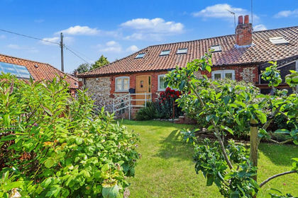
- Price
- Guide Price£350,000
Manor Court, The Street, Syderstone, Syderstone, Norfolk PE31 England
Added on 22/06/2026Barn Conversion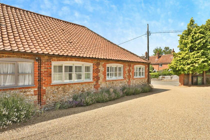
- Price
- Offers Over£350,000
The Street, Syderstone, King's Lynn, Syderstone, Norfolk PE31 England
Added on 29/01/2026Barn Conversion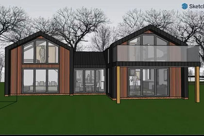
- Price
- Offers in Region of£325,000
Fakenham Road, Stanhoe, King's Lynn, Docking, Norfolk PE31 England
Added on 20/05/2026Self Build Plot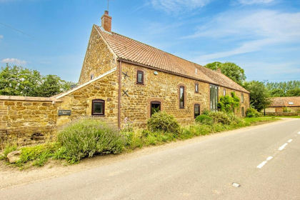
- Price
- Guide Price£375,000
Added on 17/07/2026Barn Conversion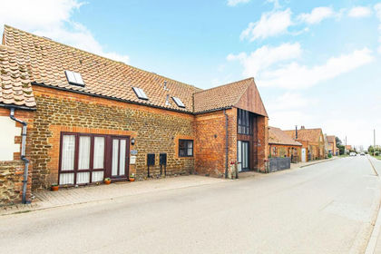 Added on 29/01/2026Barn Conversion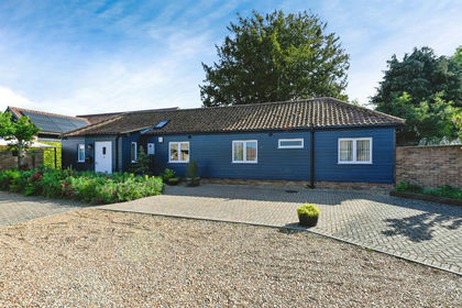
- Price
- Offers in Excess of£340,000
Hall Farm Road, Gayton, King's Lynn, Gayton, Norfolk PE32 England
Added on 28/01/2026Barn Conversion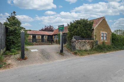
- Price
- Guide Price£290,000
Charming Detached Single-Storey Barn Conversion in Pentney, Pentney, Norfolk PE32 England
Added on 29/01/2026Barn Conversion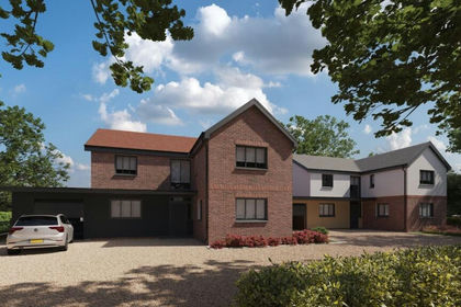
- Price
- Guide Price£275,000
- Size
- 0.35 acres
Two Building Plots, Gayton Road, King's Lynn, North West Norfolk, Norfolk PE30 England
Added on 29/01/2026Development Land
- Price
- Guide Price£275,000
- Size
- 0.35 acres
Gayton Road, Gaywood, King's Lynn, Norfolk, PE30, North West Norfolk, Norfolk PE30 England
Added on 21/05/2026Development Land
- Price
- Offers Over£425,000
Added on 15/04/2026Barn Conversion