Wolfhampcote, Rugby, CV23
- Land size
- 58.99 acres
Key Features
- Pastureland situated to the west of Braunston
- Amenity potential
- Available as a whole or in 3 lots
- Extending to 199.36 acres (80.68 ha)
Description
58.99 acres of pastureland east of Flecknoe with amenity potential.
Further land available as whole extending to 199.36 acres (80.68 ha).
Lot 1: 64.89 acres
Lot 2: 58.99 acres
Lot 3: 75.48 acres (Sold)
Distances - •Daventry: 4 miles
•Rugby: 8 miles
•Leamington Spa: 15 miles
•Northampton: 18 miles
Situation - The land is situated to the west of the A45 at Braunston and lies within the parish of Wolfhampcote. The land straddles the Northamptonshire/Warwickshire County border, with Lots 2 & 3 falling within Warwickshire and Lot 1, Northamptonshire.
Access to the land is off the A45 to the east as well as from Nethercote/Flecknoe to the south. Further detail of the location can be found on the plan to the rear of the brochure.
Description - The land on offer forms part of a wider holding, some of which is being retained. It is being offered as three individual lots or as a whole and offers purchasers the opportunity to acquire grazing land with the potential for other amenity or environmental uses.
Lot 1 - Lot 1 (shown edged red) extends to 64.89 acres, comprising 63.93 acres of reasonably level ridge and furrow pastureland presented as two parcels with mature tree and hedgerow boundaries. The land benefits from direct access to the A45 (London Road).
The land would be suited to agricultural or equestrian use, although part is scheduled as an ancient monument with Historic England. (See designation paragraph).
Lot 2 - Lot 2 (shown edged blue) extends to 58.99 acres, comprising circa 58.86 acres of gently sloping pastureland and access track shown hatched orange on the site plan).
The land would be suited to agricultural or equestrian use.
The purchaser of Lot 2 will be responsible for the erection and maintenance thereafter of a stock proof boundary fence.
Lot 3 - Lot 3 (shown edged green) extends to 75.48 acres, comprising circa 75.41 acres of gently sloping ridge and furrow pastureland, presented as 3 parcels with mature tree and hedgerow boundaries.
The land would be suited to agricultural or equestrian use.
The purchaser of Lot 3 will be required to make a new point of entrance to the land at point Z on the attached plan. (Specification to be agreed).
Tenure And Possession - The property is offered for sale freehold with vacant possession of the land being given upon completion. All three Lots are registered under Title Number WK449111.
Land Grade And Soil Type - According to Natural England, the land is classified as a mix of Grade 3 and 4 on the Agricultural Classification Maps, being slowly permeable base-rich loamy and clay soil.
Basic Payment Scheme - The land is registered to receive payment under the Basic Payment Scheme and a claim was submitted for the 2023 scheme year by the occupier and this payment and the historic reference amounts will be retained by the vendor.
Countryside Stewardship Scheme - The land is not subject to any existing CSS agreements.
The agent is of the opinion that capital grant funding may be available through the scheme towards the necessary works required to make the land stock proof (such as fencing and water troughs).
Services - Water is via a shared supply from the eastern boundary of Lot 1.
The appropriate service connection rights will be reserved across Lot 1 for the benefit of the retained land and Lot 2, in the event of it being sold separately.
Lots 1 and 3 benefit from access to a natural water supply, with drinking points along the River Leam, which forms the western boundary of Lot 1 and the northern boundary of Lot 3.
Purchasers should note that it is their specific responsibility to investigate the availability of services. Easements for services will be granted (or retained) if required by the purchaser/vendor.
Access - Lot 1 can be accessed directly by the A45 (London Road) via a concrete bell mouth, which leads to a gated entrance at point A. From there, two gated concrete tracks provide access over the land to points B and C.
Access to Lot 2 is from Nethercote/Flecknoe to the south, via a gated entrance at Y on the site plan.
Access to Lot 3 is through Wolfhampcote and via a bridge over the Grand Union Canal. It will be the responsibility of the purchaser to make a new point of entrance to the land at point Z, via the area hatched green on the attached plan.
POINT OF NOTE: the canal bridge giving access to Lot 3 is subject to a 12t weight restriction.
Overage Clause - An overage clause will be included within the sales contract for Lots 1, 2 and 3 which will reserve 30% of any increase in value due to any non-agricultural or non-equestrian development that takes place on the land for a period of 30 years from the date of the sale, triggered upon implementation of planning, sale or long lease.
Designations - Within Lot 1 lies the former site of the deserted medieval village of Braunstonbury, which is a designated Scheduled Monument (List Entry Number: 1017580). Interested parties are advised that some ground operations may require Scheduled Monument Consent.
Rights Of Way - Lot 1 is subject to a general public right of access along the footpath and byway between points A and B on the site plan, which also benefits the residents of Wolfhampcote. Existing rights of access exist for private individuals over the land from point A to points C, D and E on the attached plan. Full details of which will be provided.
The appropriate rights of access will be granted for the purchasers of each lot as well as any that are required to be retained by the vendor.
The property is sold subject to and with the benefit of all existing rights, obligations, easements, and all wayleaves and covenants, whether disclosed or not.
Sporting, Timber And Mineral Rights - All rights are believed to be held with the freehold owner and will be included within a sale of the land.
Boundaries And Fencing - The external boundary responsibility is marked with a ‘T’ mark, where known.
Plan, Area And Description - These are based on the Ordnance Survey and Rural Land Register data and are there for reference only.
The plans, area and description are believed to be correct in every way, but no claim will be entertained by the vendor or the agents in respect of any error, omissions or misdescriptions.
Method Of Sale - The property will be offered for sale by private treaty as a whole or in three lots and interested parties should submit their offers to the agent’s Rugby office.
Lot 1: £400,000
Lot 2: £500,000
Lot 3: £470,000 (SSTC)
Whole: £1.37m
The vendor reserves the right to offer the property for sale in any order other than that described in these particulars, to sub-divide, amalgamate or withdraw the property from the sale without prior notice.
Vendor Solicitor - Alex Robinson, Wright Hassall, Olympus Ave, Leamington Spa, CV34 6BF
Tel.: 01926-883-009 | Email: alexandra.
Local Authorities - West Northamptonshire District Council Tel: 0300-1267-000
Rugby Borough Council Tel: 01788-533-533
Western Power Tel: 0800-6783-105
Severn Trent Water Tel: 03457-500-500
Viewing - Strictly by prior appointment through the agent’s Rugby office on 01788-564-680, or email .
Please be aware that livestock graze the land, therefore please keep gates closed and take appropriate biosecurity measures.
What3words - Lot 1: ///tweaked.steep.intruding
Lot 2: ///cascaded.length.agreement
Lot 3: ///reassured.bordering.develops
Anti Money Laundering Regulations - We are required under due diligence, as set up under HRMC, to take a full identification (e.g. photo ID and recent utility bill as proof of address) of a potential purchaser upon submitting an offer on a property.
Map Location
Property details
- Tenure
- Freehold
- Council Tax Band
- Ask Agent
- Date Posted
- 2026-06-18
Market Value Analysis
Compared with 35 Farmland & Pasture listings in West Midlands (50+ acres).
Utilities & Restrictions
Utilities
- Electricity
- Ask Agent
- Water
- Ask Agent
- Heating
- Ask Agent
- Broadband
- Ask Agent
- Sewerage
- Ask Agent
Rights & Restrictions
- Public Rights of Way
- Ask Agent
- Private Rights of Way
- Ask Agent
- Listed Property
- Ask Agent
- Restrictions
- Ask Agent
Listed status, conservation areas and planning constraints for this location are in the full report.
Property Features
- Accessibility
- Ask Agent
- Parking
- Ask Agent
- Garden
- Ask Agent
Beyond the particulars: planning activity, flood history, heritage and ground risks, checked for this exact spot.
Connectivity
Broadband
Fastest speed available at this postcode
27 Mbps
Standard (10-30 Mbps)
Suitable for
- Web & social
- Music streaming
- Standard video calls
Mobile signal
Predicted 4G and 5G signal; indoor signal depends on building materials.
Ofcom Connected Nations postcode-level predictions. Speeds and signal are modelled, not measured, and vary between addresses and providers.
Signal is the easy part. Planning activity, flood history and protected designations here are in the full report.
Nearest Schools
Primary
- Braunston Church of England Primary School1.4 milesNo Ofsted rating
- Ages
- 4 to 11
- Pupils
- 200
- Type
- Academy converter
- Faith
- Church of England
- Staverton Church of England Voluntary Primary School2.6 milesNo Ofsted rating
- Ages
- 4 to 11
- Pupils
- 108
- Type
- Academy converter
- Faith
- Church of England
- E-ACT The Grange School3 milesOfsted: Requires improvement
- Ages
- 2 to 11
- Pupils
- 336
- Type
- Academy sponsor led
- Barby Church of England Primary School3.1 milesNo Ofsted rating
- Ages
- 4 to 11
- Pupils
- 96
- Type
- Academy converter
- Faith
- Church of England
- Ashby Fields Primary School3.1 milesOfsted: Good *
- Ages
- 4 to 11
- Pupils
- 397
- Type
- Academy converter
Secondary
- The Parker E-ACT Academy3.2 milesOfsted: Inadequate *
- Ages
- 11 to 18
- Pupils
- 1,132
- Type
- Academy sponsor led
- DSLV E-ACT Academy3.9 milesOfsted: Good
- Ages
- 3 to 18
- Pupils
- 997
- Type
- Academy sponsor led
- Ashlawn School5.2 milesOfsted: Good *
- Ages
- 11 to 18
- Pupils
- 1,564
- Type
- Academy converter
- Rugby High School5.4 milesOfsted: Good
- Ages
- 11 to 18
- Pupils
- 927
- Type
- Academy converter
- Gender
- Girls
- Rugby Free Secondary School5.5 milesOfsted report card · Apr 2026
- Ages
- 11 to 19
- Pupils
- 1,168
- Type
- Free schools
* Latest graded judgement covers quality of education only; no overall grade was issued under the 2024-25 inspection framework.
Distances are straight-line from the advertised location. Source: the national school registers (DfE, Welsh Government, Scottish Government) and Ofsted.
Schools are just the start: sold prices nearby, planning activity and any flood history are in the full report.
Amenities
Supermarket
GP surgery
Pharmacy
Hospital
Straight-line distances from the advertised location. Sources: NHS records, Geolytix supermarket locations, OS Open Greenspace and the national trails registers.
The area stacks up? Now check the location itself: planning nearby, protected designations and past flooding.
Getting Around
Nearest station
Nearest bus stop
Typical drive times
Straight-line distances from the advertised location; drive times are typical free-flow times over OpenStreetMap road data, so allow more at peak. Public transport locations from DfT NaPTAN.
Easy to reach matters. So do planning activity, flood history and ground risks: all in the full report.
Flood Risk
Environment Agency open data, checked around the advertised map pin for the listed acreage. Long-term risk counts flood defences; the planning map's flood zones do not. Provided by LandSale, not the listing agent, and not part of the agent's particulars. Risk varies across a holding, so verify before committing.
Rivers and the sea
Planning map: Flood Zone 1.
Surface water
Not at the pin: mapped about 50 metres away.
These bandings are the summary. Where this location sits on the flood maps, plus planning activity, heritage and ground risks, is in the full report.
Important notice: Information, maps and tags on this page are drawn from the advertising agent's marketing materials or generated automatically. LandSale has not verified them. Relying on these details is at your own risk, always carry out independent checks before committing to a purchase.
LandSale full disclaimer
Marketing information only - not formal particulars. The details on this website are provided for general guidance and do not constitute an offer or contract. Neither LandSale nor the advertising estate/land agent accepts responsibility for any inaccuracy.
1. Source of information
- Listing content: Core description, asking price, tenure, measurements, photographs and planning history originate from the marketing materials of the advertising estate or land agent. LandSale does not author this content and cannot guarantee its accuracy.
- Automated tags & categorisation: Property type, land-use class, acreage bands and similar labels may be applied by machine-learning models. They are intended as a helpful guide only and may not reflect the property's legal status or permitted use.
- Third-party & enriched data layers: Maps, boundary outlines, planning designations, soil reports, broadband coverage and other environmental or location-based insights are licensed from external suppliers. Such data are supplied “as is", may be incomplete or out of date and are subject to change without notice.
2. Verification required
Prospective purchasers must verify critical matters, including but not limited to planning permission, title boundaries, public rights of way, environmental constraints, acreage, services, access and VAT status, through their own inspections, specialist surveys, legal advisers and the selling agent before relying on the information or entering into any contract.
3. No warranty or liability
LandSale gives no warranty, express or implied, as to the accuracy, completeness or fitness for any particular purpose of the information displayed. LandSale shall not be liable for any loss, damage, cost or expense arising directly or indirectly from any use of or reliance on such information, save where liability may not be excluded by law.
4. Updates & feedback
If you believe any detail on this listing is inaccurate, please let us know. We will investigate and, where appropriate, update the listing or notify the agent.
© LandSale | Version 1.3 - August 2026
Listing agent
Howkins & Harrison LLP, Rugby
7-11 Albert Street, Rugby, CV21 2RX
Similar properties for sale
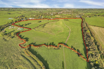
- Price
- Guide Price£400,000
- Size
- 64.89 acres
Wolfhampcote, Rugby, CV23, Wolfhampcote, Warwickshire CV23 England
Added on 29/01/2026Grazing Land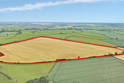
- Price
- Guide Price£500,000
- Size
- 50.32 acres
Brooks Close, Willoughby, Rugby, Willoughby, Warwickshire CV23 England
Added on 04/06/2026Arable Land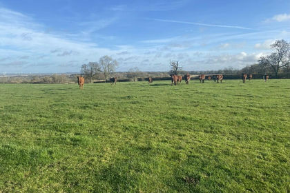
- Price
- Guide Price£510,000
- Size
- 64.61 acres
Lot 1 - Pastureland Off The Ridgeway, Barby, CV23, Barby, West Northamptonshire CV23 England
Added on 13/02/2026Farmland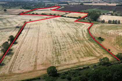
- Price
- Guide Price£600,000
- Size
- 59.93 acres
Added on 24/09/2026Arable Land
- Price
- £550,000
- Size
- 46.75 acres
Off Lyddington Road, Caldecott, Leicestershire, Caldecott, Rutland LE16 England
Added on 12/08/2026Agricultural Land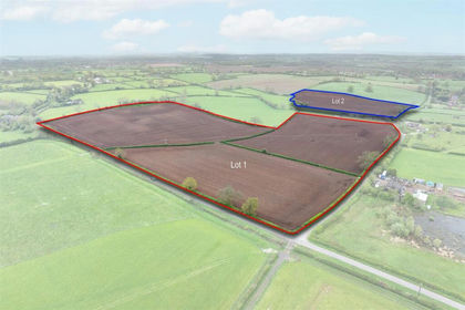
- Price
- Guide Price£475,000
- Size
- 29.03 acres
Quarry Lane, Snarestone, DE12, Snarestone, Leicestershire DE12 England
Added on 19/05/2026Arable Land
- Price
- Guide Price£560,000
- Size
- 56.85 acres
Added on 09/10/2026Farmland
- Price
- Guide Price£436,500
- Size
- 43.65 acres
Added on 09/10/2026Arable Land
- Price
- Guide Price£500,000
- Size
- 54.39 acres
Clopton Road, Old Weston, Old Weston, Cambridgeshire PE28 England
Added on 09/09/2026Arable Land
- Price
- Guide Price£420,000
- Size
- 42.7 acres
Arable Land at Winwick, Winwick, Cambridgeshire PE28 England
Added on 22/06/2026Arable Land