Maidstone Road, Borough Green, Kent, TN15
- Bedrooms
- 1
- Bathrooms
- 1
Key Features
- New 1 Bedroom Barn Conversion Bungalow
- Sitting/Dining Room Area with Bi-fold Doors
- Open Plan Fitted Kitchen Area with Integrated Appliances
- Double Bedroom
- Bathroom/Shower Room
- Under Floor Heating & Double Glazing
- Courtyard Patio Garden
- Allocated Parking Space
- Walking Distance of Local Amenities & Station
- No Chain
Description
SOLD SUBJECT TO CONTRACT VIA CLIFTON & CO
GUIDE PRICE £325,000
Whiffens Farm Barns is an exclusive development of four individual barn conversions built to an exacting standard in a secluded courtyard setting, yet located right in the heart of Borough Green. Within easy walking distance are the village’s shops, cafés, and Borough Green & Wrotham station, making this rare combination of tranquillity and convenience all the more appealing. Cob Cottage is a beautifully finished one bedroom end of terrace bungalow. As you enter via the hallway, you are led into the bright and airy living/dining/kitchen room where full width bi-fold doors open to a private patio garden. The open plan two-tone kitchen is fitted with integrated appliances for a sleek, modern feel. The double bedroom provides a comfortable haven, and the large contemporary shower bathroom offers a high standard of finish with both separate bath and shower cubicle. Underfloor heating flows throughout the property, complemented by double glazing, ensuring warmth and energy efficiency all year long. Outside, there is an allocated parking space and additional visitor parking within the development. Adjoining the impressive Grade II listed Whiffens Farmhouse, one of the village’s historic properties, Cob Cottage retains the charm of original barn features combining featheredge cladding, exposed stone and brickwork while offering all the benefits of a modern home. Due to its location it’s perfect as a first home, downsize, or weekend retreat, Cob Cottage combines heritage character with contemporary comfort in one of Kent’s most convenient and charming village settings, a truly rare opportunity not to be missed.
Location
Borough Green offers a range of local amenities including independent shops, cafés, a pharmacy, and medical centre. Borough Green Primary School is within walking distance and is highly regarded locally, while secondary and grammar schools in nearby areas such as Tonbridge, Sevenoaks and Wrotham provide excellent options for older students. The property is ideally located for commuters, with Borough Green & Wrotham mainline station offering regular services to London Victoria and Ashford International in under an hour. Road links are also excellent, with easy access to the A25, M20 and M26 connecting to the M25 for wider motorway networks.
Directions
From Borough Green & Wrotham Railway Station, (TN15 8AJ), head east on Station Approach towards Wrotham Road, A227. After 250 feet turn right onto Wrotham Road, A227 for 400 feet. Continue straight onto High Street for 0.1miles. Turn left onto Maidstone Road (A25) for 250 feet, then turn left onto Maidstone Road for 100 feet where the property can be found along on the right hand side.
Entrance Hall
Double glazed composite panelled door to front with frosted glazed windows. Plain ceiling. Downlighters. Smoke alarm. Wood effect LVT flooring with underfloor heating. Large cupboard housing fuse boards and underfloor heating controls. Access to loft space.
Living/Dining/Kitchen Area
Double glazed window to front. Full length double glazed window to front. Double glazed bi-fold doors to rear. Plain ceiling. Downlighters. Smoke alarm. Wood effect LVT flooring with underfloor heating. Fitted wall and base units in navy with grey marble effect work surfaces. Inset stainless steel Reginox sink. Quooker tap. CDA electric hob and oven with filter hood. Integrated CDA washing machine, dishwasher and fridge freezer.
Bedroom
Double glazed window to rear. Plain ceiling. Downlighters. Fitted carpet. Underfloor heating.
Bathroom/Shower Room
Double glazed frosted window to side. Plain ceiling. Downlighters. Tiled flooring with underfloor heating. Xpelair extractor fan. Panelled bath with mixer taps and shower attachment. Corner walk-in shower cubicle. Wash hand basin with tiling in vanity unit. Low level W.C. Shaver point. Half tiled walls.
Courtyard Garden to Rear
Paved patio with flower bed and tree. Fenced surround to rear. Outside light. Side garden patio.
Parking
One allocated parking space to front.
Transport Information
Borough Green 0.1 miles Kemsing 2.6 miles West Malling 4.8 miles The property is also within easy reach of Ebbsfleet Eurostar International Station. The distances calculated are as the crow flies.
Local Schools
Primary Schools: Borough Green Primary School 0.1 miles Grange Park School 0.7 miles Platt Church of England Voluntary Aided Primary School 0.7 miles Ightham Primary School 1.3 miles St George's Church of England Voluntary Controlled Primary School 1.4 miles Secondary Schools: Wrotham School 0.7 miles Grange Park School 0.7 miles Trinity School 4.3 miles The Rosewood School 4.4 miles Hadlow Rural Community School 4.7 miles Information sourced from Rightmove (findaschool). Please check with the local authority as to catchment areas and intake criteria.
Useful Information
We recognise that buying a property is a big commitment and therefore recommend that you visit the local authority websites for more helpful information about the property and local area before proceeding. Some information in these details are taken from third party sources. Should any of the information be critical in your decision making then please contact Clifton & Co for verification.
Tenure
The vendor confirms to us that the property is freehold. Should you proceed with the purchase of the property your solicitor must verify these details.
Council Tax
For confirmation please contact Tonbridge and Malling Borough Council.
Appliances/Services
The mention of any appliances and/or services within these particulars does not imply that they are in full efficient working order.
Measurements
All measurements are approximate and therefore may be subject to a small margin of error.
Opening Hours
Monday to Friday 9.00 am – 6.30 pm Saturday 9.00 am – 6.00 pm Viewing via Clifton & Co Otford
Ref
HA/HB/JT/250929 - HAR250216/D1
Map Location
Property details
- Tenure
- Freehold
- Council Tax Band
- TBC
- Date Posted
- 2026-06-18
Energy Performance Certificate
Energy Efficiency Rating
Based on UK Energy Performance Certificate standards (EU Directive 2002/91/EC)
Running costs are one side. Planning activity, flood history and ground risks for this location are in the full report.
Utilities & Restrictions
Utilities
- Electricity
- Ask Agent
- Water
- Ask Agent
- Heating
- Ask Agent
- Broadband
- Ask Agent
- Sewerage
- Ask Agent
Rights & Restrictions
- Public Rights of Way
- Ask Agent
- Private Rights of Way
- Ask Agent
- Listed Property
- Ask Agent
- Restrictions
- Ask Agent
Listed status, conservation areas and planning constraints for this location are in the full report.
Property Features
- Accessibility
- Ask Agent
- Parking
- Parking Available
- Garden
- Garden
Beyond the particulars: planning activity, flood history, heritage and ground risks, checked for this exact spot.
Connectivity
Broadband
Fastest speed available at this postcode
1.8 Gbps
Gigabit full fibre
Suitable for
- 4K streaming on every screen
- Full-time home working
- Online gaming & big downloads
Mobile signal
Outdoor predictions; indoor signal depends on building materials.
Ofcom Connected Nations postcode-level predictions. Speeds and signal are modelled, not measured, and vary between addresses and providers.
Signal is the easy part. Planning activity, flood history and protected designations here are in the full report.
Nearest Schools
Primary
- Borough Green Primary School285 metresOfsted: Good
- Ages
- 4 to 11
- Pupils
- 208
- Type
- Foundation school
- Platt Church of England Voluntary Aided Primary School0.9 milesNo Ofsted rating
- Ages
- 4 to 11
- Pupils
- 160
- Type
- Voluntary aided school
- Faith
- Church of England
- Ightham Primary School1.3 milesOfsted: Outstanding
- Ages
- 4 to 11
- Pupils
- 206
- Type
- Academy converter
- St George's Church of England Voluntary Controlled Primary School1.4 milesOfsted: Good
- Ages
- 4 to 11
- Pupils
- 195
- Type
- Voluntary controlled school
- Faith
- Church of England
- Plaxtol Primary School2.4 milesNo Ofsted rating
- Ages
- 4 to 11
- Pupils
- 85
- Type
- Community school
Secondary
- Wrotham School0.7 milesNo Ofsted rating
- Ages
- 11 to 18
- Pupils
- 1,054
- Type
- Academy converter
- Trinity School4.3 milesNo Ofsted rating
- Ages
- 11 to 19
- Pupils
- 1,153
- Type
- Free schools
- Faith
- Christian
- Hadlow Rural Community School4.8 milesOfsted: Requires improvement
- Ages
- 11 to 16
- Pupils
- 377
- Type
- Free schools
- Knole Academy5.3 milesNo Ofsted rating
- Ages
- 11 to 19
- Pupils
- 1,410
- Type
- Academy sponsor led
- Leigh Academy Hugh Christie5.4 milesOfsted: Requires improvement
- Ages
- 11 to 18
- Pupils
- 688
- Type
- Academy sponsor led
Distances are straight-line from the advertised location. Source: the national school registers (DfE, Welsh Government, Scottish Government) and Ofsted.
Schools are just the start: sold prices nearby, planning activity and any flood history are in the full report.
Amenities
Supermarket
GP surgery
Pharmacy
Hospital
Green space
Straight-line distances from the advertised location. Sources: NHS records, Geolytix supermarket locations, OS Open Greenspace and the national trails registers.
The area stacks up? Now check the location itself: planning nearby, protected designations and past flooding.
Getting Around
Nearest station
Nearest bus stop
Typical drive times
Straight-line distances from the advertised location; drive times are typical free-flow times over OpenStreetMap road data, so allow more at peak. Public transport locations from DfT NaPTAN.
Easy to reach matters. So do planning activity, flood history and ground risks: all in the full report.
Flood Risk
From Environment Agency flood map open data, checked around the advertised map pin and allowing for the listed acreage where known. This summary comes from LandSale, the advertising platform, not from the listing agent, and is not part of the agent's particulars. Risk can vary across a single holding, so verify anything critical through your own searches before committing.
Rivers and the sea
Surface water
These bandings are the summary. Where this location sits on the flood maps, plus planning activity, heritage and ground risks, is in the full report.
Important notice: Information, maps and tags on this page are drawn from the advertising agent's marketing materials or generated automatically. LandSale has not verified them. Relying on these details is at your own risk, always carry out independent checks before committing to a purchase.
LandSale full disclaimer
Marketing information only - not formal particulars. The details on this website are provided for general guidance and do not constitute an offer or contract. Neither LandSale nor the advertising estate/land agent accepts responsibility for any inaccuracy.
1. Source of information
- Listing content: Core description, asking price, tenure, measurements, photographs and planning history originate from the marketing materials of the advertising estate or land agent. LandSale does not author this content and cannot guarantee its accuracy.
- Automated tags & categorisation: Property type, land-use class, acreage bands and similar labels may be applied by machine-learning models. They are intended as a helpful guide only and may not reflect the property's legal status or permitted use.
- Third-party & enriched data layers: Maps, boundary outlines, planning designations, soil reports, broadband coverage and other environmental or location-based insights are licensed from external suppliers. Such data are supplied “as is", may be incomplete or out of date and are subject to change without notice.
2. Verification required
Prospective purchasers must verify critical matters, including but not limited to planning permission, title boundaries, public rights of way, environmental constraints, acreage, services, access and VAT status, through their own inspections, specialist surveys, legal advisers and the selling agent before relying on the information or entering into any contract.
3. No warranty or liability
LandSale gives no warranty, express or implied, as to the accuracy, completeness or fitness for any particular purpose of the information displayed. LandSale shall not be liable for any loss, damage, cost or expense arising directly or indirectly from any use of or reliance on such information, save where liability may not be excluded by law.
4. Updates & feedback
If you believe any detail on this listing is inaccurate, please let us know. We will investigate and, where appropriate, update the listing or notify the agent.
© LandSale | Version 1.3 - August 2026
Listing agent
Clifton & Co Estate Agents, North Kent
1 Church Road, Hartley, DA3 8DL
View agent profileSimilar properties for sale
- Price
- Offers in Excess of£390,000
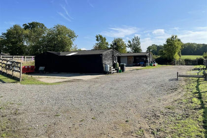
Riding Lane, Hildenborough, Hildenborough, Kent TN11 England
Added on 14/08/2026Building Plot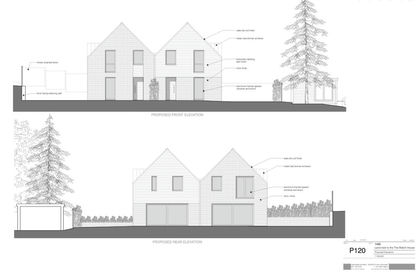
- Price
- Guide Price£400,000
Land North West Of The Watch House Burton Avenue Leigh Kent TN11, Leigh, Kent TN11 England
Added on 12/09/2026Building Plot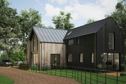
- Price
- Offers in Region of£400,000
- Size
- 0.8 acres
Canada Farm Road, South Darenth, Horton Kirby and South Darenth, Kent DA4 England
Added on 22/04/2026Self Build Plot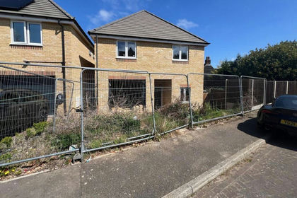
- Price
- Guide Price£365,000
Riggall Court, Cuxton, Rochester, Kent, ME2, Cuxton, Medway ME2 England
Added on 21/07/2026Development Land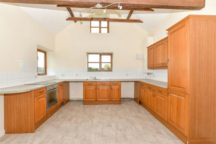
- Price
- Guide Price£300,000
Pratling Street, Aylesford, Kent, Aylesford, Kent ME20 England
Added on 17/07/2026Barn Conversion
- Price
- Guide Price£250,000
- Size
- 0.08 acres
Added on 08/08/2026Self Build Plot Added on 29/01/2026Development Land
 Added on 29/01/2026Building Plot
 Added on 12/08/2026Development Land
 Added on 08/08/2026Development Land