Brocks Lane, Frilsham, Berkshire, RG18
- Land size
- 4.95 acres
- Bedrooms
- 5
- Bathrooms
- 5
Description
**Ready To Build** An Exceptional Opportunity to Create a Landmark Residence Featuring 5,920 Sq Ft of Cutting-Edge Architectural Design and Innovation.
Situation
The village of Frilsham is situated along the Pang valley and is in an Area of Outstanding Natural Beauty. Most local amenities are provided at the neighbouring village of Yattendon and the market town of Newbury only 6 miles away. Pangbourne is also close by. There are some excellent pubs nearby, notably The Pot Kiln in Frilsham and the Royal Oak at Yattendon.
There are also a number of good schools in the area which cater for all ages. These include, Brockhurst & Marlston House, Elstree, Marlborough College, Downe House, Cheam, Pangbourne College, The Downs School and Bradfield.
The property is well placed for communications being about 5 miles from Jct 13 of the M4 giving access to London, Heathrow and the national motorway network.
The site
The site currently exists of a combination of mature hedgerows, trees and woodland which enclose the site along with scrub, ruderal vegetation and grassland.
The former quarrying activities has created a man-made topography with significant level changes compared with the original and adjacent slope of the land. This has provided an opportunity to create a truly contemporary property within this stunning, unique and secluded parcel of land.
The Western part of the site lies relatively flat and at the same height as the road, the eastern extent of the site comprises much higher ground.
The site comprises a distinct quarry face, which extends in a crescent shape to approximately 10m at its highest point resulting in far reaching, wonderful views to the west. The site is truly an oasis for wildlife and tranquillity .
The plot measure approximately 4.95 acres in total.
Planning (5920sqft)
Planning has been granted ( 22/03123/FULMAJ) (25/00453/FULMAJ) for a contemporary property of approximately 5,920sqft GIA which will be constructed in a disused quarry in the ANOB.
The ground floor will have 5 bedrooms, all with en-suite. A spectacular reception room/winter garden greets guests with a boot room, W/C and large gym found just off the reception room.
The first floor consists of a kitchen, dining room and drawing room, all vaulted and awash with natural light. Outside space consists of a wraparound south facing roof terrace with wonderful views of the south facing garden, natural swimming pool and beyond. An ideal setting for alfresco dining and entertaining.
The landscaped south facing private garden leads via a path to a pontoon perched over the secluded natural swimming pool in the southeast corner. To the northwest of the property is an oasis of woodland and wild flower meadows. A swale/stream separates the two large plots and meanders to the west offering a wealth of wildlife, privacy and sanctuary.
4 bay garage
The property has been designed to an exemplar standard using a combination of leading-edge technology and innovative building materials providing near off-grid living.
Accommodation.
See floorplans.
Local Authority
West Berkshire Council: Tel:
Postcode
RG18 9UY
Directions
From Junction 13 of the M4 head north for the A34, but take the slip road signposted Chieveley instead of joining the dual carriageway. At the T junction turn right onto Priors Court Road. Pass the garden centre and at the roundabout take the first exit. After 0.3 miles, turn right onto Marlston Road. After just under a mile turn left onto Wellhouse Lane. Continue on this road for 1.5 miles and Frilsham Lime House is on your right.
Buyers Information
We are required by law to conduct anti-money laundering checks on all those selling or buying a property. Whilst we retain responsibility for ensuring checks and any ongoing monitoring are carried out correctly, the initial checks are carried out on our behalf by Lifetime Legal who will contact you once you have agreed to instruct us in your sale or had an offer accepted on a property you wish to buy. The cost of these checks is £48 (incl. VAT), which covers the cost of obtaining relevant data and any manual checks and monitoring which might be required. This fee will need to be paid by you in advance of us publishing your property (in the case of a vendor) or issuing a memorandum of sale (in the case of a buyer), directly to Lifetime Legal, and is non-refundable.
Map Location
Property details
- Tenure
- Freehold
- Council Tax Band
- TBC
- Date Posted
- 2026-06-13
Price history
| Date | Change | Price |
|---|---|---|
| 29 Sep 2026 | Reduced 9.1% (−£45,000) | £450,000 |
| Until 29 Sep 2026 | Asking price | £495,000 |
Market Value Analysis
Compared with 37 Building Plots listings in South East England (1+ acres).
Utilities & Restrictions
Utilities
- Electricity
- Ask Agent
- Water
- Ask Agent
- Heating
- Ask Agent
- Broadband
- Ask Agent
- Sewerage
- Ask Agent
Rights & Restrictions
- Public Rights of Way
- Ask Agent
- Private Rights of Way
- Ask Agent
- Listed Property
- Ask Agent
- Restrictions
- Ask Agent
Listed status, conservation areas and planning constraints for this location are in the full report.
Property Features
- Accessibility
- Ask Agent
- Parking
- Parking Available
- Garden
- Garden
Beyond the particulars: planning activity, flood history, heritage and ground risks, checked for this exact spot.
Connectivity
Broadband
Fastest speed available at this postcode
1 Gbps
Gigabit full fibre
Suitable for
- 4K streaming on every screen
- Full-time home working
- Online gaming & big downloads
Mobile signal
Predicted 4G and 5G signal; indoor signal depends on building materials.
Ofcom Connected Nations postcode-level predictions. Speeds and signal are modelled, not measured, and vary between addresses and providers.
Signal is the easy part. Planning activity, flood history and protected designations here are in the full report.
Nearest Schools
Primary
- Yattendon C.E. Primary School1.4 milesNo Ofsted rating
- Ages
- 4 to 11
- Pupils
- 92
- Type
- Voluntary aided school
- Faith
- Church of England
- Hermitage Primary School1.9 milesOfsted: Good *
- Ages
- 4 to 11
- Pupils
- 186
- Type
- Community school
- Hampstead Norreys C.E. Primary School2.2 milesOfsted: Good
- Ages
- 4 to 11
- Pupils
- 46
- Type
- Voluntary controlled school
- Faith
- Church of England
- St Finian's Catholic Primary School2.5 milesOfsted report card · May 2026
- Ages
- 4 to 11
- Pupils
- 204
- Type
- Voluntary aided school
- Faith
- Roman Catholic
- Cold Ash St Mark's CE Primary School2.5 milesNo Ofsted rating
- Ages
- 5 to 11
- Pupils
- 195
- Type
- Voluntary controlled school
- Faith
- Church of England
Secondary
- Kennet School3.7 milesOfsted: Good
- Ages
- 11 to 18
- Pupils
- 1,824
- Type
- Academy converter
- The Downs School4.4 milesOfsted: Outstanding *
- Ages
- 11 to 18
- Type
- Academy converter
- Trinity School4.9 milesNo Ofsted rating
- Ages
- 11 to 18
- Pupils
- 1,349
- Type
- Academy converter
- Theale Green School6.1 milesOfsted report card · Apr 2026
- Ages
- 11 to 18
- Pupils
- 803
- Type
- Academy sponsor led
- St Bartholomew's School6.2 milesOfsted report card · Jan 2026
- Ages
- 11 to 18
- Pupils
- 1,905
- Type
- Academy converter
* Latest graded judgement covers quality of education only; no overall grade was issued under the 2024-25 inspection framework.
Distances are straight-line from the advertised location. Source: the national school registers (DfE, Welsh Government, Scottish Government) and Ofsted.
Schools are just the start: sold prices nearby, planning activity and any flood history are in the full report.
Amenities
Supermarket
GP surgery
Pharmacy
Hospital
Green space
Straight-line distances from the advertised location. Sources: NHS records, Geolytix supermarket locations, OS Open Greenspace and the national trails registers.
The area stacks up? Now check the location itself: planning nearby, protected designations and past flooding.
Getting Around
Nearest station
Nearest bus stop
Typical drive times
Straight-line distances from the advertised location; drive times are typical free-flow times over OpenStreetMap road data, so allow more at peak. Public transport locations from DfT NaPTAN.
Easy to reach matters. So do planning activity, flood history and ground risks: all in the full report.
Flood Risk
Environment Agency open data, checked around the advertised map pin for the listed acreage. Long-term risk counts flood defences; the planning map's flood zones do not. Provided by LandSale, not the listing agent, and not part of the agent's particulars. Risk varies across a holding, so verify before committing.
Rivers and the sea
Planning map: Flood Zone 1.
Surface water
Not at the pin: mapped about 40 metres away.
These bandings are the summary. Where this location sits on the flood maps, plus planning activity, heritage and ground risks, is in the full report.
Important notice: Information, maps and tags on this page are drawn from the advertising agent's marketing materials or generated automatically. LandSale has not verified them. Relying on these details is at your own risk, always carry out independent checks before committing to a purchase.
LandSale full disclaimer
Marketing information only - not formal particulars. The details on this website are provided for general guidance and do not constitute an offer or contract. Neither LandSale nor the advertising estate/land agent accepts responsibility for any inaccuracy.
1. Source of information
- Listing content: Core description, asking price, tenure, measurements, photographs and planning history originate from the marketing materials of the advertising estate or land agent. LandSale does not author this content and cannot guarantee its accuracy.
- Automated tags & categorisation: Property type, land-use class, acreage bands and similar labels may be applied by machine-learning models. They are intended as a helpful guide only and may not reflect the property's legal status or permitted use.
- Third-party & enriched data layers: Maps, boundary outlines, planning designations, soil reports, broadband coverage and other environmental or location-based insights are licensed from external suppliers. Such data are supplied “as is", may be incomplete or out of date and are subject to change without notice.
2. Verification required
Prospective purchasers must verify critical matters, including but not limited to planning permission, title boundaries, public rights of way, environmental constraints, acreage, services, access and VAT status, through their own inspections, specialist surveys, legal advisers and the selling agent before relying on the information or entering into any contract.
3. No warranty or liability
LandSale gives no warranty, express or implied, as to the accuracy, completeness or fitness for any particular purpose of the information displayed. LandSale shall not be liable for any loss, damage, cost or expense arising directly or indirectly from any use of or reliance on such information, save where liability may not be excluded by law.
4. Updates & feedback
If you believe any detail on this listing is inaccurate, please let us know. We will investigate and, where appropriate, update the listing or notify the agent.
© LandSale | Version 1.3 - August 2026
Listing agent
Black Cygnet Properties, Frilsham
Black Cygnet Properties Unit 6 Frilsham Home Farm Yattendon Berkshire RG18 0XT
Contact Black Cygnet Properties, Frilsham
Black Cygnet Properties Unit 6 Frilsham Home Farm Yattendon Berkshire RG18 0XT
View agent profileSimilar properties for sale
- Price
- Guide Price£400,000
- Size
- 5.4 acres
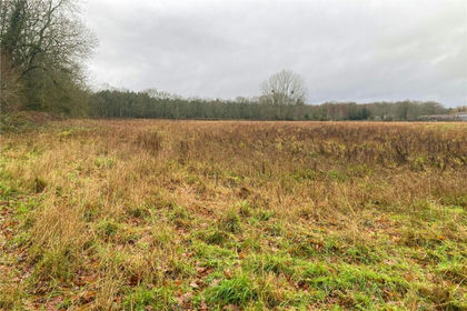
Church Lane, Dogmersfield, Hampshire, RG27, Dogmersfield, Hampshire RG27 England
Added on 27/02/2026Undeveloped Land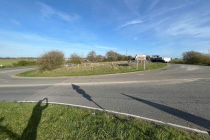
- Price
- From£400,000
- Size
- 3.4 acres
Coxwell Street, Faringdon, SN7, Great Faringdon, Oxfordshire SN7 England
Added on 25/02/2026Development Land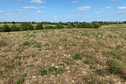
- Price
- Guide Price£475,000
- Size
- 48.54 acres
Added on 29/01/2026Arable Land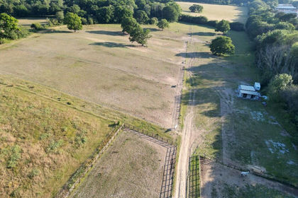
- Price
- Guide Price£375,000
- Size
- 11.88 acres
Added on 29/01/2026Equestrian property
- Price
- Guide Price£545,000
- Size
- 13.95 acres
Coulston, Westbury, Wiltshire, BA13, Coulston, Wiltshire BA13 England
Added on 26/09/2026Equestrian property