Steep, Hampshire
- Land size
- 125.56 acres
- Bedrooms
- 7
- Bathrooms
- 5
Key Features
- Grade II Listed, Master Bedroom En Suite Dressing Room and Bathroom
- 6 Further Bedrooms, 2 En Suite Bathrooms, 2 Family Bathrooms
- Hall, Sitting Room, Dining Room, Study, Kitchen/Breakfast/Living Room
- Garden and Grounds around the House of about 1.29 Hectares (3.20 Acres)
- Traditional Barn with further Outbuildings/Stores and Courtyard adjacent to the main house.
- Other former Farm Stores, Garaging and Garden, Outbuildings including an old Greenhouse
- Main Farm Yard - Range of Agricultural Buildings including an open sided Dutch Barn and Aircraft Hanger
- 1 & 2 Soal Farm Cottages - Boarded up and stripped out internally, part vandalised. Each with 3 first floor rooms and two ground floor rooms and lobbies. Garden overgrown.
- Boarded Up, Stripped Out, part Vandalised, 3 First Floor Rooms, 2 Ground Floor Rooms, Garden
- Overall 50.81 Hectares (125.56 Acres) of Undulating Pasture and Woodland. Family Shoot
Description
Out in the country in a private estate with some exceptional views, yet 5 minutes from town, a perfect combination.
The Property - Soal Farm is a remarkable private estate, approached over a long private drive and set back from a country lane, ring-fenced by its own extensive pasture and woodland. The house is Grade II Listed, described as 16th and early 20th Century and an Arts and Crafts style. The house has a large open-plan kitchen/breakfast and living room which provides a wonderful day to day living space with a practical boot room for country life and a utility room.
For more formal entertaining there are two well-proportioned reception rooms with exposed timbers and a study. Upstairs there are four double bedrooms, three with ensuite bathrooms and two further staircases, one leading to two additional attic bedrooms with a bathroom and the other a separately accessed attic bedroom. The house has plenty of character from the period and a light interior with the many windows taking full advantage of the views over the adjoining garden and grounds.
The two lodge cottages are currently uninhabitable but sit at the head of the main drive and could be renovated and used for staff or family. Alternatively, they could be let out, or subject to planning permission (STPP) replaced. The farmyard has a secondary drive and approach from Ridge Common Lane, which bisects open pasture and is ideal for anyone wanting to separate the farming or any future equestrianactivities from the domestic approach.
Location - Soal Farm is set back off a winding country lane amongst unspoilt countryside between the villages of Steep and Stroud in the heart of the South Downs National Park. Both villages have a pub and primary school and the popular market town of Petersfield is nearby with its wide range of shopping, recreational facilities and mainline station with services to London Waterloo in just over an hour. The area is well served by a wide range of independent and state schools including Bedales (Steep), Churcher’s College and Ditcham Park and in the state sector The Petersfield School. The A3 provides good regional transport links to Guildford, the M25 and London and to the south coast via the M27 to Portsmouth, Southampton and Chichester. Winchester is accessible via the A272. There are a number of good footpaths and bridleways in the area, including the Hangers Way.
Outside - The main drive sweeps gently to the front of the house and the courtyard. The traditional buildings provide an excellent opportunity for creating further space such as games rooms, a party barn, home offices or ancillary accommodation (STPP). The old gardens have become overgrown but included at times, fruit and kitchen gardens, ponds, orchard and lawns. The grounds provide scope to renovate, reinstate or redesign these areas. Overall, the grounds provide a natural environment with an abundance of flora and fauna including deer and barn owls.
The Farmland - Overall, the grassland extends to approximately 12.76 hectares (31.53 acres) and provides an exceptional opportunity to acquire a ring-fenced farm. The farm is gently undulating, classified as grade 4and is presently used for grass production and the grazing of sheep.
Soal Farm offers versatility to an incoming buyer as it is suitable for various alternative uses such as equestrian, natural capital and biodiversity offsetting (STPP).
The farm is not currently entered into any environmental schemes, providing a purchaser with the ability to design their own scheme.
Woodland - The woodland extends to approximately 2.51 hectares (6.20 acres) and is made up of a number of mature mixed deciduous and coniferous parcels.
Sporting - Whilst not currently shot, historically, the farm has supported a small shoot and offers an incoming purchaser the opportunity to reestablish one should they wish.
Buildings - Soal Farm has a good range of farm buildings to serve the farmland but also providing the potential to redevelop for alternative uses such as equestrian, tourist accommodation or employment uses (STPP). A Schedule of Buildings is available from the selling agents. The farmyard has a secondary drive and approach from Ridge Common Lane, which bisects open pasture and is ideal for anyone wanting to separate the farming or any future equestrian activities from the domestic approach.
Soal Farmhouse, Buildings And Land 17.33 - Soal Farm is a remarkable private estate, approached over a long private drive and set back from a country lane, ring-fenced by its own extensive pasture and woodland. The house is Grade II Listed, described as 16th and early 20th Century and an Arts and Crafts style. The house has a large open plan kitchen/breakfast and living room which provides wonderful day to day living space with a practical boot room for country life and a utility room. For more formal entertaining there are two well-proportioned reception rooms with exposed timbers and a study. Upstairs there are four double bedrooms, three with ensuite bathrooms and two further staircases, one leading to two additional attic bedrooms with a bathroom and the other a separately accessed attic bedroom. The house has plenty of character from the period and a light interior with the many windows taking full advantage of the views over the adjoining garden and grounds.
1 & 2 Soal Farm Cottages 1.05 Hectares (2 - The two lodge cottages are currently uninhabitable and sit at the head of the main drive and could be renovated and used for staff or family. Alternatively, they could be let out, or subject to planning permission (STPP) replaced.
Within the garden there is a single garage. Included with the cottages is a paddock and an area of woodland to the rear of the cottages.
Pasture And Woodland 32.40 Hectares (80.0 - Accessed direct from Ridge Common Lane the block of land consists of five parcels of pasture extending to 20.60 hectares (50.90 acres) and five blocks of mature mixed deciduous and coniferous woodland including the steep bank of Strawberry Hanger, which rises to the north up to Ridge Top Lane. The woodland extends to 11.80 hectares (29.16 acres).
Planning - Certain works had historically been undertaken to the dwelling without the appropriate permissions. Listed building consent has now been granted (SDNP/25/03196/LIS) to regularise a number of these changes along with further works to be undertaken in mitigation of these alterations. Further details of the works to be undertaken and associated costs are available from the selling agents.
General Remarks And Stipulations - Method of Sale
The property is offered for sale by private treaty.
Rights of Way
There are two public footpaths that cross the farm. Extracts of the definitive map are available from the selling agents.
The property is sold subject to the benefit of all rights, including rights of way, whether public or private, light, support, drainage, water and electricity supplies and any other rights and obligations, easements and proposed wayleaves for masts, electricity poles, pylons, stays, cables, drains and water, gas and other pipes, whether referred to in the Condition of Sale or not.
Services
Soal Farm: LPG fired boilers for domestic heating. Mains water and electricity. Private drainage to a treatment plant.
1 & 2 Soal Farm Cottages: Previously connected to electricity, mains water and private drainage. They have not been inhabited for some years nor private drainage system used.
Tenure and Possession
The land is currently grazed by sheep under a licence with a local farmer. Vacant possession will be given on completion.
Council Tax:
Soal Farm House: H
1 & 2 Soal Farm Cottages: Both D
EPC:
Soal Farm House: G 20
1 & 2 Soal Farm Cottages: Both G 1
Local Authorities
East Hampshire District
South Downs National Park Authority
Sporting and Timber Rights
The sporting and timber rights are in-hand and are included with the
sale of the freehold insofar as they are owned.
Mineral Rights
The mineral rights, at a depth below 200 feet over the majority of the farm, are reserved to the Church Commissioners, however, the farm is not allocated as a safeguarded site in the Hampshire Minerals and Waste Plan. Further details are available from the selling agents.
Designations
Soal Farm House is listed Grade II and the property is located within the South Downs National Park.
Areas and Schedules
These are based on the Ordnance Survey and are for reference only. They have been checked and computed by the selling agent and the Purchaser(s) shall be deemed to have satisfied themselves as to the description of the property. Any error or misstatement shall not annul a sale or entitle any party to compensation in respect thereof.
Health and Safety
When viewing the farm please take considerable care and attention. Due to the overgrown areas and condition of the cottages in Lot 2, we would ask you to be as vigilant as possible for your own personal safety. Access to the cottages will be limited due to their condition.
Agents Notes:
Mobile Phone Signal: Good outdoors, variable in-home (according to Ofcom).
Broadband: Currently Fibre To The Cabinet (FTTC) (according to Openreach).
Construction: Soal Farm is of period brick and timber construction. 1 & 2 Soal Farm Cottages are brick and hung tile construction.
Directions
Follow the A3 south from Guildford and on arriving at Petersfield, take the second exit (off the A3) signed to Winchester A272. Follow the slip road down to the roundabout and then take the fourth exit signed to Winchester. Follow the A272 along for a short distance
where you come into Stroud. Just after entering the village the road goes around a sharp right bend, take the first turning on the right into Ridge Common Lane, signposted Steep. Follow the lane for 0.75 of a mile where the entrance to Soal Farm will be found on your left (by the two lodge cottages).
///sparkles.developed.evoked
Map Location
Property details
- Tenure
- Freehold
- Council Tax Band
- H
- Date Posted
- 2026-06-11
Market Value Analysis
Compared with 17 Farms & Smallholdings listings in South East England (100+ acres).
Utilities & Restrictions
Utilities
- Electricity
- Mains
- Water
- Mains
- Heating
- Gas Heating
- Broadband
- Fibre (FTTC)
- Sewerage
- Septic Tank / Private
Rights & Restrictions
- Public Rights of Way
- Yes
- Private Rights of Way
- Ask Agent
- Listed Property
- Ask Agent
- Restrictions
- Yes
Listed status, conservation areas and planning constraints for this location are in the full report.
Property Features
- Accessibility
- Ask Agent
- Parking
- Parking Available
- Garden
- Garden
Beyond the particulars: planning activity, flood history, heritage and ground risks, checked for this exact spot.
Connectivity
Broadband
Fastest speed available at this postcode
32 Mbps
Superfast · available to 67% of premises
Suitable for
- HD streaming
- Video calls
- Web & social
Mobile signal
Outdoor predictions; indoor signal depends on building materials.
Ofcom Connected Nations postcode-level predictions. Speeds and signal are modelled, not measured, and vary between addresses and providers.
Signal is the easy part. Planning activity, flood history and protected designations here are in the full report.
Nearest Schools
Primary
- Langrish Primary School1 mileOfsted: Good
- Ages
- 4 to 11
- Pupils
- 211
- Type
- Community school
- Steep Church of England Voluntary Controlled Primary School1 mileOfsted: Good *
- Ages
- 4 to 11
- Pupils
- 102
- Type
- Voluntary controlled school
- Faith
- Church of England
- Petersfield Infant School1.4 milesOfsted: Good *
- Ages
- 4 to 7
- Pupils
- 282
- Type
- Community school
- Sheet Primary School1.6 milesOfsted: Good *
- Ages
- 4 to 11
- Pupils
- 110
- Type
- Community school
- Froxfield Church of England Primary and Pre-School1.6 milesNo Ofsted rating
- Ages
- 2 to 11
- Pupils
- 127
- Type
- Voluntary controlled school
- Faith
- Church of England
Secondary
- The Petersfield School1.5 milesNo Ofsted rating
- Ages
- 11 to 16
- Pupils
- 1,401
- Type
- Academy converter
- Horndean Technology College7.5 milesOfsted: Good *
- Ages
- 11 to 16
- Pupils
- 1,288
- Type
- Community school
- Bohunt School7.9 milesOfsted: Good
- Ages
- 11 to 18
- Pupils
- 2,012
- Type
- Academy converter
- Oakmoor School8.1 milesOfsted report card · Jan 2026
- Ages
- 11 to 16
- Pupils
- 912
- Type
- Academy sponsor led
- The Cowplain School9.1 milesOfsted: Good
- Ages
- 11 to 16
- Pupils
- 993
- Type
- Academy converter
* Latest graded judgement covers quality of education only; no overall grade was issued under the 2024-25 inspection framework.
Distances are straight-line from the advertised location. Source: the national school registers (DfE, Welsh Government, Scottish Government) and Ofsted.
Schools are just the start: sold prices nearby, planning activity and any flood history are in the full report.
Amenities
Supermarket
GP surgery
Pharmacy
Hospital
Green space
Straight-line distances from the advertised location. Sources: NHS records, Geolytix supermarket locations, OS Open Greenspace and the national trails registers.
The area stacks up? Now check the location itself: planning nearby, protected designations and past flooding.
Getting Around
Nearest station
Nearest bus stop
Typical drive times
Straight-line distances from the advertised location; drive times are typical free-flow times over OpenStreetMap road data, so allow more at peak. Public transport locations from DfT NaPTAN.
Easy to reach matters. So do planning activity, flood history and ground risks: all in the full report.
Flood Risk
From Environment Agency flood map open data, checked around the advertised map pin and allowing for the listed acreage where known. This summary comes from LandSale, the advertising platform, not from the listing agent, and is not part of the agent's particulars. Risk can vary across a single holding, so verify anything critical through your own searches before committing.
Rivers and the sea
Surface water
Mapped within the area searched, not at the advertised map pin itself.
The detail behind these bandings
The full report pinpoints where this location sits on the flood maps, and runs the deeper checks that usually only surface after an offer.
- Exact flood zones & annual chances (included in the full report)
- Any recorded past flooding (included in the full report)
- Planning activity nearby (included in the full report)
- Heritage & conservation (included in the full report)
- Protected nature designations (included in the full report)
- Ground risks (included in the full report)
- Sold prices nearby (included in the full report)
£14.99 · one-off purchase
By LandSale, the platform. Not provided by the listing agent. Ready in about a minute.
Important notice: Information, maps and tags on this page are drawn from the advertising agent's marketing materials or generated automatically. LandSale has not verified them. Relying on these details is at your own risk, always carry out independent checks before committing to a purchase.
LandSale full disclaimer
Marketing information only - not formal particulars. The details on this website are provided for general guidance and do not constitute an offer or contract. Neither LandSale nor the advertising estate/land agent accepts responsibility for any inaccuracy.
1. Source of information
- Listing content: Core description, asking price, tenure, measurements, photographs and planning history originate from the marketing materials of the advertising estate or land agent. LandSale does not author this content and cannot guarantee its accuracy.
- Automated tags & categorisation: Property type, land-use class, acreage bands and similar labels may be applied by machine-learning models. They are intended as a helpful guide only and may not reflect the property's legal status or permitted use.
- Third-party & enriched data layers: Maps, boundary outlines, planning designations, soil reports, broadband coverage and other environmental or location-based insights are licensed from external suppliers. Such data are supplied “as is", may be incomplete or out of date and are subject to change without notice.
2. Verification required
Prospective purchasers must verify critical matters, including but not limited to planning permission, title boundaries, public rights of way, environmental constraints, acreage, services, access and VAT status, through their own inspections, specialist surveys, legal advisers and the selling agent before relying on the information or entering into any contract.
3. No warranty or liability
LandSale gives no warranty, express or implied, as to the accuracy, completeness or fitness for any particular purpose of the information displayed. LandSale shall not be liable for any loss, damage, cost or expense arising directly or indirectly from any use of or reliance on such information, save where liability may not be excluded by law.
4. Updates & feedback
If you believe any detail on this listing is inaccurate, please let us know. We will investigate and, where appropriate, update the listing or notify the agent.
© LandSale | Version 1.3 - August 2026
Listing agent
BCM Wilson Hill, Petersfield
4 Lavant Street, Petersfield, GU32 3EW
Similar properties for sale
- Price
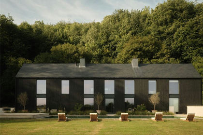
- Guide Price£5,750,000
- Size
- 7.7 acres
Ashford Lane, Steep, Petersfield, Hants, GU32, Steep, Hampshire GU32 England
Added on 25/04/2026House with Land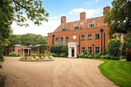
- Price
- Guide Price£4,500,000
- Size
- 16 acres
Durford Wood, Petersfield, Hampshire, GU31, Rogate, West Sussex GU31 England
Added on 22/06/2026Country Home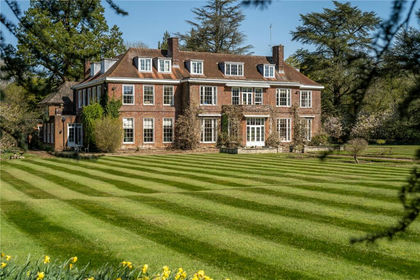
- Price
- Guide Price£3,500,000
- Size
- 29 acres
Sheet, Petersfield, Hampshire, GU31, Liss, Hampshire GU31 England
Added on 16/04/2026Country Home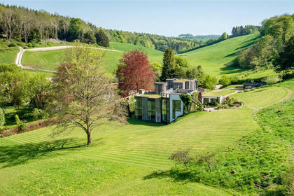
- Price
- Guide Price£3,950,000
- Size
- 2.5 acres
Ditcham, Petersfield, Hampshire, GU31, Buriton, Hampshire GU31 England
Added on 29/01/2026House with Land
- Price
- Guide Price£4,200,000
- Size
- 8 acres
Added on 28/07/2026Country Home
- Price
- Guide Price£3,500,000
- Size
- 4 acres
Minsted, Midhurst, GU29, Stedham with Iping, West Sussex GU29 England
Added on 04/06/2026House with Land
- Price
- Guide Price£4,750,000
- Size
- 10 acres
Woolmer Hill Road, Surrey, GU27 1, Haslemere, Surrey GU27 England
Added on 11/06/2026Country Estate
- Price
- Guide Price£5,950,000
- Size
- 4.4 acres
Haslemere, Surrey, GU27, Fernhurst, West Sussex GU27 England
Added on 28/07/2026House with Land
- Price
- £4,500,000
- Size
- 5.5 acres
Itchen Stoke Manor, Alresford, Hampshire, Itchen Stoke and Ovington, Hampshire SO24 England
Added on 09/07/2026House with Land
- Price
- Guide Price£3,400,000
- Size
- 1.5 acres
Weydown Road, Haslemere, GU27, Haslemere, Surrey GU27 England
Added on 11/07/2026House with Land