Ninebanks, Hexham, Northumberland, NE47
- Land size
- 12.4 acres
- Bedrooms
- 4
- Bathrooms
- 2
Key Features
- Grade II listed
- 4 bedrooms
- Double garage
- 12.4 acres of land and gardens
- Traditional features throughout
- Parking for several vehicles
- Exceptional views
Description
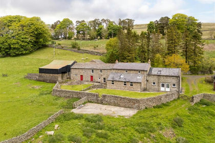
A substantial Grade II listed period property with exceptional rural views and a special Hillside setting enclosed by its own 12.4 acres of land and gardens.
Through the main front door into the entrance porch is a date-stone reading WRD 1728 which is also mentioned in English Heritages listing. Off the main porch there is a cloakroom with WC, wash hand basin and tiled floors. The main sitting room has lovely exposed beams and a double aspect overlooking the spectacular valley view below. At the heart of the seating area is a substantial inglenook fireplace with stone surround and hearth, central is a large multi-fuel burning stove. The dining room enjoys a decorative feature fireplace with Adams styles surround, the dual aspect creates a bright and inviting room, with under stairs storage cupboard.
Through from the dining room on the raised ground floor level, the kitchen diner is a generously proportioned room with distinct cooking, dining and seating areas. The dual aspect kitchen area has fitted Red Onion farmhouse style kitchen with solid oak wall and base cabinetry that includes a handy larder unit. Central to the kitchen is the Nexus gas cooker range with extractor hood and granite splash back that tie in with the granite surfaces and upstands. Integrated into the kitchen units are twin one and a half ceramic sink with moulded drainer, dishwasher and fridge. Tiled floors continue through from the kitchen area into the seating and dining. The seating area has a focal feature fireplace with a multi fuel stove. The rear entrance porch utility room has base cabinets with granite worksurfaces that tie in with the kitchen design. There is plumbing for washing machine and tiled floors that continue in from the kitchen.
The main bedroom with a dual aspect enjoys the same great view as the living room is a spacious master bedroom, benefitting from a fitted bank of wardrobes and storage into the lower roof eaves. There is a shower cubicle and wash hand basin situated in the corner of the room. On the same level as the main bedroom, the second bedroom is a spacious double room with a wash hand basin, fitted wardrobes and windows to the front. The upper level has two further double bedrooms with the third enjoying a decorative feature window that was previously an arrow slit and the fourth enjoying exposed beams. The family bathroom has a bath with shower over, partially tiled walls, wash hand Basin, WC and a towel radiator.
The property is approached down a sweeping driveway into substantial formal Gardens where you arrive at a tarmac parking area, suitable for several vehicles. The front of the property enjoys two patio seating area with a maturing orchard garden across the other side of the parking area. The tarmac parking is partially enclosed by a traditional range of stone built outbuilding that offer great storage and also house the bore hole cylinder and system. In addition, there is a double garage that benefits from having power connected with water available in the shed. Around the side of the property there is a large, paved seating area with open and very beautiful aspects of the valley. Below the patio area there is a very pleasant, enclosed garden area with bedding borders and dry stone walling. The rear garden which is mainly laid to lawn has fenced borders onto your own land and fantastic views back up the valley below.
Corryhill is well positioned being ringfenced by its own land that extends to circa 12.4 acres of rough grazing. The land has access available from both the low road and the main property driveway at the head of the hill, with the drystone walling that encloses the land has been well maintained and is in good condition.
Situated near to the rural hamlet of Ninebanks, the property is ideally located in a stunning rural setting with good connectivity to the surrounding areas. Nearby Haydon Bridge offers a range of local shops, public houses, GP practises and both primary and secondary schooling. The nearby market town of Hexham provides further schooling, hospital, major shops and a full range of retail and leisure facilities. Haydon Bridge train station offers additional public transport links, for the commuter rail services west to Carlisle and east to Newcastle Upon Tyne are regularly available in addition to the excellent road networks via the A68 and A69 dual carriageway.
SERVICES
Mains electricity is connected; the central heating is oil fired. Water is from a private bore hole and the drainage is to a septic tank. The cooker is serviced by Calor gas tanks. The property benefits from fibre broadband and has a wind turbine that generates the household a yearly financial return.
CHARGES
Northumberland County Council tax band E
VIEWINGS
Viewing is strictly by appointment. Arrangements can be made by contacting YoungsRPS, Hexham on .
FREE MARKET APPRAISAL
We would be pleased to provide professional, unbiased advice on the current value and marketing of your existing home.
WAYLEAVES, EASEMENTS & RIGHTS OF WAY
The property is being sold subject to all existing wayleaves, easements and rights of way, whether or not specified within the sales particulars.
REFERRALS
In accordance with the Estate Agents' (Provision of Information) Regulations 1991 and the Consumer Protection from Unfair Trading Regulations 2008, we are obliged to inform you that this Company may offer the following services to sellers and purchasers from which we may earn a related referral fee from on completion, in particular the referral of: Mortgages and related products our commission from a broker would be £100.00 incl VAT for Mortgages and £50 inc VAT for Insurances, however this amount can be proportionally clawed back by the lender should the mortgage and/or related product(s) be cancelled early.
Map Location
Property details
- Tenure
- Freehold
- Council Tax Band
- E
- Date Posted
- 2026-06-06
Market Value Analysis
Compared with 34 Homes with Land listings in North East England (10+ acres).
Energy Performance Certificate
Energy Efficiency Rating
Based on UK Energy Performance Certificate standards (EU Directive 2002/91/EC)
Running costs are one side. Planning activity, flood history and ground risks for this location are in the full report.
Utilities & Restrictions
Utilities
- Electricity
- Ask Agent
- Water
- Ask Agent
- Heating
- Ask Agent
- Broadband
- Ask Agent
- Sewerage
- Ask Agent
Rights & Restrictions
- Public Rights of Way
- Ask Agent
- Private Rights of Way
- Ask Agent
- Listed Property
- Ask Agent
- Restrictions
- Ask Agent
Listed status, conservation areas and planning constraints for this location are in the full report.
Property Features
- Accessibility
- Ask Agent
- Parking
- Parking Available
- Garden
- Garden
Beyond the particulars: planning activity, flood history, heritage and ground risks, checked for this exact spot.
Connectivity
Broadband
Fastest speed available at this postcode
1.8 Gbps
Gigabit full fibre
Suitable for
- 4K streaming on every screen
- Full-time home working
- Online gaming & big downloads
Fixed wireless access may also be an option here.
Mobile signal
Predicted 4G and 5G signal; indoor signal depends on building materials.
Ofcom Connected Nations postcode-level predictions. Speeds and signal are modelled, not measured, and vary between addresses and providers.
Signal is the easy part. Planning activity, flood history and protected designations here are in the full report.
Nearest Schools
Primary
- Whitfield CofE Primary School3.8 milesOfsted report card · Jan 2026
- Ages
- 3 to 11
- Pupils
- 22
- Type
- Academy sponsor led
- Faith
- Church of England
- Allendale Primary School4.1 milesNo Ofsted rating
- Ages
- 2 to 11
- Pupils
- 126
- Type
- Community school
- Nenthead Primary School5.2 milesOfsted: Good
- Ages
- 4 to 11
- Pupils
- 17
- Type
- Community school
- Alston Primary School5.5 milesOfsted: Good *
- Ages
- 4 to 11
- Pupils
- 88
- Type
- Community school
- Henshaw Church of England Primary School7.6 milesOfsted: Good
- Ages
- 4 to 11
- Pupils
- 86
- Type
- Academy converter
- Faith
- Church of England
Secondary
- Samuel King's School5.5 milesNo Ofsted rating
- Ages
- 11 to 16
- Pupils
- 113
- Type
- Foundation school
- Haydon Bridge High School8.4 milesOfsted report card · Jan 2026
- Ages
- 11 to 18
- Pupils
- 392
- Type
- Foundation school
- St Joseph's Catholic Middle School, Hexham11 milesNo Ofsted rating
- Ages
- 9 to 13
- Pupils
- 168
- Type
- Academy converter
- Faith
- Roman Catholic
- Queen Elizabeth High School11 milesOfsted: Good
- Ages
- 13 to 18
- Pupils
- 1,299
- Type
- Academy converter
- Hexham Middle School12 milesNo Ofsted rating
- Ages
- 9 to 13
- Pupils
- 619
- Type
- Academy converter
* Latest graded judgement covers quality of education only; no overall grade was issued under the 2024-25 inspection framework.
Distances are straight-line from the advertised location. Source: the national school registers (DfE, Welsh Government, Scottish Government) and Ofsted.
Schools are just the start: sold prices nearby, planning activity and any flood history are in the full report.
Amenities
Supermarket
GP surgery
Pharmacy
Hospital
Straight-line distances from the advertised location. Sources: NHS records, Geolytix supermarket locations, OS Open Greenspace and the national trails registers.
The area stacks up? Now check the location itself: planning nearby, protected designations and past flooding.
Getting Around
Nearest station
Nearest bus stop
Typical drive times
Straight-line distances from the advertised location; drive times are typical free-flow times over OpenStreetMap road data, so allow more at peak. Public transport locations from DfT NaPTAN.
Easy to reach matters. So do planning activity, flood history and ground risks: all in the full report.
Flood Risk
Environment Agency open data, checked around the advertised map pin for the listed acreage. Long-term risk counts flood defences; the planning map's flood zones do not. Provided by LandSale, not the listing agent, and not part of the agent's particulars. Risk varies across a holding, so verify before committing.
Rivers and the sea
Planning map: Flood Zone 1.
Surface water
These bandings are the summary. Where this location sits on the flood maps, plus planning activity, heritage and ground risks, is in the full report.
Important notice: Information, maps and tags on this page are drawn from the advertising agent's marketing materials or generated automatically. LandSale has not verified them. Relying on these details is at your own risk, always carry out independent checks before committing to a purchase.
LandSale full disclaimer
Marketing information only - not formal particulars. The details on this website are provided for general guidance and do not constitute an offer or contract. Neither LandSale nor the advertising estate/land agent accepts responsibility for any inaccuracy.
1. Source of information
- Listing content: Core description, asking price, tenure, measurements, photographs and planning history originate from the marketing materials of the advertising estate or land agent. LandSale does not author this content and cannot guarantee its accuracy.
- Automated tags & categorisation: Property type, land-use class, acreage bands and similar labels may be applied by machine-learning models. They are intended as a helpful guide only and may not reflect the property's legal status or permitted use.
- Third-party & enriched data layers: Maps, boundary outlines, planning designations, soil reports, broadband coverage and other environmental or location-based insights are licensed from external suppliers. Such data are supplied “as is", may be incomplete or out of date and are subject to change without notice.
2. Verification required
Prospective purchasers must verify critical matters, including but not limited to planning permission, title boundaries, public rights of way, environmental constraints, acreage, services, access and VAT status, through their own inspections, specialist surveys, legal advisers and the selling agent before relying on the information or entering into any contract.
3. No warranty or liability
LandSale gives no warranty, express or implied, as to the accuracy, completeness or fitness for any particular purpose of the information displayed. LandSale shall not be liable for any loss, damage, cost or expense arising directly or indirectly from any use of or reliance on such information, save where liability may not be excluded by law.
4. Updates & feedback
If you believe any detail on this listing is inaccurate, please let us know. We will investigate and, where appropriate, update the listing or notify the agent.
© LandSale | Version 1.3 - August 2026
Similar properties for sale
- Price
- £660,000
- Size
- 21.79 acres
Added on 21/07/2026House with Land
- Price
- Offers in Region of£750,000
- Size
- 6.1 acres
Keenley, Allendale, Northumberland, NE47, Allendale, Northumberland NE47 England
Added on 12/05/2026Farmhouse
- Price
- £675,000
- Size
- 6 acres
Cherry Tree Cottage Alston, Nenthead, CA9, Alston Moor, Westmorland and Furness CA9 England
Added on 19/08/2026House with Land
- Price
- £775,000
- Size
- 6.5 acres
Spring House Park Alston, Moor, CA9, Alston Moor, Westmorland and Furness CA9 England
Added on 19/08/2026House with Land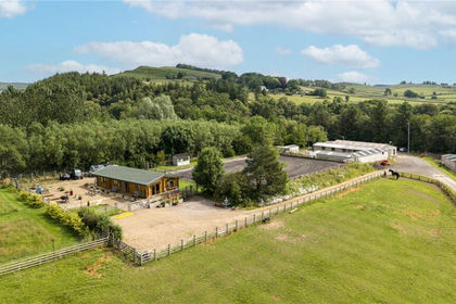
- Price
- Offers Over£700,000
- Size
- 28.51 acres
Bardon Mill, Hexham, Northumberland, NE47, Henshaw, Northumberland NE47 England
Added on 23/07/2026Equestrian property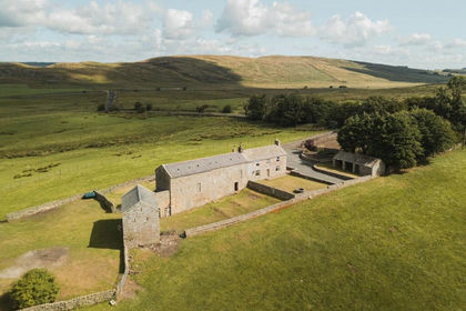
- Price
- Guide Price£795,000
- Size
- 11 acres
Hallpeat Moss, Melkridge, Haltwhistle, Northumberland, Melkridge, Northumberland NE49 England
Added on 23/09/2026House with Land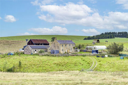
- Price
- £625,000
- Size
- 26.07 acres
High Tipalt Farm, Greenhead, Brampton, Northumberland, CA8, Greenhead, Northumberland CA8 England
Added on 22/09/2026Smallholding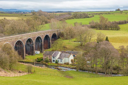
- Price
- £825,000
- Size
- 7.1 acres
Langwathby, Penrith, CA10, Hunsonby, Westmorland and Furness CA10 England
Added on 19/08/2026House with Land
- Price
- Offers Over£850,000
- Size
- 11 acres
East Barns, Newton, Stocksfield, Northumberland, Bywell, Northumberland NE43 England
Added on 03/06/2026Development Land
- Price
- £699,999
- Size
- 15 acres
Ivy House, Brampton, Appleby-in-Westmorland, Long Marton, Westmorland and Furness CA16 England
Added on 20/07/2026Equestrian property