17.10 Acres Agricultural Land, Priskilly Fawr, Castlemorris
Key Features
- Sheep fenced. Metered Water Supply.
- Gently Sloping Agricultural Land.
- Virtually all down to Permanent Pasture with the exception of a Lane.
- Within few miles of Castlemorris.
- Approached over a 200 yard track.
Description
Situated within a few miles of the hamlet of Castlemorris and the village of Hayscastle, a gently sloping south facing block of Agricultural Land which extends to 17.10 Acres or thereabouts which is virtually all down to permanent Pasture with the exception of the Lane on the northern boundary which is overgrown. The Land is Sheep fenced and in excellent heart and is approached over a 200 yard predominantly hardsurfaced track off the Council Maintained Tarmacadamed Road which leads to Priskilly Fawr. Land in this immediate district is widely regarded as some of the best in Pembrokeshire and early inspection is strongly advised. Realistic Price Guide.
Situation
The land concerned is situated within 2 miles or so of the hamlet of Castlemorris and is within 2 ½ miles or so of the well known village of Hayscastle.
Hayscastle is a small village and is situated within a mile or so of the other well known village of Hayscastle Cross, which has the benefit of a Public House.
Castlemorris is within a short drive and has the benefit of a cluster of Dwellings and a Public House and within 3 ½ miles or so is the popular hilltop village of Mathry which has the benefit of a Church, Village/Community Hall, Café/Antique Shop and a Public House.
Market Towns
The Market Town of Fishguard is some 8 miles or so North East and has the benefit of a good Shopping Centre together with a wide range of amenities and facilitates.
The County and Market Town of Haverfordwest is some 12 miles or so South East and has an excellent Shopping Centre with an extensive range of amenities and facilities including The County Council Offices and The County Hospital at Withybush. There are good road links in an easterly direction along the Main A40 from Haverfordwest to Carmarthen and M4 Motorway to Cardiff and London. There are also good rail links from both Fishguard and Haverfordwest to Carmarthen, Cardiff, London Paddington and the rest of the UK.
The Land concerned is formerly part of Priskilly Fawr and is approximately three quarters of a mile or so off the Castlemorris to Hayscastle Council Maintained District Road.
Description
The land concerned extends to some 17.10 Acres or thereabouts in One Block and is in the main down to Permanent Pasture and being gently sloping with a southerly aspect. The Land is sheep fenced and the acreage is exceptionally free draining and would lend itself to the establishing of vines. The land benefits from natural shelter from the prevailing winds and is approached off the Council Maintained District Road via a 200 yard hardsurfaced track. The boundaries of the Property are edged in red on the attached Plan which is Not to Scale.
Services
Mains Water (metered supply) connected.
Tenure
Freehold with Vacant Possession upon Completion.
Land Registry
O.S. No 1231 and amounting to 16.26 Acres is a Registered Title, although Pt OS No 9552 and Pt Os No 6150 are not registered to the vendors. The vendors have been utilising this Land for 4 years or so and prior their purchased the previous vendor utilised the same Land for a considerable period of time. On that basis, the existing vendors will convey whatever interest that they have in the unregistered Land which extends to 0.84 Acres or thereabouts which comprises of the lane on the western boundary and the overgrown lane on the northern boundary.
Rights of Way
Agricultural access Rights of Ways exist in favour of the Land off the Council Maintained District Road leading to Priskilly Fawr at point ‘A’ on the Plan and over the Track/Lane as far as point B on the same Plan. The Track/Lane between points ‘A’, ‘B’ and ‘C’ on the Plan is registered as a Public Footpath.
General Remarks
The Land concerned extends to 17.10 Acres or thereabouts and of the total Acreage there is 16.26 Acres or thereabouts of clean, gently sloping, productive and fertile Pasture Land in excellent heart. The Land is sheep fenced and is situated within a few hundred yards of the Council Maintained Roadway leading to Priskilly Fawr. Management has moved towards more sustainable and regenerative practices in the current owners tenure and early inspection is strongly advised. Realistically Priced.
Directions
From Fishguard take the Main A40 Road south for 2 miles and just prior to the village of Scleddau take the turning on the right, signposted to St Davids. Continue on this road for 300 yards and where the road sweeps right, bear left (straight on) signposted to St Davids. Continue for a mile and a half and upon reaching the crossroads at Llangloffan Cross (the second set of crossroads), turn left. Proceed through Llangloffan and continue over the bridge and follow the road until you reach Castlemorris. At the crossroads, proceed straight across and continue on this road for half a mile, passing through Penfeidr and a half a mile further on and upon reaching the crossroads, proceed straight on. Continue for half a mile or so and take the first turning on the left. Proceed for in excess of half a mile and the track leading to the land is situated on the left hand side of the road. A ‘For Sale’ direction board is placed at this point. A 200 yard track leads to the Land.
Map Location
Property details
- Tenure
- Freehold
- Council Tax Band
- Ask Agent
- Date Posted
- 2026-06-05
Utilities & Restrictions
Utilities
- Electricity
- Ask Agent
- Water
- Ask Agent
- Heating
- Ask Agent
- Broadband
- Ask Agent
- Sewerage
- Ask Agent
Rights & Restrictions
- Public Rights of Way
- Ask Agent
- Private Rights of Way
- Ask Agent
- Listed Property
- Ask Agent
- Restrictions
- Ask Agent
Listed status, conservation areas and planning constraints for this location are in the full report.
Property Features
- Accessibility
- Ask Agent
- Parking
- Ask Agent
- Garden
- Ask Agent
Beyond the particulars: planning activity, flood history, heritage and ground risks, checked for this exact spot.
Connectivity
Broadband
Fastest speed available at this postcode
1.8 Gbps
Gigabit full fibre · available to 46% of premises
Suitable for
- 4K streaming on every screen
- Full-time home working
- Online gaming & big downloads
Mobile signal
Predicted 4G and 5G signal; indoor signal depends on building materials.
Ofcom Connected Nations postcode-level predictions. Speeds and signal are modelled, not measured, and vary between addresses and providers.
Signal is the easy part. Planning activity, flood history and protected designations here are in the full report.
Nearest Schools
Primary
- Ysgol Ger y Llan1.6 miles
- Pupils
- 101
- Type
- Nursery, Infants & Juniors
- Language
- Welsh medium school / provision (including transitional)
- Wolfscastle Communty Primary School3 miles
- Pupils
- 50
- Type
- Nursery, Infants & Juniors
- Language
- Welsh medium school / provision (including transitional)
- Spittal Church in Wales VC School5.2 miles
- Pupils
- 110
- Type
- Nursery, Infants & Juniors
- Language
- English medium school / provision
- Roch Community School5.3 miles
- Pupils
- 126
- Type
- Nursery, Infants & Juniors
- Language
- English medium school / provision
- Ysgol Gymunedol Croesgoch5.5 miles
- Pupils
- 108
- Type
- Nursery, Infants & Juniors
- Language
- Welsh medium school / provision (including transitional)
Secondary
- Ysgol Bro Gwaun5.7 miles
- Pupils
- 574
- Type
- Secondary (ages 11-16)
- Language
- Dual language school / provision (Welsh and English) (including transitional)
- Ysgol Penrhyn Dewi7.7 miles
- Pupils
- 606
- Type
- Middle (ages 3-16)
- Language
- English medium school / provision
- Ysgol Caer Elen7.7 miles
- Pupils
- 907
- Type
- Middle (ages 3-16)
- Language
- Welsh medium school / provision (including transitional)
- Haverfordwest High VC School8.8 miles
- Pupils
- 1,699
- Type
- Secondary (ages 11-19)
- Language
- English medium school / provision
- Milford Haven School14 miles
- Pupils
- 1,045
- Type
- Secondary (ages 11-16)
- Language
- English medium school / provision
Distances are straight-line from the advertised location. Source: the national school registers (DfE, Welsh Government, Scottish Government) and Ofsted.
Schools are just the start: sold prices nearby, planning activity and any flood history are in the full report.
Amenities
Supermarket
GP surgery
Pharmacy
Straight-line distances from the advertised location. Sources: NHS records, Geolytix supermarket locations, OS Open Greenspace and the national trails registers.
The area stacks up? Now check the location itself: planning nearby, protected designations and past flooding.
Getting Around
Nearest station
Nearest bus stop
Typical drive times
Straight-line distances from the advertised location; drive times are typical free-flow times over OpenStreetMap road data, so allow more at peak. Public transport locations from DfT NaPTAN.
Easy to reach matters. So do planning activity, flood history and ground risks: all in the full report.
Flood Risk
Natural Resources Wales open data, checked around the advertised map pin for the listed acreage. Long-term risk counts flood defences; the planning map's flood zones do not. Provided by LandSale, not the listing agent, and not part of the agent's particulars. Risk varies across a holding, so verify before committing.
Rivers and the sea
Planning map: Flood Zone 1.
Surface water
These bandings are the summary. Where this location sits on the flood maps, plus planning activity, heritage and ground risks, is in the full report.
Important notice: Information, maps and tags on this page are drawn from the advertising agent's marketing materials or generated automatically. LandSale has not verified them. Relying on these details is at your own risk, always carry out independent checks before committing to a purchase.
LandSale full disclaimer
Marketing information only - not formal particulars. The details on this website are provided for general guidance and do not constitute an offer or contract. Neither LandSale nor the advertising estate/land agent accepts responsibility for any inaccuracy.
1. Source of information
- Listing content: Core description, asking price, tenure, measurements, photographs and planning history originate from the marketing materials of the advertising estate or land agent. LandSale does not author this content and cannot guarantee its accuracy.
- Automated tags & categorisation: Property type, land-use class, acreage bands and similar labels may be applied by machine-learning models. They are intended as a helpful guide only and may not reflect the property's legal status or permitted use.
- Third-party & enriched data layers: Maps, boundary outlines, planning designations, soil reports, broadband coverage and other environmental or location-based insights are licensed from external suppliers. Such data are supplied “as is", may be incomplete or out of date and are subject to change without notice.
2. Verification required
Prospective purchasers must verify critical matters, including but not limited to planning permission, title boundaries, public rights of way, environmental constraints, acreage, services, access and VAT status, through their own inspections, specialist surveys, legal advisers and the selling agent before relying on the information or entering into any contract.
3. No warranty or liability
LandSale gives no warranty, express or implied, as to the accuracy, completeness or fitness for any particular purpose of the information displayed. LandSale shall not be liable for any loss, damage, cost or expense arising directly or indirectly from any use of or reliance on such information, save where liability may not be excluded by law.
4. Updates & feedback
If you believe any detail on this listing is inaccurate, please let us know. We will investigate and, where appropriate, update the listing or notify the agent.
© LandSale | Version 1.3 - August 2026
Listing agent
JJ Morris, Fishguard
21 West Street, Fishguard, SA65 9AL
Similar properties for sale
- Price
- Guide Price£165,000
- Size
- 14.69 acres
At New Holmus, Little Newcastle, SA62, Puncheston, Pembrokeshire SA62 Wales
Added on 29/01/2026Pasture
- Price
- Guide Price£198,500
- Size
- 19.09 acres
Added on 27/06/2026Farmland
- Price
- £150,000
- Size
- 6 acres
And 6 Acres, Ambleston, SA62, Ambleston, Pembrokeshire SA62 Wales
Added on 29/01/2026Building Plot
- Price
- £165,000
- Size
- 33.61 acres
Puncheston, Haverfordwest, SA66, Puncheston, Pembrokeshire SA66 Wales
Added on 29/01/2026Agricultural Land
- Price
- Offers in Region of£150,000
- Size
- 26.51 acres
Land at Dale Road, Haverfordwest SA62, Tiers Cross, Pembrokeshire SA62 Wales
Added on 29/01/2026Agricultural Land
- Price
- Offers in Region of£125,000
- Size
- 14.34 acres
Targate Road, Freystrop, SA62, Freystrop, Pembrokeshire SA62 Wales
Added on 09/07/2026Vacant Land
- Price
- £190,000
- Size
- 27 acres
Added on 29/01/2026Pasture
- Price
- £200,000
- Size
- 31 acres
Land At Dolpwll, Boncath, SA37, Boncath, Pembrokeshire SA37 Wales
Added on 29/01/2026Pasture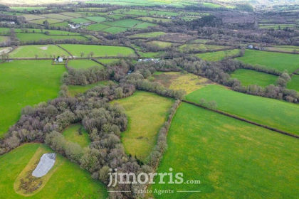
- Price
- £150,000
- Size
- 15 acres
Added on 29/01/2026Agricultural Land
- Price
- £175,000
- Size
- 17.54 acres
Added on 21/07/2026Agricultural Land