Martin Croft Road, Rossendale, Lancashire, BB4
- Land size
- 0.25 acres
- Bedrooms
- 2
- Bathrooms
- 1
Key Features
- A stone built two bedroom farmhouse with a large attached stone built traditional barn
- Range of outbuildings
- Private rear garden
- Set in approximately 0.25 acres
- A convenient and accessible location close to the amenities of Accrington and Haslingden
- For sale by private treaty as a whole
- Development opportunity
Description
LOCATION
Hud Hey Farm sits in a semi rural location to the northwest of the town of Haslingden about 1.5 miles from Haslingden town centre, 3.5 miles to Accrington town centre, 7.3 miles to Ramsbottom town centre and 13.3 miles to Bury town centre. There is easy access to the M66 and the M62 and to the wider motorway network. There are a wide range of services and amenities within close proximity to the property.
DESCRIPTION
Hud Hey Farm comprises a 2 bedroom stone built farmhouse, a traditional stone barn, attached to the farmhouse, and a range of outbuildings together with a garden to the rear. The main barn has alternative use potential (STPP) and could provide an exciting development opportunity to potential purchasers.
Farmhouse:
The farmhouse provides living accommodation over two floors together with a cellar below part of the ground floor. The farmhouse provides a gross internal floor area of approximately 83 square metres (293 square feet). The farmhouse requires renovation and refurbishment.
The ground floor comprises a porch which leads through to the hallway where the staircase takes you to the first floor. To the left of the hallway is the lounge with an open fireplace which leads to the porch which opens onto Martin Croft Road. To the right of the hallway is the kitchen which looks out to the private rear garden. The cellar is accessed from the kitchen via the original stone steps which provides a very useful storage space.
The first floor comprises two double bedrooms and a bathroom providing a bath, wash hand basin and WC.
Within the garden to the rear of the farmhouse there is former timber poultry building and a stone built storage building to the west of the carport. The rear garden is surrounded by open fields and is enclosed by mature trees allowing the property to enjoy privacy.
Main Barn:
The main barn, which is attached to the south of the farmhouse, is constructed of stone under a traditional stone slate roof and appears to be structurally sound and in good condition.
Outbuildings:
To the south of the main barn, there are a range of modern and traditional buildings all of which appear to be structurally sound and in good order.
A schedule of the buildings providing their size and description is included within these particulars.
SERVICES
The property has the benefit of mains gas, mains sewerage. mains electric and a natural spring water supply.
TENURE
Freehold with Vacant Possession on completion.
PLANNING
The property is located within the borough of Rossendale and the relevant policy within the Rossendale Local Plan 2019 to 2036 is Policy HS12: Conversion and Re-Use of Rural Buildings in the Countryside. This policy is generally supportive of the potential alternative use of the traditional buildings subject to certain criteria being met.
We consider the main barn is suitable for conversion through a full planning application for residential or commercial use and could provide approximately 2,000 square feet of living accommodation, taking into account 300mm of cavity wall construction, over two floors or approximately 3,000 square feet of accommodation over three floors. The outbuildings, mainly buildings 4, 5, 6 and 7, would require demolishing to allow for sufficient car parking and curtilage space.
It will be for buyers to take their own planning advice.
COUNCIL TAX
Band B
PLANS AND AREAS
The plans in these particulars are a copy of the Ordnance Survey data from Promap. All plans are for identification purposes only and areas are approximate and subject to verification in the title documents.
METHOD OF SALE
The property is offered for sale as a whole by private treaty.
WAYLEAVES, EASEMENTS AND RIGHTS OF WAY
We are not aware of any public rights of way, easements or wayleaves affecting the subject property .
LOCAL AUTHORITY
Rossendale Borough Council, Futures Park, Bacup, OL13 0BB.
FLOODING
According to the Environment Agency website, the property sits in flood zone 1.
MONEY LAUNDERING REGULATIONS
Prospective buyers should be aware that in the event they submit an offer to purchase the property, which is accepted by the vendors on the property, it is required that they provide documents in relation to money laundering regulations to prove identity and source of funding. A company called 'Coadjute' provide reports for us, with a cost of £45 (Inc VAT) per person in order for us to complete our due-diligence.
VIEWINGS
Viewings are strictly by appointment through Gary Hoerty Associates Ltd. Please ring or email .
What3words: ///speak.angle.exits
IMPORTANT INFORMATION
Gary Hoerty Associates for themselves and for the vendors or lessors of this property whose agent they are, give notice that:
a. All descriptions, plans, dimensions, references to condition or suitability for use, and necessary permissions for use and occupation and other details are given in good faith and are believed to be correct and any intending purchasers or tenants should not rely on them as statements of fact but must satisfy themselves by inspection or otherwise as to the correctness of each of them; b. Any electrical or other appliances on the property have not been tested, nor have the drains, heating, plumbing or electrical installations. All intending purchasers are recommended to carry out their own investigations before contract; c. No person in the employment of Gary Hoerty Associates has any authority to make or give any representations or warranty whatsoever in relation to this property. These particulars are produced in good faith and are set out as a general guide only and do not constitute any part of a contract; d. The particulars are set out as a general outline only for the guidance of intended purchasers or lessees, and do not constitute an offer or contract nor any part thereof.
Map Location
Property details
- Tenure
- Freehold
- Council Tax Band
- Ask Agent
- Date Posted
- 2026-06-03
Utilities & Restrictions
Utilities
- Electricity
- Ask Agent
- Water
- Ask Agent
- Heating
- Ask Agent
- Broadband
- Ask Agent
- Sewerage
- Ask Agent
Rights & Restrictions
- Public Rights of Way
- Ask Agent
- Private Rights of Way
- Ask Agent
- Listed Property
- Ask Agent
- Restrictions
- Ask Agent
Listed status, conservation areas and planning constraints for this location are in the full report.
Property Features
- Accessibility
- Ask Agent
- Parking
- Parking Available
- Garden
- Garden
Beyond the particulars: planning activity, flood history, heritage and ground risks, checked for this exact spot.
Connectivity
Broadband
Fastest speed available at this postcode
1.8 Gbps
Gigabit full fibre
Suitable for
- 4K streaming on every screen
- Full-time home working
- Online gaming & big downloads
Mobile signal
Predicted 4G and 5G signal; indoor signal depends on building materials.
Ofcom Connected Nations postcode-level predictions. Speeds and signal are modelled, not measured, and vary between addresses and providers.
Signal is the easy part. Planning activity, flood history and protected designations here are in the full report.
Nearest Schools
Primary
- St John's Stonefold CofE Primary School906 metresOfsted: Good
- Ages
- 4 to 11
- Pupils
- 133
- Type
- Voluntary aided school
- Faith
- Church of England
- Haslingden St James Church of England Primary School977 metresNo Ofsted rating
- Ages
- 3 to 11
- Pupils
- 204
- Type
- Voluntary aided school
- Faith
- Church of England
- Haslingden Primary School1 mileNo Ofsted rating
- Ages
- 4 to 11
- Pupils
- 372
- Type
- Foundation school
- St Mary's Roman Catholic Primary School, Haslingden1.1 milesOfsted: Outstanding
- Ages
- 4 to 11
- Pupils
- 139
- Type
- Voluntary aided school
- Faith
- Roman Catholic
- Baxenden St John's Church of England Primary School1.5 milesNo Ofsted rating
- Ages
- 4 to 11
- Pupils
- 205
- Type
- Voluntary aided school
- Faith
- Church of England
Secondary
- All Saints' Roman Catholic High School, a Voluntary Academy1.6 milesOfsted: Requires improvement
- Ages
- 11 to 16
- Pupils
- 504
- Type
- Academy converter
- Faith
- Roman Catholic
- The Hollins1.8 milesNo Ofsted rating
- Ages
- 11 to 16
- Pupils
- 794
- Type
- Academy converter
- Haslingden High School and Sixth Form1.9 milesOfsted report card · Jun 2026
- Ages
- 11 to 18
- Pupils
- 1,540
- Type
- Community school
- Alder Grange School2 milesOfsted report card · Mar 2026
- Ages
- 11 to 18
- Pupils
- 899
- Type
- Community school
- Mount Carmel Roman Catholic High School, Hyndburn2.8 milesOfsted report card · Nov 2025
- Ages
- 11 to 16
- Pupils
- 801
- Type
- Voluntary aided school
- Faith
- Roman Catholic
Distances are straight-line from the advertised location. Source: the national school registers (DfE, Welsh Government, Scottish Government) and Ofsted.
Schools are just the start: sold prices nearby, planning activity and any flood history are in the full report.
Amenities
Supermarket
GP surgery
Pharmacy
Hospital
Green space
Straight-line distances from the advertised location. Sources: NHS records, Geolytix supermarket locations, OS Open Greenspace and the national trails registers.
The area stacks up? Now check the location itself: planning nearby, protected designations and past flooding.
Getting Around
Nearest station
Nearest bus stop
Typical drive times
Straight-line distances from the advertised location; drive times are typical free-flow times over OpenStreetMap road data, so allow more at peak. Public transport locations from DfT NaPTAN.
Easy to reach matters. So do planning activity, flood history and ground risks: all in the full report.
Flood Risk
Environment Agency open data, checked around the advertised map pin for the listed acreage. Long-term risk counts flood defences; the planning map's flood zones do not. Provided by LandSale, not the listing agent, and not part of the agent's particulars. Risk varies across a holding, so verify before committing.
Rivers and the sea
Planning map: Flood Zone 1.
Surface water
These bandings are the summary. Where this location sits on the flood maps, plus planning activity, heritage and ground risks, is in the full report.
Important notice: Information, maps and tags on this page are drawn from the advertising agent's marketing materials or generated automatically. LandSale has not verified them. Relying on these details is at your own risk, always carry out independent checks before committing to a purchase.
LandSale full disclaimer
Marketing information only - not formal particulars. The details on this website are provided for general guidance and do not constitute an offer or contract. Neither LandSale nor the advertising estate/land agent accepts responsibility for any inaccuracy.
1. Source of information
- Listing content: Core description, asking price, tenure, measurements, photographs and planning history originate from the marketing materials of the advertising estate or land agent. LandSale does not author this content and cannot guarantee its accuracy.
- Automated tags & categorisation: Property type, land-use class, acreage bands and similar labels may be applied by machine-learning models. They are intended as a helpful guide only and may not reflect the property's legal status or permitted use.
- Third-party & enriched data layers: Maps, boundary outlines, planning designations, soil reports, broadband coverage and other environmental or location-based insights are licensed from external suppliers. Such data are supplied “as is", may be incomplete or out of date and are subject to change without notice.
2. Verification required
Prospective purchasers must verify critical matters, including but not limited to planning permission, title boundaries, public rights of way, environmental constraints, acreage, services, access and VAT status, through their own inspections, specialist surveys, legal advisers and the selling agent before relying on the information or entering into any contract.
3. No warranty or liability
LandSale gives no warranty, express or implied, as to the accuracy, completeness or fitness for any particular purpose of the information displayed. LandSale shall not be liable for any loss, damage, cost or expense arising directly or indirectly from any use of or reliance on such information, save where liability may not be excluded by law.
4. Updates & feedback
If you believe any detail on this listing is inaccurate, please let us know. We will investigate and, where appropriate, update the listing or notify the agent.
© LandSale | Version 1.3 - August 2026
Listing agent
GHA Associates, Grindleton
Suite 9 Grindleton Business Centre, The Spinney, Grindleton, Clitheroe BB7 4DH
Contact GHA Associates, Grindleton
Suite 9 Grindleton Business Centre, The Spinney, Grindleton, Clitheroe BB7 4DH
View agent profileSimilar properties for sale
 Added on 22/09/2026Building Plot
- Price
- £250,000
- Size
- 1.01 acres
Added on 11/07/2026Building Plot
- Price
- £250,000
- Size
- 0.13 acres
Orchard Works, Pilling Street, Waterfoot, BB4, Rossendale and Darwen, Lancashire BB4 England
Added on 29/01/2026Development Land
- Price
- £350,000
- Size
- 9.3 acres
Turn Hill, Dean Lane, Water, Rossendale, Rossendale and Darwen, Lancashire BB4 England
Added on 06/10/2026Cottage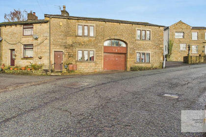
- Price
- Offers Over£250,000
The Barn, Walmerlsey Old Road, Walmersley., Bury North, Bury BL9 England
Added on 03/07/2026Barn Conversion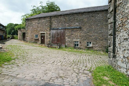
- Price
- Offers in Region of£350,000
- Size
- 0.5 acres
Lower Fowler Heights Barn, Heys Lane, Blackburn, BB3, Blackburn, Blackburn with Darwen BB3 England
Added on 05/03/2026Barn ConversionLeasehold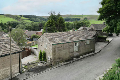 Added on 05/07/2026Barn Conversion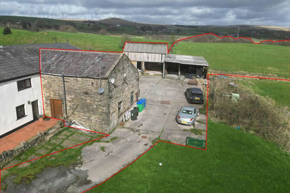
- Price
- Guide Price£350,000
- Size
- 10.9 acres
Added on 02/07/2026Barn Conversion
- Price
- Offers in Region of£270,000
- Size
- 1 acres
Harden Drive, Bolton, BL2, Bolton North East, Bolton BL2 England
Added on 07/06/2026Residential Added on 21/08/2026Barn Conversion