Moats Lane, South Nutfield
- Land size
- 10 acres
- Bedrooms
- 5
- Bathrooms
- 3
Key Features
- Grade II Listed farmhouse dating back to the 16th century
- Set along a quiet and picturesque country lane in South Nutfield
- Elevated position with far-reaching rural views
- Exposed timber beams throughout the house
- Sweeping private driveway with ample off-road parking
- Views across the private lake and surrounding countryside
- Peaceful and secluded setting with excellent privacy
- Flexible layout arranged over two well-proportioned floors
- Striking inglenook fireplace to the main sitting room
Description
Tucked away along a gently winding country lane in South Nutfield, South Hale Farm is the sort of house that announces itself quietly, confident in its history and content in its surroundings. This beautifully proportioned Grade II Listed farmhouse, dating back to the 16th century, occupies an elevated position within its own private land, enjoying far-reaching rural views and a profound sense of peace that is increasingly rare.
Approached via a sweeping driveway, the house sits comfortably within its setting, framed by mature trees and established planting that soften its historic façade. There is an immediate sense of arrival: this is a place apart, where the outside world feels pleasantly distant. From its vantage point, the house looks out across formal gardens, a private lake and rolling pasture beyond, the landscape changing colour and character with the seasons.
Inside, South Hale Farm unfolds with a reassuring solidity and warmth. The entrance hall leads naturally into the principal rooms, each revealing layers of period detail that speak to the house’s long and storied past. Exposed beams span the ceilings, mellowed by time, while original features are woven effortlessly into the fabric of everyday life. The sitting room is a particular highlight – a generous yet intimate space where the magnificent inglenook fireplace forms a dramatic focal point, perfectly suited to winter evenings spent in quiet conversation or with a good book as the fire crackles softly.
The ground floor offers a pleasing balance of formal and informal spaces. A versatile reception room, ideal as a study or snug, provides a quieter retreat, while the dining room enjoys views over both the front and rear gardens, lending itself to relaxed family gatherings and more celebratory occasions alike.
The kitchen is practical and characterful, designed for those who enjoy the rituals of cooking and entertaining. Timber base units, a central island and a substantial larder create a working kitchen with genuine substance, while a second staircase offers flexibility and potential for the annex, making the house well suited to multi-generational living or visiting guests.
A boot room, opening directly onto the rear garden, reinforces the sense that this is a house designed for country living, where muddy boots, dogs and garden produce are all part of daily life. From here, the garden and house feel intrinsically linked, encouraging a lifestyle that flows easily between indoors and out.
Upstairs, the atmosphere shifts to one of calm and retreat. The principal bedroom is spacious and light-filled, with beamed ceilings, built-in wardrobes and lovely double-aspect views that draw the countryside into the room. Additional bedrooms are equally characterful, offering generous proportions and peaceful outlooks, supported by well-placed bathrooms and cloakrooms. Waking here brings with it birdsong, soft morning light and a tangible connection to the land surrounding the house.
The grounds are an integral part of life at South Hale Farm. Formal gardens provide structure and elegance close to the house, with a paved path leading to the front door and a rear terrace perfectly positioned for outdoor dining and summer entertaining. To the west, the swimming pool adds a note of relaxed luxury, complete with an enclosed area, changing room and pump house, creating a private retreat for warm afternoons and long, languid evenings.
Beyond the gardens, approximately 10 acres of pastureland extend away from the house, bordered by mature trees and hedgerows that enhance privacy and natural beauty. Whether used for grazing, leisure or simply enjoyed as an ever-changing backdrop, the land gives the house a sense of scale and possibility that is increasingly hard to find.
Nutfield and its neighbouring towns provide ample opportunities for exploration and adventure. Families can enjoy leisurely strolls through picturesque parks and gardens, or embark on outdoor adventures in the nearby countryside. From charming country pubs serving hearty meals to trendy cafes and restaurants offering gourmet fare, there's something to satisfy every craving.
Families with school-aged children will find an array of educational options in and around Nutfield. The Hawthorns School is a thriving independent prep school & nursery along with the popular village primary school. For secondary education, nearby Reigate Grammar School and Caterham School are outstanding schools known for their academic excellence.
The village is served by regular bus services, offering convenient connections to surrounding areas. For commuters, Nutfield benefits from proximity to major road networks, including the M25 and A25, ensuring smooth travel to destinations further afield. Nearby train stations in Redhill and Oxted provide direct services to London and beyond.
Map Location
Property details
- Tenure
- Freehold
- Council Tax Band
- G
- Date Posted
- 2026-06-02
Market Value Analysis
Compared with 173 Homes with Land listings in South East England (10+ acres).
Energy Performance Certificate
Energy Efficiency Rating
Based on UK Energy Performance Certificate standards (EU Directive 2002/91/EC)
Running costs are one side. Planning activity, flood history and ground risks for this location are in the full report.
Utilities & Restrictions
Utilities
- Electricity
- Ask Agent
- Water
- Ask Agent
- Heating
- Ask Agent
- Broadband
- Ask Agent
- Sewerage
- Ask Agent
Rights & Restrictions
- Public Rights of Way
- Ask Agent
- Private Rights of Way
- Ask Agent
- Listed Property
- Ask Agent
- Restrictions
- Ask Agent
Listed status, conservation areas and planning constraints for this location are in the full report.
Property Features
- Accessibility
- Ask Agent
- Parking
- Parking Available
- Garden
- Garden
Beyond the particulars: planning activity, flood history, heritage and ground risks, checked for this exact spot.
Connectivity
Broadband
Fastest speed available at this postcode
1.8 Gbps
Gigabit full fibre · available to 75% of premises
Suitable for
- 4K streaming on every screen
- Full-time home working
- Online gaming & big downloads
Mobile signal
Predicted 4G and 5G signal; indoor signal depends on building materials.
Ofcom Connected Nations postcode-level predictions. Speeds and signal are modelled, not measured, and vary between addresses and providers.
Signal is the easy part. Planning activity, flood history and protected designations here are in the full report.
Nearest Schools
Primary
- Salfords Primary School and Nursery1.5 milesOfsted: Good
- Ages
- 2 to 11
- Pupils
- 381
- Type
- Academy sponsor led
- Nutfield Church CofE Primary School1.5 milesNo Ofsted rating
- Ages
- 5 to 11
- Pupils
- 202
- Type
- Voluntary aided school
- Faith
- Church of England
- Earlswood Junior School1.9 milesOfsted: Good
- Ages
- 7 to 11
- Pupils
- 382
- Type
- Community school
- Trinity Oaks Church of England Primary School1.9 milesOfsted report card · Jun 2026
- Ages
- 3 to 11
- Pupils
- 227
- Type
- Voluntary aided school
- Faith
- Church of England
- Earlswood Infant and Nursery School2.1 milesNo Ofsted rating
- Ages
- 3 to 7
- Pupils
- 372
- Type
- Community school
Secondary
- Oakwood School2.6 milesOfsted report card · Feb 2026
- Ages
- 11 to 16
- Pupils
- 1,610
- Type
- Community school
- Carrington School2.7 milesOfsted: Good
- Ages
- 11 to 16
- Pupils
- 1,012
- Type
- Academy converter
- Reigate School2.9 milesOfsted: Good
- Ages
- 11 to 16
- Pupils
- 1,252
- Type
- Academy converter
- Merstham Park School3.4 milesOfsted: Good
- Ages
- 11 to 16
- Pupils
- 711
- Type
- Free schools
- St Bede's School3.4 milesNo Ofsted rating
- Ages
- 11 to 18
- Pupils
- 1,918
- Type
- Voluntary aided school
- Faith
- Church of England/Roman Catholic
Distances are straight-line from the advertised location. Source: the national school registers (DfE, Welsh Government, Scottish Government) and Ofsted.
Schools are just the start: sold prices nearby, planning activity and any flood history are in the full report.
Amenities
Supermarket
GP surgery
Pharmacy
Hospital
Straight-line distances from the advertised location. Sources: NHS records, Geolytix supermarket locations, OS Open Greenspace and the national trails registers.
The area stacks up? Now check the location itself: planning nearby, protected designations and past flooding.
Getting Around
Nearest station
Nearest bus stop
Typical drive times
Straight-line distances from the advertised location; drive times are typical free-flow times over OpenStreetMap road data, so allow more at peak. Public transport locations from DfT NaPTAN.
Easy to reach matters. So do planning activity, flood history and ground risks: all in the full report.
Flood Risk
Environment Agency open data, checked around the advertised map pin for the listed acreage. Long-term risk counts flood defences; the planning map's flood zones do not. Provided by LandSale, not the listing agent, and not part of the agent's particulars. Risk varies across a holding, so verify before committing.
Rivers and the sea
Planning map: Flood Zone 1.
Surface water
Not at the pin: mapped about 40 metres away.
These bandings are the summary. Where this location sits on the flood maps, plus planning activity, heritage and ground risks, is in the full report.
Important notice: Information, maps and tags on this page are drawn from the advertising agent's marketing materials or generated automatically. LandSale has not verified them. Relying on these details is at your own risk, always carry out independent checks before committing to a purchase.
LandSale full disclaimer
Marketing information only - not formal particulars. The details on this website are provided for general guidance and do not constitute an offer or contract. Neither LandSale nor the advertising estate/land agent accepts responsibility for any inaccuracy.
1. Source of information
- Listing content: Core description, asking price, tenure, measurements, photographs and planning history originate from the marketing materials of the advertising estate or land agent. LandSale does not author this content and cannot guarantee its accuracy.
- Automated tags & categorisation: Property type, land-use class, acreage bands and similar labels may be applied by machine-learning models. They are intended as a helpful guide only and may not reflect the property's legal status or permitted use.
- Third-party & enriched data layers: Maps, boundary outlines, planning designations, soil reports, broadband coverage and other environmental or location-based insights are licensed from external suppliers. Such data are supplied “as is", may be incomplete or out of date and are subject to change without notice.
2. Verification required
Prospective purchasers must verify critical matters, including but not limited to planning permission, title boundaries, public rights of way, environmental constraints, acreage, services, access and VAT status, through their own inspections, specialist surveys, legal advisers and the selling agent before relying on the information or entering into any contract.
3. No warranty or liability
LandSale gives no warranty, express or implied, as to the accuracy, completeness or fitness for any particular purpose of the information displayed. LandSale shall not be liable for any loss, damage, cost or expense arising directly or indirectly from any use of or reliance on such information, save where liability may not be excluded by law.
4. Updates & feedback
If you believe any detail on this listing is inaccurate, please let us know. We will investigate and, where appropriate, update the listing or notify the agent.
© LandSale | Version 1.3 - August 2026
Listing agent
Stone Estate Agency, Surrey & Sussex
14 West Street, Reigate, RH2 9BS
View agent profileSimilar properties for sale
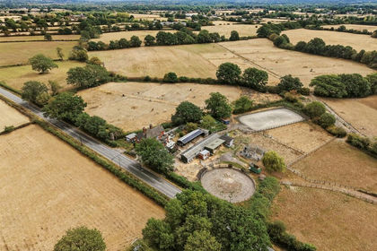
- Price
- £975,000
- Size
- 5 acres
Whitewood Lane, South Godstone, Godstone, Surrey, RH9, Horne, Surrey RH9 England
Added on 04/09/2026Equestrian property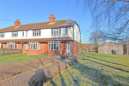
- Price
- Offers in Region of£1,100,000
- Size
- 9.66 acres
Added on 31/03/2026Equestrian property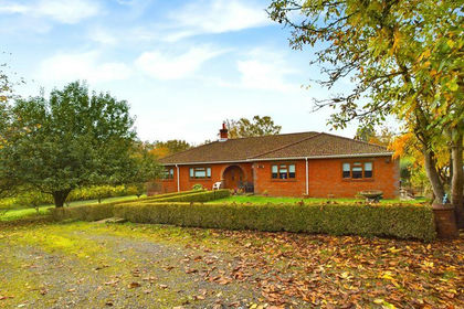
- Price
- £1,250,000
- Size
- 22 acres
Tandridge Hill Lane, Godstone, Tandridge, Surrey RH9 England
Added on 29/01/2026Smallholding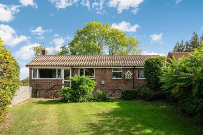
- Price
- £825,000
- Size
- 16 acres
Added on 29/01/2026Equestrian property
- Price
- Guide Price£1,250,000
- Size
- 10.82 acres
Parkgate Road, Newdigate, Dorking, Surrey, RH5, Newdigate, Surrey RH5 England
Added on 10/06/2026House with Land
- Price
- Guide Price£1,350,000
- Size
- 5.5 acres
Partridge Lane, Rusper, Horsham, West Sussex, RH12, Newdigate, Surrey RH12 England
Added on 08/09/2026Country Home
- Price
- £895,000
- Size
- 8 acres
Cottage with 8 Acres, East Grinstead, Dormansland, Surrey RH19 England
Added on 09/07/2026House with Land
- Price
- £895,000
- Size
- 8 acres
Added on 07/10/2026House with Land
- Price
- Guide Price£1,000,000
- Size
- 5.3 acres
Butcherfield Lane, Hartfield, TN7, Hartfield, East Sussex TN7 England
Added on 07/07/2026House with Land
- Price
- Offers in Excess of£1,000,000
- Size
- 8 acres
Added on 29/09/2026House with Land