Lower Wye Valley Road, St. Briavels, Lydney, Gloucestershire, GL15
- Land size
- 1.3 acres
- Bedrooms
- 4
- Bathrooms
- 3
Key Features
- Characterful Stone Detached Property
- Enjoying an Idyllic Wye Valley Setting
- Elevated with Far-Reaching Views
- Gardens and Woodland Extending to 1.3 Acres
- Modernised and Refurbished Interiors
- Light and Spacious Reception Rooms
- Four Bedrooms
- Various Outdoor Entertaining Spaces
Description
A characterful, detached stone cottage dating back to 1835 set high above the River Wye with enviable views of the Wye Valley within an idyllic woodland setting. The cottage is set over four floors with far-reaching views across the Wye towards Llandogo, set within mature, terraced gardens extending to approximately 1.3 acres with several outbuildings, lawned areas, terraces and orchard. The current owners have lovingly made sympathetic enhancements to the house including; a replacement roof, timber framed double glazed windows, new fascias and have had extensive works carried out to the outside seating area
Situation
Prospect Cottage is situated high above the River Wye, surrounded by beautiful countryside yet only a short distance from the villages of St Briavels, Llandogo and Redbrook and the towns of Monmouth and Chepstow. Both towns provide a comprehensive range of amenities, including shops, theatres and sporting opportunities including the famous Rolls of Monmouth Golf Club and Monmouth Rowing Club, Chepstow enjoys a range of facilities with Chepstow racecourse and St Pierre Golf course. Both have excellent schools both junior and senior including The Haberdashers Monmouth Schools for Boys and Girls in Monmouth as well as a broad range of shops. The property also allows easy access to the M4, M50 and M5 with both Bristol and Cardiff about 30 miles.
Accommodation
The ground floor of the property is entered through a recently installed timber door leading into the HALLWAY with a Victorian tiled floor and window to the rear. A useful CLOAKROOM has a low flush w.c. and wall mounted hand basin. Folding doors to a cupboard with shelf and hanging rail. The FAMILY ROOM / DINING AREA has a timber floor with two full height glazed windows and glazed doors opening out to the balcony with metal railings, lighting and fantastic views across the valley. There is a wood burner with a wooden mantel, surrounded by an exposed stone chimney breast and exposed stone walls to the alcoves either side.
---
A part glazed wooden door leads into the KITCHEN with Shaker style floor and walls units with timber work surfaces, a Butler sink has integral drainers with a window above. There are two wall display cabinets, modern splashback tiling. There is a dishwasher and space for a fridge/freezer and cooker (with extractor fan over). Timber double glazed doors lead out to a terraced area. Off the kitchen is the UTILITY ROOM which has a stainless steel sink unit, floor and walls units with space for a washing machine and tumble dryer. A full height shelved cupboard, tiled splashbacks and door to the terraced area.
Lower Ground Floor
An ornate cast iron spiral staircase leads down to the lower ground floor SITTING ROOM with two sash windows with deep window sills either side of French doors leading out to the lower terrace area. There is a wood burner on a slate hearth with shelving and cupboards to either side and downlighters to the ceiling. Fitted book shelves and cupboards to one wall with 'secret' door into BEDROOM with bi-fole doors leading out to the lower terrace. Tiled floor and fitted cupboard with shelves and hanging rail plus a double depth wardrobe, underfloor heating and downlighters to the ceiling. ENSUITE SHOWER ROOM with double shower with Mira electric shower, wash hand basin on wash stand, low level w.c., heated towel rail and tiling to all walls.
First Floor
The FIRST FLOOR LANDING has a Velux window and an understairs cupboard. The MASTER BEDROOM with a window to the front with views of the River Wye and two double fitted wardrobes. Across the Landing is the MAIN BATHROOM with a corner jacuzzi bath, shower cubicle with Mira electric shower, vanity unit with wash hand basin, bidet and low level w.c. Panelling to dado level, exposed timber floor, sash window, airing cupboard with shelving and housing the hot water tank, heated towel rail and motion activated extractor fan.
Second Floor
The LANDING which has a storage cupboard to the eaves leads to BEDROOMS TWO and THREE both have Velux windows and each has a small window to the side with deep window ledge. Bedroom Two has a built in wardrobe with shelf and hanging space. A SHOWER ROOM on this floor has a Velux window, shower cubicle, wash hand basin, low flush w.c., heated towel rail, tiled splashbacks and window to the front
Outdoors
The property is approached through wrought iron gates leading to a gravelled parking area bounded by a raised bed of established shrubs and wooden fencing and giving access to the front door of the house. A wide access leads down to the lower terraced area which has a raised wooden seating area and laurel hedging with views across the valley. The gardens are terraced with steps leading down to a bridleway which has a blocked up ‘shop’ which, in the past, sold refreshments to river traffic. Steps lead up to a lawned area, a small woodland, orchard, wood store and vegetable plot
---
A timber stable block with concrete flooring provides loose boxes and a storeroom. There is a pedestrian gate to the lane. The lawned area to the side of the house leads to a detached annexe/workshop with electricity, ornate wrought iron heater (currently not in use) and a shower room which could be restored.
Services
Mains electricity, Mains water, Private drainage
Local Authority
Forest of Dean District Council
Viewing
Strictly by appointment with the Agents: David James, Monmouth
Map Location
Property details
- Tenure
- Freehold
- Council Tax Band
- F
- Date Posted
- 2026-05-25
Market Value Analysis
Compared with 1,624 Homes with Land listings in South West England (1+ acres).
Energy Performance Certificate
Energy Efficiency Rating
Based on UK Energy Performance Certificate standards (EU Directive 2002/91/EC)
Running costs are one side. Planning activity, flood history and ground risks for this location are in the full report.
Utilities & Restrictions
Utilities
- Electricity
- Ask Agent
- Water
- Ask Agent
- Heating
- Ask Agent
- Broadband
- Ask Agent
- Sewerage
- Ask Agent
Rights & Restrictions
- Public Rights of Way
- Ask Agent
- Private Rights of Way
- Ask Agent
- Listed Property
- Ask Agent
- Restrictions
- Ask Agent
Listed status, conservation areas and planning constraints for this location are in the full report.
Property Features
- Accessibility
- Ask Agent
- Parking
- Parking Available
- Garden
- Garden
Beyond the particulars: planning activity, flood history, heritage and ground risks, checked for this exact spot.
Connectivity
Broadband
Fastest speed available at this postcode
4 Mbps
Under 10 Mbps here
Suitable for
- Basic browsing & email
Mobile signal
Predicted 4G and 5G signal; indoor signal depends on building materials.
Ofcom Connected Nations postcode-level predictions. Speeds and signal are modelled, not measured, and vary between addresses and providers.
Signal is the easy part. Planning activity, flood history and protected designations here are in the full report.
Nearest Schools
Primary
- St Briavels Parochial Church of England Primary School1.8 milesOfsted: Good
- Ages
- 2 to 11
- Pupils
- 148
- Type
- Voluntary aided school
- Faith
- Church of England
- Clearwell Church of England Primary School3.4 milesNo Ofsted rating
- Ages
- 4 to 11
- Pupils
- 41
- Type
- Voluntary controlled school
- Faith
- Church of England
- Redbrook Church of England Primary School3.7 milesNo Ofsted rating
- Ages
- 4 to 11
- Pupils
- 40
- Type
- Voluntary controlled school
- Faith
- Church of England
- Ellwood Primary School4.6 milesNo Ofsted rating
- Ages
- 4 to 11
- Pupils
- 139
- Type
- Community school
- Woolaston Primary School4.7 milesOfsted: Good
- Ages
- 4 to 11
- Pupils
- 113
- Type
- Community school
Secondary
- Five Acres High School6.1 milesOfsted report card · Jun 2026
- Ages
- 11 to 16
- Pupils
- 786
- Type
- Academy sponsor led
- The Dean Academy6.3 milesOfsted report card · Jan 2026
- Ages
- 11 to 16
- Pupils
- 816
- Type
- Academy sponsor led
- Wyedean School and Sixth Form Centre6.3 milesNo Ofsted rating
- Ages
- 11 to 18
- Pupils
- 1,024
- Type
- Academy converter
- SGS Berkeley Green UTC8.4 milesOfsted report card · May 2026
- Ages
- 14 to 19
- Pupils
- 391
- Type
- University technical college
- SGS Forest High School10 milesOfsted: Requires improvement
- Ages
- 11 to 16
- Pupils
- 255
- Type
- Academy sponsor led
Distances are straight-line from the advertised location. Source: the national school registers (DfE, Welsh Government, Scottish Government) and Ofsted.
Schools are just the start: sold prices nearby, planning activity and any flood history are in the full report.
Amenities
Supermarket
GP surgery
Pharmacy
Hospital
Green space
Walking trail
Straight-line distances from the advertised location. Sources: NHS records, Geolytix supermarket locations, OS Open Greenspace and the national trails registers.
The area stacks up? Now check the location itself: planning nearby, protected designations and past flooding.
Getting Around
Nearest station
Nearest bus stop
Typical drive times
Straight-line distances from the advertised location; drive times are typical free-flow times over OpenStreetMap road data, so allow more at peak. Public transport locations from DfT NaPTAN.
Easy to reach matters. So do planning activity, flood history and ground risks: all in the full report.
Flood Risk
Environment Agency open data, checked around the advertised map pin for the listed acreage. Long-term risk counts flood defences; the planning map's flood zones do not. Provided by LandSale, not the listing agent, and not part of the agent's particulars. Risk varies across a holding, so verify before committing.
Rivers and the sea
Not at the pin: mapped about 10 metres away.
Planning map: Flood Zone 3, about 20 metres away.
Surface water
These bandings are the summary. Where this location sits on the flood maps, plus planning activity, heritage and ground risks, is in the full report.
Important notice: Information, maps and tags on this page are drawn from the advertising agent's marketing materials or generated automatically. LandSale has not verified them. Relying on these details is at your own risk, always carry out independent checks before committing to a purchase.
LandSale full disclaimer
Marketing information only - not formal particulars. The details on this website are provided for general guidance and do not constitute an offer or contract. Neither LandSale nor the advertising estate/land agent accepts responsibility for any inaccuracy.
1. Source of information
- Listing content: Core description, asking price, tenure, measurements, photographs and planning history originate from the marketing materials of the advertising estate or land agent. LandSale does not author this content and cannot guarantee its accuracy.
- Automated tags & categorisation: Property type, land-use class, acreage bands and similar labels may be applied by machine-learning models. They are intended as a helpful guide only and may not reflect the property's legal status or permitted use.
- Third-party & enriched data layers: Maps, boundary outlines, planning designations, soil reports, broadband coverage and other environmental or location-based insights are licensed from external suppliers. Such data are supplied “as is", may be incomplete or out of date and are subject to change without notice.
2. Verification required
Prospective purchasers must verify critical matters, including but not limited to planning permission, title boundaries, public rights of way, environmental constraints, acreage, services, access and VAT status, through their own inspections, specialist surveys, legal advisers and the selling agent before relying on the information or entering into any contract.
3. No warranty or liability
LandSale gives no warranty, express or implied, as to the accuracy, completeness or fitness for any particular purpose of the information displayed. LandSale shall not be liable for any loss, damage, cost or expense arising directly or indirectly from any use of or reliance on such information, save where liability may not be excluded by law.
4. Updates & feedback
If you believe any detail on this listing is inaccurate, please let us know. We will investigate and, where appropriate, update the listing or notify the agent.
© LandSale | Version 1.3 - August 2026
Similar properties for sale
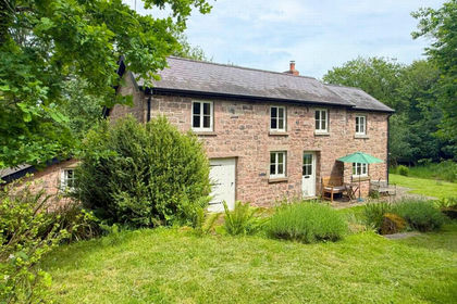
- Price
- £649,000
- Size
- 1.75 acres
Pen-Y-Fan, The Narth, NP25, Trellech United, Monmouthshire NP25 Wales
Added on 31/07/2026Cottage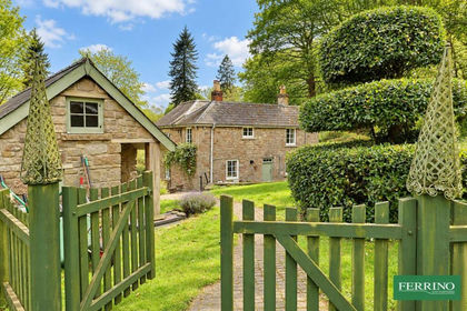
- Price
- Offers Over£650,000
- Size
- 4 acres
Added on 25/05/2026Cottage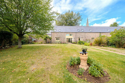
- Price
- Guide Price£625,000
De Clere Way, Monmouthshire, NP25, Trellech United, Monmouthshire NP25 Wales
Added on 08/09/2026Barn Conversion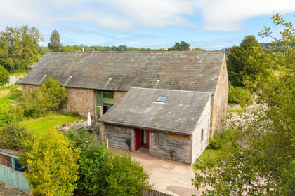 Added on 02/10/2026Barn Conversion
- Price
- £625,000
- Size
- 1.5 acres
The Chicken Shed, Trellech, Monmouthshire, Trellech United, Monmouthshire NP25 Wales
Added on 29/09/2026Holiday Let Property
- Price
- £640,000
- Size
- 6.5 acres
Bearse Common, St. Briavels, Lydney, St. Briavels, Gloucestershire GL15 England
Added on 19/09/2026House with Land
- Price
- Guide Price£750,000
- Size
- 4 acres
High Bank + 4 Acres, Laundry Lane, Newland, Newland, Gloucestershire GL16 England
Added on 22/06/2026House with Land
- Price
- £775,000
- Size
- 1.5 acres
Added on 15/10/2026Cottage
- Price
- Guide Price£600,000
- Size
- 1 acres
The Common, Woolaston, Lydney, Woolaston, Gloucestershire GL15 England
Added on 25/05/2026House with Land
- Price
- Guide Price£600,000
- Size
- 1 acres
Ring Fence, Woolaston, Woolaston, Gloucestershire GL15 England
Added on 16/10/2026House with Land