
Bersham, Wrexham.
- Land size
- 6.75 acres
- Bedrooms
- 3
- Bathrooms
- 1
Key Features
- Charming Period Cottage
- Scope for Modernisation
- Range of Outbuildings
- Land Ext. to approx. 6.75 ac
- Excellent Transport Links
- Rural yet Convenient Location
Description
A charming period farmhouse offering scope for modernisation, situated within land and gardens extending, in all, to around 6.75 acres, with a range of versatile outbuildings, pleasantly situated in a rural yet convenient village location close to Wrexham.
Description - Halls are delighted with instructions to offer The Smithy in Bersham for sale by private treaty and with the benefit of no onward chain.
The Smithy is an attractive white-rendered period farmhouse which provides just under 1,700 sq ft of versatile living accommodation all of which now offers excellent potential for modernisation and improvement.
The property is enviably positioned within land and gardens which extend, in all, to around 6.75 acres, with a sweeping driveway leading to expanses of lawn which encompass the homestead and are interspersed by a range of mature trees and floral beds, before culminating at a range of versatile outbuildings. The gardens adjoin a substantial fenced paddock ideal for the grazing of livestock, this flanked to one side by the River Clywedog which runs along the northern boundary.
Situation - The property is peacefully situated within the traditional village of Bersham, which straddles the River Clywedog and enjoys a range of local amenities, including a Church, Public House, and the Bryn Tririon School, whilst retaining a particularly convenient proximity to the nearby cities of Wrexham and Chester, both of which provide a winder range of amenities of all kinds, including educational, recreational and shopping facilities. Liverpool lies just 45 minutes to the north and the north Wales coastline is easily accessible by car via the North Wales Expressway.
Directions - Leave Wrexham to the west via the A525, continuing for around 0.7 miles until a left hand turn leads onto Homestead Lane. At the T Junction, turn right onto Bersham Road and proceed for a further 0.7 miles where a right hand turn leads onto the B5098. Follow this road until a T junction, turning right to cross the river and the property will be located on the left, identified by a Halls "For Sale" board.
W3w - ///adjusting.dome.jammy
Schooling - The property is conveniently situated for access to a number of well regarded educational establishments, including Riverside School, Rhostyllen CP School, St,Christophers School (rated outstanding), St.Mary's RC Primary, and Ysgol Clewdog.
The Property - The property provides principal access into a useful Lobby/Boot Room, ideal for storing muddy boots and coats following walks in the surrounding countryside, from where a doors leads through to an inner Hallway with access to a Utility Room and further through to a versatile Dining Room which features a domestic lift up to Bedroom Three and serves as a particularly sociable space, suited to entertaining and family moments alike, with an archway directly through a Kitchen featuring a selection of base and wall units, a window onto the rear, and planned space for white goods.
A door from the Dining Room opens into Entrance Hall positioned to the rear of the home, where stairs rise to the first floor and access is provided into a Study, perfect for those working from home. The ground floor accommodation is completed by a well proportioned Reception Room with dual aspect windows and electric "living flame" effect fire.
Access to the first floor is provided by stairs within the Entrance Hall, or via the lift situated in the Dining Room, where a full-length landing opens into three well proportioned Bedrooms, all enjoying elevated views across the countryside beyond and served by a Family Shower Room comprising a walk-in shower, hand basin, and low-flush WC.
Outside - The property is approached via a tree-lined driveway which culminates at a substantial tarmac parking area with ample space for multiple vehicles, this flanked to either side by generous expanses of lawn and bordered to the north by the River Cywedog, which runs within the boundary.
Positioned to the east of the property and gardens is a substantial enclosure of pasture land, this presently retained within one enclosure and offering excellent potential for the grazing of livestock.
Outbuildings - The Smithy is complemented by a range of versatile outbuildings all easily accessed directly from the driveway, with a traditional brick-built range of stores/garaging (approx. 15m x 5m) which offers potential for conversion for a range of future usages, such as stabling, annexe, home gym/office or similar (LA consent permitting), alongside a steel-framed agricultural shed (approx. 15m x 9m) with full-height double-opening access doors, ideal for machinery.
Services - We are advised that the property benefits from mains water, drains and electric.
Tenure - The property is said to be of freehold tenure and vacant possession will be granted upon completion.
Local Authority - Wrexham County Borough Council, The Guildhall, Wrexham, LL11 1AY.
Council Tax - The property is shown as being within council tax band F on the local authority register.
Anti-Money Laundering (Aml) Checks - We are legally obligated to undertake anti-money laundering checks on all property purchasers. Whilst we are responsible for ensuring that these checks, and any ongoing monitoring, are conducted properly; the initial checks will be handled on our behalf by a specialist company, Movebutler, who will reach out to you once your offer has been accepted.
The charge for these checks is £30 (including VAT) per purchaser, which covers the necessary data collection and any manual checks or monitoring that may be required. This cost must be paid in advance, directly to Movebutler, before a memorandum of sale can be issued, and is non-refundable. We thank you for your cooperation.
Viewings - By appointment through Halls, The Square, Ellesmere, Shropshire, SY12 0AW.
Map Location
Property details
- Tenure
- Freehold
- Council Tax Band
- Ask Agent
- Date Posted
- 2026-05-20
Market Value Analysis
Compared with 459 Homes with Land listings in Wales (5+ acres).
Energy Performance Certificate
Energy Efficiency Rating
Based on UK Energy Performance Certificate standards (EU Directive 2002/91/EC)
Running costs are one side. Planning activity, flood history and ground risks for this location are in the full report.
Utilities & Restrictions
Utilities
- Electricity
- Ask Agent
- Water
- Ask Agent
- Heating
- Ask Agent
- Broadband
- Ask Agent
- Sewerage
- Ask Agent
Rights & Restrictions
- Public Rights of Way
- Ask Agent
- Private Rights of Way
- Ask Agent
- Listed Property
- Ask Agent
- Restrictions
- Ask Agent
Listed status, conservation areas and planning constraints for this location are in the full report.
Property Features
- Accessibility
- Ask Agent
- Parking
- Parking Available
- Garden
- Garden
Beyond the particulars: planning activity, flood history, heritage and ground risks, checked for this exact spot.
Connectivity
Broadband
Fastest speed available at this postcode
80 Mbps
Superfast
Suitable for
- HD streaming
- Video calls
- Web & social
Mobile signal
Outdoor predictions; indoor signal depends on building materials.
Ofcom Connected Nations postcode-level predictions. Speeds and signal are modelled, not measured, and vary between addresses and providers.
Signal is the easy part. Planning activity, flood history and protected designations here are in the full report.
Nearest Schools
Primary
- Rhostyllen CP School897 metres
- Pupils
- 220
- Type
- Nursery, Infants & Juniors
- Language
- English medium school / provision
- Victoria Community Primary1.5 miles
- Pupils
- 440
- Type
- Nursery, Infants & Juniors
- Language
- English medium school / provision
- Ysgol Penrhyn New Broughton CP1.5 miles
- Pupils
- 218
- Type
- Nursery, Infants & Juniors
- Language
- English medium school / provision
- Penygelli C P School1.7 miles
- Pupils
- 255
- Type
- Nursery, Infants & Juniors
- Language
- English medium school / provision
- St Mary's RC Primary1.7 miles
- Pupils
- 342
- Type
- Nursery, Infants & Juniors
- Language
- English medium school / provision
Secondary
- Ysgol Clywedog1.1 miles
- Pupils
- 801
- Type
- Secondary (ages 11-16)
- Language
- English medium school / provision
- St Joseph's Catholic and Anglican High1.6 miles
- Pupils
- 748
- Type
- Secondary (ages 11-16)
- Language
- English medium school / provision
- Grango1.6 miles
- Pupils
- 580
- Type
- Secondary (ages 11-16)
- Language
- English medium school / provision
- Ysgol Bryn Alyn2.8 miles
- Pupils
- 701
- Type
- Secondary (ages 11-16)
- Language
- English medium school / provision
- Rhosnesni High School2.9 miles
- Pupils
- 1,091
- Type
- Secondary (ages 11-16)
- Language
- English medium school / provision
Distances are straight-line from the advertised location. Source: the national school registers (DfE, Welsh Government, Scottish Government) and Ofsted.
Schools are just the start: sold prices nearby, planning activity and any flood history are in the full report.
Amenities
Supermarket
GP surgery
Pharmacy
Green space
Straight-line distances from the advertised location. Sources: NHS records, Geolytix supermarket locations, OS Open Greenspace and the national trails registers.
The area stacks up? Now check the location itself: planning nearby, protected designations and past flooding.
Getting Around
Nearest station
Nearest bus stop
Typical drive times
Straight-line distances from the advertised location; drive times are typical free-flow times over OpenStreetMap road data, so allow more at peak. Public transport locations from DfT NaPTAN.
Easy to reach matters. So do planning activity, flood history and ground risks: all in the full report.
Flood Risk
From Natural Resources Wales flood map open data, checked around the advertised map pin and allowing for the listed acreage where known. This summary comes from LandSale, the advertising platform, not from the listing agent, and is not part of the agent's particulars. Risk can vary across a single holding, so verify anything critical through your own searches before committing.
Rivers and the sea
Mapped within the area searched, not at the advertised map pin itself.
Surface water
The detail behind these bandings
The full report pinpoints where this location sits on the flood maps, and runs the deeper checks that usually only surface after an offer.
- Exact flood zones & annual chances (included in the full report)
- Any recorded past flooding (included in the full report)
- Planning activity nearby (included in the full report)
- Heritage & conservation (included in the full report)
- Protected nature designations (included in the full report)
- Ground risks (included in the full report)
- Sold prices nearby (included in the full report)
£14.99 · one-off purchase
By LandSale, the platform. Not provided by the listing agent. Ready in about a minute.
Important notice: Information, maps and tags on this page are drawn from the advertising agent's marketing materials or generated automatically. LandSale has not verified them. Relying on these details is at your own risk, always carry out independent checks before committing to a purchase.
LandSale full disclaimer
Marketing information only - not formal particulars. The details on this website are provided for general guidance and do not constitute an offer or contract. Neither LandSale nor the advertising estate/land agent accepts responsibility for any inaccuracy.
1. Source of information
- Listing content: Core description, asking price, tenure, measurements, photographs and planning history originate from the marketing materials of the advertising estate or land agent. LandSale does not author this content and cannot guarantee its accuracy.
- Automated tags & categorisation: Property type, land-use class, acreage bands and similar labels may be applied by machine-learning models. They are intended as a helpful guide only and may not reflect the property's legal status or permitted use.
- Third-party & enriched data layers: Maps, boundary outlines, planning designations, soil reports, broadband coverage and other environmental or location-based insights are licensed from external suppliers. Such data are supplied “as is", may be incomplete or out of date and are subject to change without notice.
2. Verification required
Prospective purchasers must verify critical matters, including but not limited to planning permission, title boundaries, public rights of way, environmental constraints, acreage, services, access and VAT status, through their own inspections, specialist surveys, legal advisers and the selling agent before relying on the information or entering into any contract.
3. No warranty or liability
LandSale gives no warranty, express or implied, as to the accuracy, completeness or fitness for any particular purpose of the information displayed. LandSale shall not be liable for any loss, damage, cost or expense arising directly or indirectly from any use of or reliance on such information, save where liability may not be excluded by law.
4. Updates & feedback
If you believe any detail on this listing is inaccurate, please let us know. We will investigate and, where appropriate, update the listing or notify the agent.
© LandSale | Version 1.3 - August 2026
Listing agent
Halls Estate Agents, Ellesmere
The Square, Cross Street, Ellesmere, SY12 0AW
View agent profileSimilar properties for sale
- Price
- Offers Over£600,000
- Size
- 4.77 acres
Added on 30/06/2026House with Land
- Price
- Offers in Region of£695,000
- Size
- 14 acres
Added on 18/04/2026Country Home
- Price
- Offers in Excess of£475,000
- Size
- 8.92 acres
Calcott Hall, Llanymynech, SY22, Carreghofa, Powys SY22 Wales
Added on 19/08/2026Development Land
- Price
- £625,000
- Size
- 4.95 acres
Added on 01/07/2026Country Home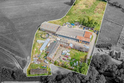
- Price
- Guide Price£495,000
- Size
- 3.9 acres
Added on 24/08/2026Development Land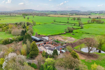
- Price
- Offers in Region of£695,000
- Size
- 12 acres
Soulton Road, Wem, Shrewsbury., Wem Rural, Shropshire SY4 England
Added on 24/04/2026Farmhouse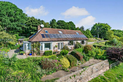
- Price
- Guide Price£650,000
- Size
- 4.66 acres
Added on 29/01/2026Country Home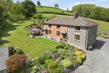
- Price
- Offers in Excess of£685,000
- Size
- 4.8 acres
Llanfair Caereinion, Welshpool, SY21, Llanfair Caereinion, Powys SY21 Wales
Added on 18/06/2026Smallholding