Aspenden, Buntingford, SG9
- Land size
- 7 acres
- Bedrooms
- 5
- Bathrooms
- 2
Key Features
- Spacious Semi Detached Grade II Listed Family Home with Scope to Improve
- 4/5 Well Proportioned Bedrooms
- Large Plot of Around 6/7 Acres
- Kitchen/Breakfast Room
- Characterful Lounge Space with Fireplace
- Conservatory
- Secluded Location Surrounded by Countryside
- Mature Gardens with Outbuildings
- 2 Bathrooms & Downstairs WC
- Viewings Strongly Recommended
Description
Property Insight
We are delighted to offer for sale this spacious semi-detached Grade II listed family home in the sought-after village of Aspenden. This property offers excellent potential to update and add value, with a large plot of around 6-7 acres, a secluded location surrounded by countryside, a kitchen/breakfast room, a characterful lounge, a conservatory, 4-5 well-proportioned bedrooms, 2 bathrooms and a downstairs WC, and mature gardens with outbuildings.
This semi-detached Grade II listed property is set back from the road in a beautiful secluded setting, with an attractive frontage, lawn gardens, and well-maintained gardens with hedgerows, trees and shrubs. Upon stepping inside, the entrance hallway is wide and welcoming, with carpets, a window to the rear, pendant lighting, room for furniture, storage, stairs to the first floor, and doors through to the downstairs living space, including cloakroom WC, a large snug space, and a downstairs shower room comprising a shower, WC and sink.
The kitchen/dining room is wonderfully open-plan, enjoying windows to a dual aspect, a range of base and wall units, laminate worktops, tiled flooring and splashbacks, strip lighting, an integrated hob, double oven and extractor fan, and space for a fridge/freezer, washing machine, dishwasher, and large dining setting and storage furniture.
The lounge is an excellent size and enjoys stunning period features, with windows to a dual aspect, exposed beams, an inglenook fireplace with a wood-burning stove, carpets, pendant lighting, and ample room for a variety of lounge and storage furniture. The conservatory is another lovely reception space, with windows and a door to a glorious garden aspect, tiled flooring and room for furniture.
Upstairs to the first floor, this spacious home continues to impress, with 4 well-proportioned bedrooms, and a family bathroom comprising a shower, WC and hand wash basin.
Outside, to the rear, the mature gardens are a remarkable size, offering multiple areas of interest and spots to sit and enjoy the sunshine. It is laid mainly to lawn, with paved patio spanning the house, providing space for garden furniture, potted plants and entertaining guests. The entire plot is around 6-7 acres, with vegetable patches, orchard trees and paddocks, all surrounded by beautiful countryside views.
Contact the team today to arrange your private viewing appointment!
Anti-Money Laundering (AML) Checks:
In line with the Money Laundering Regulations 2017, we are legally required to carry out identity and AML checks on all buyers. A fee of £25 (inc. VAT) per buyer is payable once an offer has been formally accepted. This fee is mandatory and forms part of our regulatory compliance obligations.
Location - Aspenden
Aspenden is a charming English village nestled in the picturesque county of Hertfordshire, located only 2 miles from the town and amenities of Buntingford.
One of the standout features of Aspenden is its collection of historic buildings. The centrepiece of the village is St. Mary's Church, a magnificent parish church that dates back to the 12th century. St Mary’s offers a traditional style of worship with services on most Sundays, with other activities and events held throughout the year for families.
Set in the centre of the village, The Fox has been the only public house in Aspenden since the First World War. The current hosts, Rob and Emerald, offer a friendly welcome to their traditional English pub with a large beer garden, open fire in the winter, quality cask ales, delicious home-cooked food, theme nights and an annual beer festival.
Cricket has been played on the green since the 1960s with some notable achievements and continues to be an Aspenden ‘institution’. There is a newly refurbished children’s park and playground, and ample opportunities for nature lovers to explore the countryside, scenic footpaths and bridleways.
We encourage you to visit Aspdenden to see for yourself the wonderful features this hidden gem has to offer.
Map Location
Property details
- Tenure
- Freehold
- Council Tax Band
- F
- Date Posted
- 2026-05-20
Price history
| Date | Change | Price |
|---|---|---|
| 8 Oct 2026 | Reduced 2.9% (−£25,000) | £825,000 |
| Until 8 Oct 2026 | Asking price | £850,000 |
Market Value Analysis
Compared with 197 Homes with Land listings in East Anglia (5+ acres).
Utilities & Restrictions
Utilities
- Electricity
- Mains
- Water
- Private Supply
- Heating
- Oil Heating
- Broadband
- Ask Agent
- Sewerage
- Septic Tank / Private
Rights & Restrictions
- Public Rights of Way
- Ask Agent
- Private Rights of Way
- Ask Agent
- Listed Property
- Yes
- Restrictions
- Ask Agent
Listed status, conservation areas and planning constraints for this location are in the full report.
Property Features
- Accessibility
- Ask Agent
- Parking
- Ask Agent
- Garden
- Garden
Beyond the particulars: planning activity, flood history, heritage and ground risks, checked for this exact spot.
Connectivity
Broadband
Fastest speed available at this postcode
4 Mbps
Under 10 Mbps here
Suitable for
- Basic browsing & email
Mobile signal
Predicted 4G and 5G signal; indoor signal depends on building materials.
Ofcom Connected Nations postcode-level predictions. Speeds and signal are modelled, not measured, and vary between addresses and providers.
Signal is the easy part. Planning activity, flood history and protected designations here are in the full report.
Nearest Schools
Primary
- Millfield First and Nursery School1.6 milesOfsted: Good
- Ages
- 3 to 9
- Pupils
- 311
- Type
- Community school
- Ardeley St Lawrence Church of England Voluntary Aided Primary School1.9 milesOfsted: Good
- Ages
- 3 to 11
- Pupils
- 46
- Type
- Voluntary aided school
- Faith
- Church of England
- Buntingford First School2 milesOfsted report card · May 2026
- Ages
- 2 to 9
- Pupils
- 165
- Type
- Free schools
- Layston Church of England First School2 milesOfsted: Requires improvement
- Ages
- 5 to 9
- Pupils
- 124
- Type
- Voluntary controlled school
- Faith
- Church of England
- Walkern Primary School3.3 milesOfsted: Good
- Ages
- 4 to 11
- Pupils
- 154
- Type
- Community school
Secondary
- Freman College1.6 milesNo Ofsted rating
- Ages
- 13 to 18
- Pupils
- 1,049
- Type
- Academy converter
- Edwinstree Church of England Middle School1.6 milesNo Ofsted rating
- Ages
- 9 to 13
- Pupils
- 486
- Type
- Voluntary controlled school
- Faith
- Church of England
- Ralph Sadleir School4.6 milesOfsted: Requires improvement
- Ages
- 9 to 13
- Pupils
- 283
- Type
- Academy converter
- The Nobel School5.1 milesNo Ofsted rating
- Ages
- 11 to 18
- Pupils
- 1,475
- Type
- Foundation school
- Marriotts School5.6 milesOfsted report card · Jan 2026
- Ages
- 11 to 18
- Pupils
- 1,415
- Type
- Community school
Distances are straight-line from the advertised location. Source: the national school registers (DfE, Welsh Government, Scottish Government) and Ofsted.
Schools are just the start: sold prices nearby, planning activity and any flood history are in the full report.
Amenities
Supermarket
GP surgery
Pharmacy
Hospital
Straight-line distances from the advertised location. Sources: NHS records, Geolytix supermarket locations, OS Open Greenspace and the national trails registers.
The area stacks up? Now check the location itself: planning nearby, protected designations and past flooding.
Getting Around
Nearest station
Nearest bus stop
Typical drive times
Straight-line distances from the advertised location; drive times are typical free-flow times over OpenStreetMap road data, so allow more at peak. Public transport locations from DfT NaPTAN.
Easy to reach matters. So do planning activity, flood history and ground risks: all in the full report.
Flood Risk
Environment Agency open data, checked around the advertised map pin for the listed acreage. Long-term risk counts flood defences; the planning map's flood zones do not. The map pin for this listing marks the postcode area rather than the exact location, so these readings describe the surrounding area. Provided by LandSale, not the listing agent, and not part of the agent's particulars. Risk varies across a holding, so verify before committing.
Rivers and the sea
Planning map: Flood Zone 1.
Surface water
Not at the pin: mapped about 40 metres away.
These bandings are the summary. Where this location sits on the flood maps, plus planning activity, heritage and ground risks, is in the full report.
Important notice: Information, maps and tags on this page are drawn from the advertising agent's marketing materials or generated automatically. LandSale has not verified them. Relying on these details is at your own risk, always carry out independent checks before committing to a purchase.
LandSale full disclaimer
Marketing information only - not formal particulars. The details on this website are provided for general guidance and do not constitute an offer or contract. Neither LandSale nor the advertising estate/land agent accepts responsibility for any inaccuracy.
1. Source of information
- Listing content: Core description, asking price, tenure, measurements, photographs and planning history originate from the marketing materials of the advertising estate or land agent. LandSale does not author this content and cannot guarantee its accuracy.
- Automated tags & categorisation: Property type, land-use class, acreage bands and similar labels may be applied by machine-learning models. They are intended as a helpful guide only and may not reflect the property's legal status or permitted use.
- Third-party & enriched data layers: Maps, boundary outlines, planning designations, soil reports, broadband coverage and other environmental or location-based insights are licensed from external suppliers. Such data are supplied “as is", may be incomplete or out of date and are subject to change without notice.
2. Verification required
Prospective purchasers must verify critical matters, including but not limited to planning permission, title boundaries, public rights of way, environmental constraints, acreage, services, access and VAT status, through their own inspections, specialist surveys, legal advisers and the selling agent before relying on the information or entering into any contract.
3. No warranty or liability
LandSale gives no warranty, express or implied, as to the accuracy, completeness or fitness for any particular purpose of the information displayed. LandSale shall not be liable for any loss, damage, cost or expense arising directly or indirectly from any use of or reliance on such information, save where liability may not be excluded by law.
4. Updates & feedback
If you believe any detail on this listing is inaccurate, please let us know. We will investigate and, where appropriate, update the listing or notify the agent.
© LandSale | Version 1.3 - August 2026
Listing agent
Ensum Brown, Royston
Kooky Nohmad, 42 High Street, Royston, SG8 9AG
Similar properties for sale
- Price
- Offers in Region of£880,000
- Size
- 3.25 acres
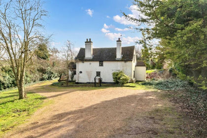
Baldock Road, Royston, SG8, Therfield, Hertfordshire SG8 England
Added on 22/07/2026House with Land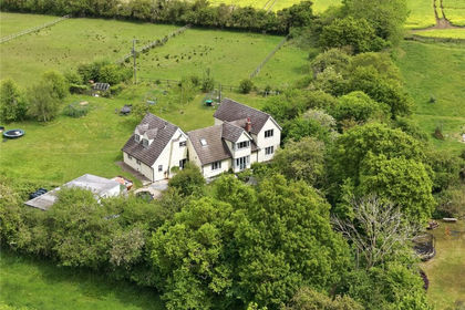
- Price
- Guide Price£975,000
- Size
- 4 acres
Langley Lower Green, Nr Saffron Walden, Essex, CB11, Langley, Essex CB11 England
Added on 03/10/2026House with Land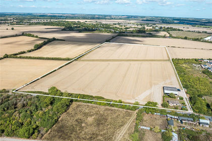
- Price
- Guide Price£725,000
- Size
- 27.74 acres
Mettle Hill Farm, Kneesworth Road, Meldreth, Royston, SG8, Royston, Cambridgeshire SG8 England
Added on 15/10/2026Small Farm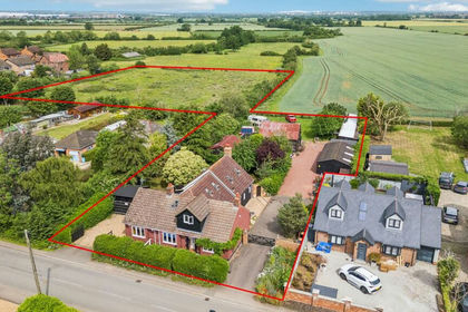
- Price
- Offers in Excess of£1,000,000
- Size
- 3 acres
Cotton End Road, Wilstead, MK45, Wilshamstead, Bedford MK45 England
Added on 03/06/2026House with Land
- Price
- Offers Over£800,000
- Size
- 5.7 acres
High Street, Toseland, St. Neots, Cambridgeshire, PE19, Toseland, Cambridgeshire PE19 England
Added on 18/06/2026Development Land
- Price
- Offers Over£900,000
- Size
- 9 acres
Howe Street, Finchingfield, Braintree, Finchingfield, Essex CM7 England
Added on 22/06/2026House with Land
- Price
- Guide Price£850,000
- Size
- 4.45 acres
Green End, Landbeach, Landbeach, Cambridgeshire CB25 England
Added on 18/09/2026Cottage
- Price
- Guide Price£960,000
- Size
- 3.61 acres
Lot 1 - West End Farm, Fenstanton, Huntingdon, Fenstanton, Cambridgeshire PE28 England
Added on 09/09/2026Farm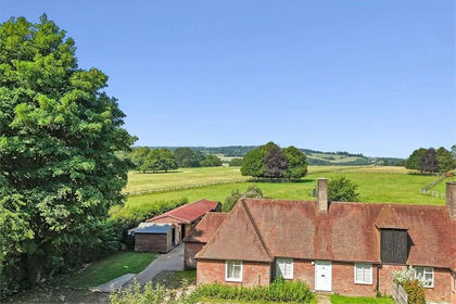
- Price
- Offers in Region of£1,000,000
- Size
- 5.33 acres
Norcott Hill, Northchurch, Hertfordshire., Northchurch, Hertfordshire HP4 England
Added on 07/03/2026Cottage
- Price
- Guide Price£825,000
- Size
- 3 acres
Wychtree Farm, Keysoe, MK44, Bolnhurst and Keysoe, Bedford MK44 England
Added on 29/01/2026Barn Conversion