Teffont, Salisbury
- Land size
- 3 acres
Key Features
- Block of naturally regenerating woodland with significant number of different species
- Abundance of Nature and Wildlife
- Hard Forestry Track Leading To the Plot
- Private Track Within Plot
- Stunning Countryside Views
- Access to the Footpath and Bridlepath network
- Access to the grounds of Philipps House
- In Total About 3 Acres
Description
Teffont Woodland is home to an abundance of wildlife, it has a variety of habitats as well as plentiful trees for timber and firewood. This particular parcel of woodland was clear felled in two stages in the recent past. Much of the upper section, has been allowed to regenerate naturally and as a result is now home to an abundance of tree species including Douglas Fir, Oak, Scots Pine, Beech, Larch, Birch, Holly and a plentiful supply of Norwegian Spruce of all sizes that can be utilised for Christmas Trees.The lower section of woodland, which was clear felled after the upper section has a similar number of tree species naturally regenerating but has recently been professionally replanted with a mixture of coniferous species with a view to producing a pleasing appearance and significant income in future years. A particular feature of this block is that it enjoys its own private track dividing the upper and lower section, enabling a purchaser to have their own private parking. The woodland is slightly sloped, with a South Easterly aspect which catches the evening sunshine. Beyond the boundary trees there are beautiful countryside views to be enjoyed. This is a very special plot that offers lots of immediate recreational opportunities with longer term income potential.
SITUATION
Tisbury 4.5 miles, Hindon 6 miles, Salisbury 8 miles, Shaftesbury 13 miles, London 103 miles
LOCATION
The woodland is situated on the western edge of Dinton and Philipps House, on the outskirts of Teffont, a well-regarded village with excellent road access and close to Tisbury which is renowned for its High Street supporting exclusively independent shops and cafes together with a small Coop convenience store as well as a mainline railway station on the London/Exeter line. The woodland benefits from good communication links with the A303 to the north providing access to the M3 and M5 motorway network. The Cathedral City of Salisbury lies within easy reach to the east with Blandford Forum, Poole and Weymouth to the south (via A350). It is possible to cycle the vast majority of the way to Salisbury via Grovely Woods a county wildlife site and other bridle paths with the remainder of the journey on quiet roads.
The market town of Shaftesbury provides a good range of services including two supermarkets, a post office, public houses, restaurants, church and a school with more comprehensive shopping, sporting, cultural and education facilities found in Salisbury. Good walking and cycling opportunities abound from the property into the surrounding Countryside. Fishing can be enjoyed on the River Nadder nearby on licence via private clubs and organisations.
TEFFONT WOODLANDS
Set in the Wiltshire countryside, Teffont Woodland is an idyllic place to enjoy peaceful wildlife observations and to relax, as well as engaging in active woodland management across the array of topography. Access to the woodland is from the B3089 via a private gated entrance that leads to a stone woodland track that`s met via the B3089. The woodland enjoys a carpet of Bluebells throughout spring.
There are some large clearings that provide grazing opportunities for the deer and other wildlife.
HISTORY
The woodlands once formed part of the Dinton Park Estate, acquired by the famous political Wyndham family in 1689 and much enlarged in the 18th and early 19th Centuries. The adjoining park land and neo-Grecian house designed by Jeffry Wyatville in 1820, now known as Philipps House, adjoins and the access to the estate in earlier times came through the property from the Lodge and there is still evidence of a driveway lined by sweet chestnuts and occasional park railings on the eastern side of this block of woodland. Philipps House is now owned by the National Trust and the parkland and grounds are open daily all year.
VIEWINGS
All viewings strictly by appointment through the agents on . Please contact Caitlin Henderson or William Fox Grant for further details or email
DIRECTIONS
From Salisbury head west on the A30 for Shaftesbury. After about 2 miles, in the centre of Barford St Martin turn right signposted Dinton(B3089). Continue through Dinton and pass the thatched lodge on your left and the woods can be found on your right hand side, before entering Teffont itself.
AGENTS NOTES
Fox Grant and their clients give notice that:
1. They have no authority to make or give any representations or warranties in relation to the property.
2. These particulars have been prepared in good faith to give a fair overall view of the property, do not form any part of an offer or contract and must not be relied upon as statements or representations of fact.
3. Any areas, measurements or distances are approximate. The text, photographs and plans are for guidance only and are not necessarily comprehensive. It should not be assumed that the property has all necessary planning, building regulation or other consents and Fox Grant have not tested any services, equipment or facilities. Purchasers must satisfy themselves by inspection or otherwise. Any error or mis-statement shall not annul the sale or entitle either party to compensation in respect thereof.
COVENANTS
There are no historic restrictive covenants over the woodland.
SPORTING RIGHTS
The sporting rights are owned and included in the sale.
RIGHT OF WAY
There will be a shared vehicular right of way to the property. There are no public or private footpaths on the land to be sold
SERVICES
None
AUTHORITY Wiltshire Council Tel:
PHONE SIGNAL
Three, O2, Vodafone
PROPERTY CODE
SH, FL, TL
Notice
Please note we have not tested any apparatus, fixtures, fittings, or services. Interested parties must undertake their own investigation into the working order of these items. All measurements are approximate and photographs provided for guidance only.
Map Location
Property details
- Tenure
- Freehold
- Council Tax Band
- Ask Agent
- Date Posted
- 2026-05-14
Market Value Analysis
Compared with 28 Woodland listings in South West England (1+ acres).
Utilities & Restrictions
Utilities
- Electricity
- Ask Agent
- Water
- Ask Agent
- Heating
- Ask Agent
- Broadband
- Ask Agent
- Sewerage
- Ask Agent
Rights & Restrictions
- Public Rights of Way
- Ask Agent
- Private Rights of Way
- Ask Agent
- Listed Property
- Ask Agent
- Restrictions
- Ask Agent
Listed status, conservation areas and planning constraints for this location are in the full report.
Property Features
- Accessibility
- Ask Agent
- Parking
- Parking Available
- Garden
- Private Garden
Beyond the particulars: planning activity, flood history, heritage and ground risks, checked for this exact spot.
Connectivity
Broadband
Fastest speed available at this postcode
1 Gbps
Superfast · available to 43% of premises
Suitable for
- 4K streaming on every screen
- Full-time home working
- Online gaming & big downloads
Mobile signal
Outdoor predictions; indoor signal depends on building materials.
Ofcom Connected Nations postcode-level predictions. Speeds and signal are modelled, not measured, and vary between addresses and providers.
Signal is the easy part. Planning activity, flood history and protected designations here are in the full report.
Nearest Schools
Primary
- Dinton CofE Primary School0.9 milesNo Ofsted rating
- Ages
- 4 to 11
- Pupils
- 66
- Type
- Academy converter
- Faith
- Church of England
- Chilmark and Fonthill Bishop Church of England Aided Primary School1.9 milesOfsted: Good
- Ages
- 4 to 11
- Pupils
- 48
- Type
- Voluntary aided school
- Faith
- Church of England
- St John's Church of England Primary School, Tisbury3.8 milesNo Ofsted rating
- Ages
- 4 to 11
- Pupils
- 104
- Type
- Voluntary controlled school
- Faith
- Church of England
- Broad Chalke CofE Primary School4.8 milesOfsted: Good *
- Ages
- 4 to 11
- Pupils
- 189
- Type
- Academy converter
- Faith
- Church of England
- Wardour Catholic Primary School5.2 milesOfsted: Good
- Ages
- 4 to 11
- Pupils
- 95
- Type
- Voluntary aided school
- Faith
- Roman Catholic
Secondary
- Sarum Academy7.3 milesNo Ofsted rating
- Ages
- 11 to 18
- Pupils
- 747
- Type
- Academy sponsor led
- Faith
- Church of England
- South Wilts Grammar School8.9 milesOfsted: Good
- Ages
- 11 to 18
- Pupils
- 1,200
- Type
- Academy converter
- Gender
- Girls
- Bishop Wordsworth's Church of England Grammar School9.2 milesOfsted: Outstanding
- Ages
- 11 to 18
- Pupils
- 1,193
- Type
- Academy converter
- Faith
- Church of England
- Gender
- Boys
- Shaftesbury School9.8 milesOfsted: Good
- Ages
- 11 to 18
- Pupils
- 782
- Type
- Academy converter
- Faith
- Church of England
- Wyvern St Edmund's Academy10 milesOfsted: Requires improvement *
- Ages
- 11 to 16
- Pupils
- 1,337
- Type
- Academy converter
- Faith
- Church of England
* Latest graded judgement covers quality of education only; no overall grade was issued under the 2024-25 inspection framework.
Distances are straight-line from the advertised location. Source: the national school registers (DfE, Welsh Government, Scottish Government) and Ofsted.
Schools are just the start: sold prices nearby, planning activity and any flood history are in the full report.
Amenities
Supermarket
GP surgery
Pharmacy
Hospital
Green space
Straight-line distances from the advertised location. Sources: NHS records, Geolytix supermarket locations, OS Open Greenspace and the national trails registers.
The area stacks up? Now check the location itself: planning nearby, protected designations and past flooding.
Getting Around
Nearest station
Nearest bus stop
Typical drive times
Straight-line distances from the advertised location; drive times are typical free-flow times over OpenStreetMap road data, so allow more at peak. Public transport locations from DfT NaPTAN.
Easy to reach matters. So do planning activity, flood history and ground risks: all in the full report.
Flood Risk
From Environment Agency flood map open data, checked around the advertised map pin and allowing for the listed acreage where known. This summary comes from LandSale, the advertising platform, not from the listing agent, and is not part of the agent's particulars. Risk can vary across a single holding, so verify anything critical through your own searches before committing.
Rivers and the sea
Surface water
The detail behind these bandings
The full report pinpoints where this location sits on the flood maps, and runs the deeper checks that usually only surface after an offer.
- Exact flood zones & annual chances (included in the full report)
- Any recorded past flooding (included in the full report)
- Planning activity nearby (included in the full report)
- Heritage & conservation (included in the full report)
- Protected nature designations (included in the full report)
- Ground risks (included in the full report)
- Sold prices nearby (included in the full report)
£14.99 · one-off purchase
By LandSale, the platform. Not provided by the listing agent. Ready in about a minute.
Important notice: Information, maps and tags on this page are drawn from the advertising agent's marketing materials or generated automatically. LandSale has not verified them. Relying on these details is at your own risk, always carry out independent checks before committing to a purchase.
LandSale full disclaimer
Marketing information only - not formal particulars. The details on this website are provided for general guidance and do not constitute an offer or contract. Neither LandSale nor the advertising estate/land agent accepts responsibility for any inaccuracy.
1. Source of information
- Listing content: Core description, asking price, tenure, measurements, photographs and planning history originate from the marketing materials of the advertising estate or land agent. LandSale does not author this content and cannot guarantee its accuracy.
- Automated tags & categorisation: Property type, land-use class, acreage bands and similar labels may be applied by machine-learning models. They are intended as a helpful guide only and may not reflect the property's legal status or permitted use.
- Third-party & enriched data layers: Maps, boundary outlines, planning designations, soil reports, broadband coverage and other environmental or location-based insights are licensed from external suppliers. Such data are supplied “as is", may be incomplete or out of date and are subject to change without notice.
2. Verification required
Prospective purchasers must verify critical matters, including but not limited to planning permission, title boundaries, public rights of way, environmental constraints, acreage, services, access and VAT status, through their own inspections, specialist surveys, legal advisers and the selling agent before relying on the information or entering into any contract.
3. No warranty or liability
LandSale gives no warranty, express or implied, as to the accuracy, completeness or fitness for any particular purpose of the information displayed. LandSale shall not be liable for any loss, damage, cost or expense arising directly or indirectly from any use of or reliance on such information, save where liability may not be excluded by law.
4. Updates & feedback
If you believe any detail on this listing is inaccurate, please let us know. We will investigate and, where appropriate, update the listing or notify the agent.
© LandSale | Version 1.3 - August 2026
Listing agent
Fox Grant, Salisbury
Windover House, St Ann Street, Salisbury, SP1 2DR
Similar properties for sale
- Price
- Guide Price£50,000
- Size
- 2.33 acres
Added on 11/08/2026Agricultural Land
- Price
- Guide Price£75,000
- Size
- 5 acres
Added on 13/06/2026Grazing Land
- Price
- Guide Price£100,000
- Size
- 9.97 acres
Street Lane, South Brewham, Bruton, Somerset, BA10, Brewham, Somerset BA10 England
Added on 21/08/2026Pasture
- Price
- Guide Price£95,000
- Size
- 5.84 acres
Street Lane, South Brewham, Bruton, Somerset, BA10, Brewham, Somerset BA10 England
Added on 21/08/2026Agricultural Land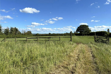
- Price
- Guide Price£40,000
- Size
- 2.82 acres
Yenston Hill, Yenston, Templecombe, Somerset, BA8, Henstridge, Somerset BA8 England
Added on 12/08/2026Cheap Land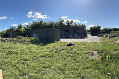
- Price
- Guide Price£70,000
- Size
- 3.73 acres
Yenston Hill, Yenston, Templecombe, Somerset, BA8, Henstridge, Somerset BA8 England
Added on 12/08/2026Grazing Land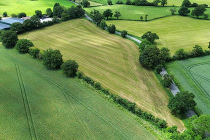
- Price
- Guide Price£85,000
- Size
- 5.66 acres
Added on 14/08/2026Pasture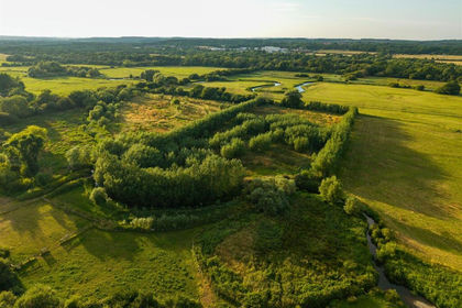
- Price
- Guide Price£95,000
- Size
- 3.41 acres
Water Meadow Lane, East Burton, Wool, Wool, Dorset BH20 England
Added on 19/08/2026Undeveloped Land
- Price
- Guide Price£90,000
- Size
- 3.01 acres
Added on 27/08/2026Agricultural Land
- Price
- Guide Price£90,000
- Size
- 3.01 acres
Added on 27/08/2026Undeveloped Land