Avon Castle Drive, Ringwood
- Land size
- 1.3 acres
- Bedrooms
- 5
- Bathrooms
- 5
Key Features
- EXCLUSIVE PRIVATE ESTATE
- RECENTLY CONSTRUCTED
- APPROACHING 8,500SQFT
- ARRANGED OVER TWO FLOORS
- 5 BEDROOMS
- 5 BATHROOMS
- ANNEX
- SET IN APPROX 1.3 ACRES
- TRIPPLE GARAGE
- STUNNING FAMILY HOME
Description
This recently built, Georgian-inspired family residence offers over 8,000 sq ft of modern living space within the exclusive Avon Castle Estate.
Designed for both functionality and impact, the home is situated on a private, level 1.3-acre plot. The main home features four spacious double bedrooms, while a separate one-bedroom annex provides additional flexibility for guests.
The property balances grand entertaining with practical daily life. It features a private, indoor heated pool and a layout designed for both entertaining and comfortable family living.
Set behind electric gates, an expansive in-and-out driveway provides ample parking and leads to a stunning family home that feels entirely secluded from the outside world.
The entrance hall is a real feature of this property defined by its symmetry, featuring twin quartz staircases with iron handrails that frame a direct view through to the gardens. Polished Porcelanosa tiles and high ceilings create an immediate sense of scale, while a central crystal chandelier adds a refined touch to the foyer.
The primary living space is an impressive open-plan hub that merges the kitchen, dining, and family areas. Large bi-folding doors connect this space to the outdoors, ensuring the garden is a constant backdrop. In the family area, an 80” smart TV and electric fireplace are integrated into a polished plaster feature wall, offering a sleek focal point. The kitchen is designed for high-end catering and socialising, anchored by quartz worktops and LED accents. It is equipped with a Bora induction hob, twin Neff ovens, and a Quooker system for instant boiling and sparkling water. Additions include a wine cooler, food waste disposal, and specialized produce-fresh drawers, while a hidden pantry and utility wing house secondary appliances and laundry facilities to keep the main kitchen clutter-free.
Versatile reception rooms branch off the main hub, including a games room partitioned by black Crittall doors and a formal sitting room with its own flame-effect fire. This sitting room opens into a dedicated hobbies area, allowing for privacy without feeling isolated. For those working from home, a private office is positioned near the front entrance alongside a guest cloakroom. The leisure wing, accessed via a secure pin-coded door, contains a mirrored home gym and a heated indoor pool with an electric cover. In warmer months, bi-fold doors transform this area into an indoor-outdoor space.
The upper level is built with solid concrete floors. Each of the four double bedrooms is a complete suite, featuring its own dressing area and private bathroom. The master suite is particularly impressive, spanning the full width of the rear elevation with garden views and a luxury ensuite fitted with a freestanding bath and walk-in shower.
Separate from the main sleeping quarters, a self-contained one-bedroom annex is located above the triple garage. Accessed via its own internal staircase, it provides an ideal setup for guests or long-term residents.
The triple garage is well-equipped for modern requirements, featuring two electric vehicle charging points and a gardeners WC.
Externally, the 1.3-acre grounds are primarily level lawn, offering a private and versatile space that functions as either a secure play area or a blank canvas for further landscaping. There is also a large patio area perfect for outdoor entertaining.
Location - Avon Castle is a prestigious residential area set in the beautiful Avon Valley located close to the western border of the New Forest National Park. One of the main attractions to this exquisite location is the private nature of the setting.
The popular market town of Ringwood (2miles) has much to offer in the way of amenities, including numerous country pubs & restaurants, boutique shops, Waitrose supermarket and David Lloyd Health & Leisure Club. Only 90 miles from London via the M3 and one hour from Heathrow airport via the M27 and M3. The A31 & A338 dual carriageways provide superb links to the sandy coastline of Bournemouth (8 miles south), Salisbury (18 miles north) & and the M27 for Southampton (18 miles east).
Agents Note: Whilst every care has been taken to prepare these particulars, they are for
guidance purposes only. All measurements are approximate and for general guidance
purposes only and whilst every care has been taken to ensure accuracy, they should not
be relied upon and potential buyers/tenants are advised to recheck the measurements
Map Location
Property details
- Tenure
- Freehold
- Council Tax Band
- H
- Date Posted
- 2026-05-13
Price history
| Date | Change | Price |
|---|---|---|
| 12 Oct 2026 | Reduced 15.7% (−£550,000) | £2,950,000 |
| Until 12 Oct 2026 | Asking price | £3,500,000 |
Market Value Analysis
Compared with 1,622 Homes with Land listings in South West England (1+ acres).
Energy Performance Certificate
Energy Efficiency Rating
Based on UK Energy Performance Certificate standards (EU Directive 2002/91/EC)
Running costs are one side. Planning activity, flood history and ground risks for this location are in the full report.
Utilities & Restrictions
Utilities
- Electricity
- Ask Agent
- Water
- Ask Agent
- Heating
- Ask Agent
- Broadband
- Ask Agent
- Sewerage
- Ask Agent
Rights & Restrictions
- Public Rights of Way
- Ask Agent
- Private Rights of Way
- Ask Agent
- Listed Property
- Ask Agent
- Restrictions
- Ask Agent
Listed status, conservation areas and planning constraints for this location are in the full report.
Property Features
- Accessibility
- Ask Agent
- Parking
- Parking Available
- Garden
- Garden
Beyond the particulars: planning activity, flood history, heritage and ground risks, checked for this exact spot.
Connectivity
Broadband
Fastest speed available at this postcode
1.8 Gbps
Gigabit full fibre · available to 67% of premises
Suitable for
- 4K streaming on every screen
- Full-time home working
- Online gaming & big downloads
Mobile signal
Predicted 4G and 5G signal; indoor signal depends on building materials.
Ofcom Connected Nations postcode-level predictions. Speeds and signal are modelled, not measured, and vary between addresses and providers.
Signal is the easy part. Planning activity, flood history and protected designations here are in the full report.
Nearest Schools
Primary
- St Ives Primary & Nursery School1 mileOfsted: Outstanding
- Ages
- 2 to 11
- Pupils
- 245
- Type
- Academy converter
- Ringwood Junior School1.4 milesNo Ofsted rating
- Ages
- 7 to 11
- Pupils
- 353
- Type
- Community school
- Ringwood Church of England Infant School1.4 milesOfsted report card · Apr 2026
- Ages
- 5 to 7
- Pupils
- 239
- Type
- Voluntary controlled school
- Faith
- Church of England
- Poulner Junior School2.5 milesNo Ofsted rating
- Ages
- 7 to 11
- Pupils
- 265
- Type
- Community school
- Poulner Infant School and Nursery2.6 milesNo Ofsted rating
- Ages
- 2 to 7
- Pupils
- 207
- Type
- Community school
Secondary
- Ringwood School Academy1.6 milesNo Ofsted rating
- Ages
- 11 to 18
- Pupils
- 1,592
- Type
- Academy converter
- West Moors Middle School3.1 milesOfsted report card · Jun 2026
- Ages
- 9 to 13
- Pupils
- 240
- Type
- Community school
- Ferndown Middle School4.5 milesNo Ofsted rating
- Ages
- 9 to 13
- Pupils
- 600
- Type
- Academy converter
- Ferndown Upper School4.5 milesOfsted report card · Mar 2026
- Ages
- 13 to 19
- Pupils
- 1,134
- Type
- Community school
- Emmanuel Church of England Middle School4.5 milesOfsted: Good
- Ages
- 9 to 13
- Pupils
- 434
- Type
- Academy sponsor led
- Faith
- Church of England
Distances are straight-line from the advertised location. Source: the national school registers (DfE, Welsh Government, Scottish Government) and Ofsted.
Schools are just the start: sold prices nearby, planning activity and any flood history are in the full report.
Amenities
Supermarket
GP surgery
Pharmacy
Hospital
Green space
Straight-line distances from the advertised location. Sources: NHS records, Geolytix supermarket locations, OS Open Greenspace and the national trails registers.
The area stacks up? Now check the location itself: planning nearby, protected designations and past flooding.
Getting Around
Nearest station
Nearest bus stop
Typical drive times
Straight-line distances from the advertised location; drive times are typical free-flow times over OpenStreetMap road data, so allow more at peak. Public transport locations from DfT NaPTAN.
Easy to reach matters. So do planning activity, flood history and ground risks: all in the full report.
Flood Risk
Environment Agency open data, checked around the advertised map pin for the listed acreage. Long-term risk counts flood defences; the planning map's flood zones do not. Provided by LandSale, not the listing agent, and not part of the agent's particulars. Risk varies across a holding, so verify before committing.
Rivers and the sea
Planning map: Flood Zone 1.
Surface water
Not at the pin: mapped about 30 metres away.
These bandings are the summary. Where this location sits on the flood maps, plus planning activity, heritage and ground risks, is in the full report.
Important notice: Information, maps and tags on this page are drawn from the advertising agent's marketing materials or generated automatically. LandSale has not verified them. Relying on these details is at your own risk, always carry out independent checks before committing to a purchase.
LandSale full disclaimer
Marketing information only - not formal particulars. The details on this website are provided for general guidance and do not constitute an offer or contract. Neither LandSale nor the advertising estate/land agent accepts responsibility for any inaccuracy.
1. Source of information
- Listing content: Core description, asking price, tenure, measurements, photographs and planning history originate from the marketing materials of the advertising estate or land agent. LandSale does not author this content and cannot guarantee its accuracy.
- Automated tags & categorisation: Property type, land-use class, acreage bands and similar labels may be applied by machine-learning models. They are intended as a helpful guide only and may not reflect the property's legal status or permitted use.
- Third-party & enriched data layers: Maps, boundary outlines, planning designations, soil reports, broadband coverage and other environmental or location-based insights are licensed from external suppliers. Such data are supplied “as is", may be incomplete or out of date and are subject to change without notice.
2. Verification required
Prospective purchasers must verify critical matters, including but not limited to planning permission, title boundaries, public rights of way, environmental constraints, acreage, services, access and VAT status, through their own inspections, specialist surveys, legal advisers and the selling agent before relying on the information or entering into any contract.
3. No warranty or liability
LandSale gives no warranty, express or implied, as to the accuracy, completeness or fitness for any particular purpose of the information displayed. LandSale shall not be liable for any loss, damage, cost or expense arising directly or indirectly from any use of or reliance on such information, save where liability may not be excluded by law.
4. Updates & feedback
If you believe any detail on this listing is inaccurate, please let us know. We will investigate and, where appropriate, update the listing or notify the agent.
© LandSale | Version 1.3 - August 2026
Listing agent
BEEZUMS, Poole
Covering Poole
Similar properties for sale
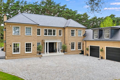
- Price
- Guide Price£2,950,000
- Size
- 1.3 acres
Avon Castle Drive, Ringwood, Dorset, BH24, St. Leonards and St. Ives, Dorset BH24 England
Added on 29/05/2026House with Land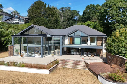
- Price
- Guide Price£2,750,000
- Size
- 1.5 acres
Windmill Lane, Ringwood, Dorset, BH24, St. Leonards and St. Ives, Dorset BH24 England
Added on 18/08/2026House with Land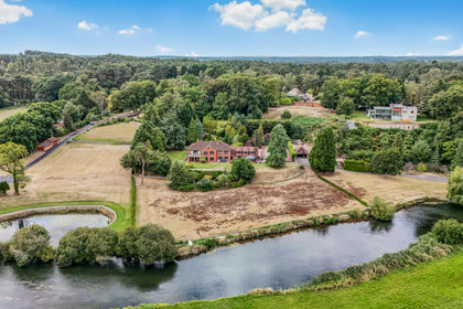
- Price
- Offers Over£2,500,000
- Size
- 2 acres
Avon Castle Drive, Ringwood, Dorset, BH24, St. Leonards and St. Ives, Dorset BH24 England
Added on 29/01/2026House with Land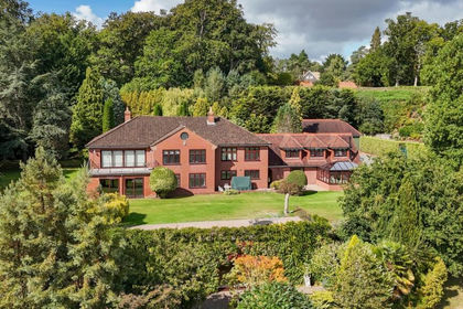
- Price
- Offers in Excess of£2,500,000
- Size
- 2 acres
Avon Castle Drive, Ringwood, BH24, St. Leonards and St. Ives, Dorset BH24 England
Added on 16/06/2026House with Land
- Price
- Guide Price£2,950,000
- Size
- 6 acres
Holly Hill, Hangersley, BH24, Ringwood, Hampshire BH24 England
Added on 10/05/2026Country Home
- Price
- Guide Price£3,000,000
- Size
- 24 acres
Highwood, Ringwood, Ellingham, Harbridge and Ibsley, Hampshire BH24 England
Added on 04/06/2026Country Home
- Price
- £2,285,000
- Size
- 1.2 acres
Forest Road, Burley, Ringwood, BH24, Burley, Hampshire BH24 England
Added on 02/04/2026House with Land
- Price
- Guide Price£2,285,000
- Size
- 1.2 acres
Forest Road, Burley, Ringwood, Hampshire, BH24, Burley, Hampshire BH24 England
Added on 01/06/2026House with Land
- Price
- £2,995,000
- Size
- 3 acres
Southfield Lane, Burley, Ringwood, BH24, Burley, Hampshire BH24 England
Added on 29/01/2026House with Land
- Price
- £2,350,000
- Size
- 2.3 acres
Tiptoe Road, Wootton, BH25, New Milton, Hampshire BH25 England
Added on 02/10/2026House with Land