Beeston St Andrew
- Bedrooms
- 4
- Bathrooms
- 2
Key Features
- ***GUIDE PRICE £625,000 - £650,000***
- Exclusive Barn Complex
- Superb Sitting Room
- Kitchen and Family Bathroom
- Principal Bedroom with En-Suite and Dressing Room
- Two Further Bedrooms and Study/Bedroom Four
- Beautiful Well-Established Garden and Parking
Description
***GUIDE PRICE £625,000 - £650,000*** Meadow View Barn is a stunning and innovative barn conversion that beautifully combines traditional elements with modern, contemporary features. Now nearing completion, this superb property offers bright, airy, and versatile single-story accommodation, extending to approximately 1584 square feet.
From the front courtyard and parking area, the entrance opens into a light-filled hallway. The open-plan sitting room and kitchen create a fantastic social space, enhanced by a partially vaulted ceiling, gable-end glazing, and double doors that lead out to the terrace and garden. The sense of space and light is truly remarkable.
The principal bedroom includes an en-suite bathroom and a dressing room, while two additional bedrooms share a family bathroom. There is also a flexible room that can serve as a study or fourth bedroom.
Unlike many new barn conversions, which often leave the garden as a blank canvas, this property boasts a well-established, beautifully landscaped garden. A spacious Indian stone terrace is perfect for entertaining, framed by raised railway sleeper borders and steps that lead up to a sweeping lawn. The attention to detail continues with the boundary fencing, featuring exclusive woven willow, adding to the overall charm and privacy of the property.
BEESTON ST ANDREW
A picturesque civil parish. Beeston St Andrew offers a peaceful and idyllic environment, making it an ideal place for those seeking a quiet and serene lifestyle. The village is surrounded by beautiful countryside, providing ample opportunities for outdoor activities such as walking, cycling, and nature exploration.
The nearby villages, including Rackheath, Thorpe End and Spixworth, as well as the nearby town of Sprowston, boast a range of amenities. These include local shops, pubs, and restaurants, providing residents with convenient access to everyday essentials and dining options.
For those seeking a bit more excitement, the nearby city of Norwich offers a wealth of cultural, historical, and entertainment attractions. Norwich is famous for its stunning medieval architecture, including the magnificent Norwich Cathedral and Norwich Castle. The city also offers a diverse range of shopping opportunities, from high-street brands to independent boutiques, as well as a vibrant night-life scene.
Norwich is also home to a variety of museums, galleries, and theatres, providing ample opportunities for cultural enrichment and entertainment. Additionally, the city hosts an array of events and festivals throughout the year, catering to a wide range of interests and tastes.
Overall, Beeston St Andrew and its proximity to Norwich offer the perfect blend of rural tranquillity and urban convenience, making it an attractive location for residents.
SERVICES CONNECTED
Mains water and electricity. Air source heating. Private drainage.
COUNCIL TAX
Band to be confirmed.
ENERGY EFFICIENCY RATING
To be confirmed.
To retrieve the Energy Performance Certificate for this property please visit and enter in the reference number above. Alternatively, the full certificate can be obtained through Sowerbys.
TENURE
Freehold.
LOCATION
What3words: ///pose.puff.poet
AGENT’S NOTE
There is a service charge payable for the treatment plant, pond and other communal areas, the amount of which is to be confirmed.
WEBSITE TAGS
village-spirit
garden-parties
family-life
fresh-visions
Parking - Driveway
Disclaimer
These particulars are provided as a guide only and do not form part of any offer or contract. Sowerbys and its representatives have no authority to make or give representations or warranties. All descriptions, measurements, photographs and plans are for guidance only and should not be relied upon as statements of fact. Buyers should satisfy themselves as to the accuracy of the information through inspection or professional advice. Services, appliances and equipment have not been tested and no warranty can be given as to their condition. Planning permissions, building regulations and other consents should be verified by the buyer’s legal adviser. In accordance with Anti-Money Laundering regulations, proceeding buyers must complete a digital ID check through our compliance partner. A charge of £48 including VAT per sale or purchase applies. Leasehold buyers should confirm ground rent, service charges and lease details with their legal adviser.
Map Location
Property details
- Tenure
- Freehold
- Council Tax Band
- H
- Date Posted
- 2026-05-11
Utilities & Restrictions
Utilities
- Electricity
- Mains
- Water
- Mains
- Heating
- Air Source Heat Pump
- Broadband
- Ask Agent
- Sewerage
- Septic Tank / Private
Rights & Restrictions
- Public Rights of Way
- Ask Agent
- Private Rights of Way
- Ask Agent
- Listed Property
- Ask Agent
- Restrictions
- Ask Agent
Listed status, conservation areas and planning constraints for this location are in the full report.
Property Features
- Accessibility
- Ask Agent
- Parking
- Driveway
- Garden
- Private Garden
Beyond the particulars: planning activity, flood history, heritage and ground risks, checked for this exact spot.
Connectivity
Broadband
No premises records for this postcode, which is common for bare land and rural plots. A new connection would be quoted by the provider.
Mobile signal
No address-level signal records for this postcode, which is common for bare land.
Ofcom Connected Nations postcode-level predictions. Speeds and signal are modelled, not measured, and vary between addresses and providers.
Signal is the easy part. Planning activity, flood history and protected designations here are in the full report.
Nearest Schools
Primary
- White Woman Lane Junior School0.9 milesNo Ofsted rating
- Ages
- 7 to 11
- Pupils
- 352
- Type
- Community school
- Spixworth Infant School1.1 milesNo Ofsted rating
- Ages
- 5 to 7
- Pupils
- 109
- Type
- Community school
- Woodland View Junior School1.1 milesOfsted: Good *
- Ages
- 7 to 11
- Pupils
- 157
- Type
- Community school
- Lodge Lane Infant School1.1 milesNo Ofsted rating
- Ages
- 4 to 7
- Pupils
- 175
- Type
- Academy converter
- White House Farm1.2 milesOfsted: Good
- Ages
- 4 to 11
- Pupils
- 349
- Type
- Free schools
Secondary
- Sprowston Community Academy1.7 milesOfsted report card · May 2026
- Ages
- 11 to 18
- Pupils
- 1,702
- Type
- Academy sponsor led
- The Open Academy2.2 milesOfsted: Good
- Ages
- 11 to 19
- Pupils
- 529
- Type
- Academy sponsor led
- Faith
- Church of England
- Sewell Park Academy2.3 milesOfsted report card · Jun 2026
- Ages
- 11 to 16
- Pupils
- 775
- Type
- Academy sponsor led
- Thorpe St Andrew School and Sixth Form3 milesOfsted: Good *
- Ages
- 11 to 18
- Pupils
- 1,830
- Type
- Academy converter
- Hellesdon High School3.1 milesOfsted: Requires improvement
- Ages
- 11 to 18
- Pupils
- 1,476
- Type
- Academy converter
* Latest graded judgement covers quality of education only; no overall grade was issued under the 2024-25 inspection framework.
Distances are straight-line from the advertised location. Source: the national school registers (DfE, Welsh Government, Scottish Government) and Ofsted.
Schools are just the start: sold prices nearby, planning activity and any flood history are in the full report.
Amenities
Supermarket
GP surgery
Pharmacy
Hospital
Green space
Straight-line distances from the advertised location. Sources: NHS records, Geolytix supermarket locations, OS Open Greenspace and the national trails registers.
The area stacks up? Now check the location itself: planning nearby, protected designations and past flooding.
Getting Around
Nearest station
Nearest bus stop
Typical drive times
Straight-line distances from the advertised location; drive times are typical free-flow times over OpenStreetMap road data, so allow more at peak. Public transport locations from DfT NaPTAN.
Easy to reach matters. So do planning activity, flood history and ground risks: all in the full report.
Flood Risk
From Environment Agency flood map open data, checked around the advertised map pin and allowing for the listed acreage where known. This summary comes from LandSale, the advertising platform, not from the listing agent, and is not part of the agent's particulars. Risk can vary across a single holding, so verify anything critical through your own searches before committing.
Rivers and the sea
Surface water
These bandings are the summary. Where this location sits on the flood maps, plus planning activity, heritage and ground risks, is in the full report.
Important notice: Information, maps and tags on this page are drawn from the advertising agent's marketing materials or generated automatically. LandSale has not verified them. Relying on these details is at your own risk, always carry out independent checks before committing to a purchase.
LandSale full disclaimer
Marketing information only - not formal particulars. The details on this website are provided for general guidance and do not constitute an offer or contract. Neither LandSale nor the advertising estate/land agent accepts responsibility for any inaccuracy.
1. Source of information
- Listing content: Core description, asking price, tenure, measurements, photographs and planning history originate from the marketing materials of the advertising estate or land agent. LandSale does not author this content and cannot guarantee its accuracy.
- Automated tags & categorisation: Property type, land-use class, acreage bands and similar labels may be applied by machine-learning models. They are intended as a helpful guide only and may not reflect the property's legal status or permitted use.
- Third-party & enriched data layers: Maps, boundary outlines, planning designations, soil reports, broadband coverage and other environmental or location-based insights are licensed from external suppliers. Such data are supplied “as is", may be incomplete or out of date and are subject to change without notice.
2. Verification required
Prospective purchasers must verify critical matters, including but not limited to planning permission, title boundaries, public rights of way, environmental constraints, acreage, services, access and VAT status, through their own inspections, specialist surveys, legal advisers and the selling agent before relying on the information or entering into any contract.
3. No warranty or liability
LandSale gives no warranty, express or implied, as to the accuracy, completeness or fitness for any particular purpose of the information displayed. LandSale shall not be liable for any loss, damage, cost or expense arising directly or indirectly from any use of or reliance on such information, save where liability may not be excluded by law.
4. Updates & feedback
If you believe any detail on this listing is inaccurate, please let us know. We will investigate and, where appropriate, update the listing or notify the agent.
© LandSale | Version 1.3 - August 2026
Similar properties for sale
- Price
- Guide Price£490,000
- Size
- 0.5 acres
Added on 18/04/2026Residential
- Price
- Offers in Excess of£500,000
St. Faiths Lane, Norwich, Norwich South, Norfolk NR1 England
Added on 02/07/2026Development Land
- Price
- £745,000
Added on 29/01/2026Barn Conversion
- Price
- Guide Price£485,000
- Size
- 1.25 acres
North Walsham Road, Coltishall, North Norfolk, Coltishall, Norfolk NR12 England
Added on 24/06/2026House with Land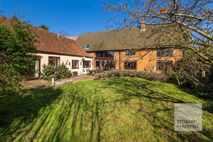
- Price
- Offers in Excess of£700,000
- Size
- 0.33 acres
Church Barn, Gt. Hautbois Road, Coltishall, Norfolk, Coltishall, Norfolk NR12 England
Added on 02/04/2026Barn Conversion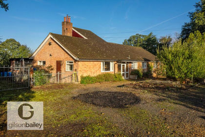
- Price
- Offers in Excess of£675,000
- Size
- 5 acres
Church Road, Postwick, Postwick with Witton, Norfolk NR13 England
Added on 15/09/2026House with Land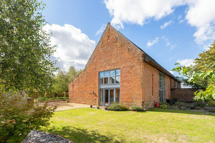
- Price
- Offers in Excess of£600,000
Added on 17/09/2026Barn Conversion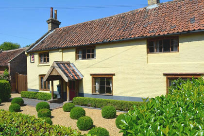
- Price
- £750,000
- Size
- 4 acres
Period Property with Private Riverside Access in Costessey, Costessey, Norfolk NR8 England
Added on 15/07/2026Cottage
- Price
- Guide Price£600,000
- Size
- 0.24 acres
Brands Lane, Felthorpe, Norwich, Felthorpe, Norfolk NR10 England
Added on 24/08/2026Barn Conversion
- Price
- Offers Over£650,000
Added on 29/01/2026Building Plot