Pyworthy, Holsworthy, EX22
Key Features
- Reserved matters planning permission granted
- No CIL to pay
- Site for 4 detached dwellings
- Sites backing onto open farmland
- Further land available by separate negotiation
- Sought-after village location
- Less than 9 miles to the beach
Description
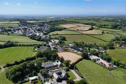
Excellent development opportunity for 4 detached dwellings on good sized plots backing onto open countryside.
The site is generally level with a gentle slope from east to west. The site comes under Torridge district council and does not have CIL to pay.
The floorplans created are for 4 x three bedroom bungalows with large open plan kitchen/living/ dining rooms. With bi-fold doors to the north and west elevations the main living space will be light and airy and bosting far reaching countryside views. The master bedroom will feature a spacious ensuite and all will be complemented by two further bedrooms, a family bathroom, study and utility room.
The vendors have advised that further land could also be available by separate negotiation.
All relevant and supporting documentation pertaining to the planning permission is available for inspection at the agents office at Kivells, The Property Suite, Market Square, New Market Road, Holsworthy, EX22 7FA.
EPC Rating: E
PLANNING
Reserved matters planning has been granted under 1/1048/2024/REM dated 30th January 2025 and was previously given outline approval under number 1/0685/2022/OUT dated 17th January 2023.
A full copy of the planning consent, a copy of the planning officer’s report to the committee and other supporting documents are available on the Torridge Distract Council website or from the agents, upon request.
The advisers who assisted the application are:
GW Architects
T:
E:
W:
COMMUNITY INFRASTRUCTURE LEVY
Please note that the proposed development will not be liable for a charge under the Community Infrastructure Levy (CIL) Regulations.
OFF SITE ALLOTMENT CONTRIBUTION
Means the sum of £704.74 (Seven Hundred and Four Pounds Seventy Four Pence) being a contribution towards the provision of allotments in the vicinity of the Site.
OFF SITE PARKS, SPORTS AND RECREATION CONTRIBUTION
Means the sum of £16,489.37 (Sixteen Thousand Four Hundred and Eighty Nine Pounds and Thirty Seven Pence), being a contribution for improvements and provision of recreational facilities near the Site.
OFF SITE PLAY SPACE CONTRIBUTION
Means the sum of £4,288.04 (Four Thousand Two Hundred and Eighty Eight Pounds and Four Pence) being a contribution for the provision or enhancement of play spaces in the vicinity of the Site.
SERVICES
There are main utility services located in the vicinity, however prospective purchasers must verify availability for any mains services required and the costs of connection of such services, for themselves.
WHAT3WORDS LOCATION
Access for Viewing: ///artichoke.unrealistic.fattest
SITE PLAN
Site plan for identification purposes only, not to scale. Full planning documents and plans are available at the agents office or online.
IMPORTANT NOTICE
Kivells, their clients and any joint agents give notice that:
1. They are not authorised to make or give any representations or warranties in relation to the property either here or elsewhere, either on their own behalf or on behalf of their client or otherwise. They assume no responsibility for any statement that may be made in these particulars. These particulars do not form part of any offer or contract and must not be relied upon as statements or representations of fact.
2. Any areas, measurements or distances are approximate. The text, photographs and plans are for guidance only and are not necessarily comprehensive. It should not be assumed that the property has all necessary planning, building regulation or other consents and Kivells have not tested any services, equipment or facilities. Purchasers must satisfy themselves by inspection or otherwise.
Disclaimer
Kivells, their clients and any joint agents give notice that they are not authorised to make or give representations or warranties in relation to the property. No responsibility is accepted for any statement within these particulars, which do not form part of any offer or contract. Areas, measurements and boundaries are approximate. Text, photographs, CGI’s and plans are for guidance only. It should not be assumed the property has all necessary planning or building consents, and Kivells have not tested any services or equipment. The property is sold subject to all matters in the Property and Charges Register, including rights of way and easements. Purchasers are deemed to know all boundaries. Nothing herein constitutes financial advice; seek your own. Use of Mortgage Genies SW Ltd. will result in a £250 + VAT referral fee to Kivells. Kivells retains copyright to all particulars and media.
Map Location
Property details
- Tenure
- Freehold
- Council Tax Band
- Ask Agent
- Date Posted
- 2026-05-01
Utilities & Restrictions
Utilities
- Electricity
- Ask Agent
- Water
- Ask Agent
- Heating
- Ask Agent
- Broadband
- Ask Agent
- Sewerage
- Ask Agent
Rights & Restrictions
- Public Rights of Way
- Ask Agent
- Private Rights of Way
- Ask Agent
- Listed Property
- Ask Agent
- Restrictions
- Ask Agent
Property Features
- Accessibility
- Ask Agent
- Parking
- Ask Agent
- Garden
- Ask Agent
Connectivity
Broadband
Fastest speed available at this postcode
80 Mbps
Superfast
Suitable for
- HD streaming
- Video calls
- Web & social
Fixed wireless access may also be an option here.
Mobile signal
Outdoor predictions; indoor signal depends on building materials.
Ofcom Connected Nations postcode-level predictions. Speeds and signal are modelled, not measured, and vary between addresses and providers.
Nearest Schools
Primary
- Holsworthy Church of England Primary School2 milesNo Ofsted rating
- Ages
- 0 to 11
- Pupils
- 338
- Type
- Voluntary controlled school
- Faith
- Church of England
- Bridgerule Church of England Primary School2.3 milesNo Ofsted rating
- Ages
- 2 to 11
- Pupils
- 62
- Type
- Academy converter
- Faith
- Church of England
- Clawton Primary School3.6 milesOfsted: Requires improvement *
- Ages
- 2 to 11
- Pupils
- 82
- Type
- Academy converter
- Whitstone Primary School4.1 milesOfsted: Good
- Ages
- 2 to 11
- Pupils
- 103
- Type
- Foundation school
- Marhamchurch CofE Academy5.6 milesOfsted: Requires improvement
- Ages
- 4 to 11
- Pupils
- 128
- Type
- Academy converter
- Faith
- Church of England
Secondary
- Holsworthy Community College1.9 milesNo Ofsted rating
- Ages
- 11 to 16
- Pupils
- 551
- Type
- Academy converter
- Budehaven Community School6.3 milesOfsted: Good
- Ages
- 11 to 18
- Pupils
- 1,145
- Type
- Foundation school
- Launceston College12 milesOfsted: Good
- Ages
- 11 to 18
- Pupils
- 1,205
- Type
- Academy converter
- Atlantic Academy13 milesOfsted: Good
- Ages
- 11 to 16
- Pupils
- 242
- Type
- Free schools
- Great Torrington School16 milesNo Ofsted rating
- Ages
- 11 to 16
- Pupils
- 863
- Type
- Academy converter
* Latest graded judgement covers quality of education only; no overall grade was issued under the 2024-25 inspection framework.
Distances are straight-line from the advertised location. Source: the national school registers (DfE, Welsh Government, Scottish Government) and Ofsted.
Amenities
Supermarket
GP surgery
Pharmacy
Hospital
Green space
Straight-line distances from the advertised location. Sources: NHS records, Geolytix supermarket locations, OS Open Greenspace and the national trails registers.
Getting Around
Nearest station
Nearest bus stop
Typical drive times
Straight-line distances from the advertised location; drive times are typical free-flow times over OpenStreetMap road data, so allow more at peak. Public transport locations from DfT NaPTAN.
Flood Risk
From Environment Agency flood map open data, checked around the advertised map pin and allowing for the listed acreage where known. This summary comes from LandSale, the advertising platform, not from the listing agent, and is not part of the agent's particulars. Risk can vary across a single holding, so verify anything critical through your own searches before committing.
Rivers and the sea
Surface water
The detail behind these bandings, including exact zones and annual chances, any recorded past flooding, plus planning, heritage, nature and ground checks, is in the .
Important notice: Information, maps and tags on this page are supplied by the advertising agent or generated automatically. LandSale has not verified them. Relying on these details is at your own risk, always carry out independent checks before committing to a purchase.
LandSale full disclaimer
Marketing information only - not formal particulars. The details on this website are provided for general guidance and do not constitute an offer or contract. Neither LandSale nor the advertising estate/land agent accepts responsibility for any inaccuracy.
1. Source of information
- Agent-supplied content: Core description, asking price, tenure, measurements, photographs and planning history are uploaded by the appointed agent, who remains solely responsible for their accuracy.
- Automated tags & categorisation: Property type, land-use class, acreage bands and similar labels may be applied by machine-learning models. They are intended as a helpful guide only and may not reflect the property's legal status or permitted use.
- Third-party & enriched data layers: Maps, boundary outlines, planning designations, soil reports, broadband coverage and other environmental or location-based insights are licensed from external suppliers. Such data are supplied “as is", may be incomplete or out of date and are subject to change without notice.
2. Verification required
Prospective purchasers must verify critical matters, including but not limited to planning permission, title boundaries, public rights of way, environmental constraints, acreage, services, access and VAT status, through their own inspections, specialist surveys, legal advisers and the selling agent before relying on the information or entering into any contract.
3. No warranty or liability
LandSale gives no warranty, express or implied, as to the accuracy, completeness or fitness for any particular purpose of the information displayed. LandSale shall not be liable for any loss, damage, cost or expense arising directly or indirectly from any use of or reliance on such information, save where liability may not be excluded by law.
4. Updates & feedback
If you believe any detail on this listing is inaccurate, please let us know. We will investigate and, where appropriate, update the listing or notify the agent.
© LandSale | Version 1.2 - January 2026

Listing agent
Kivells, Bude
8 Belle Vue, Bude, EX23 8JL
Similar properties for sale
- Price
- Guide Price£425,000
Bridgerule, Holsworthy, EX22, Bridgerule, Devon EX22 England
Added on 28/04/2026Development Land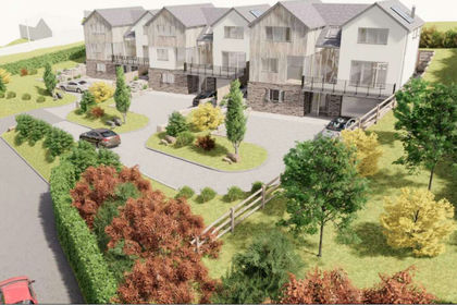
- Price
- Guide Price£350,000
- Size
- 0.87 acres
Added on 20/08/2026Building Plot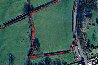
- Price
- £400,000
- Size
- 1.5 acres
Townsend, Stratton, Bude, Bude-Stratton, Cornwall EX23 England
Added on 29/01/2026Building Plot
- Price
- Offers in Region of£350,000
- Size
- 5 acres
Added on 08/08/2026Building Plot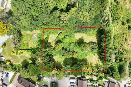
- Price
- Guide Price£350,000
Cleavelands, Bude, EX23, Bude-Stratton, Cornwall EX23 England
Added on 04/07/2026Development Land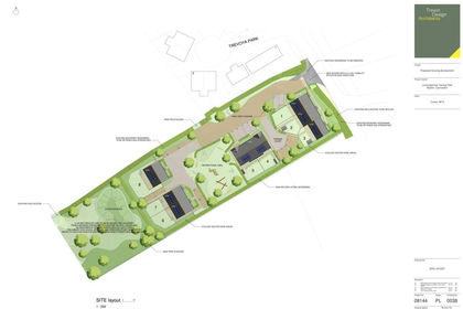
- Price
- Guide Price£295,000
- Size
- 1 acres
Added on 28/04/2026Development Land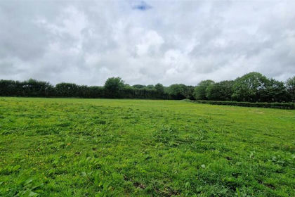
- Price
- £350,000
- Size
- 2.9 acres
Long Park Drive, Bradworthy, Holsworthy, Bradworthy, Devon EX22 England
Added on 24/06/2026Self Build Plot
- Price
- £370,000
- Size
- 6.5 acres
West Chilla, Beaworthy, EX21, Black Torrington, Devon EX21 England
Added on 01/05/2026Development Land
- Price
- £295,000
- Size
- 2.5 acres
Southland Park, Highampton, Beaworthy, Black Torrington, Devon EX21 England
Added on 08/08/2026Development Land
- Price
- Guide Price£275,000
Added on 18/08/2026Development Land